- National Register of Historic Places listings in Southampton (town), New York
-
This list is intended to provide a comprehensive listing of entries in the National Register of Historic Places in the Town of Southampton, New York. The locations of National Register properties for which the latitude and longitude coordinates are included below, may be seen in a Google map.[1]
Contents
Listings
[2] Landmark name Image Date listed Location City or Town Summary 1 Balcastle 
October 2, 1986 NW corner of Herrick and Little Plains Roads
40°53′2″N 72°23′4″W / 40.88389°N 72.38444°WSouthampton 2 Beach Road Historic District 
October 2, 1986 Between Shinnecock and Halsely Neck Roads on Beach Road at Barrier Beach
40°51′44″N 72°25′3″W / 40.86222°N 72.4175°WSouthampton 3 Beebe Windmill 
December 27, 1978 SE corner of Ocean Road and Hildreth Avenue
40°56′3″N 72°18′5″W / 40.93417°N 72.30139°WBridgehampton 4 James Benjamin Homestead August 13, 1986 1182 Flanders Road
40°54′11″N 72°37′4″W / 40.90306°N 72.61778°WFlanders 5 The Big Duck 
April 28, 1997 NY 24, NW of jct. with Bellows Pond Road, Town of Southampton
40°54′25″N 72°37′20″W / 40.90694°N 72.62222°WFlanders Moved two miles northwest of previous location in 2007 6 Big Duck Ranch September 12, 2008 1012 NY 24
40°54′27.41″N 72°37′22.61″W / 40.9076139°N 72.6229472°WFlanders New listing; refnum# 08000866 7 Dr. Wesley Bowers House October 2, 1986 Beach Road (just west of "Road C")
40°51′19″N 72°26′1″W / 40.85528°N 72.43361°WSouthampton 8 James L. Breese House 
April 18, 1980 155 Hill Street
40°53′6″N 72°23′56″W / 40.885°N 72.39889°WSouthampton 9 William Cauldwell House May 4, 2009 51 Peconic Avenue
40°59′23.59″N 72°22′21.33″W / 40.9898861°N 72.3725917°WNoyack 10 William Merritt Chase Homestead June 16, 1983 Canoe Place Road and Bathing Beach Road (east of Peconic Road)
40°53′15″N 72°28′48″W / 40.8875°N 72.48°WShinnecock Hills 11 Crowther House March 21, 1985 97 Beach Lane
40°48′16″N 72°38′3″W / 40.80444°N 72.63417°WWesthampton Beach 12 First Presbyterian Church (Sag Harbor) 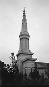
April 19, 1994 44 Union Street
40°59′50″N 72°17′39″W / 40.99722°N 72.29417°WSag Harbor Egyptian revival church designed by Minard Lafever; steeple lost in 1938 hurricane 13 Foster-Meeker House August 26, 2009 101 Mill Road
40°48′44.43″N 72°38′36.41″W / 40.8123417°N 72.6434472°WWesthampton Beach New listing; refnum 0900065 14 Capt. C. Goodale House 
October 2, 1986 300 Hampton Road
40°53′29″N 72°22′51″W / 40.89139°N 72.38083°WSouthampton 15 Jagger House December 12, 1978 Old Montauk Highway
40°49′0″N 72°40′38″W / 40.816667°N 72.67722°WWesthampton 16 Maycroft February 24, 1995 Ferry Road (NY 114)
41°0′33″N 72°18′35″W / 41.00917°N 72.30972°WNorth Haven 17 North Main Street Historic District (Southampton) 
October 2, 1986 North Main Street near CR 39 and Railroad Station Plaza
40°53′45″N 72°23′27″W / 40.89583°N 72.39083°WSouthampton 18 Quogue Life-Saving Station May 27, 1999 78 Dune Road
40°48′26″N 72°36′0″W / 40.80722°N 72.6°WQuogue 19 Rev. Paul Cuffee Gravesite October 8, 2010 North side of Montauk Highway opposite 216 East Montauk Highway
40°53′45″N 72°23′27″W / 40.89583°N 72.39083°WHampton Bays New listing; refnum 10000852; Cemeteries of the Town of Southampton, 1640-1930 MPS 20 Nathaniel Rogers House 
March 15, 2005 2539 Montauk Highway
40°56′15″N 72°18′4″W / 40.9375°N 72.30111°WBridgehampton 21 Rosemary Lodge January 14, 2000 322 Rose Hill Road
40°54′39″N 72°20′19″W / 40.91083°N 72.33861°WWater Mill 22 Sag Harbor Village District 
July 20, 1973 Roughly bounded by Sag Harbor, Rysam, Hamilton, Marsden, Main and Long Island Avenues
40°59′50″N 72°17′44″W / 40.99722°N 72.29556°WSag Harbor 23 Sagaponack Historic District 
June 2, 2000 Roughly along Main Street
40°55′29″N 72°16′40″W / 40.92472°N 72.27778°WSagaponack 24 Shinnecock Hills Golf Club 
September 29, 2000 Bet. Cty Road and Sebonac Road
40°53′46″N 72°26′28″W / 40.89611°N 72.44111°WSouthampton 25 Southampton Village Historic District 
April 25, 1988 Roughly bounded by Hill and Main Streets, Old Town Road, Atlantic Ocean, Coopers Neck and Halsey Neck Lanes
40°52′37″N 72°23′35″W / 40.87694°N 72.39306°WSouthampton 26 US Post Office-Westhampton Beach May 11, 1989 Main Street
40°48′36″N 72°38′28″W / 40.81°N 72.64111°WWesthampton Beach 27 Water Mill 
October 13, 1983 Old Mill Road
40°54′33″N 72°21′24″W / 40.90917°N 72.35667°WWater Mill 28 Wickapogue Road Historic District 
October 2, 1986 Wickapogue Road between Narrow Lane and Cobb Road
40°53′1″N 72°22′3″W / 40.88361°N 72.3675°WSouthampton 29 Windmill at Water Mill 
December 27, 1978 NY 27 and Halsey Lane
40°54′34″N 72°21′15″W / 40.90944°N 72.35417°WWater Mill 30 The Castle at Casa Basso October 12, 1976 59 Montauk Highway
40°49′17″N 72°39′47″W / 40.82139°N 72.66306°WWesthampton See also
- National Register of Historic Places listings in New York
- National Register of Historic Places listings in Suffolk County, New York
References
- ^ The latitude and longitude information provided is primarily from the National Register Information System, and has been found to be fairly accurate for about 99% of listings. For 1%, the location info may be way off. We seek to correct the coordinate information wherever it is found to be erroneous. Please leave a note in the Discussion page for this article if you believe any specific location is incorrect.
- ^ Numbers represent an ordering by significant words. Various colorings, defined here, differentiate the Historic districts, National Historic Landmarks, and other designations from other NRHP buildings, structures, sites or objects.
External links
- NRHP applications for New York State sites (Note, interface works best with Microsoft Internet Explorer browser; hit "Results" after searching, to actually see the results).
Town of Southampton, New York County Villages Hamlets Bridgehampton · Eastport · East Quogue · Flanders · Hampton Bays · Northampton · North Sea · Noyack · Quioque · Remsenburg · Riverside · Shinnecock Hills · Speonk · Tuckahoe · Water Mill · WesthamptonIndian
reservationShinnecock ReservationWebsite Categories:- Southampton (town), New York
- National Register of Historic Places in Southampton (town), New York


Wikimedia Foundation. 2010.