- National Register of Historic Places listings in Southwest Philadelphia
-
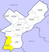
 Location of Southwest Philadelphia in Philadelphia
This is a list of the National Register of Historic Places listings in Southwest Philadelphia.
This is intended to be a complete list of the properties and districts on the National Register of Historic Places in Southwest Philadelphia, Pennsylvania, United States. The locations of National Register properties and districts for which the latitude and longitude coordinates are included below may be seen in a Google map.[1]
There are 532 properties and districts listed on the National Register in Philadelphia, including 67 National Historic Landmarks. Southwest Philadelphia includes 12 of these properties and districts, including 2 National Historic Landmarks; the city's remaining properties and districts are listed elsewhere.
Current listings
[2] Landmark name[3] Image Date listed Location Neighborhood[4] Summary 1 John Bartram High School 
December 4, 1986 67th and Elmwood Streets
39°55′16″N 75°13′58″W / 39.92111°N 75.23278°WMiddle Southwest 2 John Bartram House 
October 15, 1966 54th Street and Eastwick Avenue
39°55′54″N 75°12′43″W / 39.93167°N 75.21194°WBartram Village 3 Joseph W. Catharine School 
November 18, 1988 6600 Chester Avenue
39°55′39″N 75°14′23″W / 39.9275°N 75.23972°WMount Moriah 4 Fort Mifflin 
August 29, 1970 Fort Mifflin and Hog Island Roads
39°52′31″N 75°12′47″W / 39.87528°N 75.21306°W[5]Philadelphia International Airport 5 Fort Mifflin Hospital 
September 29, 1969 Fort Mifflin and Hog Island Road
39°52′35.5″N 75°12′40.5″W / 39.876528°N 75.21125°W[5]Philadelphia International Airport 6 S. Weir Mitchell School 
December 4, 1986 56th and Kingsessing Street
39°56′12.5″N 75°13′25.5″W / 39.936806°N 75.22375°WKingsessing 7 John M. Paterson School 
November 18, 1988 7001 Buist Avenue
39°54′58″N 75°14′12″W / 39.91611°N 75.23667°WPenrose 8 Thomas Buchanan Read School 
December 4, 1986 78th Street and Buist Avenue
39°54′23.5″N 75°14′52″W / 39.906528°N 75.24778°WElmwood Park 9 Regent-Rennoc Court 
September 12, 1985 5100 block of Regent Street and 1311–1327 South 52nd Street
39°56′29″N 75°13′9″W / 39.94139°N 75.21917°WSouthwest Schuylkill 10 Anna Howard Shaw Junior High School 
November 18, 1988 5401 Warrington Street
39°56′30″N 75°13′35″W / 39.94167°N 75.22639°WSouthwest Schuylkill 11 William J. Tilden Junior High School 
December 1, 1986 66th Street and Elmwood Avenue
39°55′18″N 75°13′56″W / 39.92167°N 75.23222°WPaschall 12 George Wolf School 
November 18, 1988 8100 Lyons Avenue
39°53′55″N 75°14′45.5″W / 39.89861°N 75.245972°WHedgerow See also
- List of National Historic Landmarks in Philadelphia
- National Register of Historic Places listings in Philadelphia, Pennsylvania
References
- ^ The latitude and longitude information provided in this table was derived originally from the National Register Information System, which has been found to be fairly accurate for about 99% of listings. For about 1% of NRIS original coordinates, experience has shown that one or both coordinates are typos or otherwise extremely far off; some corrections may have been made. A more subtle problem causes many locations to be off by up to 150 yards, depending on location in the country: most NRIS coordinates were derived from tracing out latitude and longitudes off of USGS topographical quadrant maps created under North American Datum of 1927, which differs from the current, highly accurate GPS system used by Google maps. Chicago is about right, but NRIS longitudes in Washington are higher by about 4.5 seconds, and are lower by about 2.0 seconds in Maine. Latitudes differ by about 1.0 second in Florida. Some locations in this table may have been corrected to current GPS standards.
- ^ Numbers represent an alphabetization by significant words. Various colorings, defined here, differentiate National Historic Landmark sites and National Register of Historic Places Districts from other NRHP buildings, structures, sites or objects.
- ^ "NPS Focus". National Register of Historic Places. National Park Service. http://nrhp.focus.nps.gov. Retrieved November 20, 2009.
- ^ "The Political and Community Service Boundaries of Philadelphia" (PDF). Philadelphia City Planning Commission. June 2004. http://www.philaplanning.org/data/boundaries.pdf.
- ^ a b Location is derived from Fort Mifflin website; the NRIS lists the property at the intersection of Penrose Ferry Rd. with the nonexistent Marina Rd.
Neighborhoods of the Southwest Philadelphia section of Philadelphia, Pennsylvania Angora • Bartram Village • Clearview • Eastwick • Elmwood Park • Hedgerow • Hog Island • Kingsessing • Mount Moriah • Paschall • Penrose • Philadelphia International Airport • Southwest Schuylkill
 Categories:
- Buildings and structures in Philadelphia, Pennsylvania
- National Register of Historic Places in Philadelphia, Pennsylvania


Wikimedia Foundation. 2010.