- National Register of Historic Places listings in St. Louis County, Minnesota
-
St. Louis County, Minnesota contains over 100 properties that are listed on the National Register of Historic Places. Many of these places are associated with the city of Duluth's role as the westernmost port on the Great Lakes, shared with Superior, Wisconsin. The iron ore of the Mesabi Range and the Vermilion Range led to the development of the cities of Chisholm, Hibbing, Virginia, and Ely. Three of the iron mines are National Historic Landmarks: Hull-Rust-Mahoning Open Pit Iron Mine, Mountain Iron Mine, and the underground Soudan Iron Mine.
-
- This National Park Service list is complete through NPS recent listings posted November 10, 2011.[1]
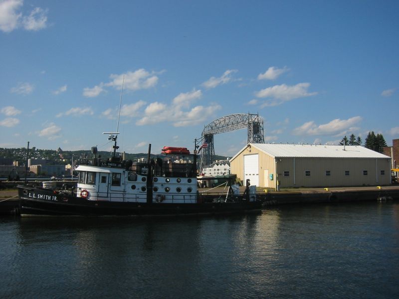
[2] Landmark name[3] Image Date listed Location City or Town Summary 1 Aerial Lift Bridge 
May 22, 1973 Lake Ave.
46°46′45″N 92°5′34″W / 46.77917°N 92.09278°WDuluth 2 Elias and Lisi Aho Historic Farmstead April 9, 1990 Off Township Road 358
47°39′23″N 92°8′58″W / 47.65639°N 92.14944°WTower 3 Alango School July 17, 1980 County Highways 22 and 25
47°46′26″N 92°47′33″W / 47.77389°N 92.7925°WCook 4 Andrew G. Anderson House December 4, 1980 1001 E. Howard St.
47°25′40″N 92°55′46″W / 47.42778°N 92.92944°WHibbing 5 Androy Hotel June 13, 1986 592 E. Howard St.
47°25′38″N 92°56′10″W / 47.42722°N 92.93611°WHibbing 6 Archaeological Site No. 21SL82 February 17, 1988 Address Restricted International Falls 7 Archeological Site 21SL141 December 31, 1987 Address Restricted International Falls 8 Archeological Site 21SL35 December 29, 1987 Address Restricted International Falls 9 Archeological Site 21SL55 July 8, 1988 Address Restricted International Falls 10 Archeological Site No. 21SL73 January 16, 1989 Address Restricted International Falls 11 B'nai Abraham Synagogue August 18, 1980 328 S. 5th St.
47°31′7″N 92°32′10″W / 47.51861°N 92.53611°WVirginia 12 W.T. Bailey House December 4, 1980 816 S. 5th Ave.
47°30′54″N 92°32′16″W / 47.515°N 92.53778°WVirginia 13 W. Bailey House August 27, 1980 705 Pierce St.
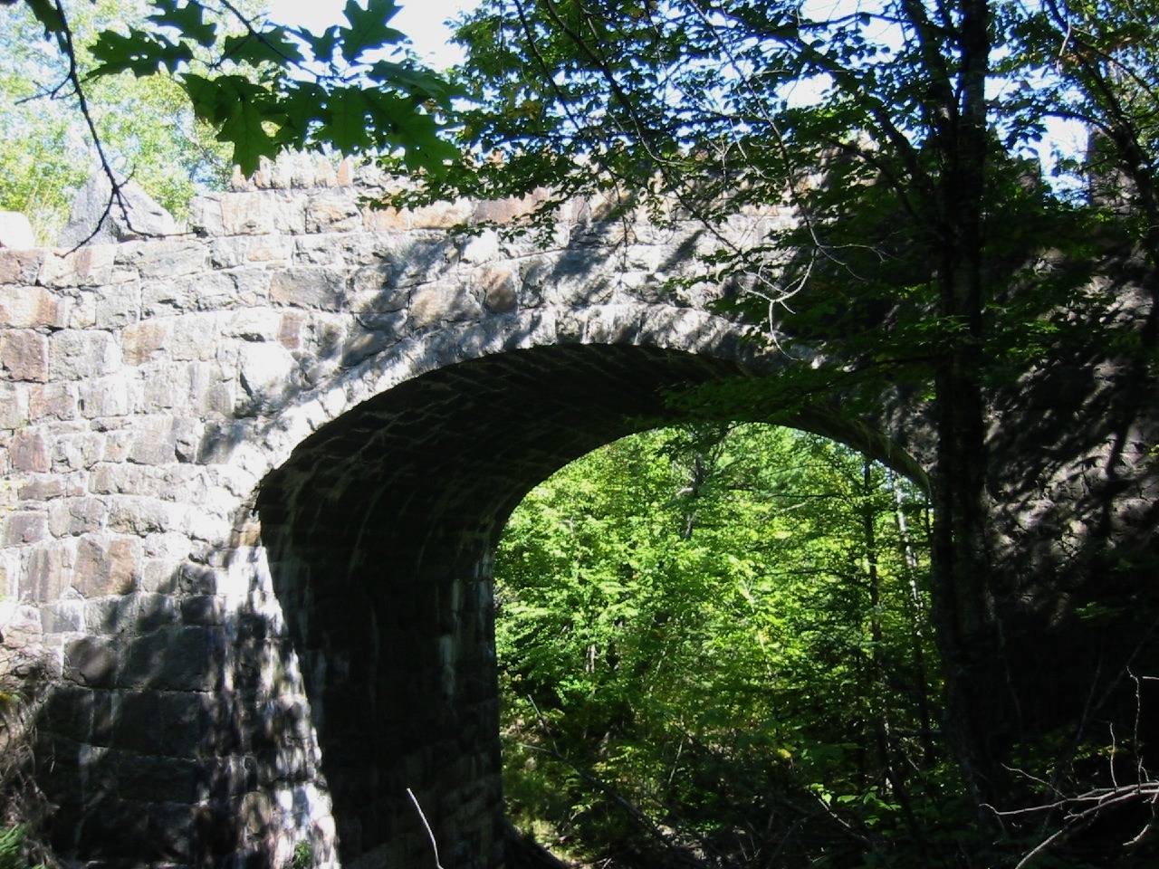
47°27′47″N 92°31′59″W / 47.46306°N 92.53306°WEveleth 14 Bridge No. 5757 
June 26, 1998 Minnesota Highway 23 over Mission Creek
46°39′38″N 92°16′32″W / 46.66056°N 92.27556°WDuluth [1] 15 Bridge No. L6007 
November 6, 1989 Skyline Parkway over Stewart Creek
46°42′13″N 92°13′41″W / 46.70361°N 92.22806°WDuluth 16 Bruce Mine Headframe November 28, 1978 Off U.S. Route 169
47°28′25″N 92°51′40″W / 47.47361°N 92.86111°WChisholm 17 Buhl Public Library February 10, 1983 Jones Ave. at Frantz St.
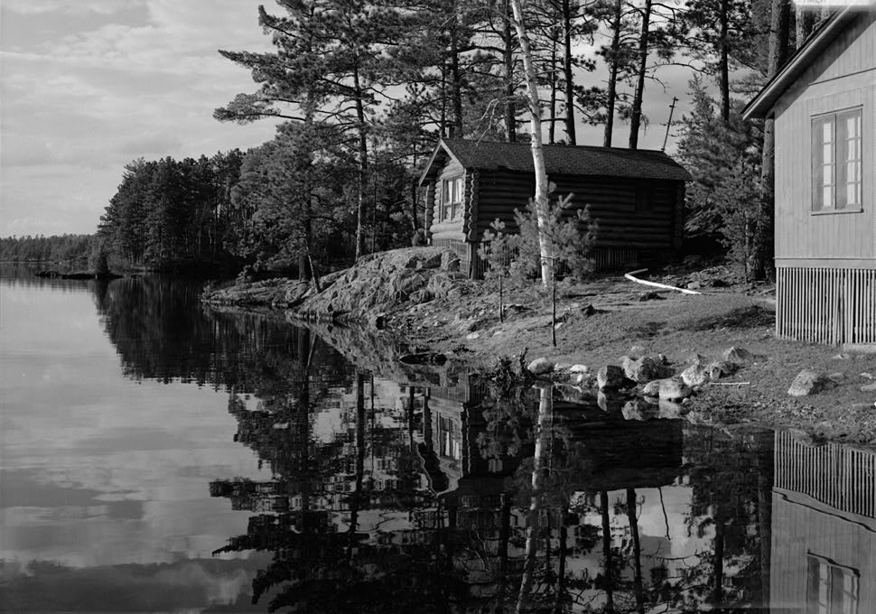
47°29′46″N 92°46′34″W / 47.49611°N 92.77611°WBuhl 18 Buhl Village Hall February 10, 1983 Jones Ave. at 4th St.
47°29′44″N 92°46′39″W / 47.49556°N 92.7775°WBuhl 19 Bull-of-the-Woods Logging Scow February 12, 1999 Address Restricted Morse Township 20 Burntside Lodge 
June 23, 1988 Off County Highway 88
47°55′27″N 91°57′6″W / 47.92417°N 91.95167°WEly 21 Emmett Butler House December 4, 1980 2530 3rd Ave., W.
47°25′14″N 92°56′38″W / 47.42056°N 92.94389°WHibbing 22 Chester Terrace 
November 19, 1980 1210-1232 E. 1st St.
46°47′59″N 92°4′58″W / 46.79972°N 92.08278°WDuluth 23 Church of St. John the Baptist (Catholic) August 27, 1980 309 S. 3rd Ave.
47°31′13″N 92°32′4″W / 47.52028°N 92.53444°WVirginia 24 Church of St. Joseph (Catholic) September 6, 2002 7897 Elmer Rd.
47°5′1″N 92°46′36″W / 47.08361°N 92.77667°WElmer 25 Church of the Holy Family (Catholic) August 27, 1980 307 Adams Ave.
47°27′51″N 92°32′18″W / 47.46417°N 92.53833°WEveleth 26 Civilian Conservation Corps Camp S-52 March 2, 1989 Off U.S. Route 53
48°6′5″N 92°50′39″W / 48.10139°N 92.84417°WOrr 27 Coates House August 18, 1980 817 S. 5th Ave.
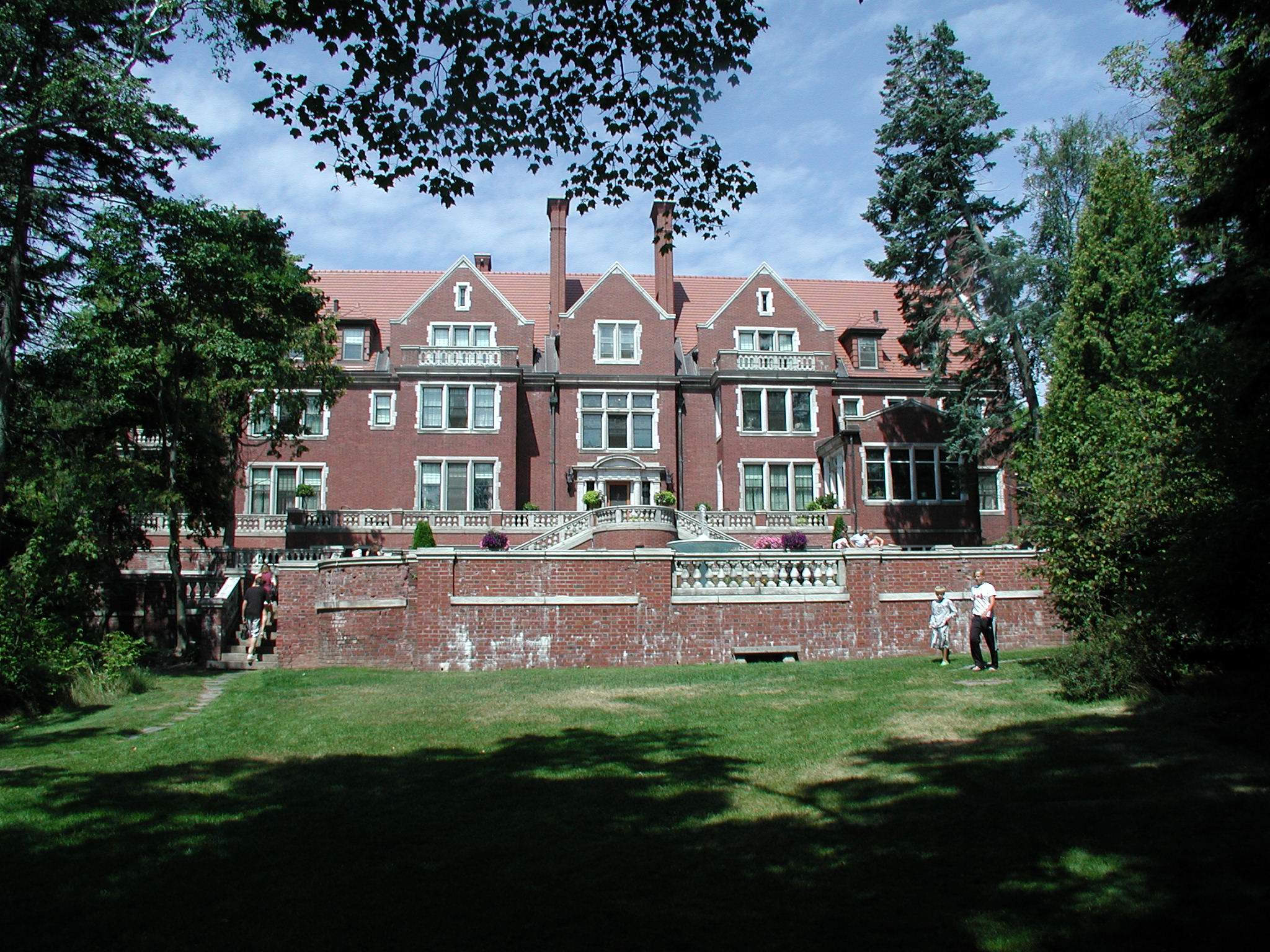
47°30′54″N 92°32′19″W / 47.515°N 92.53861°WVirginia 28 Chester and Clara Congdon Estate 
August 15, 1991 3300 London Rd.
46°48′59″N 92°3′10″W / 46.81639°N 92.05278°WDuluth 29 Delvic Building July 17, 1980 1st Ave. and Howard St.
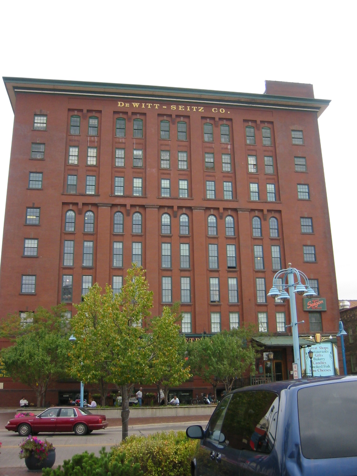
47°25′37″N 92°56′29″W / 47.42694°N 92.94139°WHibbing 30 DeWitt-Seitz Building 
September 5, 1985 394 Lake Ave., S.
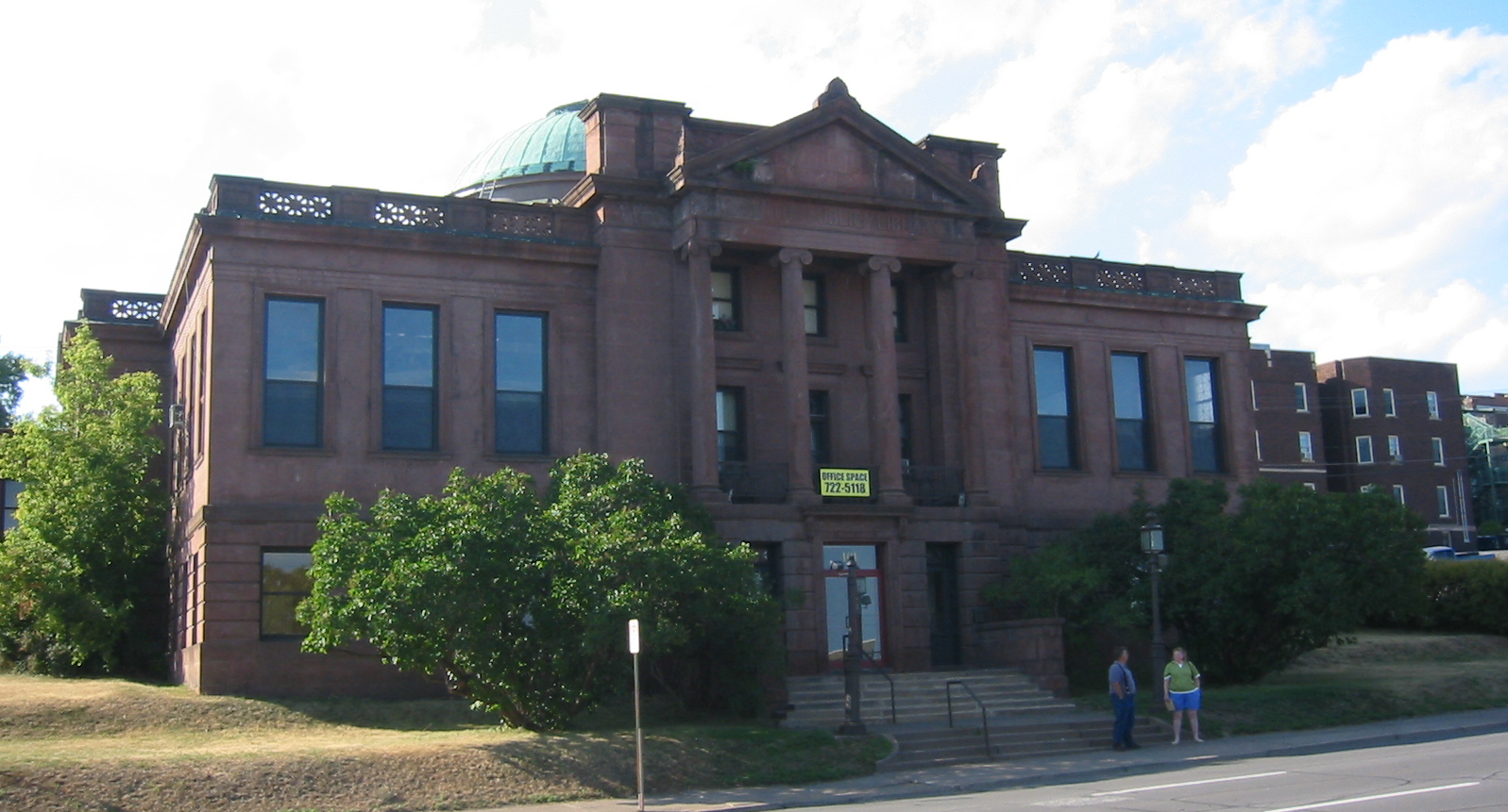
46°46′55″N 92°5′39″W / 46.78194°N 92.09417°WDuluth 31 Duluth Central High School 
November 9, 1972 Lake Ave. and 2nd St.
46°47′21″N 92°6′0″W / 46.78917°N 92.1°WDuluth 32 Duluth Armory June 1, 2011 1301-1305 London Rd.
46°47′55″N 92°4′50″W / 46.79861°N 92.08056°WDuluth 33 Duluth Civic Center Historic District 
November 6, 1986 5th Ave., W. and 1st St.
46°47′0″N 92°6′23″W / 46.783333°N 92.10639°WDuluth 34 Duluth Commercial Historic District 
May 31, 2006 Superior and 1st between 4th Ave., W. and 4th Ave., E.
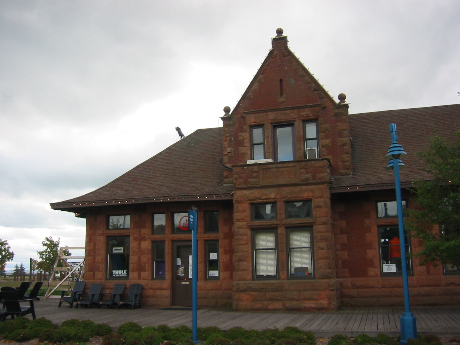
46°47′15″N 92°5′55″W / 46.7875°N 92.09861°WDuluth 35 Duluth Missabe and Iron Range Depot (Endion) 
April 16, 1975 1504 South St.
46°47′59″N 92°4′36″W / 46.79972°N 92.07667°WDuluth 36 Duluth Public Library 
May 5, 1978 101 W. 2nd St.
46°47′14″N 92°6′7″W / 46.78722°N 92.10194°WDuluth 37 Duluth South Breakwater Inner (Duluth Range Rear) Lighthouse 
August 4, 1983 South Breakwater
46°46′43″N 92°5′31″W / 46.77861°N 92.09194°WDuluth 38 Duluth State Normal School Historic District 
November 8, 1985 E. 5th St.
46°48′46″N 92°4′36″W / 46.81278°N 92.07667°WDuluth 39 Duluth Union Depot 
December 9, 1971 5th Ave., W. and Michigan St.
46°46′54″N 92°6′13″W / 46.78167°N 92.10361°WDuluth 40 Duluth, Winnipeg, and Pacific Depot August 18, 1980 600 Chestnut St.
47°31′24″N 92°32′27″W / 47.52333°N 92.54083°WVirginia 41 East Howard Street Commercial Historic District April 1, 1993 101-510 E. Howard St.
47°25′39″N 92°56′27″W / 47.4275°N 92.94083°WHibbing 42 Endion School 
February 10, 1983 1801 E. 1st St.
46°48′19″N 92°4′37″W / 46.80528°N 92.07694°WDuluth 43 Eveleth Manual Training Center August 18, 1980 Roosevelt Ave.
47°27′51″N 92°31′59″W / 47.46417°N 92.53306°WEveleth 44 Eveleth Recreation Building November 25, 1980 Garfield St. and Adams Ave.
47°27′53″N 92°32′29″W / 47.46472°N 92.54139°WEveleth 45 Finnish Sauna August 26, 1980 105 S. 1st St.
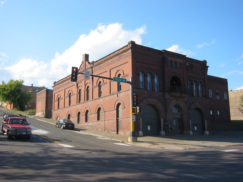
47°31′22″N 92°31′54″W / 47.52278°N 92.53167°WVirginia 46 Fire House No. 1 
May 12, 1975 Northwestern corner of 1st Ave., E. and 3rd St.
46°47′25″N 92°6′0″W / 46.79028°N 92.1°WDuluth 47 Fitger Brewing Company 
February 9, 1984 600 E. Superior St.
46°47′32″N 92°5′26″W / 46.79222°N 92.09056°WDuluth 48 Flint Creek Farm Historic District March 2, 1989 Minnesota Highway 1
47°51′46″N 92°48′34″W / 47.86278°N 92.80944°WCook 49 Jun Fujita Cabin December 2, 1996 Eastern tip of Wendt Island, approximately 30 miles east of Ranier in Voyageurs National Park
48°32′59″N 92°52′16″W / 48.54972°N 92.87111°WRanier 50 Gregorius and Mary Hanka Historic Farmstead April 9, 1990 Off Township Road 6544
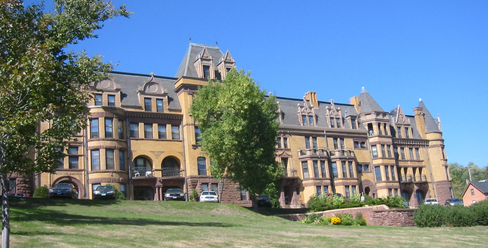
47°41′13″N 92°12′3″W / 47.68694°N 92.20083°WTower 51 Hartley Building 
December 15, 1989 740 E. Superior St.
47°41′39″N 92°4′20″W / 47.69417°N 92.07222°WDuluth 52 Height of Land Portage July 23, 1992 Off County Road 138 in Embarrass, White and Pike Townships
47°36′49″N 92°18′6″W / 47.61361°N 92.30167°WEmbarrass 53 Hibbing City Hall February 12, 1981 21st St., E. and 4th Ave.
47°25′36″N 92°56′14″W / 47.42667°N 92.93722°WHibbing 54 Hibbing Disposal Plant August 9, 1991 1300 E. 23rd St.
47°25′31″N 92°54′55″W / 47.42528°N 92.91528°WHibbing 55 Hibbing High School 
August 11, 1980 21st St. at 8th Ave.
47°25′31″N 92°55′57″W / 47.42528°N 92.9325°WHibbing 56 Matt and Emma Hill Historic Farmstead April 9, 1990 Off Township Road 303
47°39′18″N 92°19′51″W / 47.655°N 92.33083°WTower 57 Hotel Glode November 25, 1980 222 Adams Ave.
47°27′53″N 92°32′16″W / 47.46472°N 92.53778°WEveleth 58 Hull-Rust-Mahoning Open Pit Iron Mine 
November 13, 1966 3rd Ave., E.
47°27′10″N 92°57′40″W / 47.45278°N 92.96111°WHibbing 59 William Ingersoll Estate June 15, 2011 Ingersoll's Island
48°21′17″N 92°28′25″W / 48.35472°N 92.47361°WCrane Lake vicinity Tourism and Recreational Properties in Voyageurs National Park 1880-1950 MPS 60 Irving School 
November 20, 1992 101 N. 56th Ave. W.
46°44′8″N 92°10′6″W / 46.73556°N 92.16833°WDuluth 61 Jukola Boardinghouse March 10, 1982 201 N. 3rd Ave.
47°31′31″N 92°32′3″W / 47.52528°N 92.53417°WVirginia 62 Kabetogama Ranger Station District June 18, 1993 Southwestern shore of Kabetogama Lake in Voyageurs National Park
48°26′43″N 93°1′47″W / 48.44528°N 93.02972°WRay 63 Kettle Falls Historic District 
July 17, 1978 Kettle Channel in Voyageurs National Park
48°30′5″N 92°38′25″W / 48.50139°N 92.64028°WIsland View 64 Kettle Falls Hotel 
January 11, 1976 Kettle Channel in Voyageurs National Park
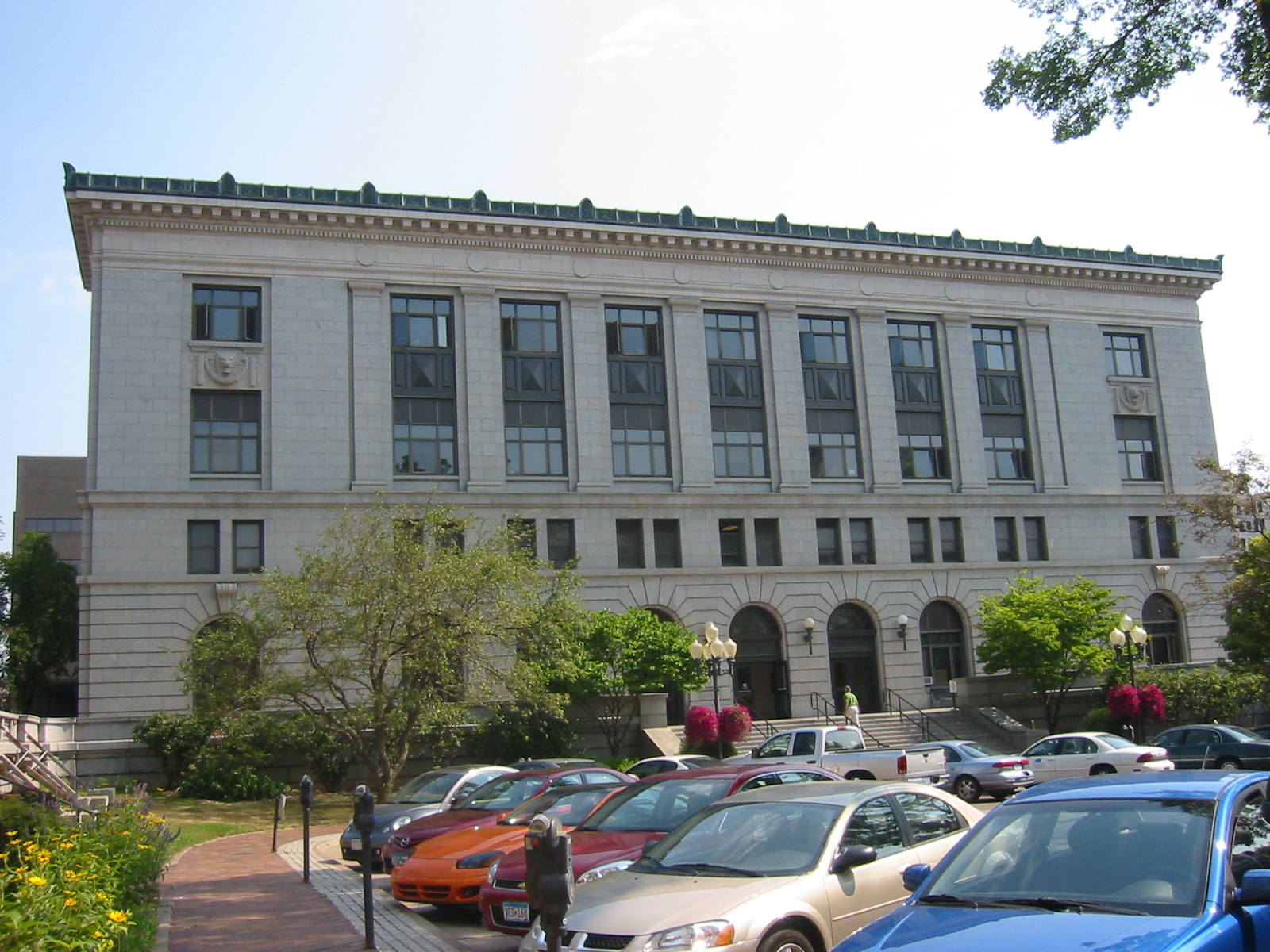
48°30′11″N 92°38′23″W / 48.50306°N 92.63972°WIsland View 65 Kitchi Gammi Club 
April 16, 1975 831 E. Superior St.
46°47′44″N 92°5′16″W / 46.79556°N 92.08778°WDuluth 66 LeMoine Building March 2, 1989 Off County Highway 74
47°58′7″N 92°49′24″W / 47.96861°N 92.82333°WOrr 67 Charles Lenont House August 18, 1980 202 N. 5th Ave.
47°31′31″N 92°32′20″W / 47.52528°N 92.53889°WVirginia 68 Lester River Bridge-Bridge No. 5772 
September 6, 2002 London Rd. over the Lester River
46°50′12″N 92°0′22″W / 46.83667°N 92.00611°WDuluth 69 Lincoln School Building November 28, 1978 3rd Ave.
47°31′28″N 92°32′2″W / 47.52444°N 92.53389°WVirginia 70 Adolph Levin Cottage June 15, 2011 Kabetogama Narrows near Ash River Maintenance Dock Kabetogama Lake vicinity Tourism and Recreational Properties in Voyageurs National Park 1880-1950 MPS 71 Listening Point December 26, 2007 3128 Listening Point Rd.
47°54′10.52″N 92°0′50.48″W / 47.9029222°N 92.0140222°WEly 72 E.J. Longyear First Diamond Drill Site July 20, 1977 Off County Highway 110
47°33′25″N 92°7′4″W / 47.55694°N 92.11778°WHoyt Lakes 73 Mike and Mary Matson Historic Farmstead April 9, 1990 Off County Highway 21
47°40′47″N 92°12′12″W / 47.67972°N 92.20333°WTower 74 Minnesota Point Lighthouse December 27, 1974 On Minnesota Point
46°42′37″N 92°1′32″W / 46.71028°N 92.02556°WDuluth Drawings here 75 Mitchell-Tappan House December 2, 1980 2145 4th Ave.
47°25′31″N 92°56′18″W / 47.42528°N 92.93833°WHibbing 76 Bergetta Moe Bakery 
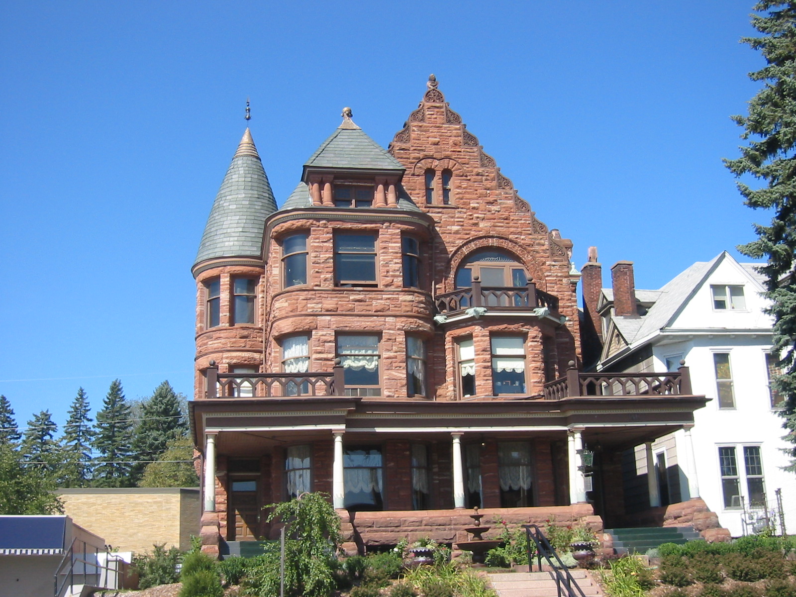
June 3, 1976 716 E. Superior St.
46°47′33″N 92°5′26″W / 46.7925°N 92.09056°WDuluth 77 Monson's Hoist Bay Resort June 15, 2011 Hoist Bay Namakan Lake vicinity Tourism and Recreational Properties in Voyageurs National Park 1880-1950 MPS 78 Mountain Iron Mine 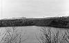
November 24, 1968 North of Mountain Iron
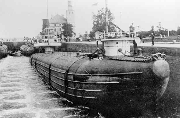
47°32′20″N 92°37′25″W / 47.53889°N 92.62361°WMountain Iron 79 Munger Terrace 
December 12, 1976 405 Mesabi Ave.
46°47′9″N 92°6′33″W / 46.78583°N 92.10917°WDuluth 80 Erick and Kristina Nelimark Saunaa April 9, 1990 Junction of Township Roads 21 and 615
47°39′46″N 92°11′45″W / 47.66278°N 92.19583°WTower 81 Northland July 31, 1978 Off U.S. Route 2
46°44′45″N 92°13′34″W / 46.74583°N 92.22611°WProctor 82 Orr Roadside Parking Area September 6, 2002 Minnesota Highway 53 at First Ave.
48°4′5″N 92°49′51″W / 48.06806°N 92.83083°WOrr 83 Pioneer Mine Buildings and A Headframe 
November 28, 1978 Off Pioneer Rd.
47°54′44″N 91°51′37″W / 47.91222°N 91.86028°WEly 84 Anna and Mikko Pyhala Farm June 12, 2003 4745 Salo Rd.
47°39′46″N 92°11′8″W / 47.66278°N 92.18556°WEmbarrass 85 Sacred Heart Cathedral, Sacred Heart School and Christian Brothers Home 
June 26, 1986 (original)
May 19, 2005 (increase)206 and 211 W. Fourth St. (original); 315 N. 2nd Ave., W. (increase)
46°47′15″N 92°6′20″W / 46.7875°N 92.10556°WDuluth 86 St. Louis County 4-H Club Camp March 4, 1985 100 Pine Lane
47°28′27″N 92°20′47″W / 47.47417°N 92.34639°WGilbert 87 St. Louis County District Courthouse June 18, 1992 300 S. 5th Ave.
47°31′15″N 92°32′16″W / 47.52083°N 92.53778°WVirginia 88 St. Mark's African Methodist Episcopal Church 
April 16, 1991 530 N. 5th Ave. E.
46°47′47″N 92°5′45″W / 46.79639°N 92.09583°WDuluth 89 Saints Peter and Paul Church-Ukrainian Catholic August 27, 1980 530 Central Ave.
47°29′01″N 92°52′44″W / 47.483514°N 92.878852°WChisholm 90 Alex Seitaniemi Housebarn April 9, 1990 Off Township Road 797
47°42′25″N 92°8′15″W / 47.70694°N 92.1375°WTower 91 Sons of Italy Hall November 25, 1980 704 E. Howard St.
47°25′38″N 92°55′59″W / 47.42722°N 92.93306°WHibbing 92 Soudan Iron Mine 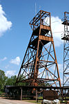
November 13, 1966 Tower-Soudan State Park
47°49′24″N 92°14′14″W / 47.82333°N 92.23722°WTower 93 I.W. Stevens Lakeside Cottage June 15, 2011 Williams Island Namakan Lake vicinity Tourism and Recreational Properties in Voyageurs National Park 1880-1950 MPS 94 Stuntz Bay Boathouse Historic District May 24, 2007 At the northern end of Stuntz Bay Rd.
47°49′33.69″N 92°14′10.63″W / 47.826025°N 92.2362861°WBreitung Township 95 Tanner's Hospital July 28, 1980 204 E. Camp St.
47°54′17″N 91°51′43″W / 47.90472°N 91.86194°WEly 96 Waino Tanttari Field Hay Barn April 9, 1990 End of Township Road 585
47°42′39″N 92°9′42″W / 47.71083°N 92.16167°WTower 97 Palmers 98 THOMAS WILSON (Whaleback Freighter) Shipwreck 
July 23, 1992 Address Restricted Duluth 99 Tower Fire Hall July 17, 1980 Main St.
47°48′19″N 92°16′29″W / 47.80528°N 92.27472°WTower 100 Oliver G. Traphagen House 
April 4, 1975 1509-1511 E. Superior St.
46°48′7″N 92°4′46″W / 46.80194°N 92.07944°WDuluth 101 United States Army Corps of Engineers Duluth Vessel Yard 
October 23, 1995 Junction of 9th St., S. and Minnesota Ave.
46°46′32″N 92°5′34″W / 46.77556°N 92.09278°WDuluth 102 US Fisheries Station, Duluth 
November 28, 1978 6008 London Rd.
46°50′10″N 92°0′22″W / 46.83611°N 92.00611°WDuluth 103 USS ESSEX Shipwreck Site 
April 14, 1994 Address Restricted Duluth 104 Valon Tuote Raittiusseura August 24, 1979 125 3rd St., N.
47°31′35″N 92°31′57″W / 47.52639°N 92.5325°WVirginia 105 Virginia Brewery August 27, 1980 305 S. 7th Ave.
47°31′16″N 92°32′33″W / 47.52111°N 92.5425°WVirginia 106 Virginia City Hall May 26, 2004 327 1st St., S.
47°31′20″N 92°32′8″W / 47.52222°N 92.53556°WVirginia 107 Virginia Commercial Historic District January 31, 1997 Chestnut St. between 1st and 6th Aves.
47°31′22″N 92°32′7″W / 47.52278°N 92.53528°WVirginia 108 Virginia Recreation Building February 4, 1982 305 S. 1st St.
47°31′21″N 92°32′7″W / 47.5225°N 92.53528°WVirginia 109 Virginia-Rainy Lake Lumber Company Manager's Residence August 18, 1980 402 and 404 S. 5th Ave.
47°31′10″N 92°32′17″W / 47.51944°N 92.53806°WVirginia 110 Virginia-Rainy Lake Lumber Company Office August 26, 1980 731 3rd St., S.
47°31′15″N 92°32′37″W / 47.52083°N 92.54361°WVirginia 111 Western Bohemian Fraternal Union Hall July 31, 1986 County Highway 29
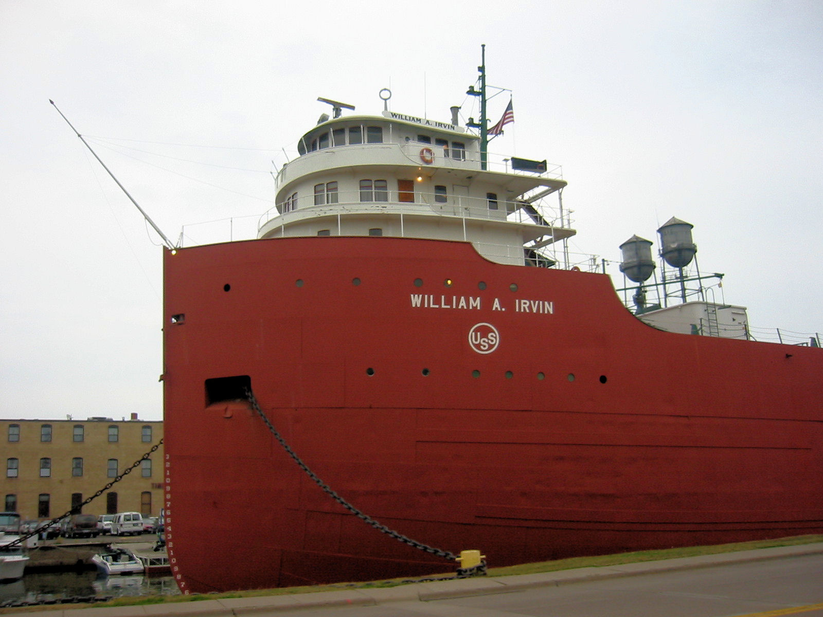
47°2′53″N 92°44′44″W / 47.04806°N 92.74556°WMeadowlands 112 WILLIAM A. IRVIN (freighter) 
July 13, 1989 Minnesota Slip in Duluth Harbor
46°47′0″N 92°5′51″W / 46.783333°N 92.0975°WDuluth 113 Wirth Building 
July 25, 1991 13 W. Superior St.
46°47′13″N 92°5′56″W / 46.78694°N 92.09889°WDuluth 114 YWCA of Duluth June 1, 2011 202 W. 2nd St.
46°47′11″N 92°6′11″W / 46.78639°N 92.10306°WDuluth Duluth's Central Business District MPS See also
References
- ^ "National Register of Historic Places: Weekly List Actions". National Park Service, United States Department of the Interior. Retrieved on November 10, 2011.
- ^ Numbers represent an ordering by significant words. Various colorings, defined here, differentiate National Historic Landmark sites and National Register of Historic Places Districts from other NRHP buildings, structures, sites or objects.
- ^ "National Register Information System". National Register of Historic Places. National Park Service. 2008-04-24. http://nrhp.focus.nps.gov/natreg/docs/All_Data.html.
Nord, Mary Ann (2003). The National Register of Historic Places in Minnesota. Minnesota Historical Society. ISBN 0-87351-448-3.
External links
- A list of the above sites, with street addresses and other information, is available at St. Louis County, MN listing of National Register of Historic Places.com, a private site serving up NRHP information.
U.S. National Register of Historic Places Topics Lists by states Alabama • Alaska • Arizona • Arkansas • California • Colorado • Connecticut • Delaware • Florida • Georgia • Hawaii • Idaho • Illinois • Indiana • Iowa • Kansas • Kentucky • Louisiana • Maine • Maryland • Massachusetts • Michigan • Minnesota • Mississippi • Missouri • Montana • Nebraska • Nevada • New Hampshire • New Jersey • New Mexico • New York • North Carolina • North Dakota • Ohio • Oklahoma • Oregon • Pennsylvania • Rhode Island • South Carolina • South Dakota • Tennessee • Texas • Utah • Vermont • Virginia • Washington • West Virginia • Wisconsin • WyomingLists by territories Lists by associated states Other  Category:National Register of Historic Places •
  Portal:National Register of Historic PlacesCategories:
- National Register of Historic Places in Minnesota by county
- St. Louis County, Minnesota
- Buildings and structures in St. Louis County, Minnesota
-


Wikimedia Foundation. 2010.