- National Register of Historic Places listings in St. Mary Parish, Louisiana
-
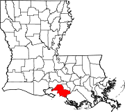
 Location of St. Mary Parish in Louisiana
This is a list of the National Register of Historic Places listings in St. Mary Parish, Louisiana.
This is intended to be a complete list of the properties and districts on the National Register of Historic Places in St. Mary Parish, Louisiana, United States. The locations of National Register properties and districts for which the latitude and longitude coordinates are included below, may be seen in a Google map.[1]
There are 27 properties and districts listed on the National Register in the parish.
-
- This National Park Service list is complete through NPS recent listings posted November 10, 2011.[2]
Current listings
[3] Landmark name[4] Image Date listed Location City or Town Summary 1 Albania Plantation House January 26, 2001 1842 Louisiana Highway 182, E.
29°54′12″N 91°38′58″W / 29.90333°N 91.64944°WJeanerette 2 Alice C Plantation House October 24, 2000 10736 Louisiana Highway 182
29°46′10″N 91°28′38″W / 29.76944°N 91.47722°WFranklin 3 Arlington Plantation House October 5, 1982 56 E. Main St.
29°46′43″N 91°29′35″W / 29.77861°N 91.49306°WFranklin 4 Atkinson Memorial Presbyterian Church March 19, 1991 214 4th St.
29°41′34″N 91°12′4″W / 29.69278°N 91.20111°WMorgan City 5 Birg House June 24, 1982 Off Louisiana Highway 182
29°49′32″N 91°30′58″W / 29.82556°N 91.51611°WBaldwin 6 Bittersweet October 28, 1980 301 Main St.
29°47′18″N 91°29′21″W / 29.78833°N 91.48917°WFranklin 7 Boy Scout Troop #1 Log Cabin September 7, 2001 601 Adams
29°47′42″N 91°30′22″W / 29.795°N 91.50611°WFranklin 8 Brubaker House September 29, 1995 1102 2nd St.
29°42′7″N 91°12′42″W / 29.70194°N 91.21167°WMorgan City 9 Calumet Plantation House October 18, 1984 West of Patterson on Louisiana Highway 182
29°42′42″N 91°20′40″W / 29.71167°N 91.34444°WPatterson 10 Joshua B. Cary House August 11, 1982 U.S. Route 90 and Louisiana Highway 317
29°45′32″N 91°25′41″W / 29.75889°N 91.42806°WCenterville 11 Darby House August 11, 1982 102 Main St.
29°50′14″N 91°32′38″W / 29.83722°N 91.54389°WBaldwin 12 Dixie Plantation House May 29, 1987 Louisiana Highway 182, 1 mile southeast of Franklin
29°46′30″N 91°29′19″W / 29.775°N 91.48861°WFranklin 13 Franklin Historic District 
December 29, 1982 U.S. Route 90; also 600-608 Palfrey St.
29°47′32″N 91°30′10″W / 29.79222°N 91.50278°WFranklin Palfrey St. represents a boundary increase of September 15, 2005 14 Grevemberg House June 6, 1980 Sterling Rd.
29°48′9″N 91°29′48″W / 29.8025°N 91.49667°WFranklin 15 Hanson Lumber Company Office October 7, 1993 10400 Louisiana Highway 182
29°45′56″N 91°27′59″W / 29.76556°N 91.46639°WGarden City 16 Hanson Lumber Company Owner's House October 7, 1993 10407 Louisiana Highway 182
29°45′54″N 91°28′0″W / 29.765°N 91.466667°WGarden City 17 Heaton House October 30, 1980 North of Baldwin on Charenton Rd.
29°52′13″N 91°31′26″W / 29.87028°N 91.52389°WBaldwin 18 Idlewild November 2, 1982 South of Patterson on Louisiana Highway 182
29°40′45″N 91°17′34″W / 29.67917°N 91.29278°WPatterson 19 Hilaire Lancon House November 9, 2001 3934 Irish Bend Rd.
29°50′45″N 91°29′16″W / 29.84583°N 91.48778°WFranklin 20 Morgan City City Hall and Courthouse April 9, 1981 Corner of Everett and 1st Sts.
29°41′42″N 91°14′21″W / 29.695°N 91.23917°WMorgan City 21 Morgan City Historic District January 9, 1986 Roughly bounded by Greenwood St., Arkansas St., Railroad Ave., and Front St.
29°41′43″N 91°12′31″W / 29.69528°N 91.20861°WMorgan City 22 Oaklawn Manor March 30, 1973 5 miles northeast of Franklin on Irish Bend Rd.
29°50′58″N 91°28′3″W / 29.84944°N 91.4675°WFranklin 23 St. Mary's Episcopal Church November 21, 1980 805 1st St.
29°47′38″N 91°32′38″W / 29.79389°N 91.54389°WFranklin 24 Smith House June 6, 1980 909 2nd St.
29°47′42″N 91°30′13″W / 29.795°N 91.50361°WFranklin 25 Southwest Reef Lighthouse September 12, 1991 Junction of Bellevue Front and Canton Sts.
29°41′37″N 91°12′59″W / 29.69361°N 91.21639°WBerwick 26 Tillandsia August 11, 1982 202 Charenton Rd.
29°50′27″N 91°32′32″W / 29.84083°N 91.54222°WBaldwin 27 US Post Office December 17, 1982 1st and Everett Sts.
29°41′39″N 91°12′33″W / 29.69417°N 91.20917°WMorgan City See also
- List of National Historic Landmarks in Louisiana
- National Register of Historic Places listings in Louisiana
References
- ^ The latitude and longitude information provided in this table was derived originally from the National Register Information System, which has been found to be fairly accurate for about 99% of listings. For about 1% of NRIS original coordinates, experience has shown that one or both coordinates are typos or otherwise extremely far off; some corrections may have been made. A more subtle problem causes many locations to be off by up to 150 yards, depending on location in the country: most NRIS coordinates were derived from tracing out latitude and longitudes off of USGS topographical quadrant maps created under North American Datum of 1927, which differs from the current, highly accurate GPS system used by Google maps. Chicago is about right, but NRIS longitudes in Washington are higher by about 4.5 seconds, and are lower by about 2.0 seconds in Maine. Latitudes differ by about 1.0 second in Florida. Some locations in this table may have been corrected to current GPS standards.
- ^ "National Register of Historic Places: Weekly List Actions". National Park Service, United States Department of the Interior. Retrieved on November 10, 2011.
- ^ Numbers represent an ordering by significant words. Various colorings, defined here, differentiate National Historic Landmark sites and National Register of Historic Places Districts from other NRHP buildings, structures, sites or objects.
- ^ "National Register Information System". National Register of Historic Places. National Park Service. 2009-03-13. http://nrhp.focus.nps.gov/natreg/docs/All_Data.html.
U.S. National Register of Historic Places Topics Lists by states Alabama • Alaska • Arizona • Arkansas • California • Colorado • Connecticut • Delaware • Florida • Georgia • Hawaii • Idaho • Illinois • Indiana • Iowa • Kansas • Kentucky • Louisiana • Maine • Maryland • Massachusetts • Michigan • Minnesota • Mississippi • Missouri • Montana • Nebraska • Nevada • New Hampshire • New Jersey • New Mexico • New York • North Carolina • North Dakota • Ohio • Oklahoma • Oregon • Pennsylvania • Rhode Island • South Carolina • South Dakota • Tennessee • Texas • Utah • Vermont • Virginia • Washington • West Virginia • Wisconsin • WyomingLists by territories Lists by associated states Other  Category:National Register of Historic Places •
  Portal:National Register of Historic Places
Municipalities and communities of St. Mary Parish, Louisiana Parish seat: Franklin Cities Franklin | Morgan City‡ | Patterson
Towns CDPs Unincorporated
communitiesAdeline | Alice B | Ashton | Avalon | Balco | Bodin | Bonvillain | Burns | Cabot | Caffery | Calumet | Camperdown | Caneland | Choupique | Clausen | Cote Blanche Landing | Cypremort | Dumesnil | Ellerslie | Englewood | Fairfax | Fairville | Farmers | Fivemile Oaks | Florence | Four Corners | Freetown | Garden City | Glencoe | Glenwild | Gold Mine | Gordy | Greenwood | Home Place | Idlewild | Irish Bend | Ivanhoe | Johnson | Julien | Katy | Kemper | Kilgore Plantation | Landry | Linwood | Luke Landing | Marguerite | Maria | Maryland | Matilda | Midway | Morgan City Beach | North Bend | Oaklawn | Oxford | Prevost | Ramos | Richland | Richard | Ricohoc | Rodriguez | Shadyside | Siracusaville | South Bend | Sorrel | Sterling | Todd | United | Verdunville | Wilsons Landing | Wyandotte
Footnotes ‡This populated place also has portions in an adjacent parish or parishes
Categories:- St. Mary Parish, Louisiana
- National Register of Historic Places in Louisiana by parish
- Buildings and structures in St. Mary Parish, Louisiana
-

Wikimedia Foundation. 2010.