- National Register of Historic Places listings in Strafford County, New Hampshire
-
 Location of Strafford County in New Hampshire
This is a list of the National Register of Historic Places listings in Strafford County, New Hampshire.
This is intended to be a complete list of the properties and districts on the National Register of Historic Places in Strafford County, New Hampshire, United States. Latitude and longitude coordinates are provided for many National Register properties and districts; these locations may be seen together in a Google map.[1]
There are 38 properties and districts listed on the National Register in the county, including 1 National Historic Landmark.
Contents: Counties in New Hampshire Belknap - Carroll - Cheshire - Coos - Grafton - Hillsborough - Merrimack - Rockingham - Strafford - Sullivan -
- This National Park Service list is complete through NPS recent listings posted November 10, 2011.[2]
Current listings
[3] Landmark name [4] Image Date listed Location City or town Summary 1 Back River Farm June 22, 1984 Bay View Rd.
43°08′21″N 70°51′16″W / 43.139167°N 70.854444°WDover 2 Canaan Chapel March 11, 1982 Canaan Rd.
43°12′09″N 71°06′04″W / 43.2025°N 71.101111°WBarrington 3 County Farm Bridge May 21, 1975 Northwest of Dover on County Farm Rd.
43°13′14″N 70°56′38″W / 43.220556°N 70.943889°WDover Over Cocheco River 4 Durham Historic District May 31, 1980 Main St. and Newmarket Rd.
43°07′47″N 70°55′10″W / 43.129722°N 70.919444°WDurham 5 Farmington Town Pound September 2, 1993 Northwestern side of Pound Rd. 300 ft (91 m) north of the junction of Ten Rod Rd.
43°21′33″N 71°04′49″W / 43.359167°N 71.080278°WFarmington 6 First Parish Church March 11, 1982 218 Central Ave.
43°10′56″N 70°52′27″W / 43.182222°N 70.874167°WDover 7 First Parish Church Site-Dover Point May 27, 1983 Dover Point Rd.
43°08′26″N 70°50′21″W / 43.140556°N 70.839167°WDover 8 Free Will Baptist Church 
November 13, 1980 Ridge Top Road
43°23′59″N 71°09′33″W / 43.399722°N 71.159167°WNew Durham 9 Garrison Hill Park and Tower September 11, 1987 Abbie Sawyer Memorial Dr.
43°12′34″N 70°52′13″W / 43.209444°N 70.870278°WDover 10 Green Street School March 7, 1985 104 Green St.
43°15′23″N 70°51′50″W / 43.256389°N 70.863889°WSomersworth 11 William Hale House November 18, 1980 5 Hale St.
43°11′37″N 70°52′30″W / 43.193611°N 70.875°WDover 12 Richard Hayes House February 27, 1986 184 Gonic Rd.
43°15′38″N 70°58′44″W / 43.260556°N 70.978889°WRochester 13 Jenness Farm March 2, 2001 626 Pickering Rd.
43°14′36″N 70°56′12″W / 43.243333°N 70.936667°WRochester 14 Lehoullier Building December 26, 1979 161-169 Main St.
43°15′31″N 70°51′46″W / 43.258611°N 70.862778°WSomersworth 15 Milton Town House November 26, 1980 NH 125 and Town House Rd.
43°26′27″N 70°59′05″W / 43.440833°N 70.984722°WMilton 16 New Durham Meetinghouse and Pound December 8, 1980 Old Bay Rd.
43°25′25″N 71°07′42″W / 43.423611°N 71.128333°WNew Durham 17 New Durham Town Hall 
November 13, 1980 Main St. and Ridge Rd.
43°26′02″N 71°09′55″W / 43.433889°N 71.165278°WNew Durham 18 Plumer-Jones Farm March 23, 1979 North of Milton on NH 125
43°27′44″N 70°59′37″W / 43.462222°N 70.993611°WMilton 19 Plummer Homestead June 14, 2002 1273 White Mountain Highway
43°27′35″N 70°59′33″W / 43.459722°N 70.9925°WMilton 20 Public Market March 7, 1985 93 Washington St.
43°11′43″N 70°52′31″W / 43.195278°N 70.875278°WDover 21 Queensbury Mill April 10, 1987 1 Market St.
43°15′54″N 70°51′58″W / 43.265°N 70.866111°WSomersworth 22 Michael Reade House February 12, 1980 43 Main St.
43°11′50″N 70°52′21″W / 43.197222°N 70.8725°WDover 23 Religious Society of Friends Meetinghouse 
February 29, 1980 141 Central Ave.
43°11′12″N 70°52′25″W / 43.186667°N 70.873611°WDover 24 Rochester Commercial and Industrial District 
April 8, 1983 N. Main, Wakefield, Hanson, and S. Main Sts. and Central Square
43°18′11″N 70°58′34″W / 43.303056°N 70.976111°WRochester 25 Rollinsford Town Hall March 5, 1999 667 Main St.
43°14′08″N 70°49′17″W / 43.235556°N 70.821389°WRollinsford 26 St. Thomas Episcopal Church June 7, 1984 5 Hale St.
43°11′37″N 70°52′30″W / 43.193611°N 70.875°WDover 27 Salmon Falls Mill Historic District February 29, 1980 Front St.
43°14′10″N 70°49′05″W / 43.236111°N 70.818056°WRollinsford 28 Sawyer Building May 23, 1980 4-6 Portland St.
43°11′48″N 70°52′21″W / 43.196667°N 70.8725°WDover 29 Sawyer Woolen Mills September 13, 1989 1 Mill St.
43°10′44″N 70°52′35″W / 43.178889°N 70.876389°WDover 30 Strafford County Farm February 25, 1981 County Farm Rd.
43°13′03″N 70°56′31″W / 43.2175°N 70.941944°WDover 31 Strafford Union Academy September 22, 1983 NH 126 and NH 202A
43°16′07″N 71°07′23″W / 43.268611°N 71.123056°WStrafford 32 Gen. John Sullivan House 
November 28, 1972 23 Newmarket Rd.
43°07′48″N 70°55′05″W / 43.13°N 70.918056°WDurham Home of American Revolutionary War General John Sullivan, elected President of New Hampshire. 33 Thompson Hall 
December 6, 1996 Off Main St., University of New Hampshire campus
43°08′09″N 70°55′59″W / 43.135833°N 70.933056°WDurham 34 US Post Office-Dover Main July 17, 1986 133-137 Washington St.
43°11′42″N 70°52′39″W / 43.195°N 70.8775°WDover 35 US Post Office-Somersworth Main July 17, 1986 2 Elm St.
43°15′33″N 70°52′18″W / 43.259167°N 70.871667°WSomersworth 36 Wiswall Falls Mills Site March 18, 1988 Address Restricted Durham 37 Woodman Institute 
July 24, 1980 182 Central Ave.
43°11′20″N 70°52′28″W / 43.188889°N 70.874444°WDover 38 Samuel Wyatt House December 2, 1982 7 Church St.
43°11′30″N 70°52′31″W / 43.191667°N 70.875278°WDover See also
- List of National Historic Landmarks in New Hampshire
- National Register of Historic Places listings in New Hampshire
References
- ^ The latitude and longitude information provided in this table was derived originally from the National Register Information System, which has been found to be fairly accurate for about 99% of listings. For about 1% of NRIS original coordinates, experience has shown that one or both coordinates are typos or otherwise extremely far off; some corrections may have been made. A more subtle problem causes many locations to be off by up to 150 yards, depending on location in the country: most NRIS coordinates were derived from tracing out latitude and longitudes off of USGS topographical quadrant maps created under the North American Datum of 1927, which differs from the current, highly accurate WGS84 GPS system used by Google maps. Chicago is about right, but NRIS longitudes in Washington are higher by about 4.5 seconds, and are lower by about 2.0 seconds in Maine. Latitudes differ by about 1.0 second in Florida. Some locations in this table may have been corrected to current GPS standards.
- ^ "National Register of Historic Places: Weekly List Actions". National Park Service, United States Department of the Interior. Retrieved on November 10, 2011.
- ^ Numbers represent an ordering by significant words. Various colorings, defined here, differentiate National Historic Landmark sites and National Register of Historic Places Districts from other NRHP buildings, structures, sites or objects.
- ^ "National Register Information System". National Register of Historic Places. National Park Service. . http://nrhp.focus.nps.gov/natreg/docs/All_Data.html.
U.S. National Register of Historic Places Topics Lists by states Alabama • Alaska • Arizona • Arkansas • California • Colorado • Connecticut • Delaware • Florida • Georgia • Hawaii • Idaho • Illinois • Indiana • Iowa • Kansas • Kentucky • Louisiana • Maine • Maryland • Massachusetts • Michigan • Minnesota • Mississippi • Missouri • Montana • Nebraska • Nevada • New Hampshire • New Jersey • New Mexico • New York • North Carolina • North Dakota • Ohio • Oklahoma • Oregon • Pennsylvania • Rhode Island • South Carolina • South Dakota • Tennessee • Texas • Utah • Vermont • Virginia • Washington • West Virginia • Wisconsin • WyomingLists by territories Lists by associated states Other Municipalities and communities of Strafford County, New Hampshire Cities 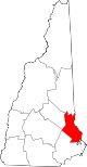
Towns Barrington | Durham | Farmington | Lee | Madbury | Middleton | Milton | New Durham | Rollinsford | Strafford
Villages Bow Lake Village | Center Strafford | East Rochester | Milton Mills
Categories:- National Register of Historic Places in New Hampshire by county
- Strafford County, New Hampshire
-


Wikimedia Foundation. 2010.