- National Register of Historic Places listings in Sumter County, South Carolina
-
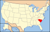
 Location of Sumter County in South Carolina
This is a list of the National Register of Historic Places listings in Sumter County, South Carolina.
This is intended to be a complete list of the properties and districts on the National Register of Historic Places in Sumter County, South Carolina, United States. The locations of National Register properties and districts for which the latitude and longitude coordinates are included below, may be seen in a Google map.[1]
There are 27 properties and districts listed on the National Register in the county, including 3 National Historic Landmarks.
-
- This National Park Service list is complete through NPS recent listings posted November 10, 2011.[2]
Current listings
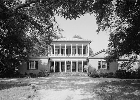
[3] Landmark name [4] Image Date listed Location City or town Summary 1 Borough House Plantation 
March 23, 1972 South Carolina Highway 261, 0.8 miles north of its intersection with Secondary Road 76/3 78 Stateburg 2 J. Clinton Brogdon House July 1, 1993 3755 Boots Branch Rd.
33°48′34″N 80°15′52″W / 33.809444°N 80.264444°WSumter 3 Carnegie Public Library August 5, 1994 219 W. Liberty St.
33°55′14″N 80°20′47″W / 33.920556°N 80.346389°WSumter 4 Ellerbe's Mill November 20, 1974 About 3 miles south of Rembert off U.S. Route 521 on Rafting Creek Rembert 5 Goodwill Parochial School May 30, 1997 295 N. Brick Church Rd.
33°54′44″N 80°08′19″W / 33.912222°N 80.138611°WMayesville 6 Heriot-Moise House December 21, 1989 Junction of U.S. Route 401 and Brewington Rd. Sumter 7 Holy Cross Episcopal Church 
November 7, 1973 South Carolina Highway 261
33°57′45″N 80°31′55″W / 33.9625°N 80.531944°WStateburg 8 Lenoir Store July 3, 1997 3240 Horatio Rd.
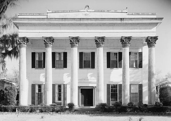
34°01′17″N 80°34′05″W / 34.021389°N 80.568056°WHoratio 9 Magnolia Hall September 2, 1999 2025 Horatio-Hagood Rd. Hagood 10 Charles T. Mason House July 3, 1997 111 Mason Croft Sumter 11 Mayesville Historic District July 16, 1979 Irregular pattern along Lafayette St. Mayesville 12 Millford Plantation 
November 19, 1971 West of Pinewood on South Carolina Highway 261 Pinewood 13 Myrtle Moor January 13, 1983 Address Restricted Sumter 14 O'Donnell House April 25, 1996 120 E. Liberty St. Sumter 15 Orange Grove August 19, 1993 Junction of South Carolina Highways 43 (Black River Rd.) and 441 Dalzell 16 Pinewood Depot June 10, 1997 Junction of East Ave. and Clarke St.
33°44′25″N 80°27′47″W / 33.740278°N 80.463056°WPinewood 17 Rip Raps Plantation December 12, 1978 East of Sumter on South Carolina Highway 378 Sumter 18 St. Mark's Church January 20, 1978 West of Pinewood on South Carolina Highway 51
33°44′50″N 80°30′40″W / 33.747222°N 80.511111°WPinewood 19 Salem Black River Presbyterian Church November 14, 1978 East of Sumter on U.S. Route 521
33°55′57″N 80°09′39″W / 33.9325°N 80.160833°WSumter 20 Henry Lee Scarborough House January 20, 1995 425 N. Main St.
33°55′42″N 80°20′26″W / 33.928333°N 80.340556°WSumter 21 Singleton's Graveyard May 13, 1976 6 miles south of Wedgefield off South Carolina Highway 261
33°49′52″N 80°33′15″W / 33.831111°N 80.554167°WWedgefield 22 Stateburg Historic District February 24, 1971 Roughly bounded by U.S. Route 76 and South Carolina Highways 261 and 441 Sumter 23 Sumter County Courthouse 
June 16, 2004 141 N. Main St.
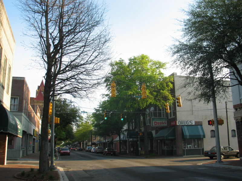
33°55′28″N 80°20′29″W / 33.924444°N 80.341389°WSumter 24 Sumter Historic District 
April 21, 1975 Commercial area centered around Main and Liberty Sts.
33°55′13″N 84°20′30″W / 33.920389°N 84.341694°WSumter 25 Sumter Town Hall-Opera House May 24, 1973 N. Main St.
33°55′15″N 80°20′30″W / 33.920833°N 80.341667°WSumter 26 Temple Sinai January 21, 1999 11 Church St.
33°55′18″N 80°20′48″W / 33.921667°N 80.346667°WSumter 27 Elizabeth White House March 21, 1978 421 N. Main St.
33°55′41″N 80°20′27″W / 33.928056°N 80.340833°WSumter See also
- List of National Historic Landmarks in South Carolina
- National Register of Historic Places listings in South Carolina
References
- ^ The latitude and longitude information provided in this table was derived originally from the National Register Information System, which has been found to be fairly accurate for about 99% of listings. For about 1% of NRIS original coordinates, experience has shown that one or both coordinates are typos or otherwise extremely far off; some corrections may have been made. A more subtle problem causes many locations to be off by up to 150 yards, depending on location in the country: most NRIS coordinates were derived from tracing out latitude and longitudes off of USGS topographical quadrant maps created under the North American Datum of 1927, which differs from the current, highly accurate WGS84 GPS system used by Google maps. Chicago is about right, but NRIS longitudes in Washington are higher by about 4.5 seconds, and are lower by about 2.0 seconds in Maine. Latitudes differ by about 1.0 second in Florida. Some locations in this table may have been corrected to current GPS standards.
- ^ "National Register of Historic Places: Weekly List Actions". National Park Service, United States Department of the Interior. Retrieved on November 10, 2011.
- ^ Numbers represent an ordering by significant words. Various colorings, defined here, differentiate National Historic Landmark sites and National Register of Historic Places Districts from other NRHP buildings, structures, sites or objects.
- ^ "National Register Information System". National Register of Historic Places. National Park Service. . http://nrhp.focus.nps.gov/natreg/docs/All_Data.html.
U.S. National Register of Historic Places in South Carolina Lists by county Abbeville • Aiken • Allendale • Anderson • Bamberg • Barnwell • Beaufort • Berkeley • Calhoun • Charleston • Cherokee • Chester • Chesterfield • Clarendon • Colleton • Darlington • Dillon • Dorchester • Edgefield • Fairfield • Florence • Georgetown • Greenville • Greenwood • Hampton • Horry • Jasper • Kershaw • Lancaster • Laurens • Lee • Lexington • Marion • Marlboro • McCormick • Newberry • Oconee • Orangeburg • Pickens • Richland • Saluda • Spartanburg • Sumter • Union • Williamsburg • York
Lists by city Other lists Municipalities and communities of Sumter County, South Carolina City 
Towns CDPs Cane Savannah | Cherryvale | Dalzell | East Sumter | Lakewood | Millwood | Mulberry | Oakland | Oswego | Privateer | Rembert | Shiloh | South Sumter | Stateburg | Wedgewood
Unincorporated
communitiesHagood | Horatio | Wedgefield
Categories:- Sumter County, South Carolina
- National Register of Historic Places in South Carolina by county
-


Wikimedia Foundation. 2010.