- National Register of Historic Places listings in Swain County, North Carolina
-

This list includes properties and districts listed on the National Register of Historic Places in Swain County, North Carolina. Click the "Map of all coordinates" link to the right to view a Google map of all properties and districts with latitude and longitude coordinates in the table below.[1]
-
- This National Park Service list is complete through NPS recent listings posted November 10, 2011.[2]
Landmark name Image Date listed Location City or Town Summary 1 Frye-Randolph House and Fryemont Inn February 18, 1983 Fryemont Rd.
35°25′28.74″N 83°26′42.41″W / 35.42465°N 83.4451139°WBryson City 2 Governors Island 
June 4, 1973 Address Restricted Bryson City 3 Hall Cabin January 30, 1976 15 miles NE of Fontana in Great Smoky Mountains National Park
35°31′12″N 83°40′46″W / 35.52°N 83.67944°WFontana 4 Abel Hyatt House March 22, 1991 E. side NC 1168, 0.2 miles N of jct with NC 1191
35°26′14″N 83°23′48″W / 35.43722°N 83.39667°WBryson City 5 Nununyi Mound and Village Site January 22, 1980 Address Restricted Cherokee 6 Oconaluftee Archeological District February 19, 1982 Address Restricted Cherokee 7 Oconaluftee Baptist Church January 1, 1976 6 miles N of Cherokee on U.S. 441 in Great Smoky Mountains National Park
35°33′13″N 83°18′31″W / 35.55361°N 83.30861°WCherokee 8 Swain County Courthouse 
May 10, 1979 Main and Fry Sts.
35°25′40″N 83°26′44″W / 35.42778°N 83.44556°WBryson City See also
- National Register of Historic Places listings in North Carolina
- List of National Historic Landmarks in North Carolina
References
- ^ The latitude and longitude information provided in this table was derived originally from the National Register Information System, which has been found to be fairly accurate for about 99% of listings. For about 1% of NRIS original coordinates, experience has shown that one or both coordinates are typos or otherwise extremely far off; some corrections may have been made. A more subtle problem causes many locations to be off by up to 150 yards, depending on location in the country: most NRIS coordinates were derived from tracing out latitude and longitudes off of USGS topographical quadrant maps created under the North American Datum of 1927, which differs from the current, highly accurate WGS84 GPS system used by Google maps. Chicago is about right, but NRIS longitudes in Washington are higher by about 4.5 seconds, and are lower by about 2.0 seconds in Maine. Latitudes differ by about 1.0 second in Florida. Some locations in this table may have been corrected to current GPS standards.
- ^ "National Register of Historic Places: Weekly List Actions". National Park Service, United States Department of the Interior. Retrieved on November 10, 2011.
U.S. National Register of Historic Places Topics Lists by states Alabama • Alaska • Arizona • Arkansas • California • Colorado • Connecticut • Delaware • Florida • Georgia • Hawaii • Idaho • Illinois • Indiana • Iowa • Kansas • Kentucky • Louisiana • Maine • Maryland • Massachusetts • Michigan • Minnesota • Mississippi • Missouri • Montana • Nebraska • Nevada • New Hampshire • New Jersey • New Mexico • New York • North Carolina • North Dakota • Ohio • Oklahoma • Oregon • Pennsylvania • Rhode Island • South Carolina • South Dakota • Tennessee • Texas • Utah • Vermont • Virginia • Washington • West Virginia • Wisconsin • WyomingLists by territories Lists by associated states Other Municipalities and communities of Swain County, North Carolina Towns 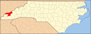
Unincorporated
communityFootnotes ‡This populated place also has portions in an adjacent county or counties
Categories:- Swain County, North Carolina
- National Register of Historic Places in North Carolina
- Buildings and structures in Swain County, North Carolina
-


Wikimedia Foundation. 2010.