- National Register of Historic Places listings in Utah County, Utah
-
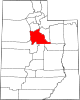
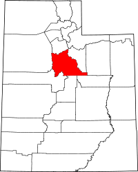 Location of Utah County in Utah
This is a list of the National Register of Historic Places listings in Utah County, Utah.
This is intended to be a complete list of the properties and districts on the National Register of Historic Places in Utah County, Utah, United States. Latitude and longitude coordinates are provided for many National Register properties and districts; these locations may be seen together in a Google map.[1]
There are 172 properties and districts listed on the National Register in the county, including 1 National Historic Landmark.
-
- This National Park Service list is complete through NPS recent listings posted November 10, 2011.[2]
Current listings
[3] Landmark name [4] Image Date listed Location City or town Summary 1 George and Temperance Adams House December 30, 1999 196 W. 400 South
40°17′25″N 111°41′58″W / 40.290278°N 111.699444°WOrem 2 John Alma Adams House June 9, 1987 625 E. 200 South
40°21′42″N 111°43′34″W / 40.361667°N 111.726111°WPleasant Grove 3 William D. Alexander House 
July 28, 1983 91 W. 200 South
40°13′51″N 111°39′33″W / 40.230833°N 111.659167°WProvo 4 Dr. Samuel H. Allen House and Carriage House 
May 18, 1979 135 E. 200 North
40°14′12″N 111°39′19″W / 40.236667°N 111.655278°WProvo 5 Alpine City Hall December 19, 1991 20 N. Main St.
40°27′12″N 111°46′36″W / 40.453333°N 111.776667°WAlpine 6 Alpine LDS Church Meetinghouse May 24, 1990 50 N. Main St.
40°27′14″N 111°46′37″W / 40.453889°N 111.776944°WAlpine 7 American Fork Cemetery Rock Wall October 7, 1994 600 N. 100 East
40°23′21″N 111°47′47″W / 40.389167°N 111.796389°WAmerican Fork 8 American Fork City Hall 
April 7, 1994 31 Church St.
40°22′23″N 111°47′50″W / 40.373056°N 111.797222°WAmerican Fork 9 American Fork Historic District December 10, 1998 Roughly along 100 South from 300 West to 200 East
40°22′29″N 111°47′59″W / 40.374722°N 111.799722°WAmerican Fork 10 American Fork Presbyterian Church 
May 23, 1980 75 N. 1st East St.
40°22′41″N 111°47′44″W / 40.378056°N 111.795556°WAmerican Fork 11 American Fork Second Ward Meetinghouse March 10, 1992 130 W. 100 South
40°22′32″N 111°48′05″W / 40.375556°N 111.801389°WAmerican Fork 12 American Fork Third Ward Meetinghouse December 20, 2002 190 W. 300 North
40°23′01″N 111°48′09″W / 40.383611°N 111.8025°WAmerican Fork 13 Ashton-Driggs House April 14, 1972 119 E. Battlecreek Rd.
40°21′42″N 111°44′13″W / 40.361667°N 111.736944°WPleasant Grove 14 Thomas Austin House July 26, 1982 427 E. 500 North
40°23′39″N 111°50′32″W / 40.394167°N 111.842222°WLehi 15 Bank of American Fork 
March 9, 1993 5 E. Main St.
40°22′37″N 111°47′51″W / 40.376944°N 111.7975°WAmerican Fork 16 David and Drusilla Baxter House 
June 11, 1998 206 W. 1600 North
40°19′37″N 111°42′01″W / 40.326944°N 111.700278°WOrem 17 Beck No. 2 Mine March 14, 1979 Southeast of Eureka
39°56′38″N 112°05′48″W / 39.943889°N 112.096667°WEureka 18 George Angus and Martha Ansil Beebe House 
October 31, 1980 489 W. 100 South
40°13′56″N 111°39′58″W / 40.232222°N 111.666111°WProvo 19 Beers House-Hotel April 7, 1994 65 N. 100 East
40°21′54″N 111°44′16″W / 40.365°N 111.737778°WPleasant Grove 20 Roswell Darius Bird, Sr. House November 28, 1980 115 S. Main St.
40°07′46″N 111°34′40″W / 40.129444°N 111.577778°WMapleton 21 John E. Booth House 
February 11, 1982 59 W. 500 North
40°14′25″N 111°39′32″W / 40.240278°N 111.658889°WProvo 22 William and Ann Bringhurst House January 5, 1998 306 S. 200 West
40°09′45″N 111°36′49″W / 40.1625°N 111.613611°WSpringville 23 George M. Brown House 
December 1, 1982 284 E. 100 North
40°14′06″N 111°39′10″W / 40.235°N 111.652778°WProvo 24 Stephen and Mary Bunnell House October 22, 1996 970 S. 800 West on the campus of Utah Valley University
40°16′48″N 111°42′55″W / 40.28°N 111.715278°WOrem 25 Caffrey and Davis Furniture Company-Senior Hotel January 5, 1998 296 S. Main St.
40°09′48″N 111°36′37″W / 40.163333°N 111.610278°WSpringville 26 Camp Floyd Site November 11, 1974 0.5 miles south of Fairfield
40°15′26″N 112°06′14″W / 40.257222°N 112.103889°WFairfield 27 Camp Williams Hostess House/Officers' Club April 1, 1985 Off State Route 68
40°26′03″N 111°55′17″W / 40.434167°N 111.921389°WCamp W. G. Williams 28 Carter-Terry-Call House June 11, 1998 815 E. 800 South
40°16′57″N 111°40′31″W / 40.2825°N 111.675278°WOrem 29 Cedar Fort School April 6, 2000 40 E. Center St.
40°19′37″N 112°06′19″W / 40.326944°N 112.105278°WCedar Fort 30 Charcoal Kilns March 14, 1979 Northeast of Eureka
39°58′25″N 112°04′00″W / 39.973611°N 112.066667°WEureka 31 Delbert and Ora Chipman House January 25, 1995 317 E. Main St.
40°22′25″N 111°47′21″W / 40.373611°N 111.789167°WAmerican Fork 32 Henry & Elizabeth Parker Chipman House February 1, 2010 846 E. 300 N.
40°22′58″N 111°46′30″W / 40.382814°N 111.775017°WAmerican Fork 33 Christeele Acres Historic District December 30, 1999 Roughly bounded by State St., 900 South, 450 East, and 1010 South
40°16′46″N 111°41′06″W / 40.279444°N 111.685°WOrem 34 Clark-Taylor House 
October 7, 1975 306 N. 500 West
40°14′17″N 111°39′59″W / 40.238056°N 111.666389°WProvo 35 Clinger-Booth House June 11, 1998 468 S. Main St.
40°17′19″N 111°41′42″W / 40.288611°N 111.695°WOrem 36 Harvey H. Cluff House 
August 4, 1982 174 N. 100 East
40°14′10″N 111°39′21″W / 40.236111°N 111.655833°WProvo 37 Alexander and Nellie P. Cordner House June 11, 1998 415 S. 400 East
40°17′22″N 111°41′06″W / 40.289444°N 111.685°WOrem 38 William James and Edna Cordner House 
June 11, 1998 440 S. State St.
40°17′21″N 111°41′28″W / 40.289167°N 111.691111°WOrem 39 Cordner-Calder House June 11, 1998 305 S. 900 East
40°17′29″N 111°40′22″W / 40.291389°N 111.672778°WOrem 40 Crandall Houses January 19, 1983 112 and 136 E. 200 North
40°10′09″N 111°36′28″W / 40.169167°N 111.607778°WSpringville 41 William J. and Lizzie Cullimore House 
June 11, 1998 396 W. 1600 North
40°19′40″N 111°42′17″W / 40.327778°N 111.704722°WOrem 42 Thomas R. Cutler Mansion July 12, 1984 150 E. State St.
40°23′45″N 111°50′42″W / 40.395833°N 111.845°WLehi 43 Dallin House March 31, 1994 253 S. 300 East
40°09′45″N 111°36′11″W / 40.1625°N 111.603056°WSpringville 44 Charles E. Davies House 
August 4, 1982 388 W. 300 North
40°14′17″N 111°39′52″W / 40.238056°N 111.664444°WProvo 45 Joshua Davis House June 11, 1998 1888 S. Main St.
40°15′46″N 111°41′39″W / 40.262778°N 111.694167°WOrem 46 Davis-Ercanbrack Farmstead October 2, 1998 2044 S. Main St.
40°15′37″N 111°41′40″W / 40.260278°N 111.694444°WOrem 47 Roe A. and Louise R. Deal House January 5, 1998 39 E. 200 North
40°09′52″N 111°36′34″W / 40.164444°N 111.609444°WSpringville 48 Deal-Mendenhall Hall January 5, 1998 163 E. 200 North
40°10′12″N 111°36′24″W / 40.17°N 111.606667°WSpringville 49 Cecil I. and Mildred H. Dimick House June 11, 1998 575 W. 800 North
40°18′43″N 111°42′33″W / 40.311944°N 111.709167°WOrem 50 Christopher F. Dixon, Jr., House November 7, 1977 248 N. Main St.
40°02′46″N 111°43′52″W / 40.046111°N 111.731111°WPayson 51 John Dixon House February 17, 1978 218 N. Main St.
40°02′45″N 111°43′53″W / 40.045833°N 111.731389°WPayson 52 Samuel Douglass House August 21, 1992 215 N. Main St.
40°02′45″N 111°43′54″W / 40.045833°N 111.731667°WPayson 53 Frederick and Della Dunn House August 3, 1990 145 N. Main St.
40°10′09″N 111°36′37″W / 40.169167°N 111.610278°WSpringville 54 Dunn-Binnall House & Farmstead February 1, 2010 352 N. 200 East
40°23′02″N 111°47′33″W / 40.384003°N 111.792364°WAmerican Fork 55 Dr. Elmo and Rhea Eddington House December 4, 1998 617 N. 100 East
40°23′46″N 111°50′46″W / 40.396111°N 111.846111°WLehi 56 Simon P. Eggertsen, Sr. House 
September 13, 1977 390 S. 500 West
40°13′43″N 111°40′01″W / 40.228611°N 111.666944°WProvo 57 Eureka Lilly Headframe March 14, 1979 East of Eureka Eureka 58 Fairfield District School 
August 6, 1987 59 N. Church St.
40°15′42″N 112°05′24″W / 40.261667°N 112.09°WFairfield 59 Joseph H. Frisby House 
July 13, 1984 209 N. 400 West
40°14′12″N 111°39′58″W / 40.236667°N 111.666111°WProvo 60 Fugal Blacksmith Shop 
April 7, 1994 Approximately 680 N. 400 East
40°22′15″N 111°43′54″W / 40.370833°N 111.731667°WPleasant Grove 61 Fugal Dugout House March 27, 1986 630 N. 400 East
40°22′14″N 111°43′55″W / 40.370556°N 111.731944°WPleasant Grove 62 Roy H. and Florence B. Gappmayer House June 11, 1998 95 E. 1200 South
40°16′31″N 111°41′32″W / 40.275278°N 111.692222°WOrem 63 Ira W. Gardner House July 28, 1977 10 N. Main St.
40°03′17″N 111°40′20″W / 40.054722°N 111.672222°WSalem 64 James H. and Rhoda H. Gardner House December 4, 1998 187 E. 300 North
40°23′39″N 111°50′47″W / 40.394167°N 111.846389°WLehi 65 Charles T.H. Goode House June 9, 1987 1215 E. Main St.
40°22′33″N 111°46′05″W / 40.375833°N 111.768056°WAmerican Fork 66 Samuel I. and Olena J. Goodwin House December 4, 1998 80 W. 400 North
40°23′34″N 111°50′59″W / 40.392778°N 111.849722°WLehi 67 Samuel Green House June 9, 1987 264 E. 200 South
40°21′40″N 111°44′07″W / 40.361111°N 111.735278°WPleasant Grove 68 John Hafen House July 23, 1982 956 S. Main St.
40°09′14″N 111°36′33″W / 40.153889°N 111.609167°WSpringville 69 Alfred William Harper House June 9, 1987 125 W. 400 North
40°20′40″N 111°43′01″W / 40.344444°N 111.716944°WLindon 70 Harrington Elementary School 
March 4, 1993 50 N. Center St.
40°22′40″N 111°47′50″W / 40.377778°N 111.797222°WAmerican Fork 71 Hines Mansion 
July 12, 1978 125 S. 4th West
40°14′03″N 111°39′51″W / 40.234167°N 111.664167°WProvo 72 Lars and Agnes Jensen House December 30, 1999 87 N. 800 West
40°17′55″N 111°42′54″W / 40.298611°N 111.715°WOrem 73 Mont and Harriet Johnson House January 5, 1998 153 E. 400 North
40°10′22″N 111°36′25″W / 40.172778°N 111.606944°WSpringville 74 Peter Axel Johnson House October 22, 1984 1075 N. 100 East
40°22′30″N 111°44′21″W / 40.375°N 111.739167°WPleasant Grove 75 Johnson-Hansen House 
December 1, 1994 485 E. 400 South
40°13′43″N 111°38′50″W / 40.228611°N 111.647222°WProvo 76 Johnson-Kearns Hotel January 5, 1998 94 W. 200 South
40°09′52″N 111°36′40″W / 40.164444°N 111.611111°WSpringville 77 David H. Jones House October 24, 1985 143 S. Main St.
40°06′29″N 111°38′54″W / 40.108056°N 111.648333°WSpanish Fork 78 T.R. Kelly House December 9, 1983 164 W. 200 South
40°09′51″N 111°36′46″W / 40.164167°N 111.612778°WSpringville 79 Nephi and Annie Kindred House January 5, 1998 188 W. Center St.
40°10′01″N 111°36′46″W / 40.166944°N 111.612778°WSpringville 80 Knight Block 
December 2, 1977 1-13 E. Center St. and 20-24 N. University Ave.
40°14′03″N 111°39′27″W / 40.234167°N 111.6575°WProvo 81 Jesse Knight House 
July 23, 1982 185 E. Center St.
40°14′02″N 111°39′16″W / 40.233889°N 111.654444°WProvo 82 Knight-Finch House 
June 11, 1998 212 S. State St.
40°17′35″N 111°41′34″W / 40.293056°N 111.692778°WOrem 83 Knight-Allen House 
July 23, 1982 390 E. Center St.
40°14′00″N 111°39′04″W / 40.233333°N 111.651111°WProvo 84 Knight-Mangum House 
July 23, 1982 381 E. Center St.
40°14′02″N 111°39′04″W / 40.233889°N 111.651111°WProvo 85 Christian and Sarah Knudsen House December 4, 1998 123 S. Center St.
40°23′14″N 111°50′43″W / 40.387222°N 111.845278°WLehi 86 Lakeview Tithing Office January 25, 1985 Off State Route 114
40°15′21″N 111°42′35″W / 40.255833°N 111.709722°WProvo 87 Christen Larsen House July 13, 1987 990 N. 400 East
40°22′29″N 111°43′54″W / 40.374722°N 111.731667°WPleasant Grove 88 Neils Peter Larsen House June 9, 1987 1146 N. 100 East
40°22′35″N 111°44′18″W / 40.376389°N 111.738333°WPleasant Grove 89 Lehi City Hall 
March 1, 1982 51 N. Center St.
40°23′19″N 111°50′56″W / 40.388611°N 111.848889°WLehi 90 Lehi Commercial and Savings Bank-Lehi Hospital 
December 17, 1998 206 E. State St.
40°23′46″N 111°50′42″W / 40.396111°N 111.845°WLehi Demolished in 2009 91 Lehi Main Street Historic District December 10, 1998 Roughly along Main St., between 200 West and Center Sts., and 51 N. Center St.
40°23′17″N 111°51′00″W / 40.388056°N 111.85°WLehi 92 Lehi North Branch Meetinghouse December 4, 1998 1190 N. 500 West
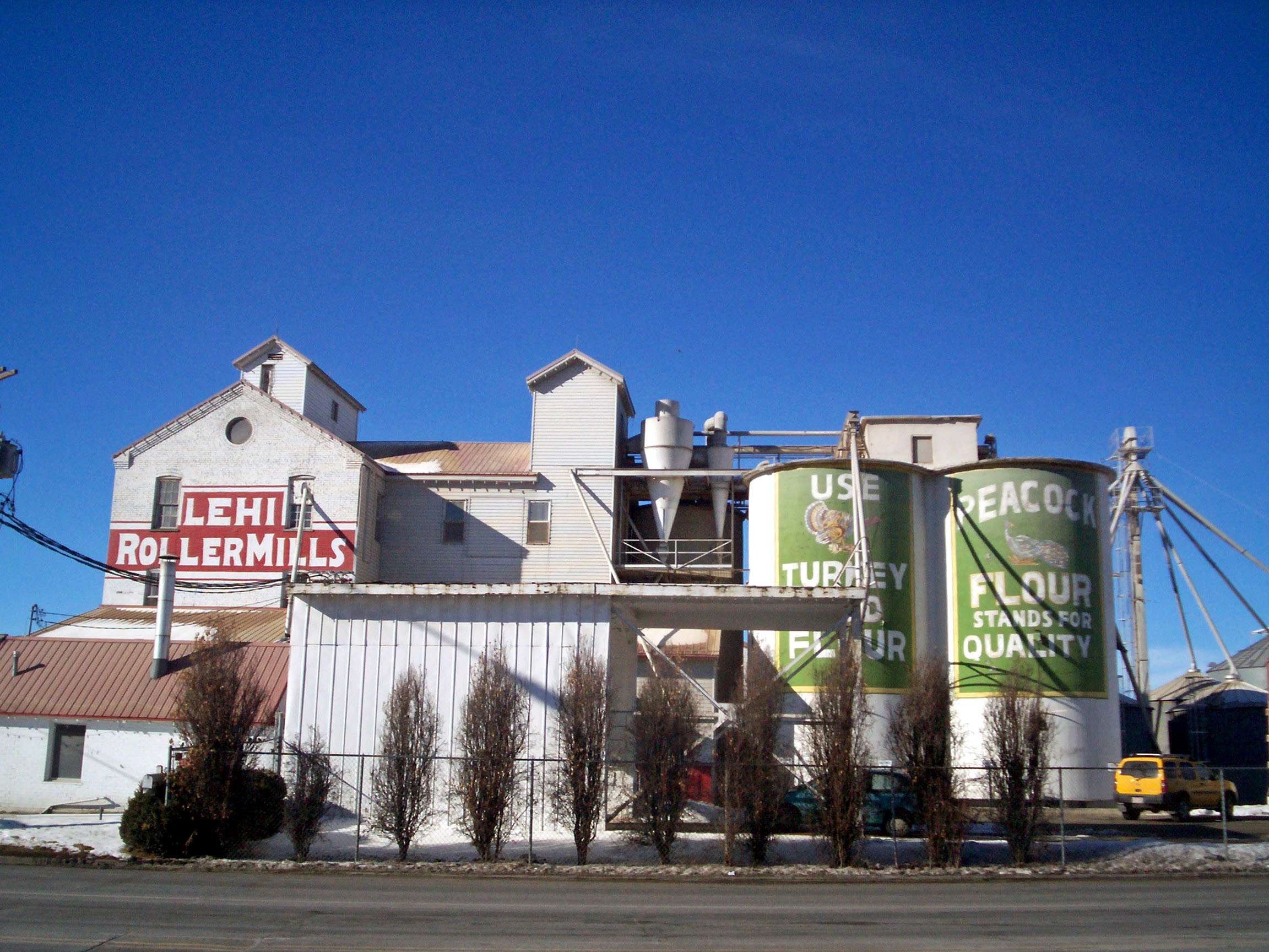
40°23′34″N 111°51′19″W / 40.392778°N 111.855278°WLehi 93 Lehi Roller Mills 
May 26, 1994 700 E. Main St.
40°23′21″N 111°50′08″W / 40.389167°N 111.835556°WLehi 94 Lehi Ward Tithing Barn-Centennial Hall 
December 4, 1998 651 N. 200 East, rear
40°23′45″N 111°50′42″W / 40.395833°N 111.845°WLehi 95 Lewis Terrace April 7, 1983 68-82 N. 700 East
40°14′34″N 111°39′22″W / 40.242778°N 111.656111°WProvo 96 John S. and Izola Lewis House June 11, 1998 343 E. 720 South
40°17′04″N 111°41′12″W / 40.284444°N 111.686667°WOrem 97 Lime Kilns March 14, 1979 Northeast of Eureka
39°58′40″N 112°04′37″W / 39.977778°N 112.076944°WEureka 98 Loveless House September 9, 2010 509 E. 800 South
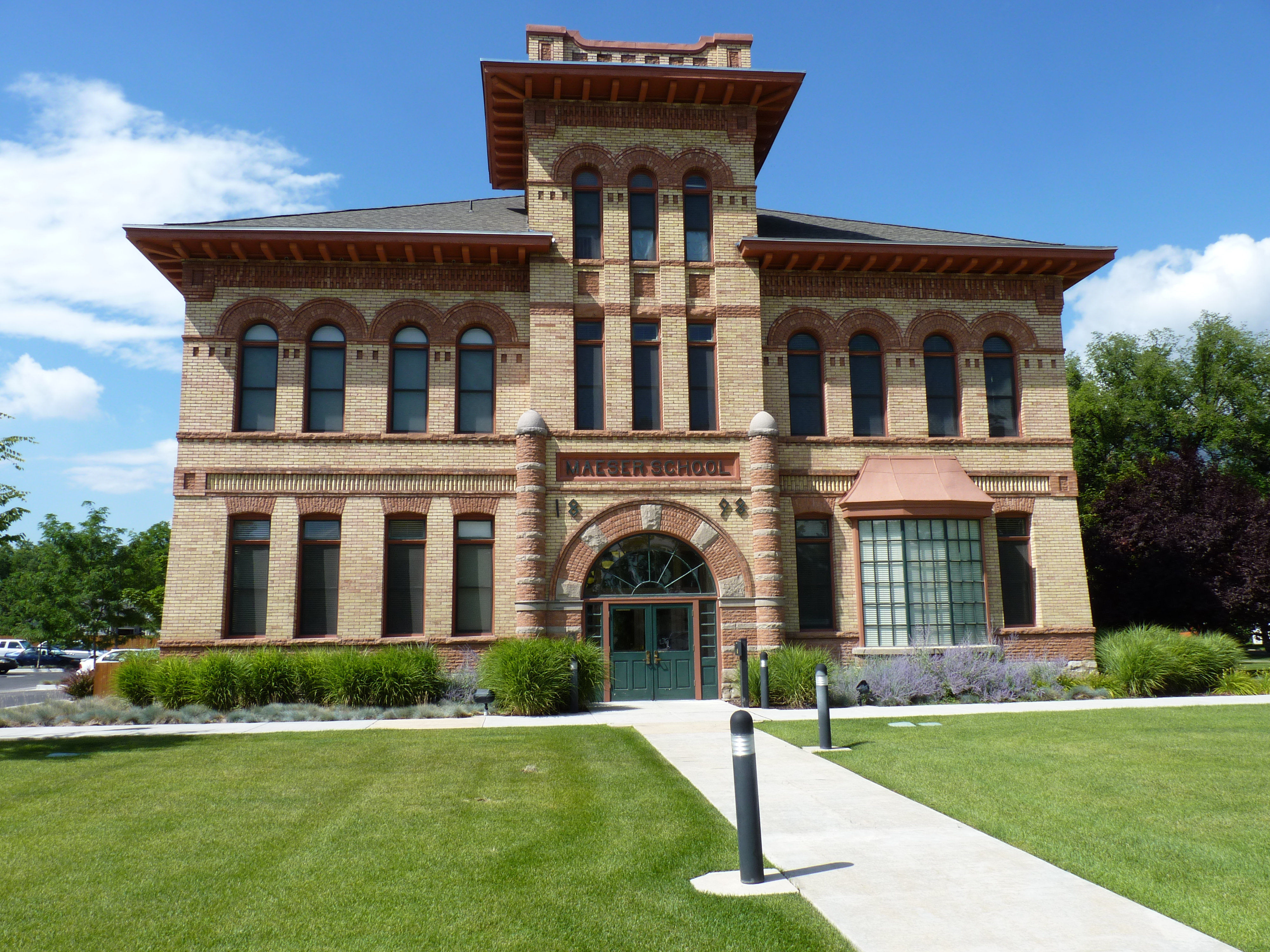
40°16′57″N 111°40′59″W / 40.2825°N 111.683056°WOrem Orem, Utah MPS 99 Maeser School 
July 26, 1982 150 S. 500 East
40°13′52″N 111°38′57″W / 40.231111°N 111.649167°WProvo 100 McBride-Sims Garage June 11, 1998 600 N. State St.
40°18′30″N 111°41′56″W / 40.308333°N 111.698889°WOrem 101 William H. and Sarah D. Meneray House January 5, 1998 190 S. 200 West
40°09′52″N 111°36′49″W / 40.164444°N 111.613611°WSpringville 102 Harry B. Merrihew Drugstore 
July 23, 1982 1st West and Main Sts.
40°23′16″N 111°51′10″W / 40.387778°N 111.852778°WLehi 103 David Morgan House February 19, 1982 Off U.S. Route 6
39°56′54″N 111°54′01″W / 39.948333°N 111.900278°WGoshen 104 Moyle House and Indian Tower December 23, 1992 606 E. 770 North
40°27′52″N 111°45′58″W / 40.464444°N 111.766111°WAlpine 105 Ami and Amanda Oakley House January 5, 1998 219 E. 400 North
40°10′21″N 111°36′20″W / 40.1725°N 111.605556°WSpringville 106 Old Goshen Site 
August 26, 1980 Address Restricted[5] Goshen 107 Olmsted Station Powerhouse 
June 26, 1972 5 miles north of Provo on U.S. Route 189
40°18′57″N 111°39′14″W / 40.315833°N 111.653889°WProvo 108 Joseph Olpin House November 7, 1977 510 Locust Ave.
40°21′28″N 111°43′41″W / 40.357778°N 111.728056°WPleasant Grove 109 Lars and Christina Olsen House June 11, 1998 417 S. 800 East
40°17′22″N 111°40′50″W / 40.289444°N 111.680556°WOrem 110 Milan and Margaret Packard House January 5, 1998 110 W. 100 South
40°09′56″N 111°36′43″W / 40.165556°N 111.611944°WSpringville 111 Payson Historic District July 3, 2007 Roughly bounded by 500 North, 300 East, 500 South, and 400 West
40°02′37″N 111°43′56″W / 40.043567°N 111.732258°WPayson 112 Payson Presbyterian Church March 27, 1986 160 S. Main St.
40°02′07″N 111°43′54″W / 40.035278°N 111.731667°WPayson 113 People's Co-op Building 
December 4, 1998 151 E. State St.
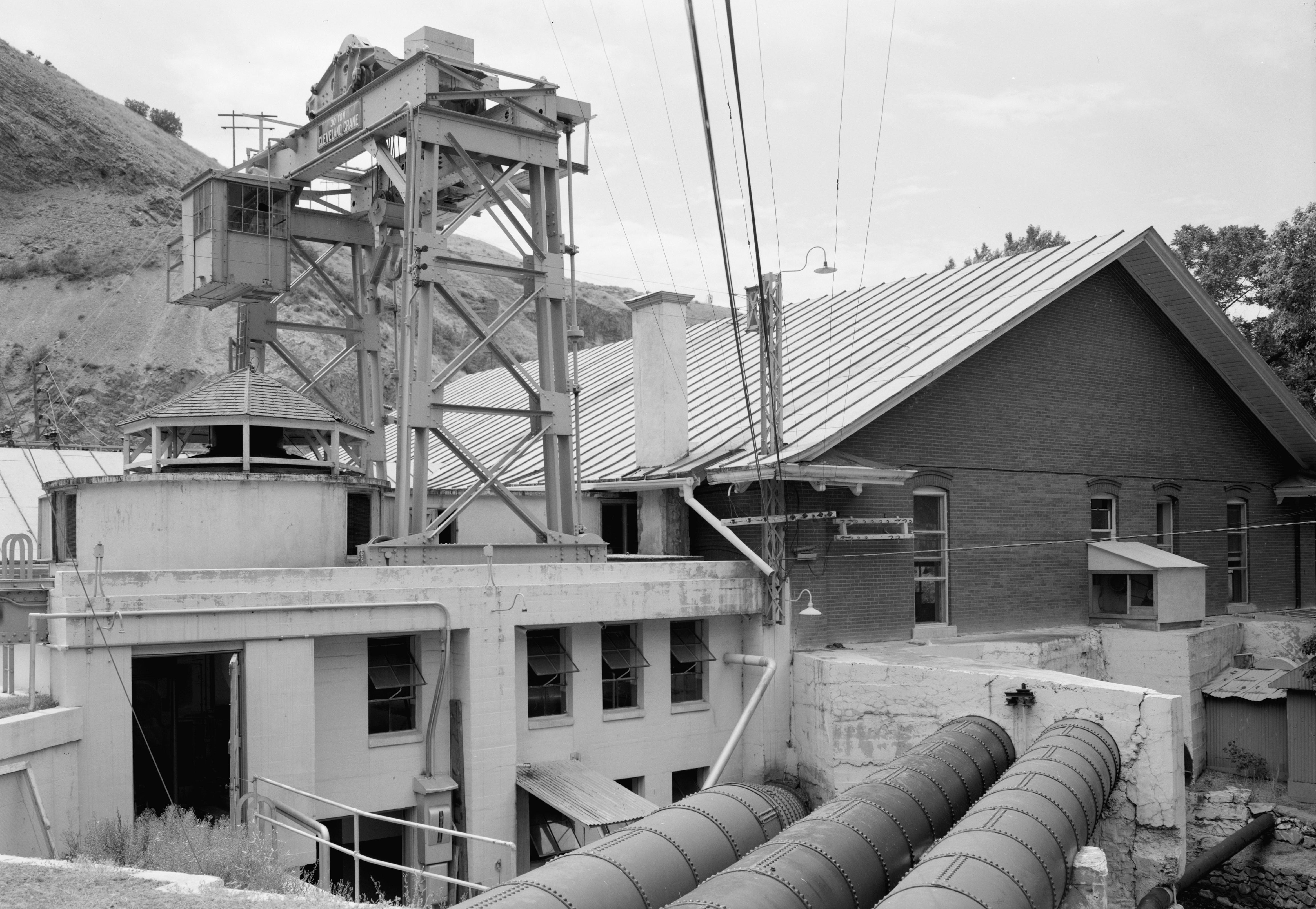
40°23′50″N 111°50′47″W / 40.397222°N 111.846389°WLehi 114 Peteetneet School May 30, 1990 50 N. 500 East
40°02′36″N 111°43′24″W / 40.043333°N 111.723333°WPayson 115 Pleasant Grove Historic District December 13, 1995 Roughly bounded by 100 N., 500 S., 300 E., and 100 W.
40°21′43″N 111°44′17″W / 40.361944°N 111.738056°WPleasant Grove 116 Pleasant Grove School February 20, 1980 65 S. 100 East
40°21′48″N 111°44′14″W / 40.363333°N 111.737222°WPleasant Grove 117 Pleasant Grove Tithing Office January 25, 1985 7 S. 300 East
40°21′50″N 111°44′04″W / 40.363889°N 111.734444°WPleasant Grove 118 Pleasant Grove Town Hall June 27, 1985 107 S. 100 East
40°21′44″N 111°44′15″W / 40.362222°N 111.7375°WPleasant Grove 119 Provo Canyon Guard Quarters June 12, 1986 Off U.S. Route 189
40°20′23″N 111°36′41″W / 40.339722°N 111.611389°WProvo 120 Provo Downtown Historic District 
May 1, 1980 Center St. and University Ave.
40°14′00″N 111°39′32″W / 40.233333°N 111.658889°WProvo 121 Provo East Central Historic District November 24, 1998 Roughly bounded by 100 East, 600 East, 500 North, and 500 South
40°14′02″N 111°39′07″W / 40.233889°N 111.651944°WProvo 122 Provo Tabernacle 
September 9, 1975 50 S. University Ave.
40°13′58″N 111°39′30″W / 40.232778°N 111.658333°WProvo 123 Provo Third Ward Chapel and Amusement Hall 
April 2, 1979 105 N. 500 West
40°14′08″N 111°40′01″W / 40.235556°N 111.666944°WProvo 124 Provo West Co-op 
July 13, 1984 450 W. Center St.
40°14′03″N 111°39′56″W / 40.234167°N 111.665556°WProvo 125 William H. Ray House 
July 23, 1982 415 S. University
40°13′41″N 111°39′27″W / 40.228056°N 111.6575°WProvo 126 Recreation Center for the Utah State Hospital April 9, 1986 1300 E. Center St.
40°14′01″N 111°37′50″W / 40.233611°N 111.630556°WProvo 127 Henry T. and Rebecca Reynolds House January 5, 1998 270 W. 200 South
40°09′52″N 111°36′53″W / 40.164444°N 111.614722°WSpringville 128 John T. and Henry T. Reynolds, Jr., House June 27, 1985 101 E. 200 South
40°09′51″N 111°36′28″W / 40.164167°N 111.607778°WSpringville 129 Thomas A. Richins House June 9, 1987 405 N. 500 East
40°22′06″N 111°43′47″W / 40.368333°N 111.729722°WPleasant Grove 130 William D. Roberts House 
July 24, 1984 212 N. 500 West
40°14′12″N 111°39′58″W / 40.236667°N 111.666111°WProvo 131 Santaquin Junior High School 
April 1, 1985 75 W. 100 South
39°58′26″N 111°46′26″W / 39.973889°N 111.773889°WSantaquin 132 Silver Row 
August 4, 1982 621-645 W. 100 North
40°14′06″N 111°40′08″W / 40.235°N 111.668889°WProvo 133 Alfred and Rosy Skinner House June 11, 1998 232 W. 800 South
40°16′57″N 111°42′02″W / 40.2825°N 111.700556°WOrem 134 Hannah Maria Libby Smith House 
February 14, 1980 315 E. Center St.
40°14′02″N 111°39′07″W / 40.233889°N 111.651944°WProvo 135 John Y. and Emerette C. Smith House December 4, 1998 518 N. 100 East
40°23′39″N 111°50′47″W / 40.394167°N 111.846389°WLehi 136 Warren B. Smith House June 19, 1979 589 E. Main St.
40°22′37″N 111°46′55″W / 40.376944°N 111.781944°WAmerican Fork 137 Reed Smoot House 
October 14, 1975 183 E. 100 South
40°13′58″N 111°39′16″W / 40.232778°N 111.654444°WProvo 138 Spanish Fork High School Gymnasium April 1, 1985 300 S. Main St.
40°06′20″N 111°39′16″W / 40.105556°N 111.654444°WSpanish Fork 139 Springville Carnegie Library December 13, 1991 175 S. Main St.
40°09′51″N 111°36′36″W / 40.164167°N 111.61°WSpringville 140 Springville High School Art Gallery April 9, 1986 126 E. 400 South
40°09′39″N 111°36′28″W / 40.160833°N 111.607778°WSpringville 141 Springville High School Mechanical Arts Building May 14, 1993 443 S. 200 East
40°09′37″N 111°36′22″W / 40.160278°N 111.606111°WSpringville 142 Springville Historic District January 21, 2004 Roughly bounded by 400 North, 400 East, 800 South, Main St., 400 South, and 400 West
40°10′19″N 111°36′43″W / 40.171944°N 111.611944°WSpringville 143 US Post Office-Springville Main November 27, 1989 309 S. Main St.
40°09′44″N 111°36′35″W / 40.162222°N 111.609722°WSpringville 144 Springville Presbyterian Church October 24, 1980 251 S. 200 East
40°09′47″N 111°36′21″W / 40.163056°N 111.605833°WSpringville 145 Stagecoach Inn 
May 14, 1971 Address unknown
40°15′41″N 112°05′34″W / 40.261389°N 112.092778°WFairfield 146 Startup Candy Factory 
October 28, 1983 534 S. 100 West
40°13′34″N 111°39′35″W / 40.226111°N 111.659722°WProvo 147 Stewart-Hills House January 21, 2004 275 E. 2000 South
40°15′40″N 111°41′16″W / 40.261111°N 111.687778°WOrem 148 James P. and Lydia Strang House January 5, 1998 306 S. 200 West
40°10′23″N 111°36′15″W / 40.173056°N 111.604167°WSpringville 149 Superintendent's Residence at the Utah State Hospital 
April 9, 1986 1079 E. Center St.
40°14′02″N 111°38′20″W / 40.233889°N 111.638889°WProvo 150 George Taylor, Jr., House 
August 9, 1983 187 N. 400 West
40°14′06″N 111°39′54″W / 40.235°N 111.665°WProvo 151 Thomas N. Taylor House 
July 23, 1982 342 N. 500 West
40°14′18″N 111°40′03″W / 40.238369°N 111.667417°WProvo 152 Timpanogos Cave Historic District 
October 13, 1982 State Route 80
40°26′25″N 111°42′44″W / 40.440278°N 111.712222°WPleasant Grove 153 Timpanogos Cooperative Marketing Association Building July 5, 2008 380 S. Orem Boulevard
40°17′25″N 111°41′40″W / 40.2902°N 111.69447°WOrem 154 Tintic Standard Reduction Mill 
September 13, 1978 East of Goshen off U.S. Route 6
39°57′26″N 111°51′10″W / 39.957222°N 111.852778°WGoshen 155 John R. Twelves House 
July 23, 1982 287 E. 100 North
40°14′07″N 111°39′10″W / 40.235278°N 111.652778°WProvo 156 Upper American Fork Hydroelectric Power Plant Historic District April 20, 1989 State Route 80
40°26′16″N 111°43′22″W / 40.437778°N 111.722778°WHighland 157 Utah Southern Railroad Depot 
June 8, 1994 Approximately 813 N. 150 East (north of Union Pacific railroad tracks)
40°23′51″N 111°50′42″W / 40.3975°N 111.845°WLehi 158 Utah State Training School Amphitheater and Wall October 7, 1994 Roughly 845 E. 700 North
40°23′39″N 111°46′31″W / 40.394167°N 111.775278°WAmerican Fork 159 Verd's Fruit Market Complex September 9, 2010 1320 N. State St.
40°19′17″N 111°42′16″W / 40.321389°N 111.704444°WOrem Orem, Utah MPS 160 Veterans Memorial Building April 14, 1994 53 N. Center St.
40°22′41″N 111°47′54″W / 40.378056°N 111.798333°WAmerican Fork 161 Edward Wadley House June 9, 1987 2445 N. Canyon Rd.
40°23′25″N 111°44′23″W / 40.390278°N 111.739722°WPleasant Grove 162 Patrick L. and Rose O. Ward House January 5, 1998 511 S. Main St.
40°09′35″N 111°36′34″W / 40.159722°N 111.609444°WSpringville 163 Alvin and Grace Washburn House December 30, 1999 753 N. 100 West
40°18′41″N 111°41′53″W / 40.311389°N 111.698056°WOrem 164 Water Lily Shaft March 14, 1979 Northeast of Eureka
39°59′04″N 112°03′13″W / 39.984444°N 112.053611°WEureka 165 Thomas and Mary Webb House December 4, 1998 388 N. 200 East
40°23′33″N 111°50′42″W / 40.3925°N 111.845°WLehi 166 Peter Wentz House 
April 26, 1978 575 N. University Ave.
40°14′28″N 111°39′30″W / 40.241111°N 111.658333°WProvo 167 Jacob Hanmer White House June 9, 1987 599 E. 100 South
40°21′46″N 111°43′39″W / 40.362778°N 111.7275°WPleasant Grove 168 Wood-Harrison House January 19, 1983 310 S. 300 West
40°09′44″N 111°36′56″W / 40.162222°N 111.615556°WSpringville 169 Yankee Headframe March 14, 1979 East of Eureka
39°56′52″N 112°05′49″W / 39.947778°N 112.096944°WEureka 170 Yard-Groesbeck House January 5, 1998 157 W. 200 South
40°09′51″N 111°36′44″W / 40.164167°N 111.612222°WSpringville 171 Brigham Young Academy 
January 1, 1976 5th and 6th North Sts. and University Ave. and 1st East St.
40°14′28″N 111°39′24″W / 40.241111°N 111.656667°WProvo Now the Provo City Library 172 William Friend Young House June 9, 1987 550 E. 500 North
40°22′08″N 111°43′42″W / 40.368889°N 111.728333°WPleasant Grove Former listing
[3] Landmark name Image Date listed Location City or town Summary 1 Stratton House-Orem City Hall 
September 3, 2009 870 W. Center St.
40°17′53″N 111°42′57″W / 40.29806°N 111.71583°WOrem Originally listed June 11, 1998; removed September 3, 2009[6] See also
References
- ^ The latitude and longitude information provided in this table was derived originally from the National Register Information System, which has been found to be fairly accurate for about 99% of listings. For about 1% of NRIS original coordinates, experience has shown that one or both coordinates are typos or otherwise extremely far off; some corrections may have been made. A more subtle problem causes many locations to be off by up to 150 yards, depending on location in the country: most NRIS coordinates were derived from tracing out latitude and longitudes off of USGS topographical quadrant maps created under the North American Datum of 1927, which differs from the current, highly accurate WGS84 GPS system used by Google maps. Chicago is about right, but NRIS longitudes in Washington are higher by about 4.5 seconds, and are lower by about 2.0 seconds in Maine. Latitudes differ by about 1.0 second in Florida. Some locations in this table may have been corrected to current GPS standards.
- ^ "National Register of Historic Places: Weekly List Actions". National Park Service, United States Department of the Interior. Retrieved on November 10, 2011.
- ^ a b Numbers represent an ordering by significant words. Various colorings, defined here, differentiate National Historic Landmark sites and National Register of Historic Places Districts from other NRHP buildings, structures, sites or objects.
- ^ "National Register Information System". National Register of Historic Places. National Park Service. . http://nrhp.focus.nps.gov/natreg/docs/All_Data.html.
- ^ Some listings on the NRHP are highly sensitive sites and may be subject to looting or vandalism. The NRHP lists this site as "Address Restricted."
- ^ "National Register of Historic Places Listings: September 11, 2009". U.S. National Park Service. http://www.nps.gov/history/nr/listings/20090911.htm. Retrieved September 29, 2009.
External links
 Media related to National Register of Historic Places in Utah County, Utah at Wikimedia Commons
Properties on the National Register of Historic Places in Utah 
U.S. National Register of Historic Places Topics Lists by states Alabama • Alaska • Arizona • Arkansas • California • Colorado • Connecticut • Delaware • Florida • Georgia • Hawaii • Idaho • Illinois • Indiana • Iowa • Kansas • Kentucky • Louisiana • Maine • Maryland • Massachusetts • Michigan • Minnesota • Mississippi • Missouri • Montana • Nebraska • Nevada • New Hampshire • New Jersey • New Mexico • New York • North Carolina • North Dakota • Ohio • Oklahoma • Oregon • Pennsylvania • Rhode Island • South Carolina • South Dakota • Tennessee • Texas • Utah • Vermont • Virginia • Washington • West Virginia • Wisconsin • WyomingLists by territories Lists by associated states Other Municipalities and communities of Utah County, Utah Cities Alpine | American Fork | Cedar Hills | Draper | Eagle Mountain | Elk Ridge | Highland | Lehi | Lindon | Mapleton | Orem | Payson | Pleasant Grove | Provo | Salem | Santaquin | Saratoga Springs | Spanish Fork | Springville | Woodland Hills
Towns Cedar Fort | Fairfield | Genola | Goshen | Vineyard
CDPs Benjamin | Elberta | Lake Shore | Palmyra | Spring Lake | West Mountain
Unincorporated
communitiesIndian
reservationGhost towns Categories:- National Register of Historic Places in Utah by county
- Utah County, Utah
-


Wikimedia Foundation. 2010.