- National Register of Historic Places listings in Warren County, New Jersey
-
List of the National Register of Historic Places listings in Warren County, New Jersey
Contents: Counties in New Jersey Atlantic - Bergen - Burlington - Camden - Cape May - Cumberland - Essex - Gloucester - Hudson - Hunterdon - Mercer - Middlesex - Monmouth - Morris - Ocean - Passaic - Salem - Somerset - Sussex - Union - Warren This is intended to be a complete list of properties and districts listed on the National Register of Historic Places in Warren County, New Jersey. The locations of National Register properties and districts (at least for all showing latitude and longitude coordinates below) may be seen in a Google map by clicking on "Map of all coordinates".[1]
-
- This National Park Service list is complete through NPS recent listings posted November 10, 2011.[2]
[3] Site name[4] Image Date listed Location[1] City or Town Summary 1 Allamuchy Freight House September 23, 2002 Rte. 612 Allamuchy 2 Jacob C. Allen House August 24, 2005 206 W. Moore St.
40°51′16″N 74°49′47″W / 40.85444°N 74.82972°WHackettstown 3 Asbury Historic District March 19, 1993 Roughly, NJ 643 from Maple Ave. to NJ 623 and adjacent parts of Maple, NJ 623 and Kitchen and School Sts.
40°41′53″N 75°0′50″W / 40.69806°N 75.01389°WAsbury 4 Beattystown September 28, 1990 Jct. of NJ 57 and Kings Hwy., Mansfield Twnshp.
40°48′41″N 74°50′36″W / 40.81139°N 74.84333°WBeattystown 5 Belvidere Historic District October 3, 1980 Off U.S. 46
40°49′45″N 75°4′37″W / 40.82917°N 75.07694°WBelvidere 6 Blairstown Historic District 
February 16, 2007 Main St., East Ave., Douglas St., Water St., Blair Place
40°58′59.8218″N 74°57′35.136″W / 40.983283833°N 74.95976°WBlairstown 7 Bowerstown Historic District May 10, 1996 Roughly bounded by Bowerstown, Plane Hill, Lanning and Mine Hill Rds., Washington Township
40°46′22″N 74°59′48″W / 40.77278°N 74.99667°WBelvidere 8 Centenary Collegiate Institute June 13, 1997 400 Jefferson St.
40°50′57″N 74°50′1″W / 40.84917°N 74.83361°WHackettstown 9 Delaware Historic District March 20, 2003 Ann, Clinton, Charles, and Valley STs., Delaware Rd., NJ 46 and Ferry Ln.
40°53′44″N 75°3′51″W / 40.89556°N 75.06417°WKnowlton Township 10 Fairview Schoolhouse August 12, 1977 E of Columbia on Dean Rd.
40°55′16″N 75°0′54″W / 40.92111°N 75.015°WColumbia 11 Finesville-Seigletown Historic District November 10, 2010 County Route 627; Mountain, Musconetcong, Mt. Joy and Bellis Rds.
40°36′26″N 75°10′17″W / 40.60722°N 75.17139°WPohatcong New listing; refnum 10000892 12 Great Meadows Railroad Station March 23, 1989 Cemetery Rd.
40°53′1″N 74°54′29″W / 40.88361°N 74.90806°WGreat Meadows 13 Hixson-Skinner Mill Complex December 2, 1982 Still Valley Rd.
40°39′41″N 75°8′11″W / 40.66139°N 75.13639°WPhillipsburg 14 Hope District 
July 20, 1973 Roughly bounded by Beaver Brook, Washington St., and Brookaloo Swamp
40°54′42″N 74°58′13″W / 40.91167°N 74.97028°WHope 15 George Hunt House September 12, 1979 SW of Alpha at 135 Warren Glen Rd.
40°35′54″N 75°10′57″W / 40.59833°N 75.1825°WAlpha 16 Imlaydale Historic District March 27, 1991 Imlaydale Rd. and surrounding land between NJ 31 and the Musconetcong R., Washington and Lebanon Townships
40°42′50″N 74°58′5″W / 40.71389°N 74.96806°WHampton 17 Johnsonburg Historic District October 15, 1992 NJ 519 and 661 and adjacent parts of Mott and Allamuchy Rds., Frelinghuysen Township
40°57′59″N 74°52′36″W / 40.96639°N 74.87667°WJohnsonburg 18 Kennedy House and Mill May 16, 1996 306 NJ 173, Greenwich Township
40°39′41″N 75°6′56″W / 40.66139°N 75.11556°WStewartsville 19 Lander-Stewart Mansion and Stites Building June 26, 2008 102-104 S. Main St.
40°41′22.923″N 75°12′3.7836″W / 40.68970083°N 75.201051°WPhillipsburg 20 Miller Farmstead September 11, 1989 NJ 57
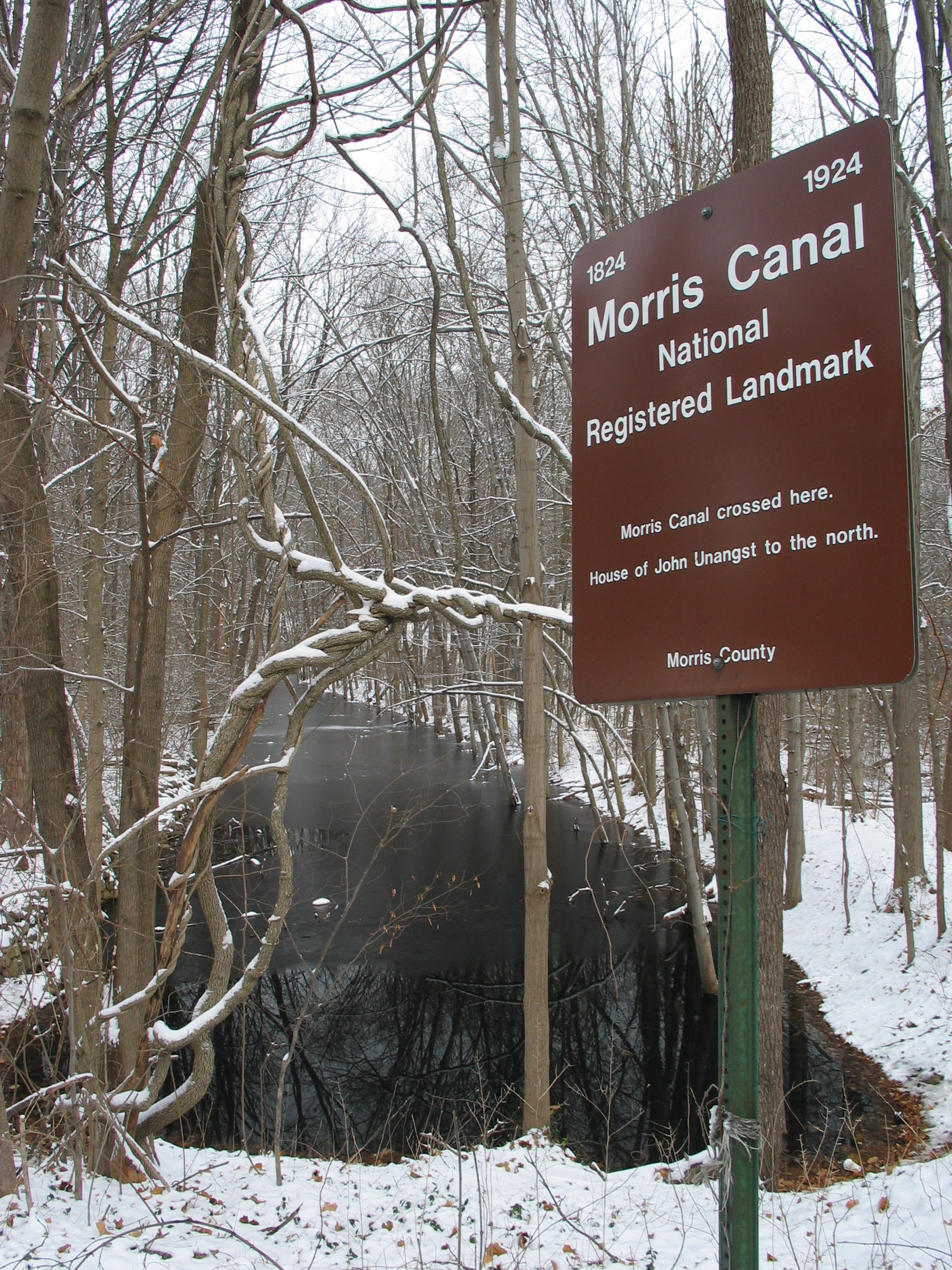
40°47′19″N 74°53′41″W / 40.78861°N 74.89472°WAnderson 21 Morris Canal 
October 1, 1974 Irregular line beginning at Phillipsburg and ending at Jersey City
40°41′8″N 75°9′49″W / 40.68556°N 75.16361°WNot Applicable 22 Mount Bethel Methodist Church February 29, 1980 S of Vienna on Mount Bethel Rd.
40°49′32″N 74°54′7″W / 40.82556°N 74.90194°WVienna 23 New Hampton Pony Pratt Truss Bridge July 26, 1977 N of Hampton over Musconetcong River
40°43′13″N 74°57′50″W / 40.72028°N 74.96389°WChangewater 24 Old Mine Road Historic District December 3, 1980 NJ 521, Delaware, Old Mine, and River Rds.
41°9′15″N 74°55′4″W / 41.15417°N 74.91778°WWallpack Center 25 Oxford Furnace 
July 6, 1977 Belvidere and Washington Aves.
40°48′14″N 74°59′52″W / 40.80389°N 74.99778°WOxford 26 Oxford Industrial Historic District August 27, 1992 NJ 31, Mine Hill Rd., Belvidere and Axford Aves., Oxford Township
40°47′55″N 74°59′42″W / 40.79861°N 74.995°WOxford 27 Perry-Petty Farmstead April 9, 1999 882 Jackson Valley Rd.
40°48′7″N 74°56′24″W / 40.80194°N 74.94°WMansfield Township 28 Phillipsburg Commercial Historic District October 8, 2008 29-169 S. Main St., 60-178 S. Main St., 3 Hudson St., 9 and 12-30 Morris St./Main St., 7-11, 17, and 21-27 Union Sq.
40°41′29″N 75°12′8″W / 40.69139°N 75.20222°WPhillipsburg 29 Pleasant Valley Historic District February 17, 1994 Area surrounding Mill Pond Rd., Washington Township
40°44′59″N 75°0′17″W / 40.74972°N 75.00472°WPleasant Valley 30 Port Colden Historic District January 21, 1999 Roughly along Port Colden Rd., Lock St., NJ 57, and Morris Canal Terrace
40°45′59″N 74°57′17″W / 40.76639°N 74.95472°WWashington Township 31 Port Murray Historic District June 7, 1996 Roughly, Port Murray Rd. from Cherry Tree Bend Rd. to Hoffman Rd., Mansfield Township
40°47′26″N 74°55′1″W / 40.79056°N 74.91694°WWashington 32 Ramsaysburg Homestead October 27, 2004 NJ 46
40°52′45″N 75°3′20″W / 40.87917°N 75.05556°WKnowlton 33 John Richey House March 20, 2002 6 Schetzer Ln.
40°43′6″N 75°0′14″W / 40.71833°N 75.00389°WFranklin 34 John Roseberry Homestead April 3, 1973 540 Warren St.
40°41′19″N 75°10′54″W / 40.68861°N 75.18167°WPhillipsburg 35 Seigle Homestead November 7, 1977 N of Finesville
40°36′39″N 75°9′59″W / 40.61083°N 75.16639°WFinesville 36 Shippen Manor 
December 20, 1984 Belvidere Rd.
40°48′19″N 74°59′51″W / 40.80528°N 74.9975°WOxford 37 Spring Valley Christian Church Site September 18, 1997 Spring Valley Rd., 0.5 mi (0.80 km). E of Hardwick Center
41°0′20″N 74°56′23″W / 41.00556°N 74.93972°WHardwick Township 38 St. Luke's Episcopal Church March 16, 2007 346 High St.
40°54′37″N 74°58′9″W / 40.91028°N 74.96917°WHope 39 Van Nest-Hoff-Vannatta Farmstead December 28, 2005 Cty Rd. 519
40°45′47″N 75°7′49″W / 40.76306°N 75.13028°WHarmony 40 Vass Farmstead September 17, 1999 109 Stillwater Rd.
41°0′15″N 74°55′1″W / 41.00417°N 74.91694°WHardwick 41 Warrington Stone Bridge December 16, 1977 NE of Columbia off NJ 94
40°55′59″N 75°4′30″W / 40.93306°N 75.075°WColumbia 42 Washington Railroad Station 
July 3, 1979 Railroad Ave.
40°45′30″N 74°58′6″W / 40.75833°N 74.96833°WWashington References
- ^ a b The latitude and longitude information provided in this table was derived originally from the National Register Information System, which has been found to be fairly accurate for about 99% of listings. For about 1% of NRIS original coordinates, experience has shown that one or both coordinates are typos or otherwise extremely far off; some corrections may have been made. A more subtle problem causes many locations to be off by up to 150 yards, depending on location in the country: most NRIS coordinates were derived from tracing out latitude and longitudes off of USGS topographical quadrant maps created under the North American Datum of 1927, which differs from the current, highly accurate WGS84 GPS system used by Google maps. Chicago is about right, but NRIS longitudes in Washington are higher by about 4.5 seconds, and are lower by about 2.0 seconds in Maine. Latitudes differ by about 1.0 second in Florida. Some locations in this table may have been corrected to current GPS standards.
- ^ "National Register of Historic Places: Weekly List Actions". National Park Service, United States Department of the Interior. Retrieved on November 10, 2011.
- ^ Numbers represent an ordering by significant words. Various colorings, defined here, differentiate National Historic Landmark sites, a [[National Historic Site (United States)|]], and several National Register of Historic Places Districts from other NRHP buildings, structures, sites or objects.
- ^ "National Register Information System". National Register of Historic Places. National Park Service. 2008-04-24. http://nrhp.focus.nps.gov/natreg/docs/All_Data.html.
U.S. National Register of Historic Places Topics Lists by states Alabama • Alaska • Arizona • Arkansas • California • Colorado • Connecticut • Delaware • Florida • Georgia • Hawaii • Idaho • Illinois • Indiana • Iowa • Kansas • Kentucky • Louisiana • Maine • Maryland • Massachusetts • Michigan • Minnesota • Mississippi • Missouri • Montana • Nebraska • Nevada • New Hampshire • New Jersey • New Mexico • New York • North Carolina • North Dakota • Ohio • Oklahoma • Oregon • Pennsylvania • Rhode Island • South Carolina • South Dakota • Tennessee • Texas • Utah • Vermont • Virginia • Washington • West Virginia • Wisconsin • WyomingLists by territories Lists by associated states Other  State of New Jersey
Topics Regions - Atlantic Coastal Plain
- Central Jersey
- Delaware River Region
- Delaware Valley
- Gateway Region
- Gold Coast
- Highlands
- Jersey Shore
- Meadowlands
- New York metro area
- North Hudson
- North Jersey
- Pascack Valley
- Piedmont
- Pine Barrens
- Raritan Bayshore
- Ridge-and-Valley Appalachians
- Southern Shore Region
- Skylands Region
- South Jersey
- Tri‑State Region
- West Hudson
Counties Major cities Categories:- National Register of Historic Places in New Jersey
- Warren County, New Jersey
-


Wikimedia Foundation. 2010.