- National Register of Historic Places listings in Washington County, Mississippi
-
 Location of Washington County in Mississippi
This is a list of the National Register of Historic Places listings in Washington County, Mississippi.
This is intended to be a complete list of the properties and districts on the National Register of Historic Places in Washington County, Mississippi, United States. Latitude and longitude coordinates are provided for many National Register properties and districts; these locations may be seen together in a Google map.[1]
There are 19 properties and districts listed on the National Register in the county, including 1 National Historic Landmark.
-
- This National Park Service list is complete through NPS recent listings posted November 10, 2011.[2]
Current listings
[3] Landmark name [4] Image Date listed Location City or town Summary 1 Arcola Mounds January 3, 1991 Address Restricted Arcola 2 Bank of Washington July 16, 1987 120 S. Poplar St.
33°24′42″N 91°03′44″W / 33.411667°N 91.062222°WGreenville 3 Belmont 
April 11, 1972 Junction of Mississippi Highways 1 and 438
33°16′09″N 91°01′59″W / 33.269167°N 91.033056°WWayside 4 Finlay House April 27, 1982 137 N. Poplar St.
33°24′47″N 91°03′42″W / 33.413056°N 91.061667°WGreenville 5 First National Bank of Greenville 
January 30, 1978 Main and S. Poplar Sts.
33°24′39″N 91°03′47″W / 33.410833°N 91.063056°WGreenville 6 Gamwyn Park Historic District August 11, 2004 Bounded by Gamwyn Park Dr., N. Gamwyn Dr., E. Gamwyn Dr., S. Dr., and W. Gamwyn Dr.
34°12′N 91°02′W / 34.2°N 91.03°WGreenville 7 Greenville Commercial Historic District October 10, 1997 Roughly Main St. from Walnut to Poplar Sts.
33°24′38″N 91°03′48″W / 33.410556°N 91.063333°WGreenville 8 Griffin-Spragins House April 5, 1984 Southwest of Greenville off U.S. Route 82
33°17′47″N 91°08′05″W / 33.296389°N 91.134722°WGreenville 9 Hollyknowe October 10, 1985 Southeast of the junction of U.S. Route 82 and County Road 299
33°24′02″N 90°49′59″W / 33.400556°N 90.833056°WLeland 10 Leavenworth-Wasson-Carroll House July 23, 1980 623 S. Washington Ave.
33°23′55″N 91°03′08″W / 33.398611°N 91.052222°WGreenville 11 Leland Historic District October 12, 2004 Portions of N. and S. Broad, N. and S. Main, Deer Creek Dr., and 3rd St.
34°12′56″N 90°52′57″W / 34.215556°N 90.8825°WLeland 12 Linden November 12, 1982 North of the Glen Allan junction of Mississippi Highways 69 and 97
33°02′56″N 91°01′50″W / 33.048889°N 91.030556°WGlen Allan 13 Mount Holly August 14, 1973 Northwest of Foote off Mississippi Highway 1
33°05′42″N 91°02′12″W / 33.095°N 91.036667°WFoote 14 Old Delta Democrat Times Building March 25, 1982 201-203 Main St.
33°24′43″N 91°03′53″W / 33.411944°N 91.064722°WGreenville 15 U.S. Post Office April 21, 1983 204 N. Broad St.
33°24′21″N 90°53′47″W / 33.405833°N 90.896389°WLeland 16 Junius R. Ward House April 28, 1975 Old Mississippi Highway 1
33°06′13″N 91°02′50″W / 33.103611°N 91.047222°WErwin 17 Washington Avenue-Main Street Historic District 
May 3, 1984 Roughly bounded by railroad tracks, Yerger, Arnold Ave., and Cherry St.
33°24′09″N 91°03′07″W / 33.4025°N 91.051944°WGreenville 18 Wetherbee House October 28, 1977 509 Washington Ave.
33°24′38″N 91°03′36″W / 33.410556°N 91.06°WGreenville 19 Winterville Site 
August 17, 1973 Along Mississippi Highway 1, approximately 6 miles north of Greenville
33°29′9″N 91°3′40″W / 33.48583°N 91.06111°W[5]Greenville See also
- List of National Historic Landmarks in Mississippi
- National Register of Historic Places listings in Mississippi
References
- ^ The latitude and longitude information provided in this table was derived originally from the National Register Information System, which has been found to be fairly accurate for about 99% of listings. For about 1% of NRIS original coordinates, experience has shown that one or both coordinates are typos or otherwise extremely far off; some corrections may have been made. A more subtle problem causes many locations to be off by up to 150 yards, depending on location in the country: most NRIS coordinates were derived from tracing out latitude and longitudes off of USGS topographical quadrant maps created under North American Datum of 1927, which differs from the current, highly accurate GPS system used by Google maps. Chicago is about right, but NRIS longitudes in Washington are higher by about 4.5 seconds, and are lower by about 2.0 seconds in Maine. Latitudes differ by about 1.0 second in Florida. Some locations in this table may have been corrected to current GPS standards.
- ^ "National Register of Historic Places: Weekly List Actions". National Park Service, United States Department of the Interior. Retrieved on November 10, 2011.
- ^ Numbers represent an ordering by significant words. Various colorings, defined here, differentiate National Historic Landmark sites and National Register of Historic Places Districts from other NRHP buildings, structures, sites or objects.
- ^ "National Register Information System". National Register of Historic Places. National Park Service. . http://nrhp.focus.nps.gov/natreg/docs/All_Data.html.
- ^ Location derived from this National Park Service webpage; the NRIS lists the site as "Address Restricted"
U.S. National Register of Historic Places Topics Lists by states Alabama • Alaska • Arizona • Arkansas • California • Colorado • Connecticut • Delaware • Florida • Georgia • Hawaii • Idaho • Illinois • Indiana • Iowa • Kansas • Kentucky • Louisiana • Maine • Maryland • Massachusetts • Michigan • Minnesota • Mississippi • Missouri • Montana • Nebraska • Nevada • New Hampshire • New Jersey • New Mexico • New York • North Carolina • North Dakota • Ohio • Oklahoma • Oregon • Pennsylvania • Rhode Island • South Carolina • South Dakota • Tennessee • Texas • Utah • Vermont • Virginia • Washington • West Virginia • Wisconsin • WyomingLists by territories Lists by associated states Other  Category:National Register of Historic Places •
  Portal:National Register of Historic Places
Municipalities and communities of Washington County, Mississippi County seat: Greenville Cities 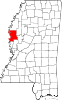
Towns Unincorporated
communitiesCategories:- Washington County, Mississippi
- National Register of Historic Places in Mississippi by county
- Buildings and structures in Washington County, Mississippi
-


Wikimedia Foundation. 2010.