- National Register of Historic Places listings in Washington County, Texas
-
List of Registered Historic Places in Washington County, Texas
This is intended to be a complete list of properties and districts listed on the National Register of Historic Places in Washington County, Texas. The locations of National Register properties and districts (at least for all showing latitude and longitude coordinates below) may be seen in a Google map by clicking on "Map of all coordinates".[1]
-
- This National Park Service list is complete through NPS recent listings posted November 10, 2011.[2]
[3] Landmark name Image Date listed Location City or town Summary 1 Allcorn-Kokemoor Farmstead August 6, 1998 Independence Rd., 5 mi (8.0 km). N of Brenham
30°13′22″N 96°22′51″W / 30.222778°N 96.380833°WBrenham 2 Isaac Applewhite House 
February 20, 1985 Church St.
30°08′35″N 96°15′09″W / 30.143056°N 96.2525°WChappell Hill 3 Bassett and Bassett Banking House April 21, 1983 222 E. Main St.
30°10′03″N 96°23′46″W / 30.1675°N 96.396111°WBrenham 4 Becker-Hildebrandt House March 29, 1990 1402 S. Church
30°09′22″N 96°23′46″W / 30.156111°N 96.396111°WBrenham 5 Blinn College March 29, 1990 Roughly bounded by Third, Jackson, Fifth, Green, College, and High
30°09′34″N 96°24′15″W / 30.159444°N 96.404167°WBrenham 6 Blue Bell Creameries Complex March 29, 1990 602 Creamery
30°09′59″N 96°23′24″W / 30.166389°N 96.39°WBrenham 7 Brenham Downtown Historic District March 10, 2004 Roughly bounded W. Vulcan, E. Vulcan, South Market, West First, Bassett, S. Austin and N. Austin
30°10′00″N 96°23′49″W / 30.166667°N 96.396944°WBrenham 8 Brenham High School March 29, 1990 1301 S. Market
30°09′30″N 96°23′34″W / 30.158333°N 96.392778°WBrenham 9 Brenham High School Gymnasium March 29, 1990 1301 S. Market
30°09′33″N 96°23′31″W / 30.159167°N 96.391944°WBrenham 10 Brenham School March 29, 1990 600 E. Alamo
30°10′02″N 96°23′36″W / 30.167222°N 96.393333°WBrenham 11 Brenham Water Works March 29, 1990 1105 S. Austin
30°09′31″N 96°23′51″W / 30.158611°N 96.3975°WBrenham 12 Brockschmidt-Miller House March 29, 1990 806 S. Day
30°09′37″N 96°24′00″W / 30.160278°N 96.4°WBrenham 13 John M. Brown House April 16, 1975 S of Washington on FM 912
30°18′37″N 96°10′01″W / 30.310278°N 96.166944°WWashington 14 W. W. Browning House January 20, 1972 S of Chappell Hill near jct. of U.S. 290 and FM 1155
30°07′34″N 96°15′27″W / 30.126111°N 96.2575°WChappell Hill 15 Burton Commercial Historic District June 11, 1991 Roughly bounded by Railroad, Live Oak, Brazos and Burton, including area S of Railroad between Washington and Texas Sts.
30°10′54″N 96°35′45″W / 30.181667°N 96.595833°WBurton 16 Burton Farmers Gin June 11, 1991 Main St. SE of Burton St.
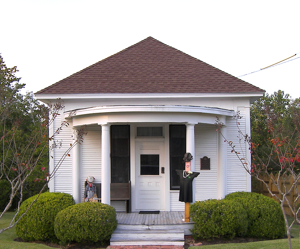
30°10′40″N 96°35′38″W / 30.177778°N 96.593889°WBurton 17 Burton High School June 11, 1991 Jct. of Main St. and FM 390
30°11′02″N 96°35′53″W / 30.183889°N 96.598056°WBurton 18 Chappell Hill Circulating Library 
February 20, 1985 Cedar St.
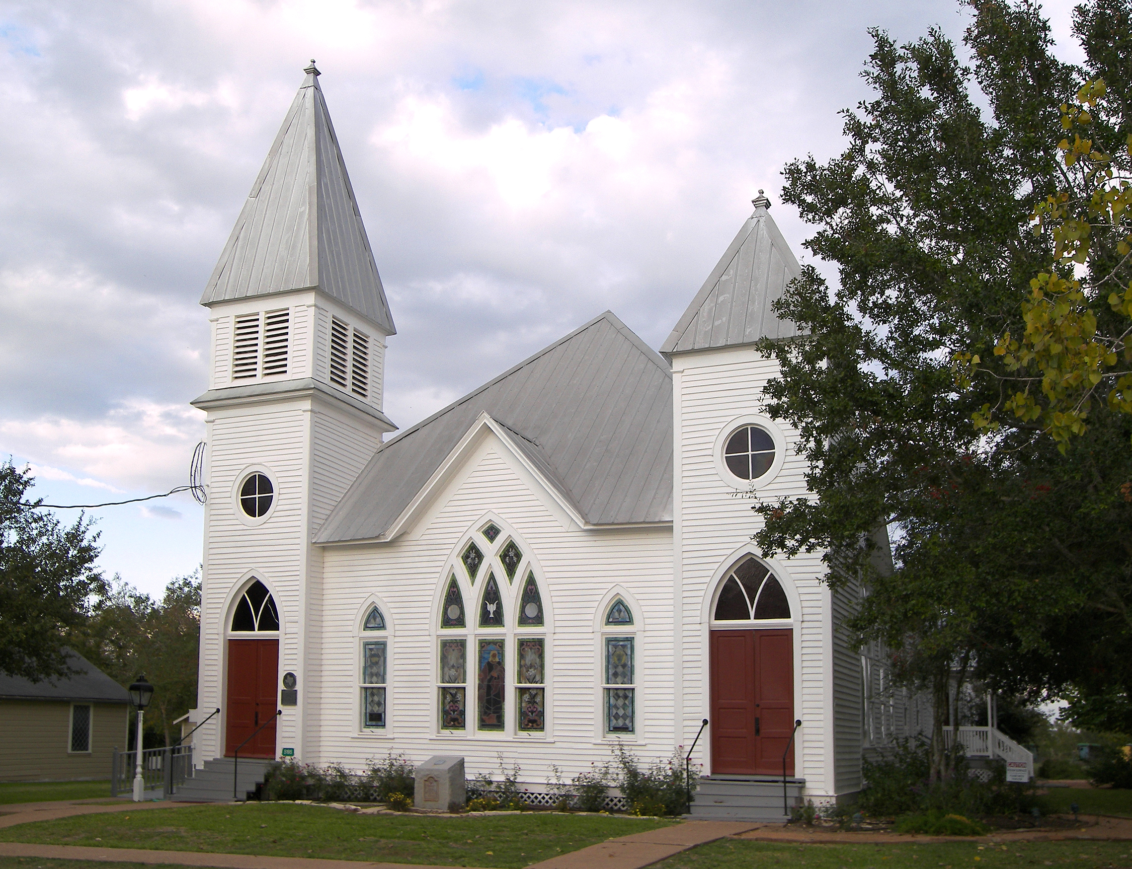
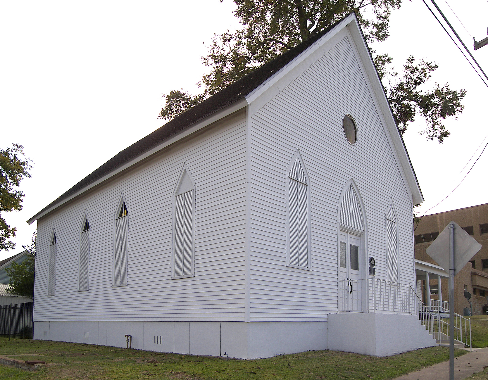
30°08′32″N 96°15′19″W / 30.142222°N 96.255278°WChappell Hill 19 Chappell Hill Methodist Episcopal Church 
February 20, 1985 Church St.
30°08′29″N 96°15′09″W / 30.141389°N 96.2525°WChappell Hill 20 Chappell Hill Public School and Chappell Hill Female College Bell 
February 20, 1985 Poplar St.
30°08′27″N 96°15′10″W / 30.140833°N 96.252778°WChappell Hill 21 East Brenham March 29, 1990 Roughly bounded by Crockett, Embrey, E. Academy, Ross, E. Main, Market, Sycamore, Cottonwood, Botts, McIntyre, and Alma
30°10′15″N 96°23′37″W / 30.170833°N 96.393611°WBrenham 22 E. King Felder House February 20, 1985 Haller st.
30°08′28″N 96°15′50″W / 30.141111°N 96.263889°WChappell Hill 23 Gantt-Jones House November 16, 1979 1.5 mi (2.4 km). NW of Burton off SR 1697
30°12′19″N 96°37′04″W / 30.205278°N 96.617778°WBurton 24 Giddings-Stone Mansion June 24, 1976 204 E. Stone St.
30°09′56″N 96°24′54″W / 30.165556°N 96.415°WBrenham 25 Giddings-Wilkin House December 12, 1976 805 Crocket St.
30°10′25″N 96°23′29″W / 30.173611°N 96.391389°WBrenham 26 Hatfield Plantation January 25, 1971 NW of Brenham off FM 912
30°18′28″N 96°10′34″W / 30.307778°N 96.176111°WBrenham 27 Hodde Drugstore June 11, 1991 Main St. SE of Burton St.
30°10′50″N 96°35′36″W / 30.180556°N 96.593333°WBurton 28 Edmund Holle House March 29, 1990 1002 S. Day
30°09′32″N 96°24′00″W / 30.158889°N 96.4°WBrenham 29 Mrs. Sam Houston House October 22, 1970 FM 390, 1 block E of jct. with FM 50
30°19′08″N 96°20′41″W / 30.318889°N 96.344722°WIndependence 30 Asa Hoxey House June 29, 1976 W of Independence
30°19′12″N 96°21′59″W / 30.32°N 96.366389°WIndependence 31 Kneip-Bredthauer House 
June 11, 1991 SE corner of Colorado and Cedar
30°11′06″N 96°35′46″W / 30.185°N 96.596111°WBurton 32 Dr. Charles Laas House June 11, 1991 NE corner of Live Oak and Colorado Sts.
30°11′04″N 96°35′44″W / 30.184444°N 96.595556°WBurton 33 Dr. Robert Lenert House March 29, 1990 602 S. Market
30°09′48″N 96°23′43″W / 30.163333°N 96.395278°WBrenham 34 Main Building, Blinn College December 6, 1978 804 College Ave.
30°09′34″N 96°24′18″W / 30.159444°N 96.405°WBrenham 35 Main Street Historic District May 15, 1985 Main St.
30°08′35″N 96°15′25″W / 30.143056°N 96.256944°WChappell Hill 36 Edgar Matchett House March 29, 1990 502 W. Main
30°09′57″N 96°24′10″W / 30.165833°N 96.402778°WBrenham 37 Mt. Zion Methodist Church March 29, 1990 500 High
30°09′43″N 96°24′25″W / 30.161944°N 96.406944°WBrenham 38 William Neumann House 
June 18, 1991 Navasota St. W of Washington St.
30°10′40″N 96°36′11″W / 30.177778°N 96.603056°WBurton 39 Herbert Nienstedt House June 11, 1991 NE corner of Brazos and Washington Sts.
30°10′59″N 96°35′43″W / 30.183056°N 96.595278°WBurton 40 William Nienstedt House June 11, 1991 SE corner of Brazos and Texas Sts.
30°10′56″N 96°35′39″W / 30.182222°N 96.594167°WBurton 41 Pampell-Day House October 15, 1970 409 W. Alamo St.
30°09′55″N 96°24′09″W / 30.165278°N 96.4025°WBrenham 42 Red House January 25, 1971 NE of Gay Hill via TX 36 and FM 390
30°16′55″N 96°27′27″W / 30.281944°N 96.4575°WGay Hill 43 Reichardt-Low House March 29, 1990 609 S. Austin
30°09′45″N 96°23′54″W / 30.1625°N 96.398333°WBrenham 44 Reue-Eickenhorst House April 27, 1995 FM Hwy. 2621, 0.5 mi (0.80 km). E of jct. with TX 50
30°15′03″N 96°21′20″W / 30.250833°N 96.355556°WBrenham 45 William S. Rogers House 
February 20, 1985 Cedar St.
30°08′32″N 96°15′21″W / 30.142222°N 96.255833°WChappell Hill 46 J. R. Routt House 
February 20, 1985 Chestnut St.
30°08′36″N 96°15′10″W / 30.143333°N 96.252778°WChappell Hill 47 William Edward Sanders House June 11, 1991 Railroad St. SE of US 290
30°10′35″N 96°35′28″W / 30.176389°N 96.591111°WBurton 48 Santa Fe Railway Company Freight Depot March 29, 1990 214 S. Austin
30°09′55″N 96°24′00″W / 30.165278°N 96.4°WBrenham 49 Almot Schlenker House March 29, 1990 405 College
30°09′35″N 96°23′24″W / 30.159722°N 96.39°WBrenham 50 Schlenker-Kolwes House March 29, 1990 1304 S. Market
30°09′26″N 96°23′37″W / 30.157222°N 96.393611°WBrenham 51 Schmidt House December 10, 1990 906 W. 5th St.
30°09′28″N 96°24′23″W / 30.157778°N 96.406389°WBrenham 52 Fritz Paul and Emma Schroeder House September 30, 1994 Co. Rd. 68, N side, N of Brenham
30°16′51″N 96°18′29″W / 30.280833°N 96.308056°WBrenham 53 F. W. Schuerenberg House March 29, 1990 503 W. Alamo
30°09′55″N 96°24′10″W / 30.165278°N 96.402778°WBrenham 54 R. A. Schuerenberg House March 29, 1990 703 S. Market
30°09′44″N 96°23′40″W / 30.162222°N 96.394444°WBrenham 55 W. E. Seelhorst House March 29, 1990 702 Seelhorst
30°09′56″N 96°23′28″W / 30.165556°N 96.391111°WBrenham 56 John Sterling Smith Jr. House 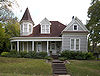
February 20, 1985 Chestnut St.
30°08′35″N 96°15′12″W / 30.143056°N 96.253333°WChappell Hill 57 Southern Pacific Railroad Freight Depot March 29, 1990 306 S. Market
30°09′57″N 96°23′46″W / 30.165833°N 96.396111°WBrenham 58 St. Mary's Catholic Church March 29, 1990 701 Church
30°09′42″N 96°23′49″W / 30.161667°N 96.396944°WBrenham 59 Stage Coach Inn 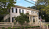
December 12, 1976 Main and Chestnut Sts.
30°08′36″N 96°15′26″W / 30.143333°N 96.257222°WChappell Hill 60 Synagogue B'nai Abraham 
March 29, 1990 302 N. Park
30°10′05″N 96°23′53″W / 30.168056°N 96.398056°WBrenham 61 US Post Office-Federal Building-Brenham March 29, 1990 105 S. Market
30°09′43″N 96°24′25″W / 30.161944°N 96.406944°WBrenham 62 James Walker Log House August 21, 1989 Co. Rd. 80
30°10′24″N 96°20′03″W / 30.173333°N 96.334167°WBrenham 63 Washington County Courthouse 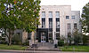
March 29, 1990 110 E. Main
30°10′01″N 96°23′51″W / 30.166944°N 96.3975°WBrenham 64 Waverly April 14, 1983 FR 2447
30°08′42″N 96°15′03″W / 30.145°N 96.250833°WChappell Hill 65 Wehring Shoe Shop and Residence June 11, 1991 Main St. SE of Burton St.
30°10′47″N 96°35′36″W / 30.179722°N 96.593333°WBurton 66 Wood-Hughes House March 29, 1990 614 S. Austin
30°09′43″N 96°23′56″W / 30.161944°N 96.398889°WBrenham See also
References
- ^ The latitude and longitude information provided in this table was derived originally from the National Register Information System, which has been found to be fairly accurate for about 99% of listings. For about 1% of NRIS original coordinates, experience has shown that one or both coordinates are typos or otherwise extremely far off; some corrections may have been made. A more subtle problem causes many locations to be off by up to 150 yards, depending on location in the country: most NRIS coordinates were derived from tracing out latitude and longitudes off of USGS topographical quadrant maps created under the North American Datum of 1927, which differs from the current, highly accurate WGS84 GPS system used by Google maps. Chicago is about right, but NRIS longitudes in Washington are higher by about 4.5 seconds, and are lower by about 2.0 seconds in Maine. Latitudes differ by about 1.0 second in Florida. Some locations in this table may have been corrected to current GPS standards.
- ^ "National Register of Historic Places: Weekly List Actions". National Park Service, United States Department of the Interior. Retrieved on November 10, 2011.
- ^ Numbers represent an ordering by significant words. Various colorings, defined here, differentiate National Historic Landmark sites and National Register of Historic Places Districts from other NRHP buildings, structures, sites or objects.
U.S. National Register of Historic Places Topics Lists by states Alabama • Alaska • Arizona • Arkansas • California • Colorado • Connecticut • Delaware • Florida • Georgia • Hawaii • Idaho • Illinois • Indiana • Iowa • Kansas • Kentucky • Louisiana • Maine • Maryland • Massachusetts • Michigan • Minnesota • Mississippi • Missouri • Montana • Nebraska • Nevada • New Hampshire • New Jersey • New Mexico • New York • North Carolina • North Dakota • Ohio • Oklahoma • Oregon • Pennsylvania • Rhode Island • South Carolina • South Dakota • Tennessee • Texas • Utah • Vermont • Virginia • Washington • West Virginia • Wisconsin • WyomingLists by territories Lists by associated states Other Categories:- Washington County, Texas
- National Register of Historic Places in Texas
- Buildings and structures in Washington County, Texas
-


Wikimedia Foundation. 2010.