- National Register of Historic Places listings in Wayne County, Indiana
-
 Location of Wayne County in Indiana
This is a list of the National Register of Historic Places listings in Wayne County, Indiana.
This is intended to be a complete list of the properties and districts on the National Register of Historic Places in Wayne County, Indiana, United States. Latitude and longitude coordinates are provided for many National Register properties and districts; these locations may be seen together in a Google map.[1]
There are 32 properties and districts listed on the National Register in the county, including 1 National Historic Landmark.
-
- This National Park Service list is complete through NPS recent listings posted November 10, 2011.[2]
Current listings
[3] Landmark name [4] Image Date listed Location City or town Summary 1 Beechwood (Isaac Kinsey House) 
February 21, 1975 2 miles south of Milton on Sarver Rd.
39°45′15″N 85°09′04″W / 39.754167°N 85.151111°WMilton 2 Bethel A.M.E. Church 
September 5, 1975 200 S. 6th St.
39°49′33″N 84°53′41″W / 39.825833°N 84.894722°WRichmond 3 Mary Birdsall House 
September 23, 1999 504 NW. 5th St.
39°50′05″N 84°54′31″W / 39.834722°N 84.908611°WRichmond 4 Cambridge City Historic District 
June 14, 1991 Roughly bounded by Boundary, Maple, High, and 4th Sts.
39°48′41″N 85°10′16″W / 39.811389°N 85.171111°WCambridge City 5 Centerville Historic District 
October 26, 1971 Bounded by the corporation limits, 3rd and South Sts., and Willow Grove Rd.
39°49′09″N 84°59′47″W / 39.819167°N 84.996389°WCenterville 6 Levi Coffin House 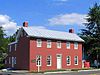
October 15, 1966 115 N. Main St.
39°57′23″N 84°55′02″W / 39.956389°N 84.917222°WFountain City 7 Conklin-Montgomery House 
February 24, 1975 302 E. Main St.
39°48′45″N 85°09′52″W / 39.8125°N 85.164444°WCambridge City 8 David Worth Dennis House 
April 25, 2001 610 W. Main St.
39°49′45″N 84°54′36″W / 39.829167°N 84.91°WRichmond 9 Doddridge Chapel and Cemetery September 28, 2003 9465 Chapel Rd.
39°45′04″N 85°03′21″W / 39.751111°N 85.055833°WCenterville 10 Earlham College Observatory 
October 21, 1975 National Rd. on the Earlham College campus
39°49′28″N 84°54′51″W / 39.824444°N 84.914167°WRichmond 11 East Main Street-Glen Miller Park Historic District 
March 27, 1986 Both sides of E. Main St. from N. 18th to N. 30th Sts. and Glen Miller Park east of 30th St.
39°49′58″N 84°52′04″W / 39.832778°N 84.867778°WRichmond 12 Abram Gaar House and Farm February 20, 1975 2411 Pleasant View Rd.
39°50′57″N 84°52′00″W / 39.849167°N 84.866667°WRichmond 13 Henry and Alice Gennett House 
August 11, 1983 1829 E. Main St.
39°49′47″N 84°52′37″W / 39.829722°N 84.876944°WRichmond 14 Hagerstown I.O.O.F. Hall January 3, 1978 Main and Perry Sts.
39°54′40″N 85°09′37″W / 39.911111°N 85.160278°WHagerstown 15 Hicksite Friends Meetinghouse (Wayne County Museum) 
October 14, 1975 1150 N. A St.
39°49′51″N 84°53′13″W / 39.830833°N 84.886944°WRichmond 16 The Huddleston House Tavern 
June 15, 1975 E. U.S. Route 40
39°48′41″N 85°11′03″W / 39.811389°N 85.184167°WMount Auburn 17 Lewis Jones House June 7, 1984 College Corner and Eliason Rds.
39°49′52″N 84°58′33″W / 39.831111°N 84.975833°WCenterville 18 King-Dennis Farm June 15, 2000 2939 King Rd.
39°52′10″N 84°58′34″W / 39.869444°N 84.976111°WCenterville 19 Lackey-Overbeck House 
May 28, 1976 520 E. Church St.
39°48′42″N 85°09′42″W / 39.811667°N 85.161667°WCambridge City 20 Leland Hotel February 28, 1985 900 S. A St.
39°49′38″N 84°53′24″W / 39.827222°N 84.89°WRichmond 21 Oliver P. Morton House 
October 10, 1975 319 W. Main St.
39°49′02″N 85°00′02″W / 39.817222°N 85.000556°WCenterville 22 Murray Theater 
March 25, 1982 1003 Main St.
39°49′44″N 84°53′19″W / 39.828889°N 84.888611°WRichmond 23 Old Richmond Historic District 
June 28, 1974 Roughly bounded by the former C&O railroad line, S. 11th, S. A, and the alley south of South E St.; also roughly bounded by A, 11th, and E Sts., and the former C&O railroad tracks
39°49′21″N 84°53′32″W / 39.8225°N 84.892222°WRichmond Second set of boundaries represents an increase and decrease of boundaries 24 Reeveston Place Historic District January 17, 2003 Bounded by S. B, S. E, S. 16th, and S. 23rd Sts.
39°49′26″N 84°52′32″W / 39.823828°N 84.875456°WRichmond 25 Richmond Gas Company Building 
August 25, 1981 100 E. Main St.
39°49′47″N 84°53′58″W / 39.829722°N 84.899444°WRichmond 26 Richmond Railroad Station Historic District October 8, 1987 Roughly bounded by the Norfolk Southern railroad tracks, N. 10th St., Elm Pl., N. D St., and Ft. Wayne Ave.
39°50′03″N 84°53′26″W / 39.834167°N 84.890556°WRichmond 27 Andrew F. Scott House 
October 10, 1975 126 N. 10th St.
39°49′53″N 84°53′22″W / 39.831389°N 84.889444°WRichmond 28 Samuel G. Smith Farm January 14, 1983 West of Richmond at 3431 Crowe Rd.
39°50′23″N 84°56′51″W / 39.839722°N 84.9475°WRichmond 29 Starr Historic District 
June 28, 1974 Roughly bounded by N. 16th, E and A Sts., and the alley west of N. 10th St.
39°49′57″N 84°53′05″W / 39.8325°N 84.884722°WRichmond 30 Wayne County Courthouse 
December 8, 1978 Bounded by 3rd, 4th, Main, and S. A Sts.
39°49′42″N 84°53′50″W / 39.828333°N 84.897222°WRichmond 31 Westcott Stock Farm 
December 17, 1998 306 E. North St.
39°49′18″N 84°59′37″W / 39.821667°N 84.993611°WCenterville 32 Witt-Champe-Myers House 
June 9, 1995 Southeastern corner of the junction of Spring and Foundry Sts.
39°48′38″N 85°12′07″W / 39.810556°N 85.201944°WDublin See also
- List of National Historic Landmarks in Indiana
- National Register of Historic Places listings in Indiana
References
- ^ The latitude and longitude information provided in this table was derived originally from the National Register Information System, which has been found to be fairly accurate for about 99% of listings. For about 1% of NRIS original coordinates, experience has shown that one or both coordinates are typos or otherwise extremely far off; some corrections may have been made. A more subtle problem causes many locations to be off by up to 150 yards, depending on location in the country: most NRIS coordinates were derived from tracing out latitude and longitudes off of USGS topographical quadrant maps created under the North American Datum of 1927, which differs from the current, highly accurate WGS84 GPS system used by Google maps. Chicago is about right, but NRIS longitudes in Washington are higher by about 4.5 seconds, and are lower by about 2.0 seconds in Maine. Latitudes differ by about 1.0 second in Florida. Some locations in this table may have been corrected to current GPS standards.
- ^ "National Register of Historic Places: Weekly List Actions". National Park Service, United States Department of the Interior. Retrieved on November 10, 2011.
- ^ Numbers represent an ordering by significant words. Various colorings, defined here, differentiate National Historic Landmark sites and National Register of Historic Places Districts from other NRHP buildings, structures, sites or objects.
- ^ "National Register Information System". National Register of Historic Places. National Park Service. . http://nrhp.focus.nps.gov/natreg/docs/All_Data.html.
U.S. National Register of Historic Places Topics Lists by states Alabama • Alaska • Arizona • Arkansas • California • Colorado • Connecticut • Delaware • Florida • Georgia • Hawaii • Idaho • Illinois • Indiana • Iowa • Kansas • Kentucky • Louisiana • Maine • Maryland • Massachusetts • Michigan • Minnesota • Mississippi • Missouri • Montana • Nebraska • Nevada • New Hampshire • New Jersey • New Mexico • New York • North Carolina • North Dakota • Ohio • Oklahoma • Oregon • Pennsylvania • Rhode Island • South Carolina • South Dakota • Tennessee • Texas • Utah • Vermont • Virginia • Washington • West Virginia • Wisconsin • WyomingLists by territories Lists by associated states Other Municipalities and communities of Wayne County, Indiana City 
Towns Boston | Cambridge City | Centerville | Dublin | East Germantown | Economy | Fountain City | Greens Fork | Hagerstown | Milton | Mount Auburn | Spring Grove | Whitewater
Townships Unincorporated
communitiesAbington | Beesons | Bethel | Chester | Dalton | East Haven | Franklin | Hiser | Hoover Mill | Jacksonburg | Locust Grove | Middleboro | Pennville | Pinhook | Webster | Williamsburg
Categories:- National Register of Historic Places in Wayne County, Indiana
- National Register of Historic Places in Indiana by county
-


Wikimedia Foundation. 2010.