- National Register of Historic Places listings in Wayne County, Pennsylvania
-
 Location of Wayne County in Pennsylvania
This is a list of the National Register of Historic Places listings in Wayne County, Pennsylvania.
This is intended to be a complete list of the properties and districts on the National Register of Historic Places in Wayne County, Pennsylvania, United States. The locations of National Register properties and districts for which the latitude and longitude coordinates are included below, may be seen in a Google map.[1]
There are 17 properties and districts listed on the National Register in the county. One site is further designated as a National Historic Landmark.
-
- This National Park Service list is complete through NPS recent listings posted November 10, 2011.[2]
Current listings
[3] Landmark name[4] Image Date listed Location City or Town Summary 1 Bellemonte Silk Mill June 28, 2010 230 Welwood Ave.
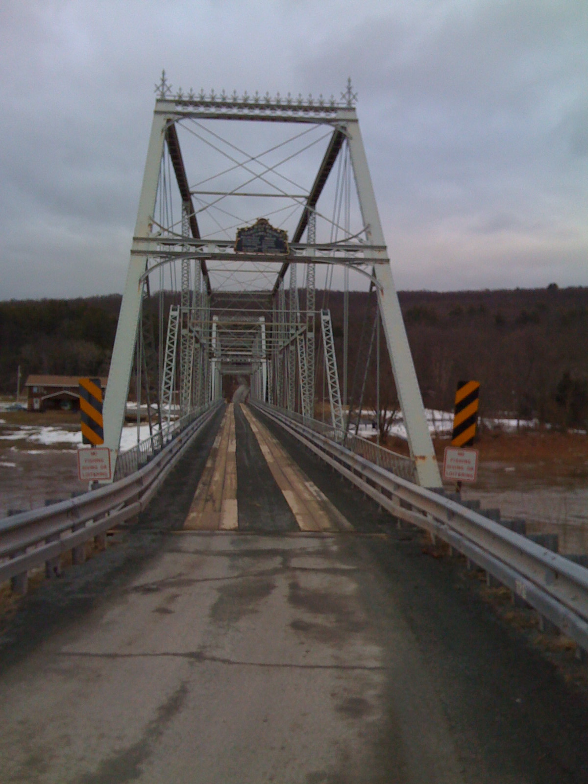
41°28′19″N 75°10′20″W / 41.47194°N 75.17222°WHawley New listing; refnum 10000407 2 Bridge in Dreher Township 
June 22, 1988 Legislative Route 171 over Haags Mill Creek
41°17′17″N 75°19′52″W / 41.28806°N 75.33111°WDreher Township 3 Damascus Historic District August 14, 1992 Roughly Pennsylvania Route 371 from Galilee Road to the Delaware River and adjacent part of Route 63027 south of Pennsylvania Route 371
41°42′37″N 75°4′15″W / 41.71028°N 75.07083°WDamascus Township 4 Delaware and Hudson Canal November 24, 1968 Delaware and Hudson Canal Honesdale Extends into Pike County 5 Eugene Dorflinger Estate September 18, 1978 U.S. Route 6 and Charles Street in White Mills
41°31′32″N 75°12′12″W / 41.52556°N 75.20333°WTexas Township 6 Equinunk Historic District November 12, 1999 Generally following Pennsylvania Route 191, Pine Mill, Lordville, and Grocery Hill Roads in Equinunk
41°51′18″N 75°13′37″W / 41.855°N 75.22694°WBuckingham and Manchester Townships 7 Hill's Sawmill November 8, 1974 South of Equinunk off Pennsylvania Route 191
41°45′9″N 75°11′36″W / 41.7525°N 75.19333°WDamascus Township 8 Honesdale Residential Historic District February 6, 1998 Roughly bounded by the Lackawaxen River, Dyberry Creek, the Dyberry Cemetery, and Overlook and 18th Streets
41°34′51″N 75°15′35″W / 41.58083°N 75.25972°WHonesdale 9 Lacawac August 9, 1979 East of Ledgedale
41°22′43″N 75°17′40″W / 41.37861°N 75.29444°WPaupack and Salem Townships 10 Milanville Historic District April 29, 1993 Roughly Legislative Route 63027 from the junction with Legislative Route 63029 east to Skinner's Falls Bridge via Bridge Approach Road, in Milanville
41°40′16″N 75°3′48″W / 41.67111°N 75.06333°WDamascus Township 11 Milanville-Skinners Falls Bridge 
November 14, 1988 Legislative Route 63027 over the Delaware River at Milanville
41°40′10″N 75°3′31″W / 41.66944°N 75.05861°WDamascus Township Extends into Cochecton in Sullivan County, New York 12 J.S. O'Connor American Rich Cut Glassware Factory March 23, 2005 120 Falls Avenue
41°28′31″N 75°10′17″W / 41.47528°N 75.17139°WHawley 13 Octagon Stone Schoolhouse May 6, 1977 1 mile (1.6 km) southwest of South Canaan
41°29′42″N 75°25′53″W / 41.495°N 75.43139°WSouth Canaan Township 14 Patriotic Order Sons of America Washington Camp 422 December 27, 2010 465 South Sterling Road
41°16′27.7″N 75°20′11″W / 41.274361°N 75.33639°WDreher Township 15 Starlight Station, New York, Ontario, and Western Railway August 30, 2001 O&W Road northeast of Depot Hill Road, Starlight
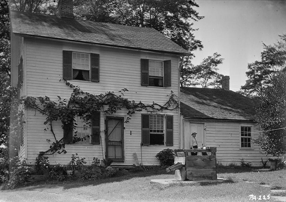
41°54′14″N 75°19′46″W / 41.90389°N 75.32944°WBuckingham Township 16 Wilmot House 
February 15, 1974 Wayne Street
41°36′46″N 75°17′3″W / 41.61278°N 75.28417°WBethany 17 Wilmot Mansion January 26, 1978 Wayne and Sugar Streets
41°36′47″N 75°17′6″W / 41.61306°N 75.285°WBethany Former listing
[3] Landmark name[4] Image Date listed Location City or Town Summary 1 Stone Arch Bridge June 27, 1986 Starrucca Creek Starrucca See also
- List of National Historic Landmarks in Pennsylvania
- National Register of Historic Places listings in Pennsylvania
- List of Pennsylvania state historical markers in Wayne County
References
- ^ The latitude and longitude information provided in this table was derived originally from the National Register Information System, which has been found to be fairly accurate for about 99% of listings. For about 1% of NRIS original coordinates, experience has shown that one or both coordinates are typos or otherwise extremely far off; some corrections may have been made. A more subtle problem causes many locations to be off by up to 150 yards, depending on location in the country: most NRIS coordinates were derived from tracing out latitude and longitudes off of USGS topographical quadrant maps created under North American Datum of 1927, which differs from the current, highly accurate GPS system used by Google maps. Chicago is about right, but NRIS longitudes in Washington are higher by about 4.5 seconds, and are lower by about 2.0 seconds in Maine. Latitudes differ by about 1.0 second in Florida. Some locations in this table may have been corrected to current GPS standards.
- ^ "National Register of Historic Places: Weekly List Actions". National Park Service, United States Department of the Interior. Retrieved on November 10, 2011.
- ^ a b Numbers represent an ordering by significant words. Various colorings, defined here, differentiate National Historic Landmark sites and National Register of Historic Places Districts from other NRHP buildings, structures, sites or objects.
- ^ a b "NPS Focus". National Register of Historic Places. National Park Service. http://nrhp.focus.nps.gov. Retrieved November 20, 2009.
Municipalities and communities of Wayne County, Pennsylvania County seat: Honesdale Boroughs 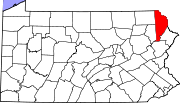
Townships Berlin | Buckingham | Canaan | Cherry Ridge | Clinton | Damascus | Dreher | Dyberry | Lake | Lebanon | Lehigh | Manchester | Mount Pleasant | Oregon | Palmyra | Paupack | Preston | Salem | Scott | South Canaan | Sterling | Texas
CDP Big Bass Lake
Unincorporated
communitiesEquinunk | Gouldsboro | Lake Ariel | Lake Como | Lakeville | Milanville | Newfoundland | Orson | Poyntelle | Starlight
Categories:- Wayne County, Pennsylvania
- National Register of Historic Places in Pennsylvania by county
-


Wikimedia Foundation. 2010.