- National Register of Historic Places listings in Wilmington, Delaware
-
This is a list of properties listed on the National Register of Historic Places in Wilmington, Delaware:[1][2]
This page was transferred for reasons of size from National Register of Historic Places listings in New Castle County, Delaware, of which it is an integral part. It in turn was transferred from National Register of Historic Places listings in Delaware, of which it is an integral part.
This lists includes all National Register of Historic Places that are either in the city of Wilmington or use a Wilmington address. The locations of National Register properties and districts for which the latitude and longitude coordinates are included below, may be seen in a Google map.[3]
There are 378 properties and districts listed on the National Register in the county. Of these, 110 are in Wilmington. Of these 111 sites, 5 are further designated as National Historic Landmarks.
-
- This National Park Service list is complete through NPS recent listings posted November 10, 2011.[4]
Landmark name Image Date listed Location City or Town Summary 1 James Armor House 
August 31, 1992 4905 Lancaster Pike, Christiana Hundred
39°45′44″N 75°37′7″W / 39.76222°N 75.61861°WWilmington 2 Augustine Paper Mill 
August 3, 1978 N. Brandywine Park Dr.
39°45′43″N 75°33′25″W / 39.76194°N 75.55694°WWilmington 3 Bancroft and Sons Cotton Mills 
December 20, 1984 Rockford Rd.
39°46′6″N 75°33′47″W / 39.76833°N 75.56306°WWilmington 4 Baynard Boulevard Historic District 
July 26, 1979 Baynard Blvd. between 18th St. and Concord Ave.
39°45′20″N 75°32′38″W / 39.75556°N 75.54389°WWilmington 5 Beaver Valley Rock Shelter Site 
September 1, 1978 Address Restricted Wilmington 6 Bellevue Range Rear Light Station 
April 26, 2006 Christina River northern side, 0.3 mile west of Delaware River, 50 feet south of Cherry Island
39°43′20″N 75°31′3″W / 39.72222°N 75.5175°WWilmington 7 Brandywine Manufacturers Sunday School April 13, 1972 North of Wilmington on Hagley Rd.
39°46′45″N 75°34′34″W / 39.77917°N 75.57611°WWilmington 8 Brandywine Park 
December 22, 1976 Roughly bounded by Augustine, 18th, and Market Sts. and Lovering Ave.
39°45′1″N 75°32′57″W / 39.75028°N 75.54917°WWilmington 9 Brandywine Powder Mills District 
May 3, 1984 Delaware Route 141 and the Brandywine River
39°46′48″N 75°34′40″W / 39.78°N 75.57778°WWilmington Hagley Museum 10 Brandywine Village Historic District 
February 24, 1971 Roughly bounded by Brandywine Creek, Tatnall, 22nd, Gordon Sts., Vandever Ave., Mabel St., and the 14th St. bridge
39°45′4″N 75°32′29″W / 39.75111°N 75.54139°WWilmington 11 Braunstein's Building 
December 19, 1985 704-706 N. Market St.
39°44′34″N 75°32′59″W / 39.74278°N 75.54972°WWilmington 12 Breck's Mill Area 
November 5, 1971 Breck's Lane and Creek Rd.
39°46′14″N 75°34′56″W / 39.77056°N 75.58222°WWilmington 13 Brindley Farm September 28, 1976 West of Wilmington at Barley Mill Rd. and Kennett Pike
39°46′13″N 75°35′35″W / 39.77028°N 75.59306°WWilmington 14 Dr. John A. Brown House 
April 24, 1979 4 7th Ave.
39°44′6″N 75°34′18″W / 39.735°N 75.57167°WWilmington 15 Church Street Historic District 
June 12, 1987 Bounded by Eighth, Locust, Seventh, and Church Sts.
39°44′21″N 75°32′26″W / 39.73917°N 75.54056°WWilmington 16 Abner Cloud House 
August 31, 1992 14 Ravine Rd., Brandywine Hundred
39°48′53″N 75°28′49″W / 39.81472°N 75.48028°WWilmington 17 Cloud-Reese House 
August 17, 2001 2202 Old Kennett Rd.
39°49′20″N 75°39′25″W / 39.82222°N 75.65694°WWilmington 18 Continental Army Encampment Site 
December 18, 1973 Lovering Ave. near Broom St.
39°45′28″N 75°33′22″W / 39.75778°N 75.55611°WWilmington 19 Cool Spring Park Historic District 
December 27, 1983 Bounded by Park Pl., Jackson, Van Buren, and 10th Sts.
39°45′0″N 75°33′34″W / 39.75°N 75.55944°WWilmington 20 Crosby and Hill Building 
January 30, 1985 605 N. Market St.
39°44′32″N 75°33′1″W / 39.74222°N 75.55028°WWilmington 21 Delaware Academy of Medicine 
April 17, 2003 1925 Lovering Ave.
39°45′44″N 75°33′42″W / 39.76222°N 75.56167°WWilmington 22 Delaware Avenue Historic District 
September 13, 1976 Delaware Ave. from N. Harrison to N. Broom Sts. (both sides)
39°45′18″N 75°33′34″W / 39.755°N 75.55944°WWilmington 23 Delaware Trust Building 
April 18, 2003 900-912 N. Market St.
39°44′34″N 75°32′51″W / 39.74278°N 75.5475°WWilmington Residences@Rodney Square 24 Delmarva Power and Light Building 
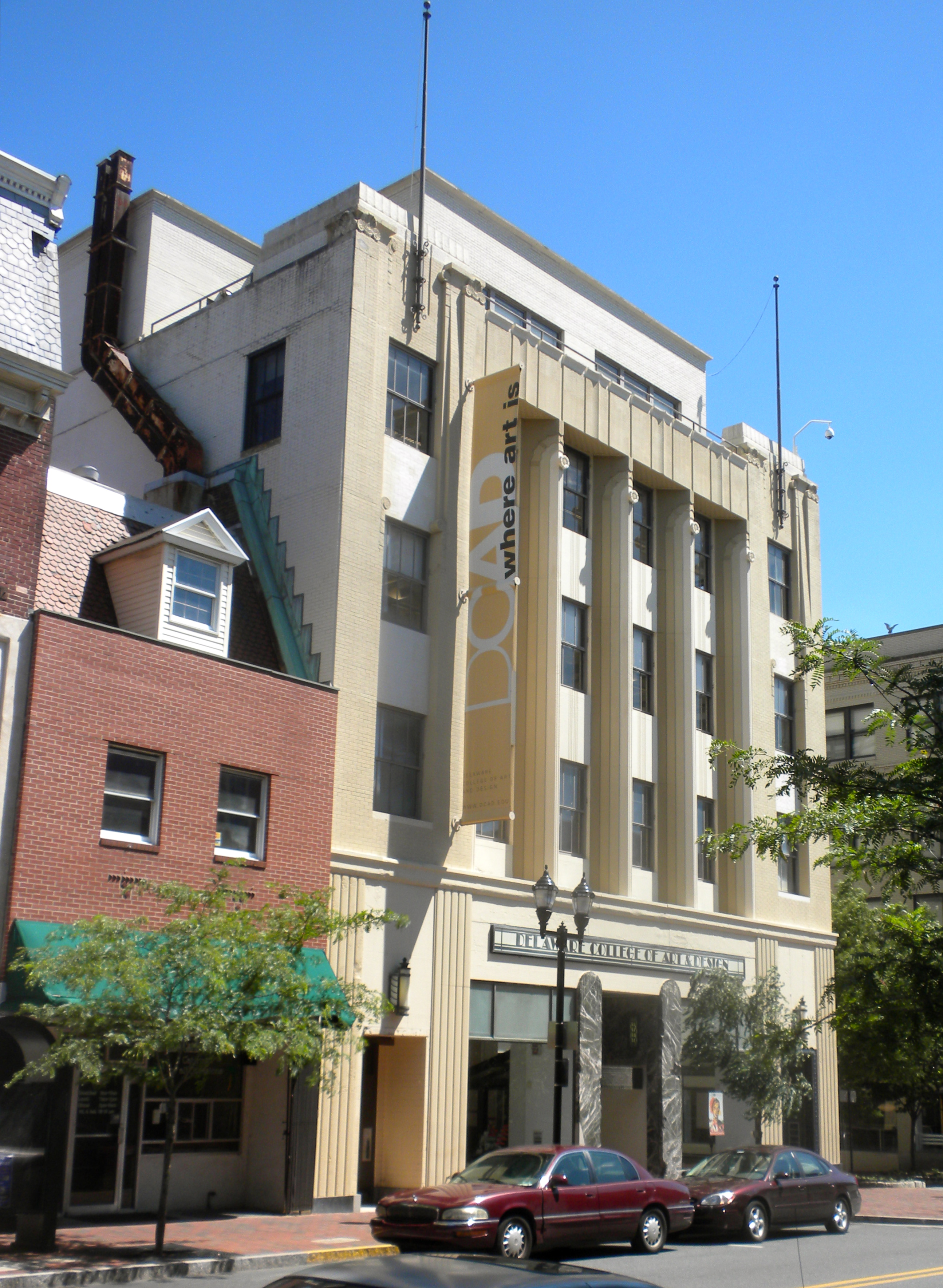
January 30, 1985 600 N. Market St.
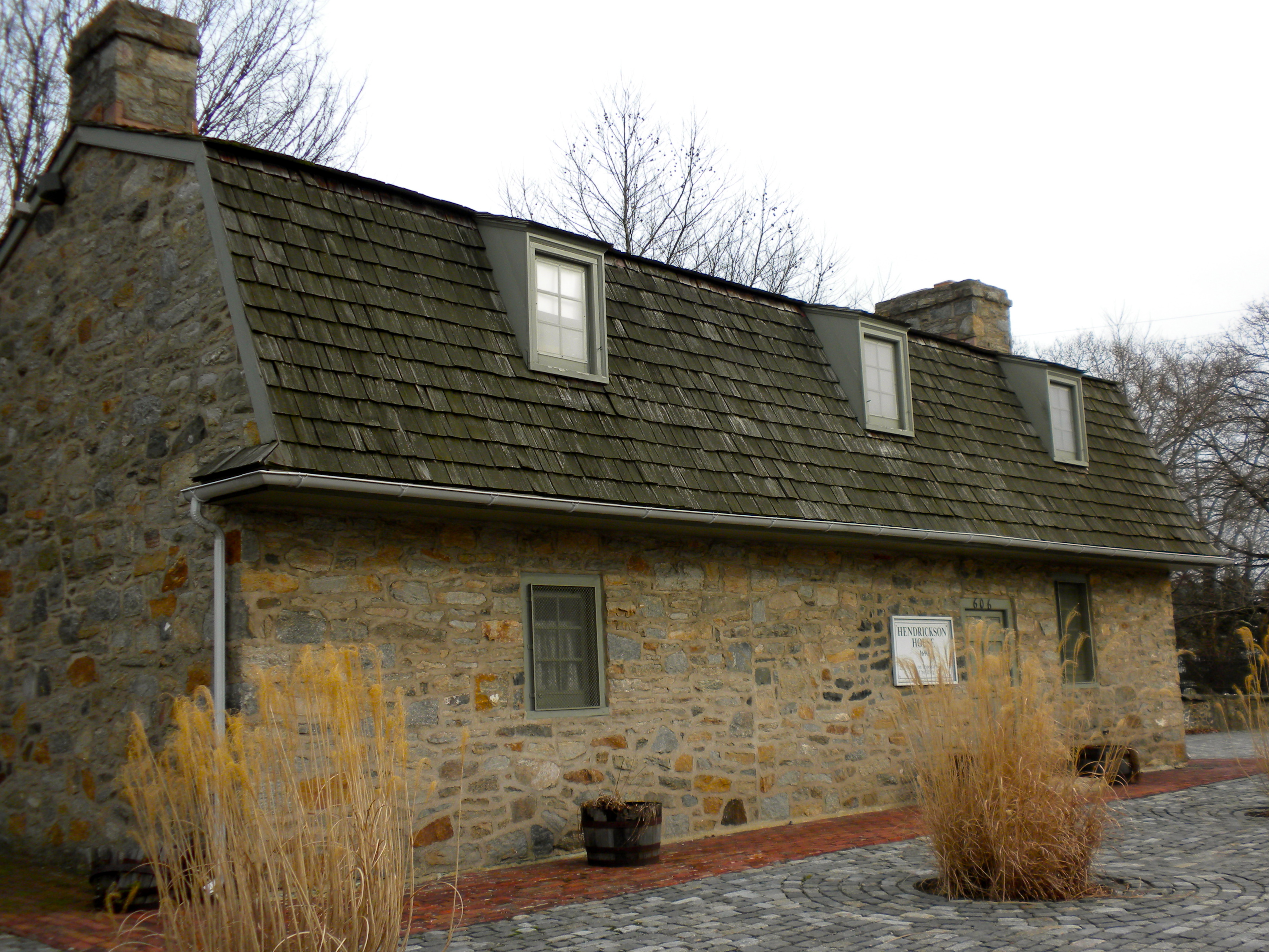
39°44′31″N 75°33′1″W / 39.74194°N 75.55028°WWilmington DCAD 25 Jacob Dingee House 
October 16, 1970 105 E. 7th St.
39°44′31″N 75°32′56″W / 39.74194°N 75.54889°WWilmington 26 Obidiah Dingee House 
October 21, 1970 107 E. 7th St.
39°44′31″N 75°32′56″W / 39.74194°N 75.54889°WWilmington 27 P. S. Dupont High School 
October 23, 1986 Thirty-fourth St. between N. Monroe and N. Franklin Sts.
39°45′51″N 75°32′0″W / 39.76417°N 75.533333°WWilmington 28 East Brandywine Historic District 
December 19, 1985 Roughly bounded by Sixteenth St., Brandywine Creek, Twelfth St., and U.S. Route 13
39°44′55″N 75°32′31″W / 39.74861°N 75.54194°WWilmington 29 Eighth Street Park Historic District 
August 4, 1983 Roughly bounded by 6th, 10th, Harrison, and Broom Sts.
39°44′56″N 75°33′47″W / 39.74889°N 75.56306°WWilmington 30 Eleutherian Mills 
November 13, 1966 North of Wilmington on Delaware Route 141 at Brandywine Creek Bridge
39°46′50″N 75°34′30″W / 39.78056°N 75.575°WWilmington 31 Fell Historic District 
June 16, 1983 Faulkland Rd. and New Fell's Lane
39°44′56″N 75°38′16″W / 39.74889°N 75.63778°WWilmington 32 Zachariah Ferris House 
October 19, 1970 414 W. 2nd St.
39°44′23″N 75°33′23″W / 39.73972°N 75.55639°WWilmington 33 Foord & Massey Furniture Company Building 
March 24, 2006 701 N. Shipley St.
39°44′43″N 75°33′5″W / 39.74528°N 75.55139°WWilmington 34 Fort Christina 
October 15, 1966 E. 7th St. and the Christina River, Fort Christina State Park
39°44′14″N 75°32′18″W / 39.73722°N 75.53833°WWilmington 35 Friends Meetinghouse 
November 7, 1976 4th and West Sts.
39°44′31″N 75°33′17″W / 39.74194°N 75.55472°WWilmington 36 Gibraltar 
September 14, 1998 250 Pennsylvania Ave.
39°45′48″N 75°34′31″W / 39.76333°N 75.57528°WWilmington 37 Glynrich 
November 1, 1979 Mill Rd. and Race St.
39°43′56″N 75°34′59″W / 39.73222°N 75.58306°WWilmington 38 Govatos'/McVey Building 
January 30, 1985 800 N. Market St.
39°44′36″N 75°32′57″W / 39.74333°N 75.54917°WWilmington 39 Grace United Methodist Church 
November 12, 1983 9th and West Sts.
39°44′46″N 75°33′7″W / 39.74611°N 75.55194°WWilmington 40 Charles Gray Printing Shop 
January 30, 1985 11 E. 8th St.
39°44′35″N 75°32′55″W / 39.74306°N 75.54861°WWilmington 41 Harlan and Hollingsworth Office Building 
April 26, 1979 West St.
39°44′18″N 75°33′23″W / 39.73833°N 75.55639°WWilmington 42 Hersey-Duncan House 
November 15, 1990 2116 Duncan Rd., Mill Creek Hundred
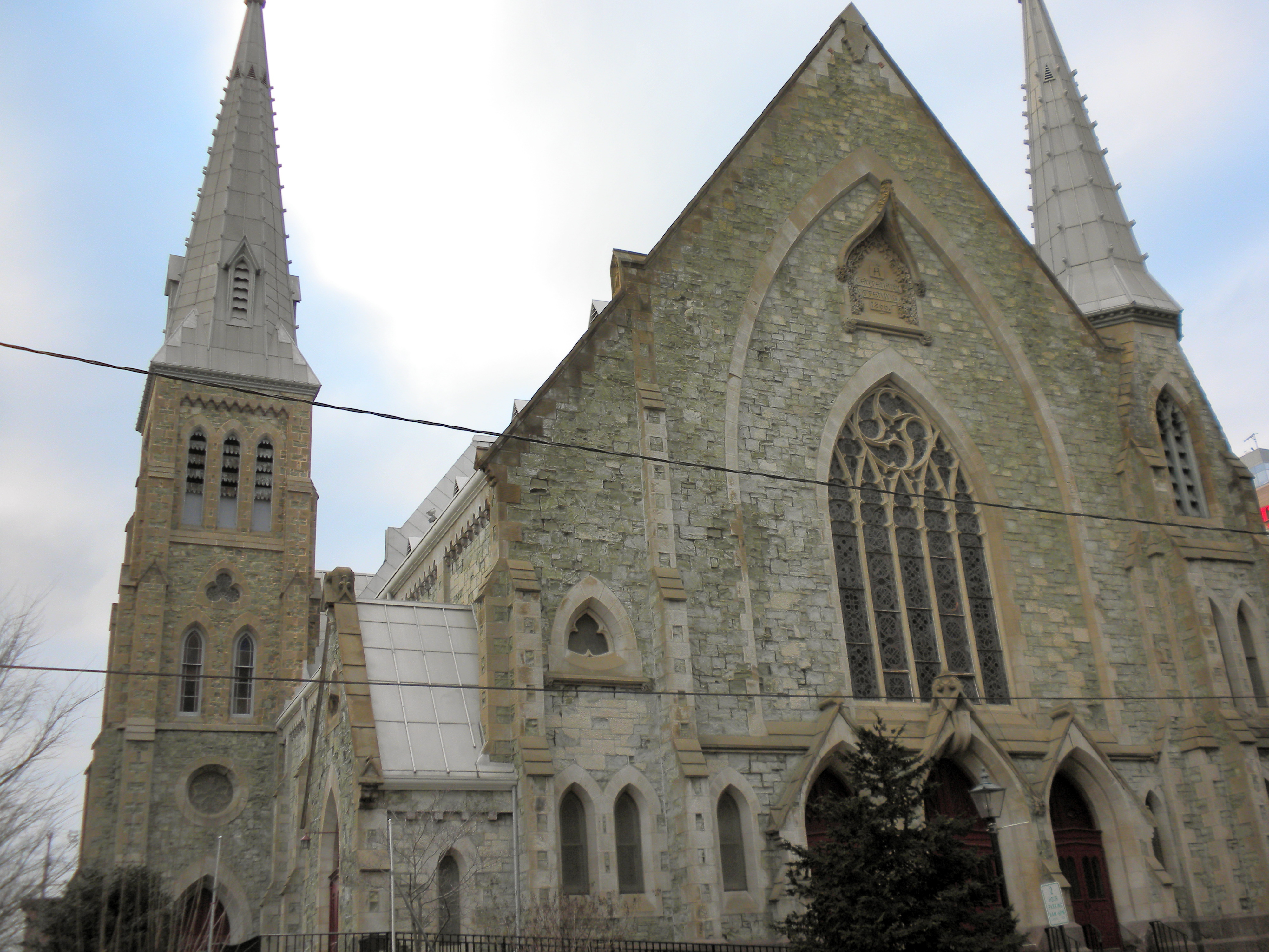
39°44′5″N 75°38′26″W / 39.73472°N 75.64056°WWilmington 43 Holy Trinity Church 
October 15, 1966 7th and Church Sts.
39°44′18″N 75°32′26″W / 39.73833°N 75.54056°WWilmington 44 Howard High School 
February 21, 1985 13th and Poplar Sts.
39°44′48″N 75°32′30″W / 39.74667°N 75.54167°WWilmington 45 Thomas Justis House 
September 23, 1993 1001 Milltown Rd., Mill Creek Hundred
39°44′3″N 75°39′31″W / 39.73417°N 75.65861°WWilmington 46 Justis-Jones House 
August 28, 1998 2606 Newport Gap Pike
39°44′36″N 75°38′25″W / 39.74333°N 75.64028°WWilmington 47 Max Keil Building 
January 30, 1985 712 N. Market St.
39°44′35″N 75°32′58″W / 39.74306°N 75.54944°WWilmington 48 Max Keil Building 
January 30, 1985 700 N. Market St.
39°44′33″N 75°32′59″W / 39.7425°N 75.54972°WWilmington 49 Kingswood Methodist Episcopal Church 
February 9, 1989 Fourteenth and Claymont Sts.
39°44′36″N 75°31′58″W / 39.74333°N 75.53278°WWilmington Replaced by new construction. 50 Laurel 
December 4, 1974 619 Shipley Rd.
39°46′26″N 75°31′2″W / 39.77389°N 75.51722°WWilmington 51 Lobdell Estate, Minquadale Home 
June 4, 1973 U.S. Route 13
39°42′22″N 75°34′12″W / 39.70611°N 75.57°WWilmington 52 Logan House 
April 2, 1980 1701 Delaware Ave.
39°45′28″N 75°33′43″W / 39.75778°N 75.56194°WWilmington 53 Lombardy Hall 
December 5, 1972 U.S. Route 202
39°46′53″N 75°32′41″W / 39.78139°N 75.54472°WWilmington 54 Charles B. Lore Elementary School 
June 16, 1983 Fourth St. and Woodlawn Ave.
39°45′1″N 75°34′36″W / 39.75028°N 75.57667°WWilmington 55 Louviers December 13, 1971 10 Black Gates Rd.
39°47′8″N 75°34′20″W / 39.78556°N 75.57222°WWilmington 56 Lower Louviers and Chicken Alley February 1, 1972 North of Wilmington on Black Gates Rd.
39°47′3″N 75°34′26″W / 39.78417°N 75.57389°WWilmington 57 Lower Market Street Historic District 
May 15, 1980 Market St.
39°44′21″N 75°33′7″W / 39.73917°N 75.55194°WWilmington 58 Main Office of the New Castle Leather Company 
December 19, 1985 Eleventh and Poplar Sts.
39°44′41″N 75°32′38″W / 39.74472°N 75.54389°WWilmington 59 Marcus Hook Range Rear Light 
March 27, 1989 Light House Rd.
39°45′44″N 75°30′13″W / 39.76222°N 75.50361°WWilmington 60 Masonic Hall and Grand Theater 
December 11, 1972 818 N. Market St.
39°44′37″N 75°32′57″W / 39.74361°N 75.54917°WWilmington 61 Louis McLane House 
April 24, 1973 606 Market St.
39°44′31″N 75°33′0″W / 39.74194°N 75.55°WWilmington 62 Montgomery House 
July 28, 1988 2900 Old Limestone Rd.
39°43′51″N 75°40′14″W / 39.73083°N 75.67056°WWilmington 63 Mount Lebanon Methodist Episcopal Church 
May 3, 1984 850 Mount Lebanon Rd.
39°47′54″N 75°34′6″W / 39.79833°N 75.56833°WWilmington 64 Mount Pleasant Methodist Episcopal Church and Parsonage 
August 28, 1998 1009 Philadelphia Pike
39°46′45″N 75°29′27″W / 39.77917°N 75.49083°WWilmington 65 New Castle Leather Raw Stock Warehouse 
June 16, 1983 14th and Poplar Sts.
39°44′49″N 75°32′31″W / 39.74694°N 75.54194°WWilmington 66 New Century Club 
June 16, 1983 1014 Delaware Ave.
39°45′6″N 75°33′22″W / 39.75167°N 75.55611°WWilmington Delaware Children's Theatre 67 Old Asbury Methodist Church 
November 7, 1976 Walnut and 3rd Sts.
39°44′17″N 75°32′56″W / 39.73806°N 75.54889°WWilmington 68 Old Customshouse 
November 21, 1974 516 N. King St.
39°44′28″N 75°32′58″W / 39.74111°N 75.54944°WWilmington Wilmington University building 69 Old First Presbyterian Church of Wilmington 
April 13, 1972 West St. on Brandywine Park Dr.
39°45′2″N 75°32′51″W / 39.75056°N 75.5475°WWilmington 70 Old Town Hall 
December 31, 1974 512 Market St.
39°44′30″N 75°33′3″W / 39.74167°N 75.55083°WWilmington 71 Old Town Hall Commercial Historic District 
January 30, 1985 Roughly bounded by 5th, N. King, 6th, and Shipley Sts.
39°44′29″N 75°33′2″W / 39.74139°N 75.55056°WWilmington 72 Philips-Thompson Buildings 
April 16, 1980 200-206 E. 4th St.
39°44′22″N 75°32′59″W / 39.73944°N 75.54972°WWilmington 73 Postles House 
November 12, 1982 1007 N. Broom St.
39°45′7″N 75°33′45″W / 39.75194°N 75.5625°WWilmington 74 Public School No. 19 
December 20, 1984 801 S. Harrison St.
39°44′14″N 75°34′7″W / 39.73722°N 75.56861°WWilmington Susan McLaughlin Treatment Ctr. 75 Howard Pyle Studios 
March 8, 1978 1305 and 1307 N. Franklin St.
39°45′18″N 75°33′24″W / 39.755°N 75.55667°WWilmington 76 Joshua Pyle House and Wagon Barn September 13, 1993 2603 Foulk Rd., Brandywine Hundred
39°49′44″N 75°30′3″W / 39.82889°N 75.50083°WWilmington 77 Quaker Hill Historic District 
September 6, 1979 Roughly bounded by Tatnall, Jefferson, 2nd and 7th Sts.
39°44′31″N 75°33′18″W / 39.74194°N 75.555°WWilmington 78 Reynold's Candy Company Building 
January 30, 1985 703 N. Market St.
39°44′34″N 75°33′0″W / 39.74278°N 75.55°WWilmington Cavanaugh's Restaurant 79 Rockford Park 
September 20, 1978 Roughly bounded by Red Oak and Rockford Rds., Church and Rising Sun Lanes, and the Brandywine River
39°46′0″N 75°34′18″W / 39.766667°N 75.57167°WWilmington 80 Rockwood 
July 12, 1976 610 Shipley Rd.
39°46′20″N 75°31′16″W / 39.77222°N 75.52111°WWilmington 81 Rodney Court 
April 2, 1980 1100 Pennsylvania Ave.
39°45′8″N 75°33′27″W / 39.75222°N 75.5575°WWilmington 82 Rodney Square Historic District 
August 10, 2011 Buildings fronting Rodney Square at 10th, 11th, Market & King Sts.
39°44′45″N 75°32′49″W / 39.74583°N 75.54694°WWilmington 83 Rosemont 
February 27, 2009 15½ Cragmere Road
39°46′15″N 75°29′33″W / 39.77083°N 75.4925°WWilmington 84 St. Anthony's Roman Catholic Church 
May 3, 1984 W. 9th and N. DuPont Sts.
39°45′11″N 75°34′1″W / 39.75306°N 75.56694°WWilmington 85 St. Hedwig's Roman Catholic Church 
November 12, 1982 Linden and S. Harrison Sts.
39°44′25″N 75°33′57″W / 39.74028°N 75.56583°WWilmington 86 St. Joseph's Catholic Church 
January 14, 2004 1012 N. French St.
39°44′42″N 75°32′45″W / 39.745°N 75.54583°WWilmington 87 St. Mary of the Immaculate Conception Church 
December 12, 1976 6th and Pine Sts.
39°44′20″N 75°32′40″W / 39.73889°N 75.54444°WWilmington 88 St. Mary's School 
January 5, 1983 502 Pine St.
39°44′19″N 75°32′40″W / 39.73861°N 75.54444°WWilmington Elementary Workshop Montessori School 89 Charles Schagrin Building 
January 30, 1985 608 N. Market St.
39°44′31″N 75°33′0″W / 39.74194°N 75.55°WWilmington 90 Frank E. Schoonover Studios 
April 20, 1979 1616 Rodney St.
39°45′23″N 75°33′35″W / 39.75639°N 75.55972°WWilmington 91 Shipley Run Historic District 
August 9, 1984 Roughly bounded by Adams, 11th, Jefferson, and 7th Sts.
39°44′49″N 75°33′21″W / 39.74694°N 75.55583°WWilmington 92 Charles Springer Tavern 
September 11, 1992 4921 Lancaster Pike, Christiana Hundred
39°45′42″N 75°37′14″W / 39.76167°N 75.62056°WWilmington 93 Starr House 
March 24, 1971 1310 King St.
39°44′52″N 75°32′41″W / 39.74778°N 75.54472°WWilmington 94 State of Pennsylvania (steamboat) 
April 20, 1979 Christina River
39°43′53″N 75°33′39″W / 39.73139°N 75.56083°WWilmington (Nonextant) 95 William Talley House 
February 21, 1985 1813 Foulk Rd.
39°48′33″N 75°30′57″W / 39.80917°N 75.51583°WWilmington 96 Torbert Street Livery Stables 
September 14, 1998 305-307 Torbert St.
39°45′5″N 75°33′0″W / 39.75139°N 75.55°WWilmington 97 Henry Townsend Building 
January 30, 1985 709 N. Market St.
39°44′35″N 75°32′59″W / 39.74306°N 75.54972°WWilmington 98 Trinity Episcopal Church 
August 16, 1984 1108 N. Adams St.
39°44′59″N 75°33′20″W / 39.74972°N 75.55556°WWilmington 99 U.S. Post Office, Courthouse, and Customhouse 
June 14, 1979 11th and Market Sts.
39°44′48″N 75°32′48″W / 39.74667°N 75.54667°WWilmington Wilmington Trust Building 100 Walker's Mill and Walker's Bank 
February 1, 1972 North of Wilmington on eastern bank of Brandywine Creek at Rising Sun Lane Bridge
39°46′14″N 75°34′44″W / 39.77056°N 75.57889°WWilmington 101 Water Witch Steam Fire Engine Company No. 5 
September 23, 2011 1814 Gilpin Ave.
39°45′36″N 75°33′48″W / 39.76°N 75.56333°WWilmington 102 Wawaset Park Historic District 
January 3, 1986 Bounded by Pennsylvania Ave., Woodlawn Ave., Seventh St., and Greenhill Ave.
39°45′22″N 75°34′31″W / 39.75611°N 75.57528°WWilmington 103 West 9th Street Commercial Historic District 
December 22, 2008 111-320 W. 9th St., 901-909 N. Orange St., 825-901 N. Tatnall St.
39°44′44″N 75°33′2″W / 39.74556°N 75.55056°WWilmington 104 Wilmington Amtrak Station 
November 21, 1976 Front and French Sts.
39°44′12″N 75°33′6″W / 39.73667°N 75.55167°WWilmington Frank Furness, architect (1908). 105 Wilmington Club 
April 19, 2006 1103 N. Market St.
39°44′49″N 75°32′51″W / 39.74694°N 75.5475°WWilmington 106 Wilmington Rail Viaduct 
November 10, 1999 Amtrak's northeast corridor through Wilmington
39°44′12″N 75°33′10″W / 39.73667°N 75.55278°WWilmington 107 Wilmington Savings Fund Society 
January 30, 1985 838 N. Market St.
39°44′40″N 75°32′55″W / 39.74444°N 75.54861°WWilmington 108 Wilmington YMCA 
February 20, 2002 501 W. 11th St.
39°45′0″N 75°33′1″W / 39.75°N 75.55028°WWilmington 109 Woodstock 
September 7, 1973 102 Middleboro Rd.
39°43′10″N 75°35′36″W / 39.71944°N 75.59333°WWilmington 110 Woodward Houses 
April 20, 1979 701-703 West St.
39°44′39″N 75°33′11″W / 39.74417°N 75.55306°WWilmington 111 F. W. Woolworth Company Building 
January 2, 1987 839 N. Market St.
39°44′40″N 75°32′56″W / 39.74444°N 75.54889°WWilmington Downtown Happy Harry's References
- ^ National Register listings for New Castle County, Delaware
- ^ "National Register Information System". National Register of Historic Places. National Park Service. 2008-04-15. http://nrhp.focus.nps.gov/natreg/docs/All_Data.html.
- ^ The latitude and longitude information provided in this table was derived originally from the National Register Information System, which has been found to be fairly accurate for about 99% of listings. For about 1% of NRIS original coordinates, experience has shown that one or both coordinates are typos or otherwise extremely far off; some corrections may have been made. A more subtle problem causes many locations to be off by up to 150 yards, depending on location in the country: most NRIS coordinates were derived from tracing out latitude and longitudes off of USGS topographical quadrant maps created under the North American Datum of 1927, which differs from the current, highly accurate WGS84 GPS system used by Google maps. Chicago is about right, but NRIS longitudes in Washington are higher by about 4.5 seconds, and are lower by about 2.0 seconds in Maine. Latitudes differ by about 1.0 second in Florida. Some locations in this table may have been corrected to current GPS standards.
- ^ "National Register of Historic Places: Weekly List Actions". National Park Service, United States Department of the Interior. Retrieved on November 10, 2011.
U.S. National Register of Historic Places Topics Lists by states Alabama • Alaska • Arizona • Arkansas • California • Colorado • Connecticut • Delaware • Florida • Georgia • Hawaii • Idaho • Illinois • Indiana • Iowa • Kansas • Kentucky • Louisiana • Maine • Maryland • Massachusetts • Michigan • Minnesota • Mississippi • Missouri • Montana • Nebraska • Nevada • New Hampshire • New Jersey • New Mexico • New York • North Carolina • North Dakota • Ohio • Oklahoma • Oregon • Pennsylvania • Rhode Island • South Carolina • South Dakota • Tennessee • Texas • Utah • Vermont • Virginia • Washington • West Virginia • Wisconsin • WyomingLists by territories Lists by associated states Other Categories:- Wilmington, Delaware
- National Register of Historic Places in Delaware
-


Wikimedia Foundation. 2010.