- National Register of Historic Places listings in Yamhill County, Oregon
-
This is a list of properties and districts in Yamhill County, Oregon that are listed on the National Register of Historic Places.
Current listings
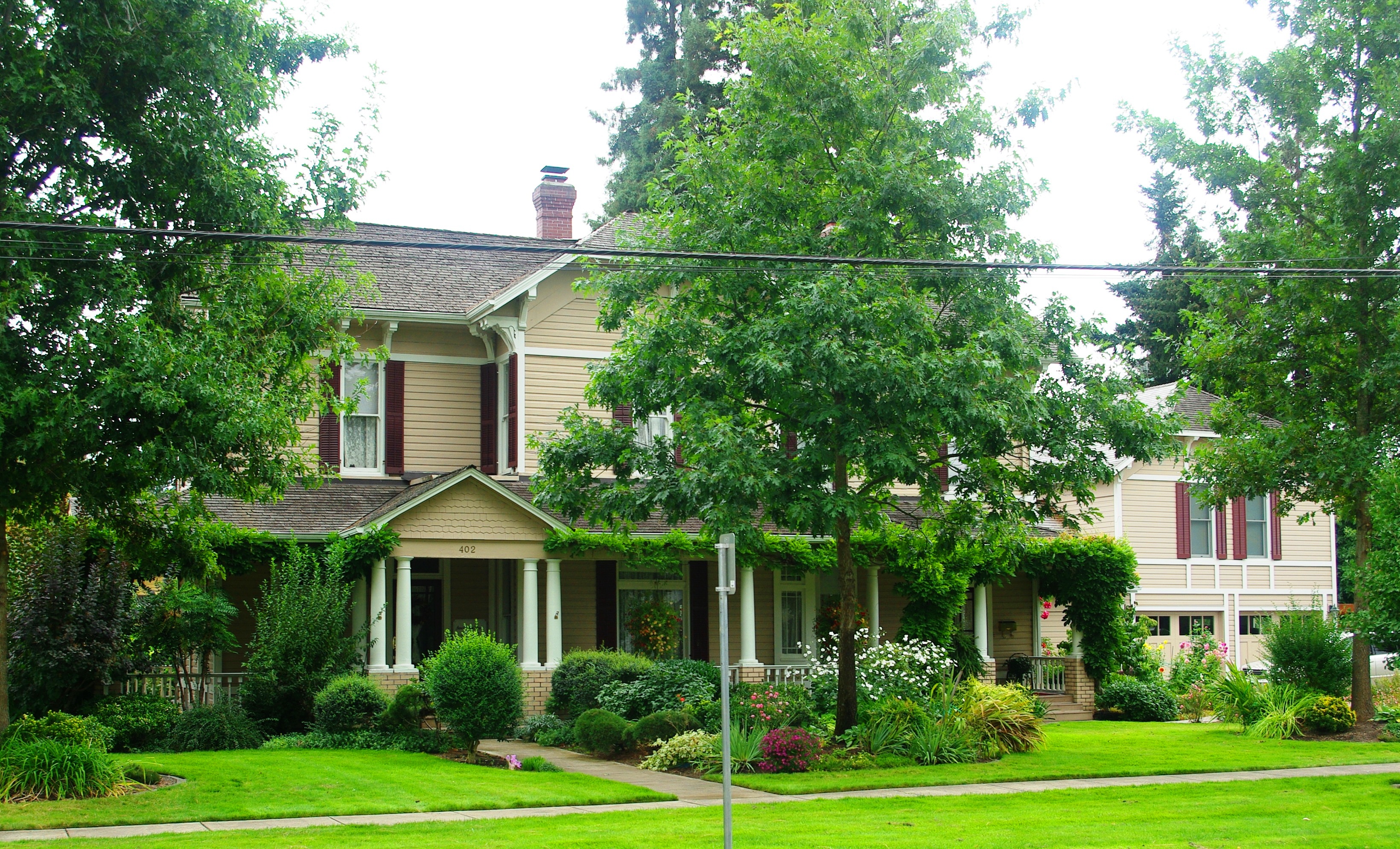
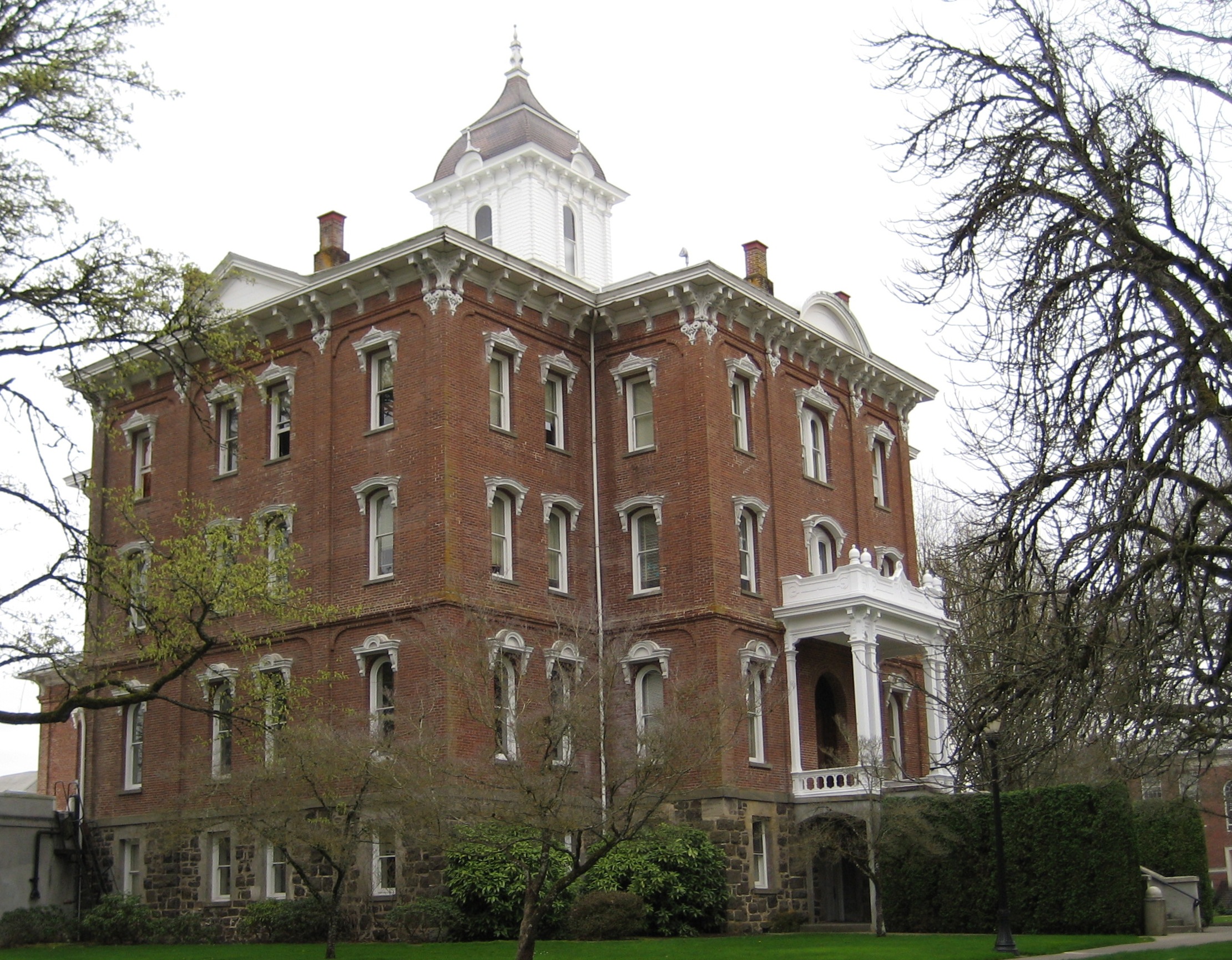
[1] Landmark name Image Date listed Location City or town Summary 1 Avery House 
March 16, 1987 403 Church St.
45°13′18″N 123°04′39″W / 45.221667°N 123.0775°WDayton 2 Baxter House 
March 16, 1987 407 Church St.
45°13′17″N 123°04′41″W / 45.221389°N 123.078056°WDayton 3 Berry-Sigler Investment Property August 3, 1987 700 Church St.
45°13′07″N 123°04′55″W / 45.218611°N 123.081944°WDayton 4 Henry Bertram, Sr. House February 29, 1988 6160 SE Webfoot Rd.
45°12′51″N 123°05′04″W / 45.214167°N 123.084444°WDayton 5 Briedwell School 
July 28, 1988 11935 SW Bellevue Hwy.
45°06′48″N 123°14′12″W / 45.113333°N 123.236667°WAmity Built in 1895, this is the most intact and architecturally sophisticated of the few remaining one-room schoolhouses in Yamhill County. It served students in kindergarten through 8th grade until it closed in 1957, and has since been converted into a house. It is the sole remnant of the former railroad town of Briedwell.[2] 6 Brookside Cemetery March 16, 1987 S end of Third St.
45°13′08″N 123°04′17″W / 45.218889°N 123.071389°WDayton 7 John Marion Bunn House 
October 16, 1979 285 W 3rd St.
45°20′21″N 123°11′17″W / 45.339167°N 123.188056°WYamhill 8 Cain House March 16, 1987 208 Alder St.
45°13′13″N 123°04′20″W / 45.220278°N 123.072222°WDayton 9 Carlton State and Savings Bank 
February 11, 1988 109 W. Main St.
45°17′40″N 123°10′33″W / 45.294444°N 123.175833°WCarlton 10 Carter-Goodrich House 
March 16, 1987 521 Church St.
45°13′16″N 123°04′42″W / 45.221111°N 123.078333°WDayton 11 Asa F. Cate Farm Ensemble February 23, 1990 16900 NW. Baker Creek Rd.
45°13′52″N 123°17′16″W / 45.231111°N 123.287778°WMcMinnville 12 Joseph and Virginia Chambers Farmstead 
March 5, 1992 30295 N. OR 99W
45°18′47″N 122°55′33″W / 45.313056°N 122.925833°WNewberg 13 Commercial Club-Stuckey, S. C., Building March 16, 1987 304 Ferry St.
45°13′14″N 123°04′27″W / 45.220556°N 123.074167°WDayton 14 Amos Cook House 
December 31, 1974 NW of Dayton on OR 233
45°14′14″N 123°06′50″W / 45.237222°N 123.113889°WDayton 15 Courthouse Square Park 
March 16, 1987 Bounded by Third, Fourth, Ferry, and Main Sts.
45°13′16″N 123°04′30″W / 45.221111°N 123.075°WDayton 16 Dayton Common School March 16, 1987 504 Fourth St.
45°13′10″N 123°04′29″W / 45.219444°N 123.074722°WDayton 17 Dayton High School 
March 16, 1987 801 Ferry St.
45°13′00″N 123°04′58″W / 45.216667°N 123.082778°WDayton 18 Dayton Methodist Episcopal Church March 16, 1987 302 Fourth St.
45°13′18″N 123°04′37″W / 45.221667°N 123.076944°WDayton 19 Diehl-Seitters House March 16, 1987 527 Church St.
45°13′15″N 123°04′45″W / 45.220833°N 123.079167°WDayton 20 Dundee Woman's Club Hall 
June 5, 1986 OR 99W
45°16′31″N 123°00′44″W / 45.275278°N 123.012222°WDundee 21 Jesse Edwards House 
August 25, 1980 402 S. College St.
45°17′52″N 122°58′17″W / 45.297778°N 122.971389°WNewberg 22 Evangelical Church of Lafayette 
October 31, 2002 605 Market St.
45°14′47″N 123°06′40″W / 45.246389°N 123.111111°WLafayette 23 Evangelical United Brethren Church August 3, 1987 302 Fifth St.
45°13′15″N 123°04′41″W / 45.220833°N 123.078056°WDayton 24 Frank W. Fenton House 
September 1, 1983 434 N. Evans St.
45°12′41″N 123°11′34″W / 45.211389°N 123.192778°WMcMinnville 25 Fernwood Pioneer Cemetery 
August 5, 1994 Everest Rd., 0.5 mi. S of jct. with OR 219
45°17′42″N 122°57′33″W / 45.295°N 122.959167°WNewberg 26 First Baptist Church 
October 16, 1979 3rd and Main Sts.
45°13′18″N 123°04′31″W / 45.221667°N 123.075278°WDayton 27 Carl Fischer Meats March 16, 1987 400 Ferry St.
45°13′12″N 123°04′31″W / 45.22°N 123.075278°WDayton 28 Alfred P. Fletcher Farmhouse 
August 25, 1980 1007 3rd St.
45°14′32″N 123°06′26″W / 45.242222°N 123.107222°WLafayette 29 Francis Fletcher House 
October 29, 1975 W of Dayton off OR 18
45°13′26″N 123°06′25″W / 45.223889°N 123.106944°WDayton 30 Fletcher-Stretch House March 16, 1987 401 Oak St.
45°13′20″N 123°04′43″W / 45.222222°N 123.078611°WDayton 31 Foster Oil Company March 16, 1987 216 Ferry St.
45°13′15″N 123°04′25″W / 45.220833°N 123.073611°WDayton 32 Free Methodist Church 
March 16, 1987 411 Oak St.
45°13′20″N 123°04′44″W / 45.222222°N 123.078889°WDayton 33 Gabriel-Filer House 
March 16, 1987 525 Church St.
45°13′15″N 123°04′44″W / 45.220833°N 123.078889°WDayton 34 Gabriel-Will House March 16, 1987 401 Third St.
45°13′18″N 123°04′28″W / 45.221667°N 123.074444°WDayton 35 Levi Hagey House 
December 19, 1974 Off OR 99W
45°17′05″N 123°00′05″W / 45.284722°N 123.001389°WDundee 36 Harrington House March 16, 1987 212 Mill St.
45°13′10″N 123°04′19″W / 45.219444°N 123.071944°WDayton 37 Harris Building March 16, 1987 302 Ferry St.
45°13′14″N 123°04′26″W / 45.220556°N 123.073889°WDayton 38 William Hibbert House November 30, 1978 426 5th St.
45°13′11″N 123°04′37″W / 45.219722°N 123.076944°WDayton 39 Hole House March 16, 1987 623 Ferry St.
45°13′04″N 123°04′49″W / 45.217778°N 123.080278°WDayton 40 J. C. Penney Building 
June 13, 2007 516 E. First St.
45°18′01″N 122°58′22″W / 45.300278°N 122.972778°WNewberg 41 Jessen-Goodrich House March 16, 1987 324 Sixth St.
45°13′10″N 123°04′47″W / 45.219444°N 123.079722°WDayton 42 James M. and Paul R. Kelty House 
September 23, 1982 675 3rd St.
45°14′36″N 123°06′36″W / 45.243333°N 123.11°WLafayette 43 Dr. Andrew Kershaw House 
March 2, 1989 472 E. Main St.
45°04′50″N 123°28′49″W / 45.080556°N 123.480278°WWillamina 44 Krietz House March 16, 1987 627 Church St.
45°13′11″N 123°04′53″W / 45.219722°N 123.081389°WDayton 45 Lee Laughlin House 
March 26, 1979 100 S. Laurel St.
45°20′29″N 123°11′07″W / 45.341389°N 123.185278°WYamhill 46 Lewis-Shippy House March 16, 1987 421 Sixth St.
45°13′09″N 123°04′44″W / 45.219167°N 123.078889°WDayton 47 Gottlieb Londershausen House March 16, 1987 402 Main St.
45°13′14″N 123°04′35″W / 45.220556°N 123.076389°WDayton 48 Paul Londershausen House 
March 16, 1987 309 Main St.
45°13′17″N 123°04′33″W / 45.221389°N 123.075833°WDayton 49 Mabee-Mayberry House August 3, 1987 309 Seventh St.
45°13′07″N 123°04′52″W / 45.218611°N 123.081111°WDayton 50 Joseph Mattey House 
February 15, 1977 W of Lafayette at jct. of Mattey Lane and Rutherford Rd.
45°14′44″N 123°07′53″W / 45.245556°N 123.131389°WLafayette 51 McMinnville Downtown Historic District 
September 14, 1987 Bounded by Fifth St., Southern Pacific RR tracks, Second, and N. Adams Sts.
45°12′37″N 123°11′36″W / 45.210278°N 123.193333°WMcMinnville 52 McNamar Building March 16, 1987 310-312 Ferry St.
45°13′13″N 123°04′29″W / 45.220278°N 123.074722°WDayton 53 McNish House March 16, 1987 1005 Ferry St.
45°12′53″N 123°05′09″W / 45.214722°N 123.085833°WDayton 54 Mellinger House March 16, 1987 414 Fifth St.
45°13′12″N 123°04′38″W / 45.22°N 123.077222°WDayton 55 Mellinger-Ponnay House August 3, 1987 102 Tribbett Court
45°13′04″N 123°04′08″W / 45.217778°N 123.068889°WDayton 56 Methodist Episcopal Parsonage August 3, 1987 202 Fourth St.
45°13′19″N 123°04′39″W / 45.221944°N 123.0775°WDayton 57 Minthorn Hall 
June 13, 1997 North St. on the George Fox University Campus
45°18′15″N 122°58′00″W / 45.304167°N 122.966667°WNewberg 58 Dr. Henry J. Minthorn House (Herbert Hoover House) 
December 19, 2003 115 S. River St.
45°17′59″N 122°58′03″W / 45.299722°N 122.9675°WNewberg 59 Monahan House March 16, 1987 120 Fifth St.
45°13′19″N 123°04′46″W / 45.221944°N 123.079444°WDayton 60 Morse House March 16, 1987 409 Oak St.
45°13′13″N 123°04′43″W / 45.220278°N 123.078611°WDayton 61 Morse House March 16, 1987 101 Fifth St.
45°13′22″N 123°04′46″W / 45.222778°N 123.079444°WDayton 62 Nichols House March 16, 1987 303 Main St.
45°13′18″N 123°04′32″W / 45.221667°N 123.075556°WDayton 63 Oregon Mutual Merchant Fire Insurance Association Office March 16, 1987 308 Ferry St.
45°13′14″N 123°04′28″W / 45.220556°N 123.074444°WDayton 64 Palmer House 
March 16, 1987 600 Ferry St.
45°13′05″N 123°04′42″W / 45.218056°N 123.078333°WDayton 65 William Albert and Anna May Bristow Parrish Farmstead 
July 17, 2000 30280 NE Wilsonville Rd.
45°17′18″N 122°55′32″W / 45.288333°N 122.925556°WNewberg 66 Paulson-Gregory House 
March 18, 1999 509 S. College
45°17′48″N 122°58′19″W / 45.296667°N 122.971944°WNewberg 67 Pioneer Hall, Linfield College 
February 23, 1978 Linfield College campus
45°12′06″N 123°12′00″W / 45.201667°N 123.2°WMcMinnville 68 Curtis W. Powell House March 16, 1987 524 Ash St.
45°13′20″N 123°04′47″W / 45.222222°N 123.079722°WDayton 69 Rippey House March 16, 1987 533 Ash St.
45°13′21″N 123°04′50″W / 45.2225°N 123.080556°WDayton 70 Sigler House March 16, 1987 521 Ferry St.
45°13′10″N 123°04′38″W / 45.219444°N 123.077222°WDayton 71 Andrew Smith House June 23, 1976 306 5th St.
45°13′14″N 123°04′40″W / 45.220556°N 123.077778°WDayton 72 John T. Smith House 
November 15, 1984 414 N. College St.
45°18′12″N 122°58′16″W / 45.303333°N 122.971111°WNewberg 73 Charles K. Spaulding House 
August 26, 1994 717 E. Sheridan St.
45°18′07″N 122°58′14″W / 45.301944°N 122.970556°WNewberg 74 Jack Spence House 
February 27, 1986 536 E. Fifth St.
45°12′41″N 123°11′32″W / 45.211389°N 123.192222°WMcMinnville 75 Dr. Stuart House March 16, 1987 103 Ferry St.
45°13′19″N 123°04′19″W / 45.221944°N 123.071944°WDayton 76 Travelers Home 
July 8, 1982 147 NE Yamhill St.
45°06′03″N 123°23′35″W / 45.100833°N 123.393056°WSheridan 77 Union Block 
May 5, 2000 610-620 E. First St.
45°18′00″N 122°58′19″W / 45.3°N 122.971944°WNewberg 78 Yamhill River Lock and Dam 
June 21, 1991 Across the Yamhill R. at S terminus of Locks Rd.
45°13′50″N 123°06′11″W / 45.230556°N 123.103056°WDayton 79 Ewing Young Site November 26, 1989 Address Restricted Newberg References
- ^ Numbers represent an ordering by significant words. Various colorings, defined here, differentiate National Historic Landmark sites and National Register of Historic Places Districts from other NRHP buildings, structures, sites or objects.
- ^ Cram, Lauren (January 15, 1987). National Register of Historic Places Registration Form: Briedwell School.
External links
 Media related to National Register of Historic Places in Yamhill County, Oregon at Wikimedia Commons
U.S. National Register of Historic Places in Oregon Lists by county Baker • Benton • Clackamas • Clatsop • Columbia • Coos • Crook • Curry • Deschutes • Douglas • Gilliam • Grant • Harney • Hood River • Jackson • Jefferson • Josephine • Klamath • Lake • Lane • Lincoln • Linn • Malheur • Marion • Morrow • Multnomah: Portland North • Multnomah: Portland Northeast • Multnomah: Portland Northwest • Multnomah: Portland Southeast • Multnomah: Portland Southwest • Multnomah: Other • Polk • Sherman • Tillamook • Umatilla • Union • Wallowa • Wasco • Washington • Wheeler • Yamhill
Other lists Categories:- National Register of Historic Places in Yamhill County, Oregon
- Oregon-related lists


Wikimedia Foundation. 2010.