- National Register of Historic Places listings in Yolo County, California
-
This list includes properties and districts listed on the National Register of Historic Places in Yolo County, California. Click the "Map of all coordinates" link to the right to view a Google map of all properties and districts with latitude and longitude coordinates in the table below.[1]
-
- This National Park Service list is complete through NPS recent listings posted November 10, 2011.[2]
See also
- National Register of Historic Places listings in California
- List of National Historic Landmarks in California
References
- ^ The latitude and longitude information provided in this table was derived originally from the National Register Information System, which has been found to be fairly accurate for about 99% of listings. For about 1% of NRIS original coordinates, experience has shown that one or both coordinates are typos or otherwise extremely far off; some corrections may have been made. A more subtle problem causes many locations to be off by up to 150 yards, depending on location in the country: most NRIS coordinates were derived from tracing out latitude and longitudes off of USGS topographical quadrant maps created under the North American Datum of 1927, which differs from the current, highly accurate WGS84 GPS system used by Google maps. Chicago is about right, but NRIS longitudes in Washington are higher by about 4.5 seconds, and are lower by about 2.0 seconds in Maine. Latitudes differ by about 1.0 second in Florida. Some locations in this table may have been corrected to current GPS standards.
- ^ "National Register of Historic Places: Weekly List Actions". National Park Service, United States Department of the Interior. Retrieved on November 10, 2011.
- ^ Numbers represent an ordering by significant words. Various colorings, defined here, differentiate National Historic Landmark sites and National Register of Historic Places Districts from other NRHP buildings, structures, sites or objects.
- ^ "National Register Information System". National Register of Historic Places. National Park Service. . http://nrhp.focus.nps.gov/natreg/docs/All_Data.html.
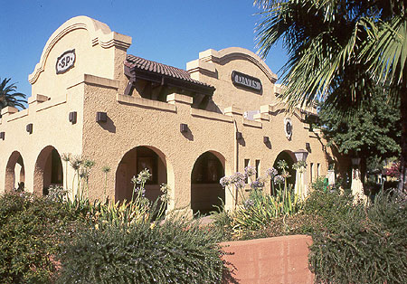
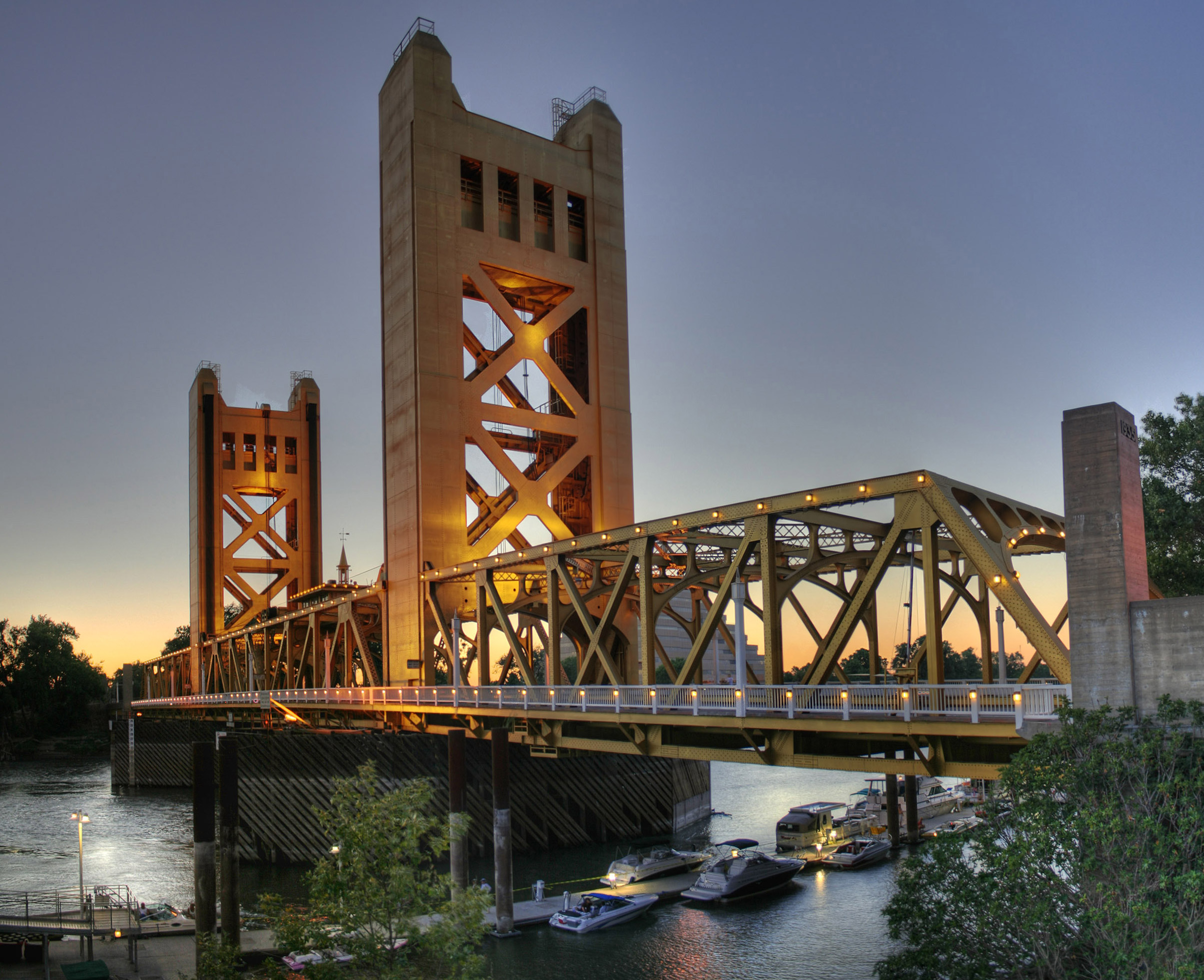
U.S. National Register of Historic Places Topics Lists by states Alabama • Alaska • Arizona • Arkansas • California • Colorado • Connecticut • Delaware • Florida • Georgia • Hawaii • Idaho • Illinois • Indiana • Iowa • Kansas • Kentucky • Louisiana • Maine • Maryland • Massachusetts • Michigan • Minnesota • Mississippi • Missouri • Montana • Nebraska • Nevada • New Hampshire • New Jersey • New Mexico • New York • North Carolina • North Dakota • Ohio • Oklahoma • Oregon • Pennsylvania • Rhode Island • South Carolina • South Dakota • Tennessee • Texas • Utah • Vermont • Virginia • Washington • West Virginia • Wisconsin • WyomingLists by territories Lists by associated states Other NRHPs in Yolo County, California Animal Science Building · Beamer House · Canon School · Davis Subway · Downtown Woodland Historic District · Downtown Winters Historic District · Dresbach-Hunt-Boyer House · Hotel Woodland · I Street Bridge † · I.O.O.F. Building · James Moore House · Joshua B. Tufts House · Nelson Ranch · Porter Building · Rumsey Town Hall · Southern Pacific Railroad Station · Tower Bridge (California) † · Union Church of Dunnigan · Walnut Street School · William B. Gibson House · Woodland Opera House · Woodland Public Library · Yolo Branch Library · Yolo County Courthouse
† - Shared between Yolo and Sacramento Counties.
Municipalities and communities of Yolo County, California Cities Davis | West Sacramento | Winters | Woodland
CDPs Unincorporated
communitiesArcade | Arroz | Beatrice | Brooks | Browns Corner | Cadenasso | Capay | Central | Citrona | Conaway | Coniston | Daisie | Dufour | El Macero | El Rio Villa | Fremont | Green | Greendale | Hershey | Jacobs Corner | Kiesel | King Farms | Lovdal | Lund | Merritt | Mikon | Morgans Landing | Norton | Peethill | Plainfield | Riverview | Rumsey | Saxon | Sorroca | Sugarfield | Swingle | Tancred | Tyndall Landing | Valdez | Vin | Webster | Willow Point | Zamora
Ghost towns Categories:- History of Yolo County, California
- National Register of Historic Places in California by county
- Lists of National Register of Historic Places in California
-


Wikimedia Foundation. 2010.