- National Register of Historic Places listings in Yukon–Koyukuk Census Area, Alaska
-
 Location of the Yukon-Koyukuk Census Area in Alaska
This is a list of the National Register of Historic Places listings in Yukon-Koyukuk Census Area, Alaska.
This is intended to be a complete list of the properties and districts on the National Register of Historic Places in Yukon-Koyukuk Census Area, Alaska, United States. The locations of National Register properties and districts for which the latitude and longitude coordinates are included below, may be seen in a Google map.[1]
There are 17 properties and districts listed on the National Register in the census area.
-
- This National Park Service list is complete through NPS recent listings posted November 10, 2011.[2]
Current listings
[3] Landmark name[4] Image Date listed Location Community Summary 1 Ed Beiderman Fish Camp July 20, 1987 Left bank of the Yukon River ½ mile down across from the Kandick River
65°21′58″N 143°18′1″W / 65.36611°N 143.30028°WEagle 2 Bettles Lodge May 8, 1997 Bettles Field, off Winter Trail, approximately 3.5 miles east of Bettles
66°55′7″N 151°30′59″W / 66.91861°N 151.51639°WBettles 3 Central House July 31, 1978 Mile 128 on the Steese Highway
65°34′20″N 144°47′45″W / 65.57222°N 144.79583°WCentral 4 Christ Church Mission May 8, 1980 In Anvik
62°39′16″N 160°12′3″W / 62.65444°N 160.20083°WAnvik 5 Coal Creek Historic Mining District 
May 4, 1995 Along the Yukon River, southeast of Circle, in the Yukon-Charley Rivers National Park
65°18′29″N 143°11′27″W / 65.30806°N 143.19083°WCircle 6 George McGregor Cabin 
July 21, 1987 Left bank of the Yukon River 2 miles down from Coal Creek
65°21′4″N 143°7′36″W / 65.35111°N 143.12667°WEagle 7 Mission Church April 11, 1977 Eastern fork of Chandalar River
68°7′32″N 145°20′25″W / 68.12556°N 145.34028°WArctic Village 8 Nenana Depot August 10, 1977 A St.
64°33′52″N 149°6′2″W / 64.56444°N 149.10056°WNenana 9 Old Mission House November 7, 1978 Ft. Yukon
66°34′5″N 145°16′24″W / 66.56806°N 145.27333°WFort Yukon 10 Presentation of Our Lord Chapel 
June 6, 1980 In Nikolai
62°58′3″N 154°9′42″W / 62.9675°N 154.16167°WNikolai 11 Ruby Roadhouse May 20, 1982 Olson St.
64°44′25″N 155°29′25″W / 64.74028°N 155.49028°WRuby 12 Frank Slaven Roadhouse 
July 20, 1987 Left bank of the Yukon River ¼ mile from the mouth of Coal Creek
65°20′40″N 143°7′35″W / 65.34444°N 143.12639°WEagle 13 Sourdough Inn December 30, 1997 Junction of 1st and Sled Sts.
66°33′49″N 145°16′6″W / 66.56361°N 145.26833°WFort Yukon 14 Tanana Mission August 3, 1977 East of Tanana
65°10′18″N 152°2′17″W / 65.17167°N 152.03806°WTanana 15 Teklanika Archeological District January 31, 1976 On a knoll overlooking the Teklanika River
63°40′35″N 149°45′20″W / 63.67639°N 149.75556°W[5]Toklat 16 Tolovana Roadhouse October 7, 1988 Sled Rd.
64°50′52″N 149°48′18″W / 64.84778°N 149.805°WNenana 17 Woodchopper Roadhouse 
July 20, 1987 Left bank of the Yukon River 1 mile up from Woodchopper Creek
65°20′58″N 143°17′56″W / 65.34944°N 143.29889°WEagle See also
- List of National Historic Landmarks in Alaska
- National Register of Historic Places listings in Alaska
References
- ^ The latitude and longitude information provided in this table was derived originally from the National Register Information System, which has been found to be fairly accurate for about 99% of listings. For about 1% of NRIS original coordinates, experience has shown that one or both coordinates are typos or otherwise extremely far off; some corrections may have been made. A more subtle problem causes many locations to be off by up to 150 yards, depending on location in the country: most NRIS coordinates were derived from tracing out latitude and longitudes off of USGS topographical quadrant maps created under the North American Datum of 1927, which differs from the current, highly accurate WGS84 GPS system used by Google maps. Chicago is about right, but NRIS longitudes in Washington are higher by about 4.5 seconds, and are lower by about 2.0 seconds in Maine. Latitudes differ by about 1.0 second in Florida. Some locations in this table may have been corrected to current GPS standards.
- ^ "National Register of Historic Places: Weekly List Actions". National Park Service, United States Department of the Interior. Retrieved on November 10, 2011.
- ^ Numbers represent an ordering by significant words. Various colorings, defined here, differentiate National Historic Landmark sites and National Register of Historic Places Districts from other NRHP buildings, structures, sites or objects.
- ^ "National Register Information System". National Register of Historic Places. National Park Service. 2008-04-24. http://nrhp.focus.nps.gov/natreg/docs/All_Data.html.
- ^ Location derived from West, Frederick H. "Teklanika West" in American Beginnings: The Prehistory and Palaeoecology of Beringia, Frank Hadleigh West, ed. Chicago: U of Chicago P, 1996, 332. The NRIS lists the site as "Address Restricted".
U.S. National Register of Historic Places Topics Lists by states Alabama • Alaska • Arizona • Arkansas • California • Colorado • Connecticut • Delaware • Florida • Georgia • Hawaii • Idaho • Illinois • Indiana • Iowa • Kansas • Kentucky • Louisiana • Maine • Maryland • Massachusetts • Michigan • Minnesota • Mississippi • Missouri • Montana • Nebraska • Nevada • New Hampshire • New Jersey • New Mexico • New York • North Carolina • North Dakota • Ohio • Oklahoma • Oregon • Pennsylvania • Rhode Island • South Carolina • South Dakota • Tennessee • Texas • Utah • Vermont • Virginia • Washington • West Virginia • Wisconsin • WyomingLists by territories Lists by associated states Other Properties on the National Register of Historic Places in Alaska  Boroughs
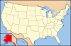 Census areasAleutians West • Bethel • Dillingham • Hoonah-Angoon • Nome • Petersburg • Prince of Wales-Hyder • Southeast Fairbanks • Valdez-Cordova • Yukon-KoyukukThere are no sites listed on the National Register of Historic Places in Wade Hampton Census Area
Municipalities and communities of Yukon-Koyukuk Census Area, Alaska Cities 
CDPs Alatna | Arctic Village | Beaver | Birch Creek | Central | Chalkyitsik | Circle | Coldfoot | Evansville | Flat | Four Mile Road | Lake Minchumina | Livengood | Manley Hot Springs | Minto | New Allakaket | Rampart | Stevens Village | Takotna | Venetie | Wiseman
Unincorporated
communitiesCategories:- National Register of Historic Places in Alaska by borough and census area
- Yukon–Koyukuk Census Area, Alaska
-


Wikimedia Foundation. 2010.