- National Register of Historic Places listings in central Washington, D.C.
-
This is a list of properties and districts listed on the National Register of Historic Places in the central area of Washington, D.C. For the purposes of this list central Washington, D. C. is defined as all of the Northwest quadrant south of M Street and all of the Southwest quadrant. This includes the National Mall, Downtown, the Penn Quarter, the Monumental Core and most of the popular tourist sites in Washington.
-
- This National Park Service list is complete through NPS recent listings posted November 10, 2011.[1]
Current listings
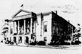
Landmark name Image Date listed Location Neighborhood Summary 1 Adas Israel Synagogue 
March 24, 1969 3rd and G Sts., NW.
38°53′52″N 77°1′11″W / 38.89778°N 77.01972°WDowntown East Now The Lillian & Albert Small Jewish Museum 2 Alibi Club 
October 21, 1994 1806 Eye St., NW.
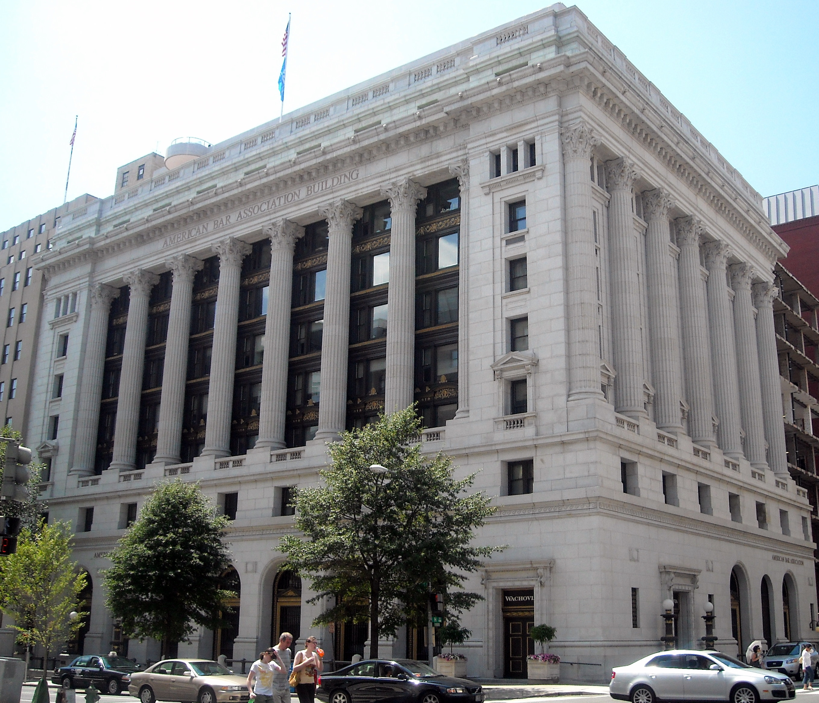
38°54′7″N 77°2′32″W / 38.90194°N 77.04222°WGolden Triangle 3 American Federation of Labor Building 
September 13, 1974 901 Massachusetts Ave., NW.
38°54′12″N 77°1′28″W / 38.90333°N 77.02444°WMount Vernon Square 4 American Institute of Pharmacy Building 
August 18, 1977 2215 Constitution Ave., NW.
38°53′34″N 77°2′59″W / 38.89278°N 77.04972°WMonumental Core 5 American Peace Society 
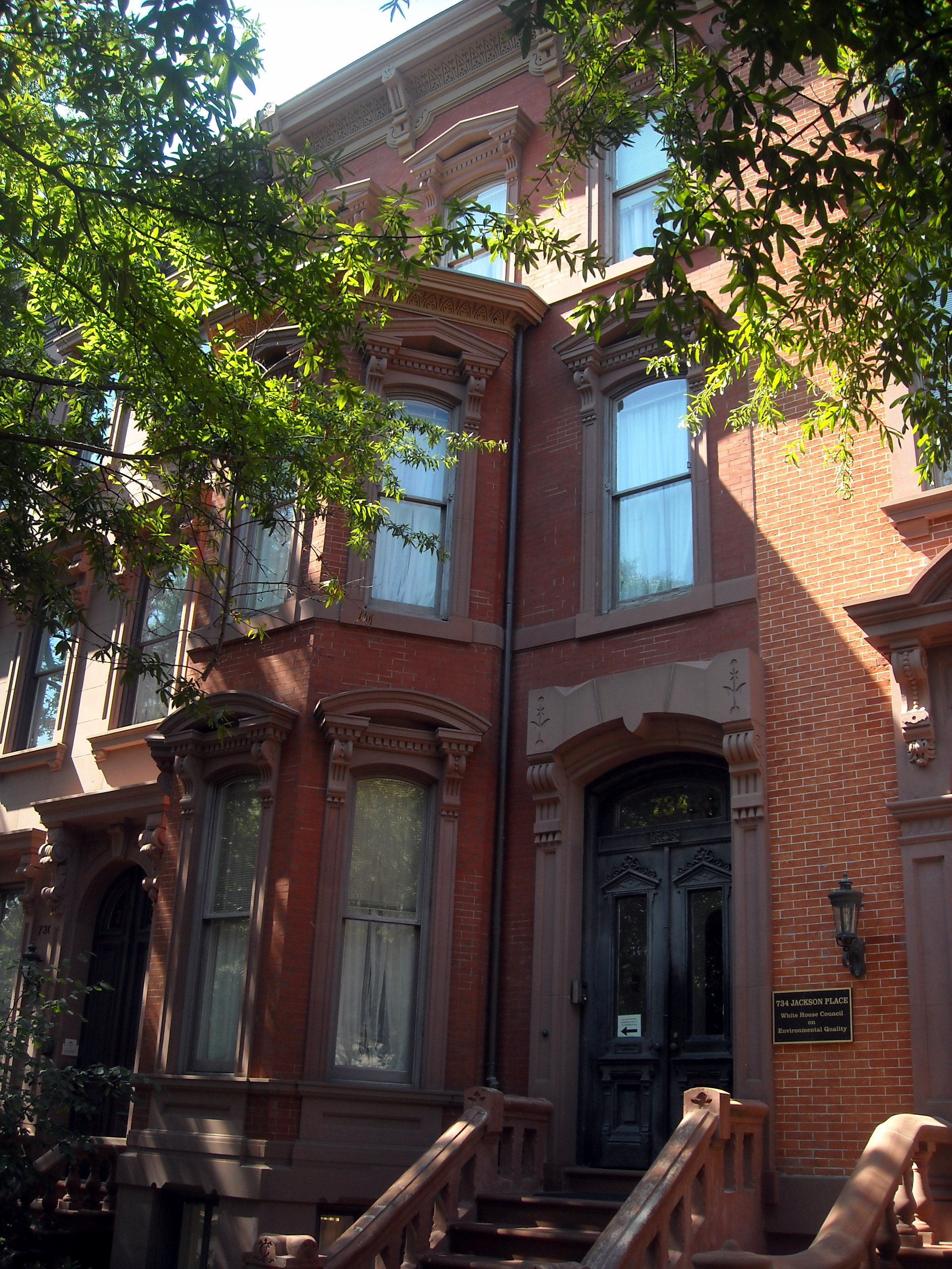
September 13, 1974 734 Jackson Pl., NW.
38°53′58″N 77°2′19″W / 38.89944°N 77.03861°WMonumental Core Headquarters of the American Peace Society from 1911 to 1948, in LaFayette Square Historic District 6 American Red Cross National Headquarters 
October 15, 1966 17th and D Sts., NW
38°53′41″N 77°2′26″W / 38.89472°N 77.04056°WMonumental Core 7 American Revolution Statuary 
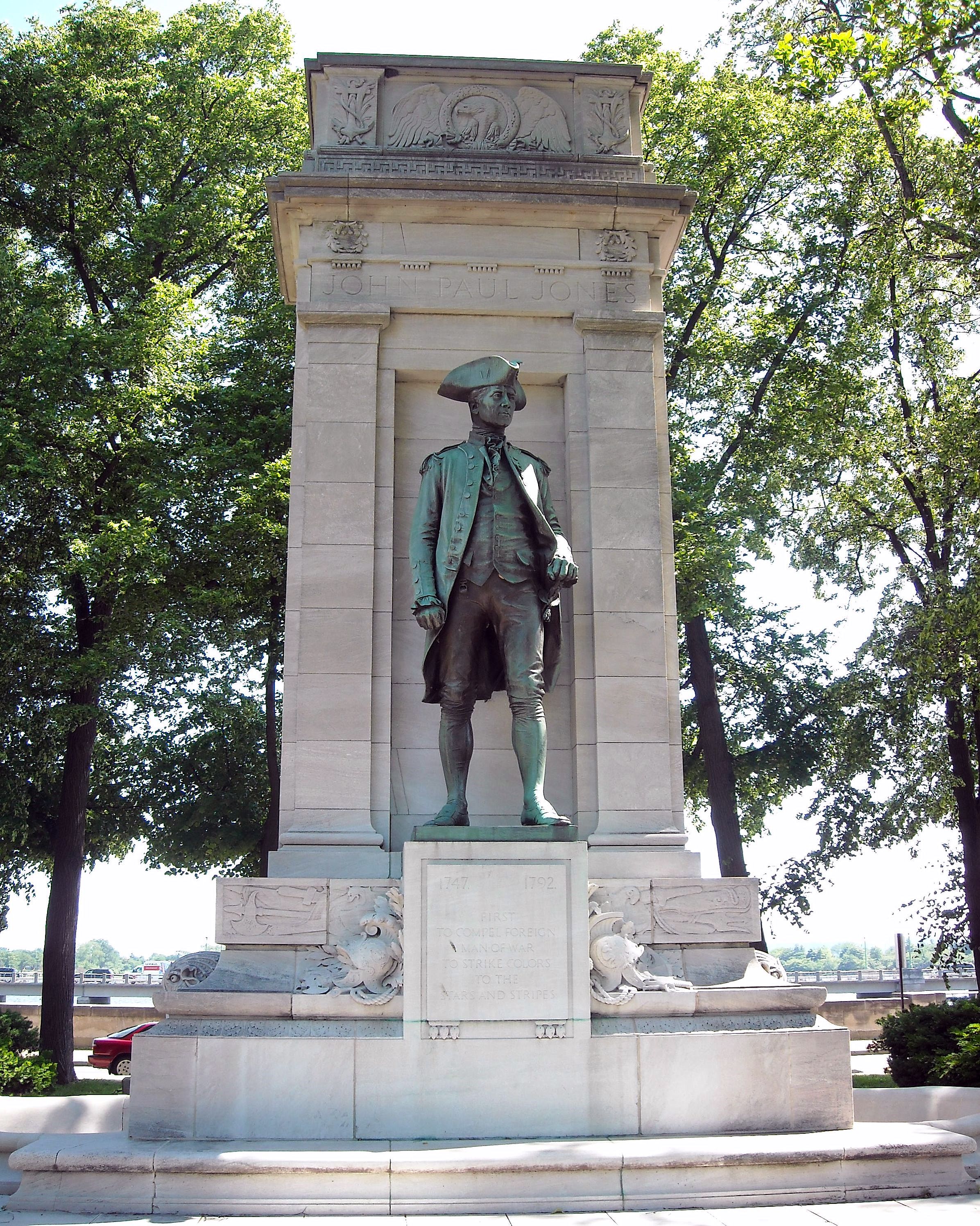
July 14, 1978 Public buildings and various parks within DC
38°53′54″N 77°2′16″W / 38.89833°N 77.03778°WMonumental Core 11 statues in central DC, including G. Washington, B. Franklin, N. Hale, J.P. Jones, J. Barry, E. Burke, C. Pulaski, de Lafayette, T. Kosciuszko, von Steuben, and de Rochambeau
and 3 statues in other districts8 American Security and Trust Company Building 
July 16, 1973 15th and Pennsylvania Ave., NW.
38°53′56″N 77°2′3″W / 38.89889°N 77.03417°WGolden Triangle 9 Elizabeth Arden Building 
August 18, 2003 1147 Connecticut Ave.
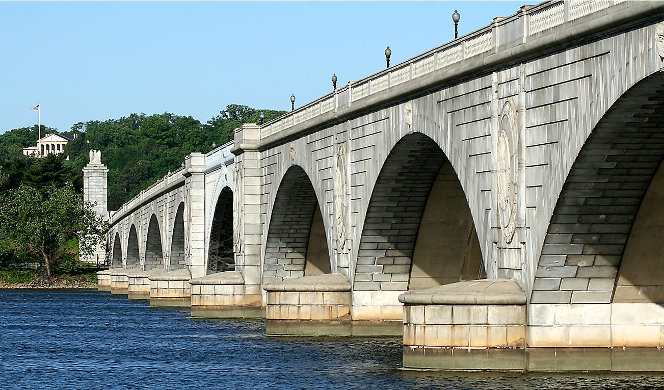
38°54′18″N 77°2′28″W / 38.905°N 77.04111°WNW 10 Arlington Memorial Bridge 
April 4, 1980 Spans Potomac River
38°53′12″N 77°3′39″W / 38.88667°N 77.06083°WSW 11 Arts and Industries Building 
November 11, 1971 900 Jefferson Dr., SW.
38°53′13″N 77°1′29″W / 38.88694°N 77.02472°WSW 12 Arts Club of Washington 
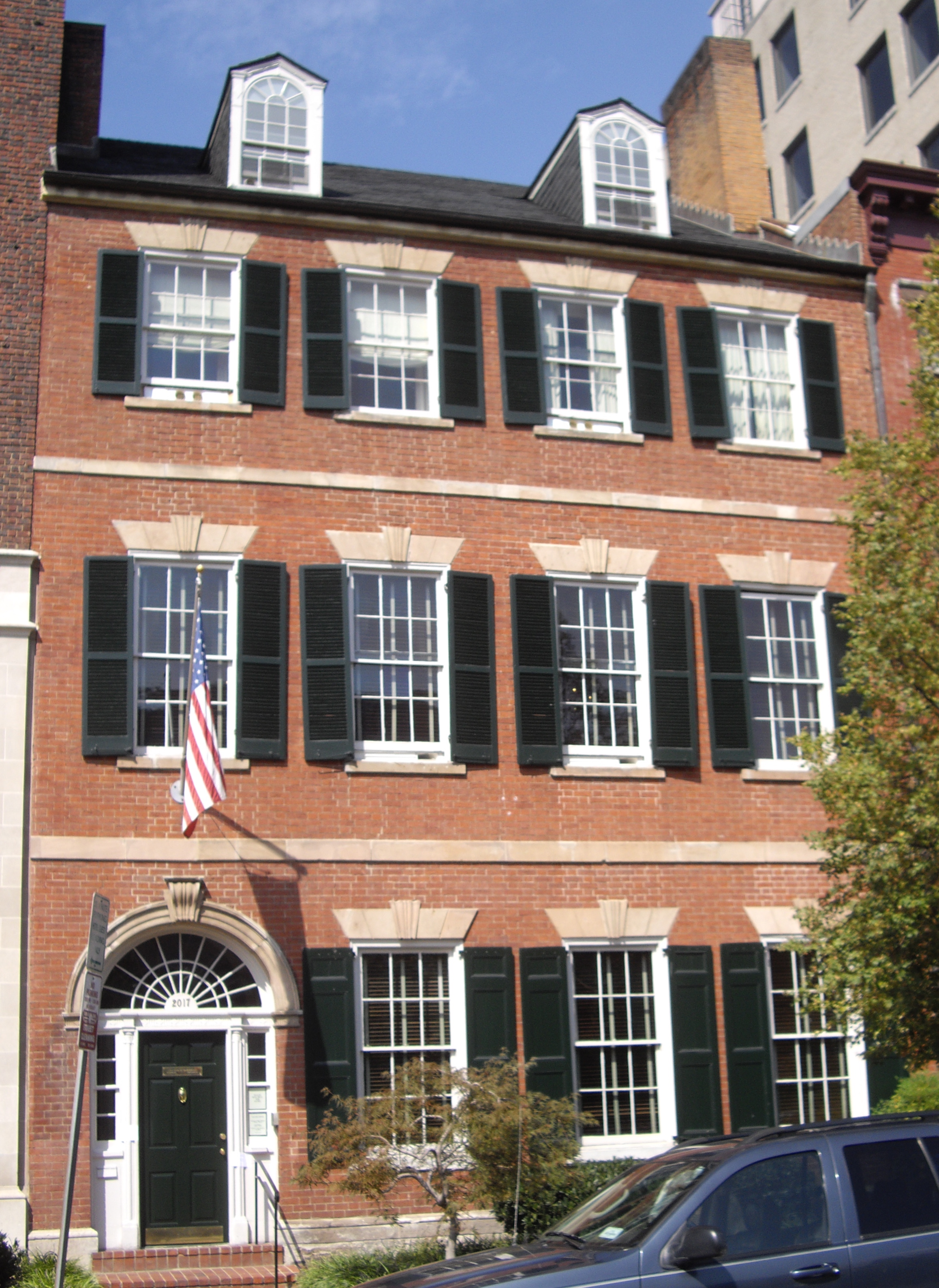
March 24, 1969 2017 I St., NW.
38°54′5″N 77°2′46″W / 38.90139°N 77.04611°WGolden Triangle Cleveland Abbe, a meteorologist who became known as the father of the National Weather Service, lived in this house from 1877 to 1909. Previous occupants in the early decades of the 19th century included James Monroe and the British legation. Built ca. 1802 to 1805, this is a fine example of the Federal style of residential architecture. 13 Asbury United Methodist Church 
November 1, 1986 Eleventh and K Sts. NW
38°54′8″N 77°1′39″W / 38.90222°N 77.0275°WDowntown 14 Ashburton House 
November 7, 1973 1525 H St., NW.
38°54′1″N 77°2′9″W / 38.90028°N 77.03583°WGolden Triangle 15 Auditor's Building Complex 
April 27, 1978 14th St. and Independence Ave.
38°53′10″N 77°2′1″W / 38.88611°N 77.03361°WSW 16 Augusta Apartment Building 
September 9, 1994 1151 New Jersey Ave. (216 New York Ave.), NW.
38°54′19″N 77°0′52″W / 38.90528°N 77.01444°WNorth Capitol Street 17 Bachelor Apartment House 
December 8, 1978 1737 H St., NW.
38°54′1″N 77°2′30″W / 38.90028°N 77.04167°WGolden Triangle 18 Blair House 
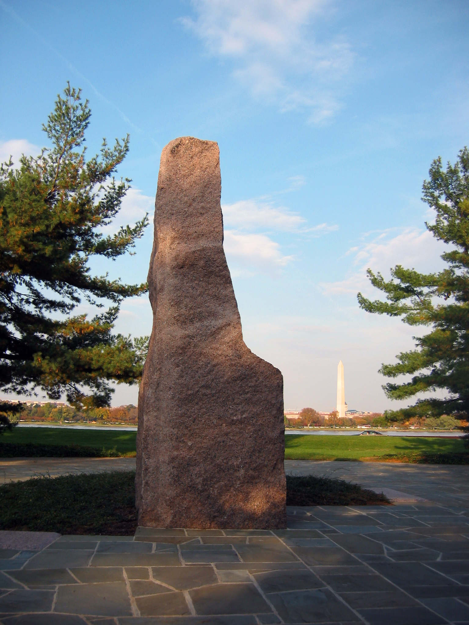
October 15, 1966 1651 Pennsylvania Ave., NW
38°53′56.04″N 77°2′19.02″W / 38.8989°N 77.0386167°WMonumental Core 19 Bond Building 
September 15, 1983 1404 New York Ave., NW
38°53′56″N 77°1′57″W / 38.89889°N 77.0325°WDowntown 20 Brownley Confectionery Building 
December 1, 1994 1309 F St., NW.
38°53′51″N 77°1′50″W / 38.8975°N 77.03056°WDowntown 21 Buildings at 1000 Block of Seventh Street, and 649-651 New York Avenue NW 
February 2, 1984 1005-1035 7th St., and 649-651 New York Ave. NW
38°54′12″N 77°1′19″W / 38.90333°N 77.02194°WMount Vernon Square 649 New York Avenue, NW 22 Bulletin Building 
November 12, 2008 717 6th St., NW
38°53′56″N 77°1′11″W / 38.89889°N 77.01972°WChinatown 23 Capitol Hill Historic District 
August 27, 1976 Roughly bounded by Virginia Ave., SE., S. Capitol St., F St. NE., and 14th Sts. SE & NE.
38°53′13″N 76°59′51″W / 38.88694°N 76.9975°WNE, SE and NW Boundary increase (listed July 3, 2003): Roughly bounded by 7th St. NE, I-295, M St. SE and 11th St. SE 24 Carlton Hotel 
June 28, 1990 923 16th St., NW.
38°54′7″N 77°2′11″W / 38.90194°N 77.03639°WGolden Triangle 25 Carnegie Endowment for International Peace 
September 13, 1974 700 Jackson Pl., NW
38°53′56″N 77°2′19″W / 38.89889°N 77.03861°WMonumental Core 26 Central National Bank 
April 27, 1995 633 Pennsylvania Ave., NW.
38°53′37″N 77°0′39″W / 38.89361°N 77.01083°WPenn Quarter 27 Central Heating Plant 
July 6, 2007 325 13th St. SW
38°53′8″N 77°1′44″W / 38.88556°N 77.02889°WSW 28 Central Public Library 
December 3, 1969 Mount Vernon Sq., 8th and K Sts., NW.
38°54′8″N 77°1′24″W / 38.90222°N 77.02333°WMount Vernon Square 29 Champlain Apartment Building 
September 7, 1994 1424 K St., NW.
38°54′9″N 77°1′58″W / 38.9025°N 77.03278°WDowntown 30 Chase's Theater and Riggs Building 
September 7, 1978 1426 G St. NW. and 615-627 15th St. NW.
38°53′53″N 77°2′1″W / 38.89806°N 77.03361°WDowntown 31 Chesapeake and Potomac Telephone Company Building 
August 5, 1988 730 Twelfth St., NW
38°53′56″N 77°1′42″W / 38.89889°N 77.02833°WDowntown 32 Chesapeake and Potomac Telephone Company, Old Main Building 
June 13, 1988 722 Twelfth St., NW
38°53′56″N 77°1′42″W / 38.89889°N 77.02833°WDowntown 33 Church of the Ascension 
January 19, 1984 1215 Massachusetts Ave. NW
38°54′18″N 77°1′43″W / 38.905°N 77.02861°WMount Vernon Square 34 Church of the Epiphany 
September 10, 1971 1317 G St., NW.
38°53′55″N 77°1′51″W / 38.89861°N 77.03083°WDowntown 35 Civil War Fort Sites 
July 15, 1974 Civil War Forts from Battery Kemble, NW to Fort Gremble, SW
38°54′22″N 77°1′30″W / 38.90611°N 77.025°WNW and SW 36 Civil War Monuments in Washington, DC 
September 20, 1978 Various parks within the original boundaries of city
38°54′8″N 76°57′18″W / 38.90222°N 76.955°WVarious 18 statues about people and topics related to the Civil War, including 11 in central Washington, 6 in the NW quadrant, and 1 in the NE quadrant. 37 Commercial National Bank 
October 11, 1991 1405 G St., NW.
38°53′54″N 77°1′57″W / 38.89833°N 77.0325°WDowntown 38 Concordia German Evangelical Church and Rectory 
December 14, 1978 20th and G Sts., NW.
38°53′52″N 77°2′42″W / 38.89778°N 77.045°WFoggy Bottom 39 Constitution Hall 
September 16, 1985 311 Eighteenth St., NW.
38°53′35″N 77°2′30″W / 38.89306°N 77.04167°WMonumental Core 40 Corcoran Gallery of Art 
May 6, 1971 17th St. at New York Ave., NW.
38°53′44″N 77°2′26″W / 38.89556°N 77.04056°WMonumental Core 41 Corcoran Hall, George Washington University 
April 12, 1991 721 21st St., NW.
38°53′57″N 77°2′48″W / 38.89917°N 77.04667°WGeorge Washington University 42 Cuban Friendship Urn 
October 11, 2007 Reservation 332, Ohio Dr at 14th St. Bridge SW
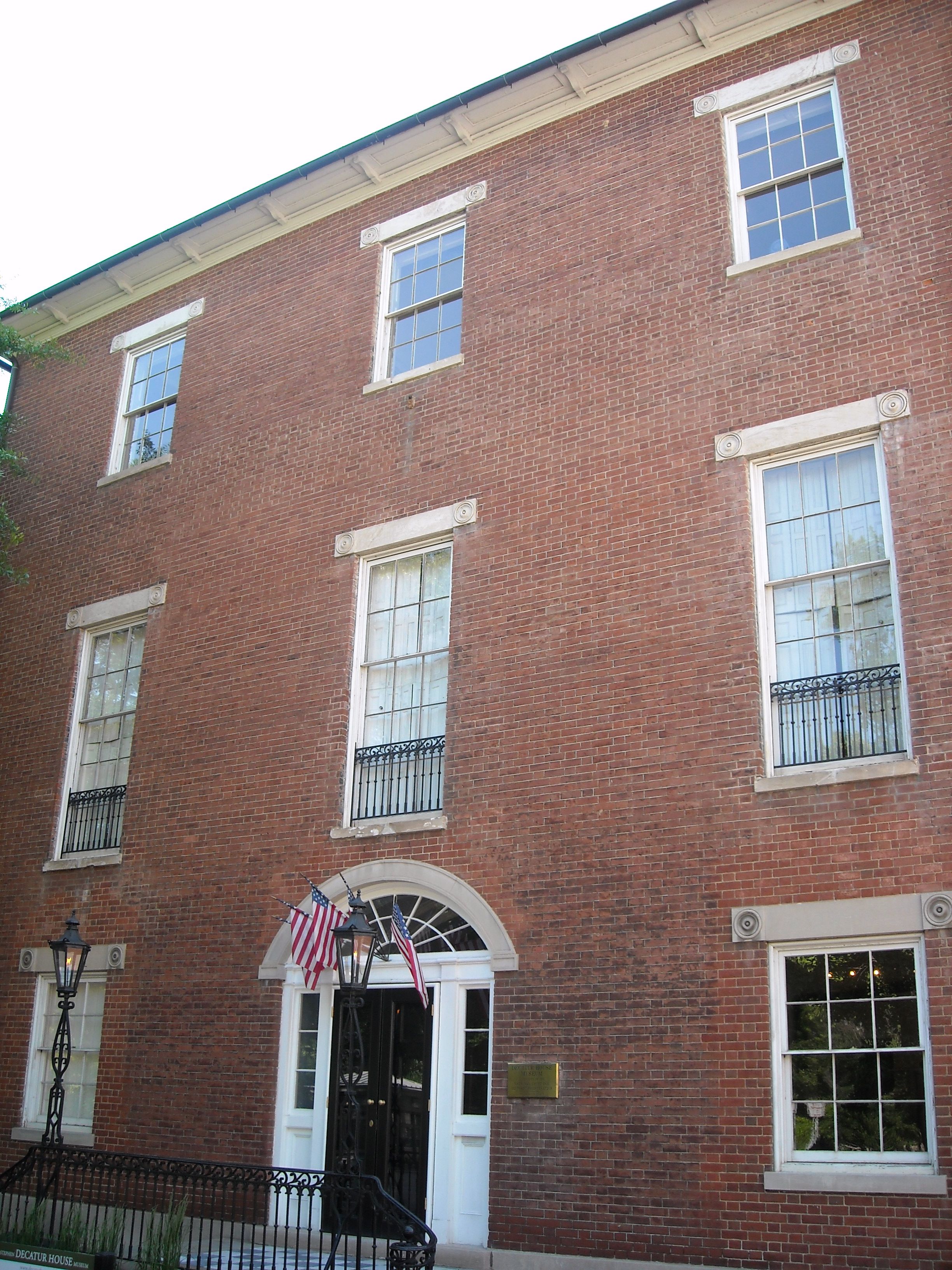
38°52′43″N 77°2′18″W / 38.87861°N 77.03833°WSW 43 Decatur House 
October 15, 1966 748 Jackson Pl., NW.
38°53′59″N 77°2′20″W / 38.89972°N 77.03889°WMonumental Core Federal Style house designed by Benjamin Henry Latrobe for naval hero Stephen Decatur across Lafayette Square from the White House. During 1827-1833 was home to successive Secretaries of State Henry Clay, Martin Van Buren, and Judah P. Benjamin. 44 James C. Dent House 
November 2, 2010 156 Q St., SW
38°52′14″N 77°0′48″W / 38.87056°N 77.01333°WSW 45 District Building 
March 16, 1972 SE corner of 14th and E Sts., NW.
38°53′41″N 77°1′54″W / 38.89472°N 77.03167°WMonumental Core 46 District of Columbia City Hall 
October 15, 1966 4th and E Sts., NW
38°53′43″N 77°1′4″W / 38.89528°N 77.01778°WDowntown East 47 Downtown Historic District 
September 22, 2001 Roughly, Seventh St. from Pennsylvania Ave. to Mt. Vernon Sq., and F St. between Eleventh and Seventh Sts., NW
38°53′50.31″N 77°1′29.21″W / 38.8973083°N 77.0247806°WDowntown 48 Duncanson-Cranch House 
July 26, 1973 468-470 N St., SW.
38°52′29″N 77°1′6″W / 38.87472°N 77.01833°W49 John J. Earley Office and Studio 
June 18, 2010 2131 G St., NW
38°53′54.99″N 77°2′53.26″W / 38.8986083°N 77.0481278°WGeorge Washington University 50 East and West Potomac Parks: East Potomac Park; West Potomac Park 
November 30, 1973 Bounded by Constitution Ave., 17th St., Independence Ave., Washington Channel, Potomac River, and Rock Creek Park
38°52′42″N 77°2′8″W / 38.87833°N 77.03556°WNW and SW 51 Eight Hundred Block of F St. NW 
April 2, 1974 800-818 F St. and 527 9th St., NW.
38°53′49″N 77°1′26″W / 38.89694°N 77.02389°WPenn Quarter 52 Engine Company 16-Truck Company 3 
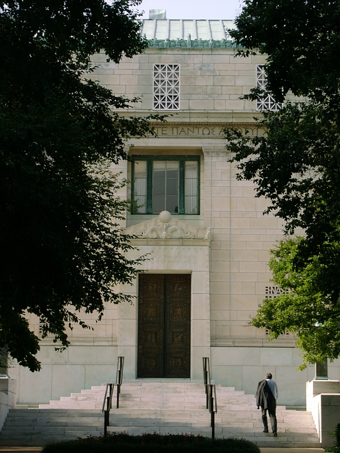
May 18, 2011 1018 13th St., NW
38°54′12″N 77°1′47″W / 38.90333°N 77.02972°WDowntown Firehouses in Washington DC MPS 53 Engine Company 23 
June 6, 2007 2119 G St., NW
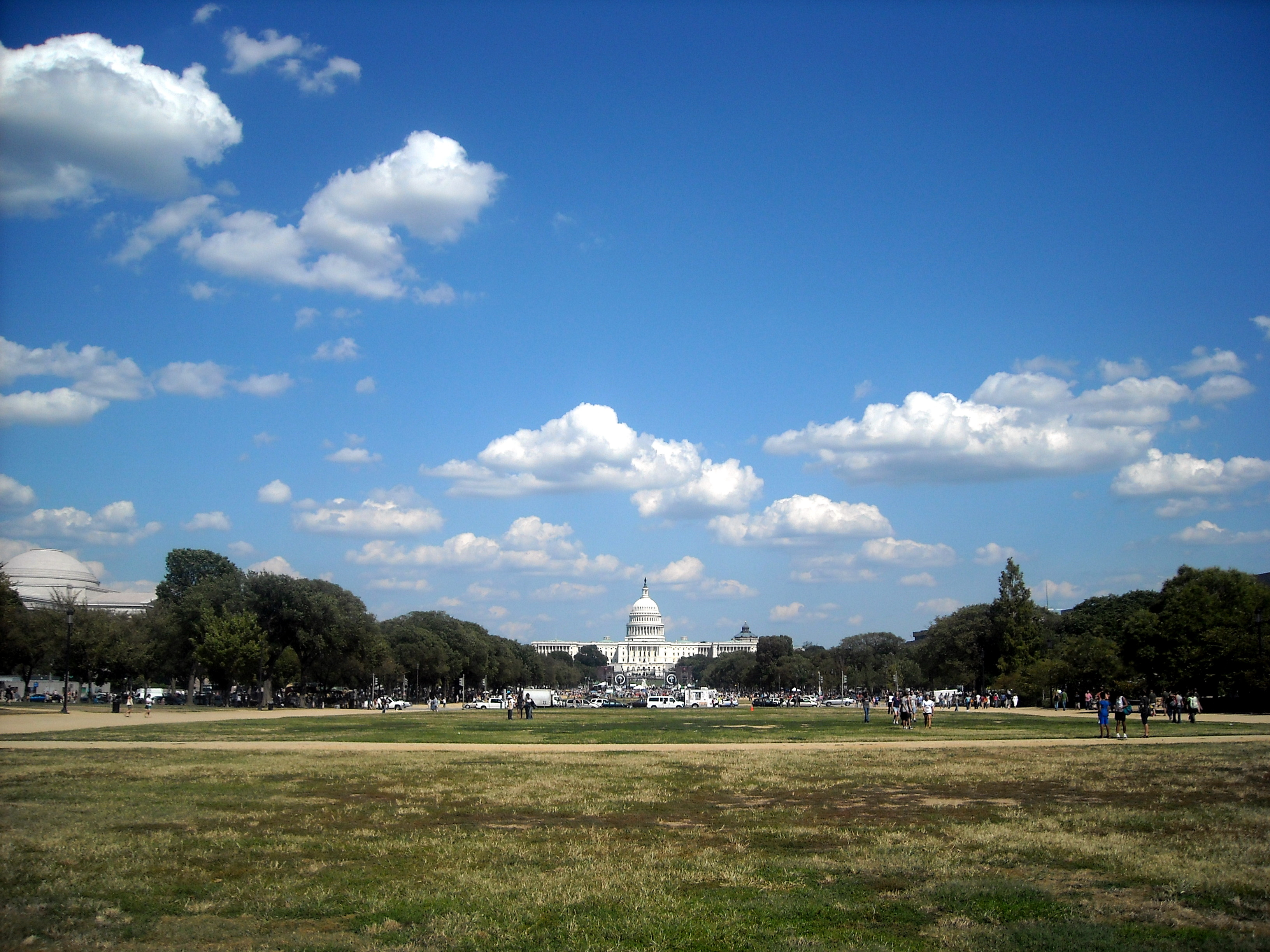
38°53′52″N 77°2′54″W / 38.89778°N 77.04833°WGeorge Washington University 54 Equitable Co-operative Building Association 
December 29, 1994 915 F St., NW.
38°53′50″N 77°1′29″W / 38.89722°N 77.02472°WChinatown 55 The Everglades 
June 18, 2010 2223 H St., NW
38°53′58.66″N 77°2′59.36″W / 38.8996278°N 77.0498222°WGeorge Washington University Apartment Buildings in Washington, DC, Multiple Property Submission 56 Executive Office Building 
June 4, 1969 Pennsylvania Ave. and 17th St., NW
38°53′51″N 77°2′21″W / 38.8975°N 77.03917°WMonumental Core 57 Federal Home Loan Bank Board Building 
July 3, 2007 320 First St., NW
38°53′35″N 77°1′9″W / 38.89306°N 77.01917°WDowntown East 58 Federal-American National Bank 
December 29, 1994 615-621 14th St., NW.
38°53′52″N 77°1′54″W / 38.89778°N 77.03167°WDowntown 59 Fifteenth Street Financial Historic District 
October 12, 2006 Fifteenth St., from Pennsylvania Ave. to I St., NW
38°53′55″N 77°2′2″W / 38.89861°N 77.03389°WMonumental Core, Downtown 60 The Flagler 
June 18, 2010 736 22nd St., NW
38°53′57.74″N 77°2′57.06″W / 38.8993722°N 77.0491833°WGeorge Washington University Apartment Buildings in Washington, DC, Multiple Property Submission 61 Fletcher Chapel 
August 14, 1997 401 New York Ave., NW
38°54′18″N 77°0′59″W / 38.905°N 77.01639°WMount Vernon Square 62 Foggy Bottom Historic District 
October 14, 1987 Bounded by New Hampshire Ave., Twenty-fourth, Twenty-sixth, H, and K Sts., NW
38°54′2″N 77°3′12″W / 38.90056°N 77.05333°WFoggy Bottom 63 Ford's Theatre National Historic Site 
October 15, 1966 10th St., NW., between E and F Sts.
38°53′47″N 77°1′34″W / 38.89639°N 77.02611°WPenn Quarter 64 Franklin School 
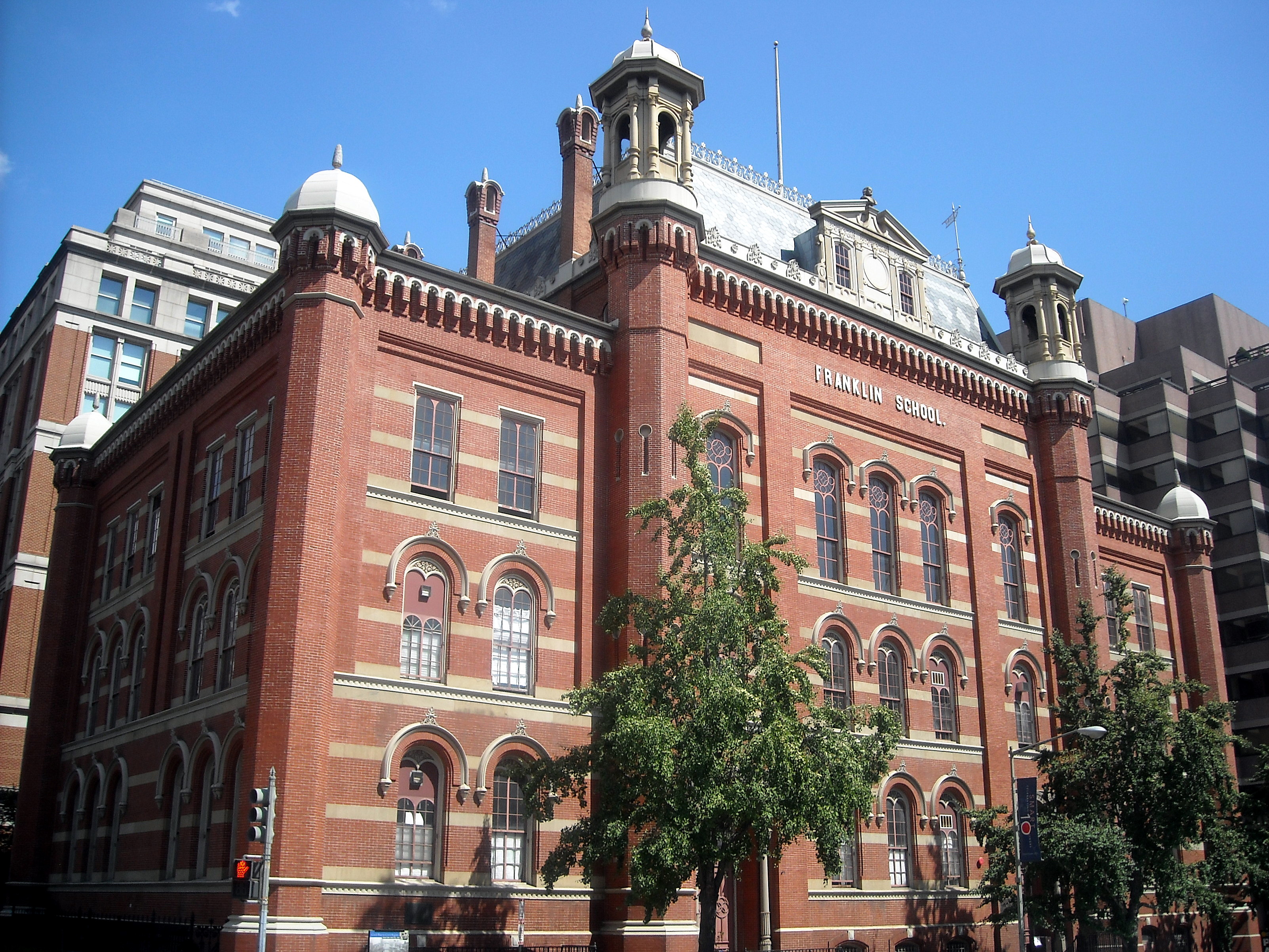
April 11, 1973 13th and K Sts., NW.
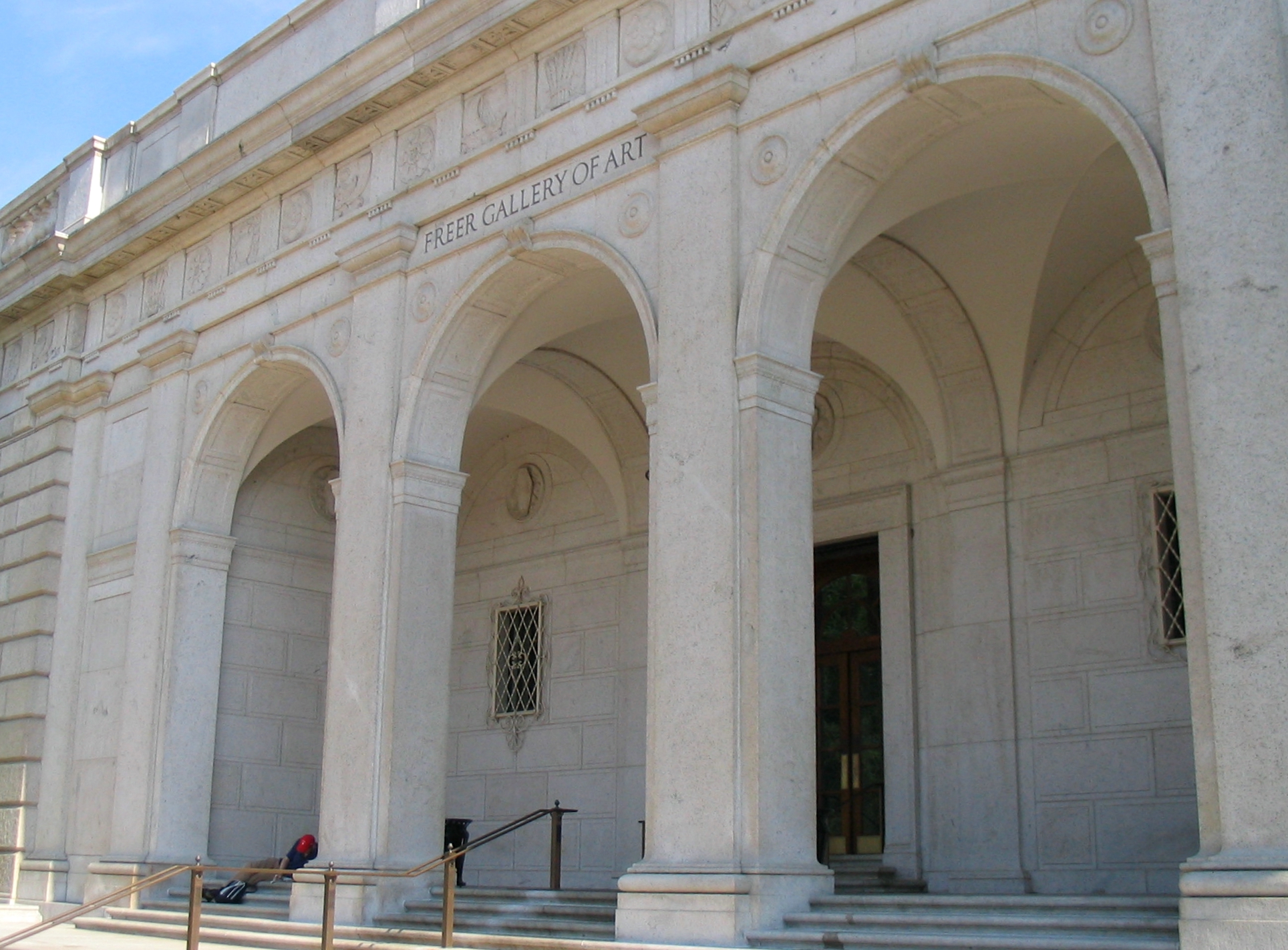
38°54′8″N 77°1′47″W / 38.90222°N 77.02972°WDowntown A nineteenth-century school, site of Alexander Graham Bell's experiments with the photophone. 65 Freer Gallery of Art 
June 23, 1969 12th St. and Jefferson Dr., SW.
38°53′17″N 77°1′40″W / 38.88806°N 77.02778°WSW 66 Friendship Baptist Church 
November 19, 2004 734 First St. SW
38°52′54.768″N 77°0′42.9438″W / 38.88188°N 77.011928833°WSW 67 Garfinckel's Department Store 
April 4, 1995 1401 F St., NW.
38°53′51″N 77°1′56″W / 38.8975°N 77.03222°WDowntown 68 General Post Office 
March 24, 1969 E and F Sts. between 7th and 8th Sts., NW
38°53′48″N 77°1′22″W / 38.89667°N 77.02278°WPenn Quarter 69 Germuiller Row 
December 1, 1994 748 3rd St. and 300-302 H St., NW.
38°53′59″N 77°0′56″W / 38.89972°N 77.01556°WChinatown 70 Godey Lime Kilns 
November 2, 1973 Rock Creek and Potomac Pkwy. at 27th and L Sts., NW.
38°54′12″N 77°3′22″W / 38.90333°N 77.05611°WWest End 71 Samuel Gompers Memorial 
October 11, 2007 Massachusetts Ave., 10th & L Sts. NW, Reservation 69
38°54′21″N 77°1′36″W / 38.90583°N 77.02667°WMount Vernon Square 72 Ulysses S. Grant School 
May 22, 2007 2130 G St. NW
38°53′59″N 77°2′53″W / 38.89972°N 77.04806°WGeorge Washington University 73 Harris & Ewing Photographic Studio 
December 16, 1994 1311-1313 F St., NW.
38°53′51″N 77°1′51″W / 38.8975°N 77.03083°WDowntown 74 Harrison Apartment Building 
September 7, 1994 704 3rd St., NW.
38°53′55″N 77°0′56″W / 38.89861°N 77.01556°WChinatown 75 W. B. Hibbs and Company Building 
March 19, 1991 725 Fifteenth St., NW.
38°53′57″N 77°2′0″W / 38.89917°N 77.033333°WDowntown 76 Hotel Washington 
March 30, 1995 515 15th St., NW.
38°53′49″N 77°2′1″W / 38.89694°N 77.03361°WDowntown 77 Interior Department Offices 
November 23, 1986 Eighteenth and F Sts. NW
38°53′48″N 77°2′35″W / 38.89667°N 77.04306°WGolden Triangle 78 Jefferson Apartment Building 
September 7, 1994 315 H St., NW.
38°54′1″N 77°0′57″W / 38.90028°N 77.01583°WMount Vernon Square 79 Thomas Jefferson Memorial 
October 15, 1966 S bank of the Tidal Basin
38°52′52″N 77°2′13″W / 38.88111°N 77.03694°WSW 80 Lyndon Baines Johnson Memorial Grove On The Potomac 
December 28, 1973 Lady Byrd Johnson Park, Columbia Island
38°52′42″N 77°3′5″W / 38.87833°N 77.05139°WSW 81 The Keystone 
June 18, 2010 2150 Pennsylvania Ave., NW
38°54′6.02″N 77°2′53.88″W / 38.9016722°N 77.0483°WGeorge Washington University Apartment Buildings in Washington, DC, Multiple Property Submission 82 Martin Luther King Memorial Library 
October 22, 2007 901 G St. NW.
38°54′2″N 77°1′29″W / 38.90056°N 77.02472°WChinatown 83 Korean War Veterans Memorial 
July 27, 1995 SE of Lincoln Memorial, off Independence Ave.
38°53′16.29″N 77°2′50.41″W / 38.8878583°N 77.0473361°WSW 84 Lafayette Building 
September 1, 2005 811 Vermont Ave. NW
38°54′2.83″N 77°2′4.52″W / 38.9007861°N 77.0345889°WGolden Triangle 85 Lafayette Square Historic District 
August 29, 1970 Roughly between 15th and 17th Sts. and H St. and State and Treasury Places, exclusive of the White House and its grounds
38°53′55″N 77°2′11″W / 38.89861°N 77.03639°WMonumental Core, Golden Triangle, Downtown 86 Julius Lansburgh Furniture Co., Inc. 
May 8, 1974 909 F St., NW.
38°53′51″N 77°1′29″W / 38.8975°N 77.02472°WChinatown Also known as the Old Masonic Temple 87 Thomas Law House 
August 14, 1973 1252 6th St., SW.
38°52′29″N 77°1′9″W / 38.87472°N 77.01917°WSW 88 L'Enfant Plan of the City of Washington, District of Columbia 
April 24, 1997 Roughly bounded by Florida Ave. from Rock Cr., NW. to 15th St., NE., S to C St., and E to the Anacostia River
38°53′26″N 77°1′13″W / 38.89056°N 77.02028°WAll 89 Lenthall Houses, George Washington University 
March 16, 1972 606–610 21St., NW
38°53′51.6″N 77°2′48.97″W / 38.897667°N 77.0469361°WGeorge Washington University 90 Lisner Auditorium, George Washington University 
October 25, 1990 730 21st St., NW.
38°53′57″N 77°2′50″W / 38.89917°N 77.04722°WGeorge Washington University 91 Lockkeeper's House, C & O Canal Extension 
November 30, 1973 SW corner of 17th St. and Constitution Ave., NW.
38°53′31″N 77°2′24″W / 38.89194°N 77.04°WMonumental Core 92 Luzon Apartment Building 
September 7, 1994 2501 Pennsylvania Ave., NW.
38°54′14″N 77°3′12″W / 38.90389°N 77.05333°WWest End 93 M Street High School 
October 23, 1986 128 M St. NW
38°54′19″N 77°0′49″W / 38.90528°N 77.01361°WNorth Capitol Street 94 Gen. Robert Macfeely House 
September 15, 1989 2015 I St., NW.
38°54′6″N 77°2′4″W / 38.90167°N 77.03444°WGolden Triangle 95 Masonic Temple 
February 18, 1987 801 Thirteenth St., NW
38°54′0″N 77°1′46″W / 38.9°N 77.02944°WDowntown 96 Mayflower Hotel 
November 14, 1983 1127 Connecticut Ave. NW
38°54′16″N 77°2′23″W / 38.90444°N 77.03972°WGolden Triangle 97 McLachlen Building 
November 6, 1986 1001 G St. NW
38°53′54″N 77°1′35″W / 38.89833°N 77.02639°WDowntown 98 Memorial Continental Hall 
November 28, 1972 17th St., between C and D Sts., NW
38°53′37″N 77°2′25″W / 38.89361°N 77.04028°WMonumental Core 99 Metropolitan African Methodist Episcopal Church 
July 26, 1973 1518 M St., NW.
38°54′19″N 77°2′9″W / 38.90528°N 77.03583°WGolden Triangle Gothic-style church dedicated in 1886; held the funerals of Frederick Douglass and Rosa Parks; on the National Trust for Historic Preservation 2010 list of America's Most Endangered Places[2] 100 Metropolitan Club 
April 28, 1995 1700 H St., NW.
38°54′0″N 77°2′24″W / 38.9°N 77.04°WGolden Triangle 101 Milton Hall 
June 18, 2010 2222 I St., NW
38°54′2.3″N 77°2′59.34″W / 38.900639°N 77.0498167°WGeorge Washington University Apartment Buildings in Washington, DC, Multiple Property Submission 102 Moran Building 
September 26, 1983 501-509 G St., NW
38°53′54″N 77°1′10″W / 38.89833°N 77.01944°WChinatown 103 Morrison and Clark Houses 
March 19, 1991 1013-1015 L St., NW.
38°54′15″N 77°1′38″W / 38.90417°N 77.02722°WMount Vernon Square 104 Mount Vernon Memorial Highway 
May 18, 1981 Washington St. and George Washington Memorial Pkwy.
38°46′35″N 77°3′13″W / 38.77639°N 77.05361°WSW 105 Mount Vernon Square Historic District 
September 3, 1999 Roughly bounded by New York Ave., 7th St., N St., and 1st St. NW
38°54′19″N 77°1′4″W / 38.90528°N 77.01778°WMount Vernon Square, extends north of M Street 106 Mount Vernon Triangle Historic District 
September 19, 2006 Roughly bounded by: 400 blks. Massachusettes Ave. NW and K St. NW, Prather's Alley and 5th St. NW
38°54′13″N 77°1′6″W / 38.90361°N 77.01833°WMount Vernon Square 107 Mullett Rowhouses 
September 30, 1994 2517, 2519 and 2525 Pennsylvania Ave., NW.
38°54′15″N 77°3′16″W / 38.90417°N 77.05444°WWest End 108 Munson Hall 
June 18, 2010 2212 H St., NW
38°53′58.44″N 77°2′56.4″W / 38.8995667°N 77.049°WGeorge Washington University Apartment Buildings in Washington, DC, Multiple Property Submission 109 Myrene Apartment Building 
September 9, 1994 703 6th St., NW.
38°53′55″N 77°1′11″W / 38.89861°N 77.01972°WChinatown 110 National Academy of Sciences 
March 15, 1974 2101 Constitution Ave., NW.
38°53′34″N 77°2′54″W / 38.89278°N 77.04833°WMonumental Core 111 National Archives 
May 27, 1971 Constitution Ave. between 7th and 9th Sts., NW.
38°53′33″N 77°1′24″W / 38.8925°N 77.02333°WMonumental Core 112 National Bank of Washington, Washington Branch 
May 8, 1974 301 7th St., NW.
38°53′37″N 77°1′16″W / 38.89361°N 77.02111°WPenn Quarter 113 National Mall 
October 15, 1966 Between Independence and Constitution Aves. from the U.S. Capitol to the Washington Monument
38°53′23″N 77°1′20″W / 38.88972°N 77.02222°WNW and SW 114 National Metropolitan Bank Building 
September 13, 1978 613 15th St., NW.
38°53′52″N 77°2′1″W / 38.89778°N 77.03361°WDowntown 115 National Portrait Gallery 
October 15, 1966 F and G Sts. between 7th and 9th Sts., NW
38°53′52″N 77°1′23″W / 38.89778°N 77.02306°WChinatown 116 National Saving And Trust Company 
March 16, 1972 New York Ave. and 15th St., NW.
38°53′57″N 77°2′1″W / 38.89917°N 77.03361°WDowntown 117 National Union Building 
September 21, 1990 918 F St., NW
38°53′49″N 77°1′29″W / 38.89694°N 77.02472°WPenn Quarter 118 National War College 
November 28, 1972 P St., within Fort Lesley J. McNair
38°51′47″N 77°1′1″W / 38.86306°N 77.01694°WSW 119 The Octagon 
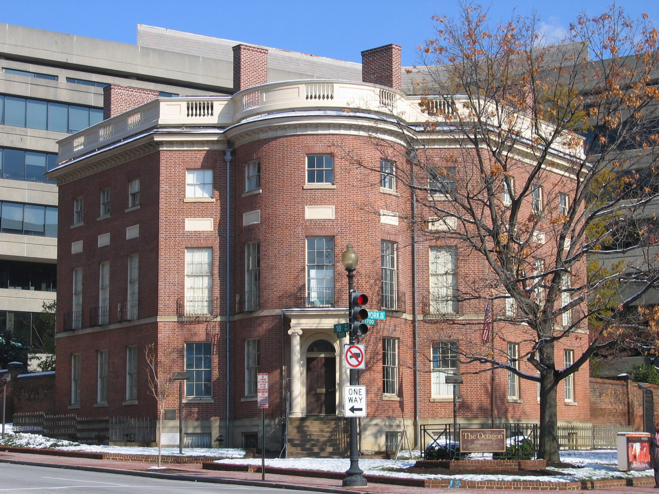
October 15, 1966 1799 New York Ave., NW
38°53′46″N 77°2′30″W / 38.89611°N 77.04167°WGolden Triangle NHL: Served as the temporary Executive Mansion for Pres. James Madison after White House was burned by the British in the War of 1812 120 Old Engine Company No. 6 
September 5, 1975 438 Massachusetts Ave., NW.
38°54′1″N 77°1′3″W / 38.90028°N 77.0175°WChinatown 121 Old Naval Observatory 
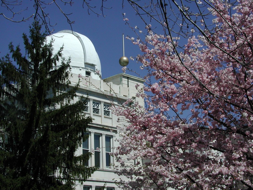
October 15, 1966 23rd and E Sts., NW
38°53′42″N 77°3′7″W / 38.895°N 77.05194°WMonumental Core 122 Old Post Office and Clock Tower 
April 11, 1973 Pennsylvania Ave. at 12th St., NW.
38°53′38″N 77°1′41″W / 38.89389°N 77.02806°WMonumental Core 123 Oriental Building Association No. 6 Building 
September 10, 2004 600 F St. NW
38°53′56″N 77°1′13″W / 38.89889°N 77.02028°WPenn Quarter 124 Pan American Union Building 
June 4, 1969 17th St. between C St. and Constitution Ave., NW.
38°53′34″N 77°2′27″W / 38.89278°N 77.04083°WMonumental Core 125 Pennsylvania Avenue National Historic Site 
October 15, 1966 Roughly bounded by Constitution Ave., F St., 3rd, and 15th Sts. NW
38°53′35″N 77°1′35″W / 38.89306°N 77.02639°WMonumental Core, Downtown East, Downtown, Penn Quarter 126 Pension Building 
March 24, 1969 4th and 5th Sts. between F and G Sts., NW
38°53′51″N 77°1′5″W / 38.8975°N 77.01806°WChinatown Now the National Building Museum 127 Philadelphia (gundelo) 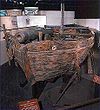
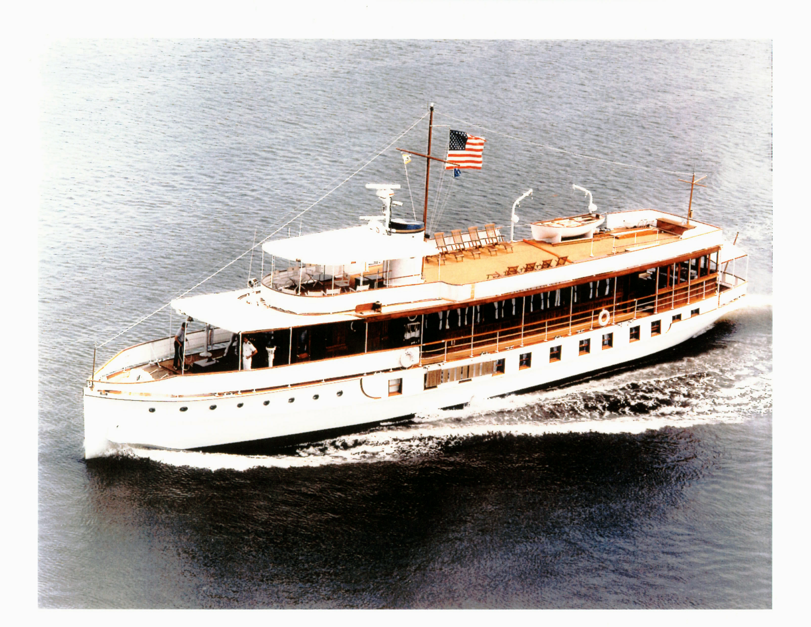
October 15, 1966 National Museum of American History, 14th St. and Constitution Ave., NW Monumental Core Only surviving American gunboat from the Revolutionary War, fought in Battle of Valcour Island 128 USS SEQUOIA (yacht) 
December 23, 1987 Gangplank Marina (as of 2010)[3]
38°52′32″N 77°1′21″W / 38.87556°N 77.0225°WSW 129 President's Office, George Washington University 
September 13, 1991 2003 G St., NW. and 700 20th St., NW.
38°53′54″N 77°2′43″W / 38.89833°N 77.04528°WGeorge Washington University 130 President's Park South 
May 6, 1980 Constitution Ave.
38°53′39″N 77°2′13″W / 38.89417°N 77.03694°WNW 131 Railroad Retirement Board Building 
July 6, 2007 330 C St. SW
38°53′8″N 77°1′0″W / 38.88556°N 77.016667°WSW 132 Randall Junior High School 
December 22, 2008 65 I St., SW
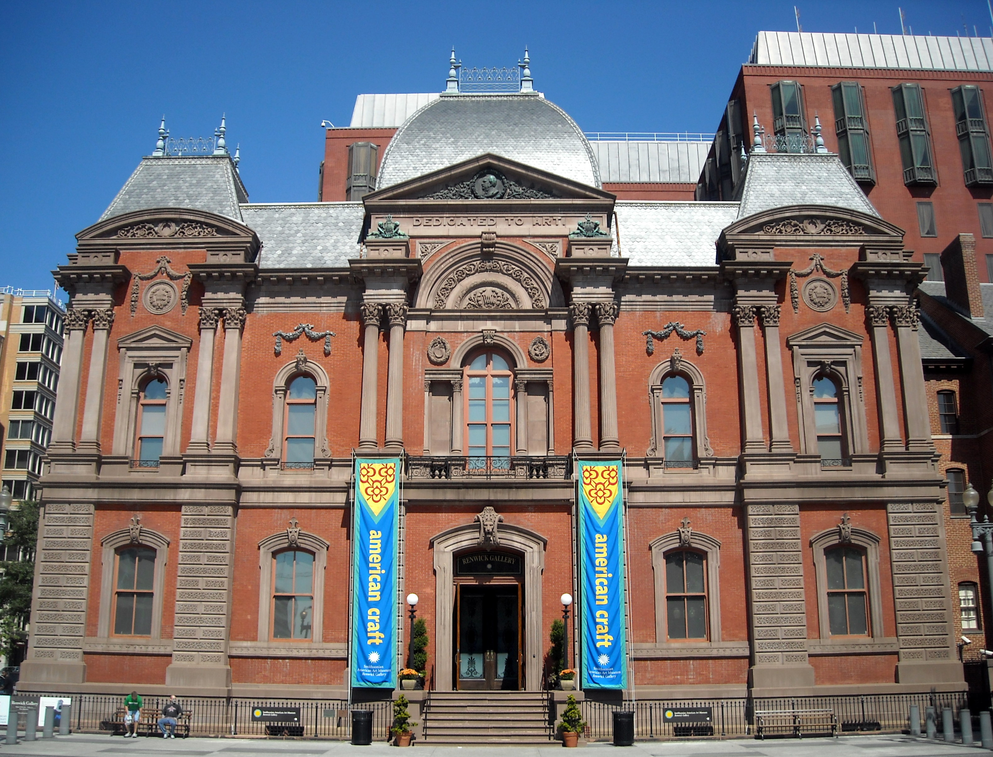
38°52′45.48″N 77°0′39.18″W / 38.8793°N 77.0108833°WSW 133 Renwick Gallery 
March 24, 1969 Northeast corner of 17th St. and Pennsylvania Ave., NW
38°53′56″N 77°2′22″W / 38.89889°N 77.03944°WMonumental Core 134 Rhodes' Tavern 
March 24, 1969 601-603 15th St. and 1431 F St., NW.
38°53′51″N 77°2′1″W / 38.8975°N 77.03361°WDowntown 135 Riggs National Bank 
July 16, 1973 1503-1505 Pennsylvania Ave., NW.
38°53′56″N 77°2′4″W / 38.89889°N 77.03444°WGolden Triangle 136 Riggs National Bank, Washington Loan and Trust Company Branch 
May 6, 1971 SW corner of 9th and F Sts., NW.
38°53′50″N 77°1′29″W / 38.89722°N 77.02472°WPenn Quarter 137 Ringgold-Carroll House 
July 26, 1973 1801 F St., NW.
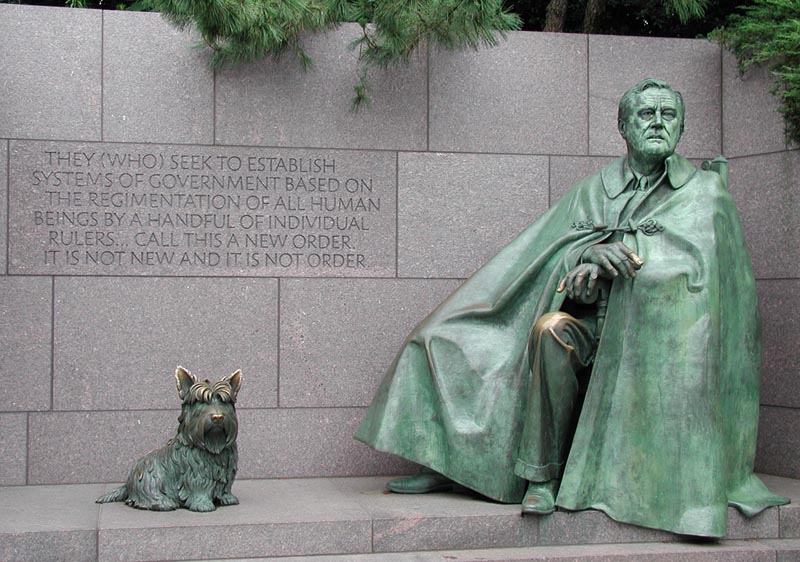
38°53′51″N 77°2′33″W / 38.8975°N 77.0425°WGolden Triangle 138 Franklin Delano Roosevelt Memorial 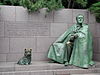
May 2, 1997 Cherry Tree Walk, Tidal Basin
38°53′35″N 77°1′26″W / 38.89306°N 77.02389°WSW 139 St. Aloysius Catholic Church 
July 26, 1973 N. Capitol and I Sts., NW.
38°54′5″N 77°0′36″W / 38.90139°N 77.01°WNorth Capitol Street 140 St. John's Church 
October 15, 1966 16th and H Sts., NW
38°54′1″N 77°2′11″W / 38.90028°N 77.03639°WGolden Triangle 141 St. Mary's Episcopal Church 
April 2, 1973 730 23rd St., NW.
38°53′57″N 77°3′2″W / 38.89917°N 77.05056°WFoggy Bottom 142 General Jose de San Martin Memorial 
October 12, 2007 Reservation 106, Virginia Ave. & 20th St., NW.
38°53′48″N 77°2′44″W / 38.89667°N 77.04556°WMonumental Core 143 Schneider Triangle 
December 13, 1982 Bounded by Washington Circle, New Hampshire Ave. NW, K, 22nd, and L Sts. NW
38°54′11″N 77°2′58″W / 38.90306°N 77.04944°WGolden Triangle 144 Second Baptist Church 
June 30, 2004 816 3rd St. NW
38°54′9″N 77°0′57″W / 38.9025°N 77.01583°WMount Vernon Square 145 Second National Bank 
December 29, 1994 1331 G St., NW.
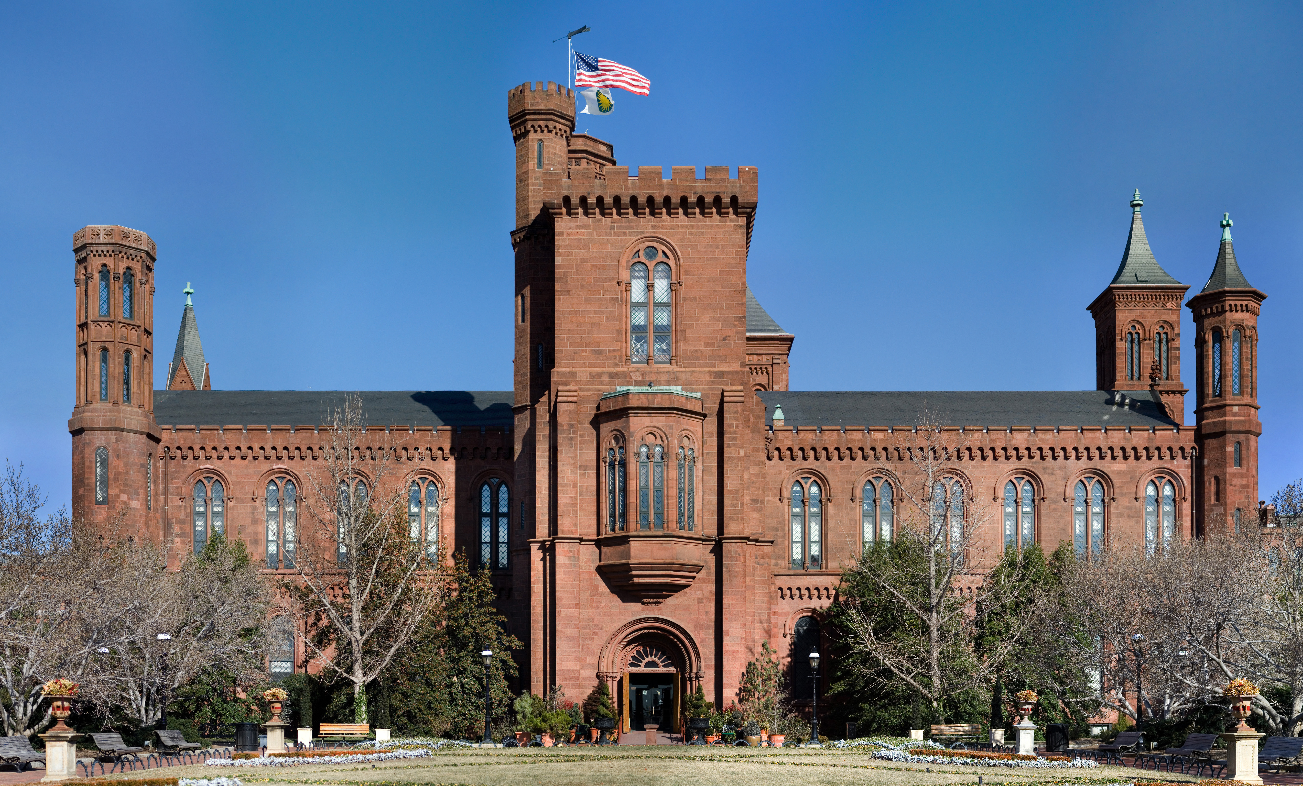
38°53′54″N 77°1′52″W / 38.89833°N 77.03111°WDowntown 146 Smithsonian Building 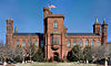
October 15, 1966 Jefferson Dr. at 10th St., SW
38°53′19″N 77°1′35″W / 38.88861°N 77.02639°WSW 147 Social Security Administration Building 
July 6, 2007 330 Independence Ave. SW
38°52′55″N 77°1′1″W / 38.88194°N 77.01694°WSW 148 Steedman-Ray House 
September 21, 1990 1925 F St., NW
38°53′50″N 77°2′42″W / 38.89722°N 77.045°WFoggy Bottom 149 Thaddeus Stevens School 
July 12, 2001 1050 Twenty-First St., NW
38°54′0″N 77°2′36″W / 38.9°N 77.04333°WGolden Triangle 150 Stockton Hall 
September 13, 1991 720 20th St., NW.
38°53′57″N 77°2′43″W / 38.89917°N 77.04528°WGeorge Washington University 151 Hattie M. Strong Residence Hall 
April 12, 1991 620 21st St., NW.
38°53′52″N 77°2′50″W / 38.89778°N 77.04722°WGeorge Washington University 152 Sun Building 
March 27, 1985 1317 F St., NW
38°53′48″N 77°1′34″W / 38.89667°N 77.02611°WDowntown 153 Mary E. Surratt House 
August 11, 2009 604 H Street
38°53′58″N 77°1′13″W / 38.89944°N 77.02028°WChinatown 154 William Syphax School 
July 25, 2003 1360 Half St., SW
38°52′33″N 77°0′31″W / 38.87583°N 77.00861°WSW 155 Temperance Fountain 
October 12, 2007 7th St. & Indiana Ave. NW
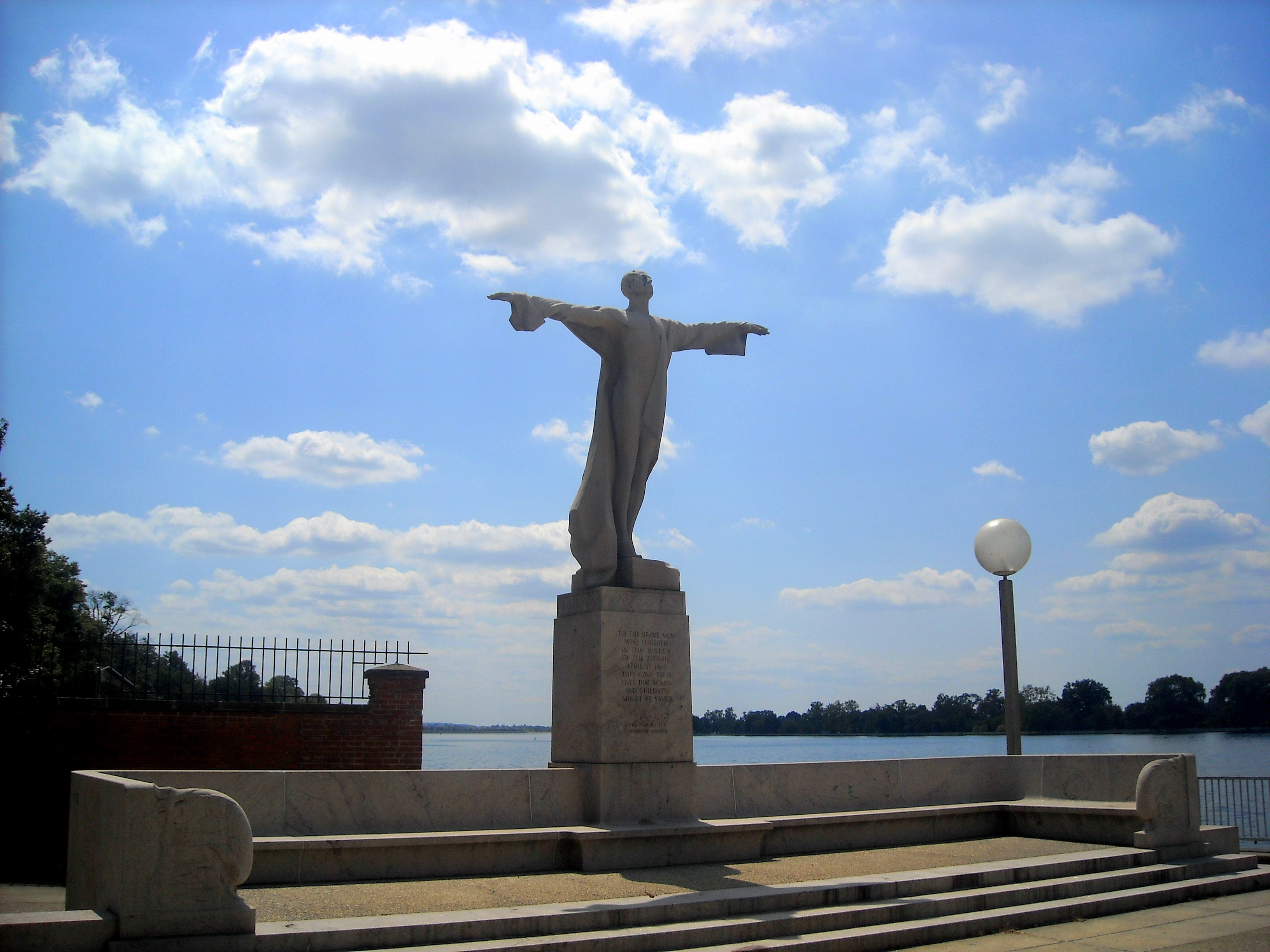
38°53′37″N 77°1′19″W / 38.89361°N 77.02194°WPenn Quarter 156 Titanic Memorial 
October 12, 2007 Reservation 717, SW Waterfront Park, Water & P Sts., SW
38°52′38″N 77°1′16″W / 38.87722°N 77.02111°WSW 157 Tower Building 
September 7, 1995 1401 K St., NW.
38°54′5″N 77°1′57″W / 38.90139°N 77.0325°WDowntown 158 U.S. Department of the Treasury 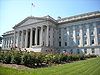
November 11, 1971 1500 Pennsylvania Ave., NW
38°53′21″N 77°2′5″W / 38.88917°N 77.03472°WMonumental Core 159 2000 Block of Eye Street, NW, GWU 
August 9, 1977 South side of 2000 block of Eye St., NW.
38°54′0″N 77°2′46″W / 38.9°N 77.04611°WGeorge Washington University 160 U.S. Capitol Gatehouses and Gateposts 
November 30, 1973 7th, 15th, and 17th Sts., and Constitution Ave., NW.
38°53′27″N 77°1′56″W / 38.89083°N 77.03222°WMonumental Core 161 U.S. Court Of Military Appeals 
January 21, 1974 450 E St., NW.
38°53′44″N 77°1′7″W / 38.89556°N 77.01861°WDowntown East 162 Oscar W. Underwood House 
December 8, 1976 2000 G St., NW
38°53′53″N 77°2′43″W / 38.89806°N 77.04528°WFoggy Bottom 163 Union Trust Building 
January 19, 1984 740 15th St. NW
38°54′0″N 77°2′2″W / 38.9°N 77.03389°WGolden Triangle 164 United Brotherhood of Carpenters and Joiners-Local 132 
September 17, 2003 1010 10th St. NW, 1001 K St. NW
38°54′9″N 77°1′35″W / 38.9025°N 77.02639°WDowntown 165 United Mine Workers of America Building 
September 13, 2000 900 Fifteenth St. NW
38°54′8″N 77°2′13″W / 38.90222°N 77.03694°WGolden Triangle 166 US Chamber of Commerce Building 
May 13, 1992 1615 H St., NW.
38°54′1″N 77°2′17″W / 38.90028°N 77.03806°WGolden Triangle 167 US Courthouse-District of Columbia 
July 5, 2007 333 Constitution Ave. NW
38°53′22″N 77°1′2″W / 38.88944°N 77.01722°WDowntown East 168 U.S. Department of Agriculture Administration Building 
January 24, 1974 12th St. and Jefferson Dr., SW.
38°53′17″N 77°1′49″W / 38.88806°N 77.03028°WSW 169 U.S. Department of Agriculture South Building 
July 5, 2007 14th St. and Independence Ave., SW
38°53′12″N 77°1′48″W / 38.88667°N 77.03°WSW 170 U.S. Department of Housing and Urban Development 
August 26, 2008 451 7th St., SW
38°53′2.46″N 77°1′19.24″W / 38.8840167°N 77.0220111°WSW Known as "Robert C. Weaver Federal Building", it was designed by Marcel Breuer 171 US Department of the Interior Building 
November 10, 1986 Eighteenth and C Sts. NW
38°53′41″N 77°1′54″W / 38.89472°N 77.03167°WMonumental Core 172 US General Accounting Office Building 
September 21, 1995 441 G St., NW.
38°53′48″N 77°1′4″W / 38.89667°N 77.01778°WChinatown 173 US Public Health Service Building 
July 5, 2007 1951 Constitution Ave. NW
38°53′34″N 77°2′40″W / 38.89278°N 77.04444°WMonumental Core 174 U.S. Tax Court 
August 26, 2008 400 2nd St., NW.
38°53′43.17″N 77°0′52.37″W / 38.895325°N 77.0145472°WDowntown East 175 Vietnam Veterans Memorial 
November 13, 1982 West end of Constitution Gardens
38°53′27″N 77°2′50″W / 38.89083°N 77.04722°WNW 176 Waggaman-Ray Commercial Row 
February 24, 1995 1141, 1143 and 1145 Connecticut Ave.
38°54′15″N 77°2′28″W / 38.90417°N 77.04111°WNW 177 George Washington Memorial Parkway 
June 2, 1995 Roughly, S side of the Potomac R. from American Legion to Memorial Bridge and N side from Brickyard Rd. to Chain Bridge
38°56′19″N 77°8′7″W / 38.93861°N 77.13528°WSW 178 Washington Monument 
October 15, 1966 The Mall, between 14th and 17th Sts., NW.
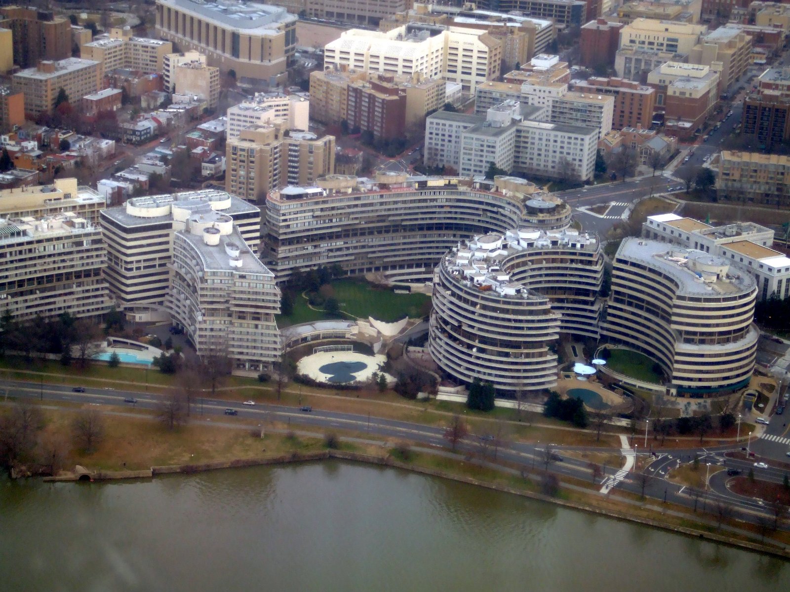
38°53′23″N 77°2′9″W / 38.88972°N 77.03583°WMonumental Core 179 Watergate Complex 
October 12, 2005 2500, 2600, 2650, 2600 Virginia Ave. NW, 600, 700 New Hampshire Ave. NW
38°53′56″N 77°3′17″W / 38.89889°N 77.05472°WFoggy Bottom 180 Margaret Wetzel House 
October 25, 1990 714 21st St., NW.
38°53′56″N 77°2′50″W / 38.89889°N 77.04722°WGeorge Washington University 181 Wheat Row 
July 23, 1973 1315, 1317, 1319, and 1321 4th St., SW.
38°52′26″N 77°1′5″W / 38.87389°N 77.01806°WSW 182 Emily Wiley House 
May 26, 2006 902 3rd St., NW
38°54′12″N 77°0′56″W / 38.90333°N 77.01556°WMount Vernon Square 183 Willard Hotel 
February 15, 1974 1401-1409 Pennsylvania Ave., NW.
38°53′49″N 77°1′58″W / 38.89694°N 77.03278°WDowntown 184 Winder Building 
March 24, 1969 604 17th St., NW.
38°53′51″N 77°2′25″W / 38.8975°N 77.04028°WGolden Triangle 185 Maxwell Woodhull House 
April 12, 1991 2033 G St., NW.
38°53′54″N 77°2′48″W / 38.89833°N 77.04667°WGeorge Washington University 186 Yale Steam Laundry 
March 18, 1999 437-443 New York Ave., NW
38°54′17″N 77°1′5″W / 38.90472°N 77.01806°WMount Vernon Square References
- ^ "National Register of Historic Places: Weekly List Actions". National Park Service, United States Department of the Interior. Retrieved on November 10, 2011.
- ^ Ruane, Michael E. (May 19, 2010). "Historic D.C. church lands on most-endangered list". The Washington Post: p. B01. http://www.washingtonpost.com/wp-dyn/content/story/2010/05/18/ST2010051806169.html?sid=ST2010051806169. Retrieved May 20, 2010.
- ^ C-Span
Categories:- National Register of Historic Places in Washington, D.C.
-


Wikimedia Foundation. 2010.