- National Register of Historic Places listings in downtown Cincinnati, Ohio
-
This is a list of the National Register of Historic Places listings in downtown Cincinnati, Ohio.
This is intended to be a complete list of the properties and districts on the National Register of Historic Places in downtown Cincinnati, Ohio, United States. Downtown Cincinnati is defined as being all of the city south of Central Parkway, west of Interstates 71 and 471, and east of Interstate 75. The locations of National Register properties and districts may be seen in a Google map.[1]
There are 242 properties and districts listed on the National Register in Cincinnati, including 12 National Historic Landmarks. Downtown Cincinnati includes 50 of these properties and districts, including 5 National Historic Landmarks; the city's remaining properties and districts are listed elsewhere.
-
- This National Park Service list is complete through NPS recent listings posted November 4, 2011.[2]
Current listings
[3] Landmark name[4] Image Date listed Location Summary 1 Alkemeyer Commercial Buildings 
December 9, 1980 19-23 W. Court St.
39°6′21″N 84°30′52″W / 39.10583°N 84.51444°W2 Brittany Apartment Building 
March 3, 1980 100-104 W. 9th St.
39°6′19″N 84°30′57″W / 39.10528°N 84.51583°W3 Carew Tower 
August 5, 1982 W. 5th St. and Fountain Sq.
39°6′3.6″N 84°30′42″W / 39.101°N 84.51167°W4 John Church Company Building 
June 17, 1994 14-16 E. 4th St.
39°6′1″N 84°30′43″W / 39.10028°N 84.51194°W5 Cincinnati and Suburban Telephone Company Building 
April 20, 1995 209 W. 7th St.
39°6′10″N 84°31′2″W / 39.10278°N 84.51722°W6 Cincinnati City Hall 
December 11, 1972 801 Plum St.
39°6′15″N 84°31′10″W / 39.10417°N 84.51944°W7 Cincinnati East Manufacturing and Warehouse District 
March 12, 1999 Between E. Court and E. 8th, Broadway and Main Sts.
39°6′19″N 84°30′32″W / 39.10528°N 84.50889°W8 Cincinnati Enquirer Building 
November 13, 1985 617 Vine St.
39°6′11″N 84°30′49″W / 39.10306°N 84.51361°W9 Cincinnati Gymnasium and Athletic Club 
February 17, 1983 111 Shillito Pl.
39°6′9″N 84°30′55″W / 39.1025°N 84.51528°W10 Court Street Firehouse 
July 18, 1974 311 W. Court St.
39°6′19″N 84°31′10″W / 39.10528°N 84.51944°W11 Courtland Flats 
December 20, 1984 117-121 E. Court St.
39°6′23″N 84°30′42″W / 39.10639°N 84.51167°W12 Covenant First Presbyterian Church 
January 29, 1973 8th and Elm Sts.
39°6′14″N 84°31′2″W / 39.10389°N 84.51722°W13 Covington and Cincinnati Suspension Bridge 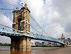
May 15, 1975 Spans the Ohio River between Cincinnati and Covington
39°5′32″N 84°30′34″W / 39.09222°N 84.50944°WExtends into Kenton County, Kentucky 14 Cuvier Press Club 
October 26, 1972 22 Garfield Pl.
39°6′17″N 84°30′52″W / 39.10472°N 84.51444°W15 Tyler Davidson Fountain 
October 11, 1979 5th St.
39°6′5″N 84°30′44″W / 39.10139°N 84.51222°W16 H. W. Derby Building 
March 3, 1980 300 W. 4th St.
39°5′57″N 84°31′3″W / 39.09917°N 84.5175°W17 Doctors' Building 
December 4, 1986 19 Garfield Pl.
39°6′15″N 84°30′53″W / 39.10417°N 84.51472°W18 East Fourth Street Historic District 
February 22, 1988 123, 127, and 135-137 E. 4th St.
39°6′0″N 84°30′36″W / 39.1°N 84.51°W19 Fenwick Club Annex 
March 7, 1973 426 E. 5th St.
39°6′9″N 84°30′21″W / 39.1025°N 84.50583°W20 Abraham J. Friedlander House 
May 7, 1979 8 W. 9th St.
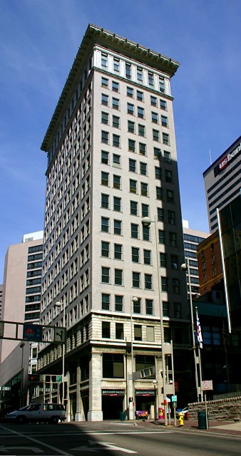
39°6′19″N 84°30′51″W / 39.10528°N 84.51417°W21 Goodall Building 
February 9, 1984 324 W. 9th St.
39°6′17″N 84°31′12″W / 39.10472°N 84.52°W22 Gwynne Building 
August 3, 1979 6th and Main Sts
39°6′11″N 84°30′36″W / 39.10306°N 84.51°W23 Hooper Building 
March 3, 1980 139-151 W. 4th St.
39°5′57″N 84°30′56″W / 39.09917°N 84.51556°W24 Hotel Metropole 
June 18, 2009 609 Walnut St.
39°6′11.11″N 84°30′43.3″W / 39.1030861°N 84.512028°W25 Ingalls Building 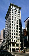
March 7, 1975 6 E. 4th St.
39°6′0″N 84°30′45″W / 39.1°N 84.5125°W26 Krippendorf-Dittman Company 
March 3, 1980 628 Sycamore St.
39°6′14″N 84°30′30″W / 39.10389°N 84.50833°W27 Lombardy Apartment Building 
March 3, 1980 318-326 W. 4th St.
39°5′57″N 84°31′5″W / 39.09917°N 84.51806°W28 Lytle Park Historic District 
March 26, 1976 Roughly bounded by 3rd, 5th, Sycamore, Commercial Sq., and Butler Sts.
39°6′4″N 84°30′19″W / 39.10111°N 84.50528°W29 Main and Third Street Cluster 
July 15, 1983 300-302, 304-306 Main St., and 208-210 E. 3rd St.
39°5′58″N 84°30′31″W / 39.09944°N 84.50861°W30 MAJESTIC 
January 3, 1980 Ohio River below Central Bridge
39°5′49″N 84°30′17″W / 39.09694°N 84.50472°WOriginally listed on the NRHP as "SHOWBOAT MAJESTIC"; declared a National Historic Landmark under this name on December 20, 1989 31 Newport and Cincinnati Bridge 
April 17, 2001 Spans the Ohio River
39°5′41″N 84°29′40″W / 39.09472°N 84.49444°WAlso known as the Newport Southbank Bridge; extends into Campbell County, Kentucky 32 Ninth Street Historic District 
November 25, 1980 9th St. between Vine and Plum Sts.
39°6′17″N 84°30′59″W / 39.10472°N 84.51639°W33 Palace Hotel 
March 3, 1980 6th and Vine Sts.
39°6′9″N 84°30′49″W / 39.1025°N 84.51361°W34 Palace Theatre 
March 24, 1980 12 E. 6th St.
39°6′9″N 84°30′46″W / 39.1025°N 84.51278°W35 Phoenix Building/Cincinnati Club 
January 11, 1985 30 Garfield Pl. and 812 Race St.
39°6′17″N 84°30′55″W / 39.10472°N 84.51528°W36 Phoenix Club 
March 3, 1980 9th and Race Sts.
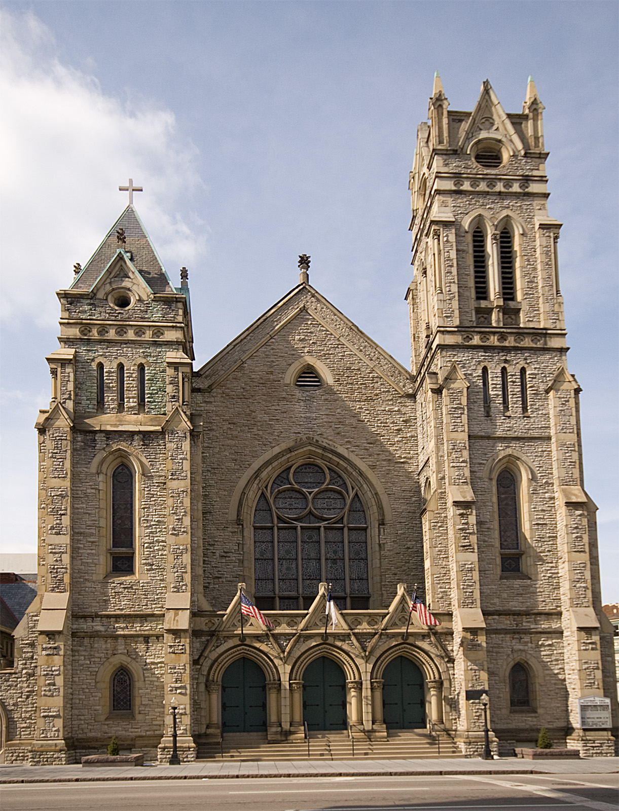
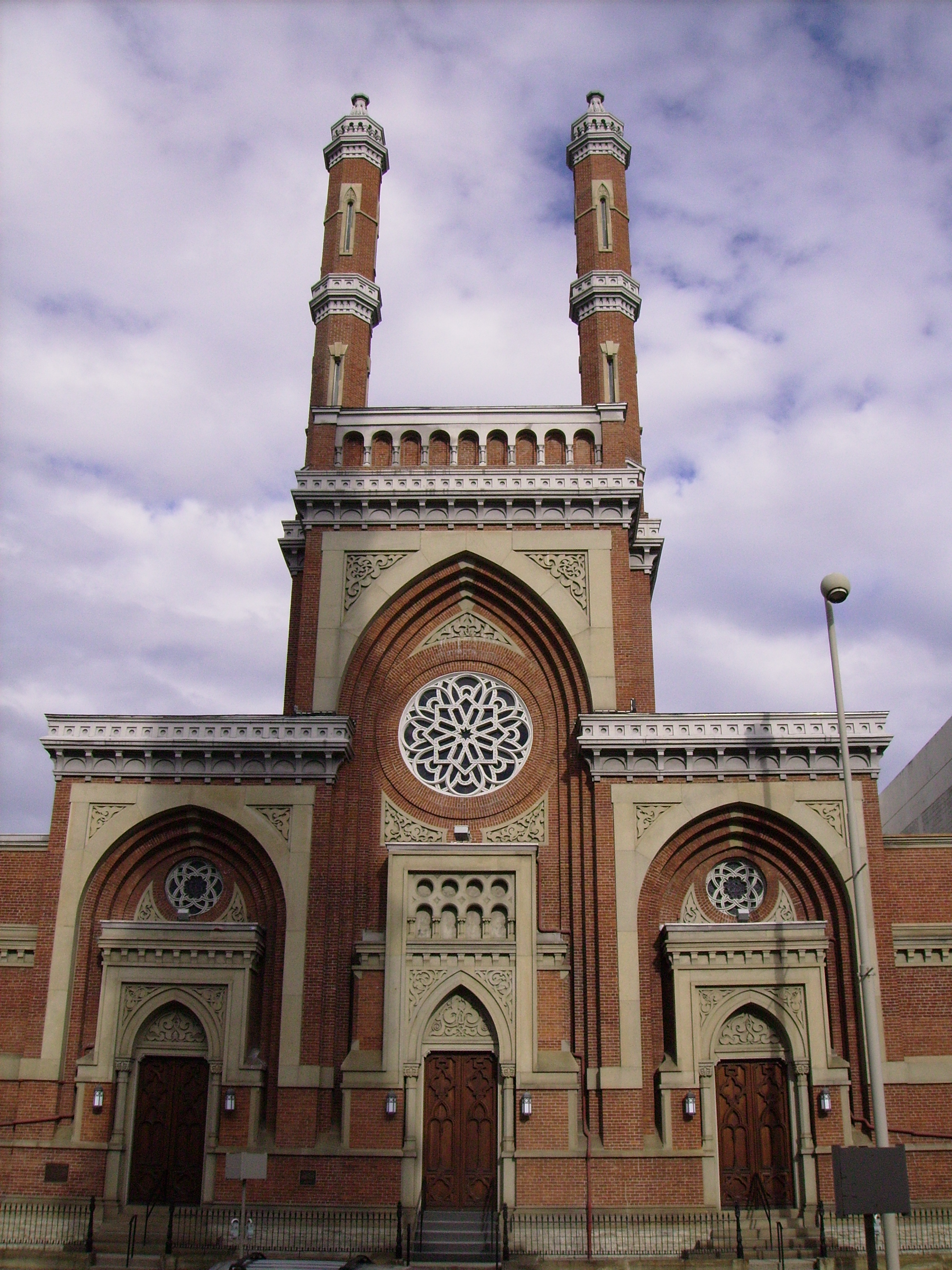
39°6′18″N 84°30′55″W / 39.105°N 84.51528°W37 Plum Street Temple 
December 27, 1972 8th and Plum Sts.
39°6′13″N 84°31′5″W / 39.10361°N 84.51806°WNow known as Isaac M. Wise Temple 38 Police Station No. 2 
May 18, 1981 314 Broadway
39°6′1.4″N 84°30′20.4″W / 39.100389°N 84.505667°W39 Power Building 
March 5, 1999 224 E. 8th St.
39°6′19″N 84°30′32″W / 39.10528°N 84.50889°W40 Race Street Historic District 
August 4, 1995 Roughly along Race, W. 6th and W. 7th Sts. and Shillito Pl.
39°6′11″N 84°30′54″W / 39.10306°N 84.515°W41 Nathaniel Ropes Building 
September 30, 1982 917 Main St.
39°6′22″N 84°30′40″W / 39.10611°N 84.51111°W42 St. Francis Xavier Church 
July 18, 1980 607 Sycamore St.
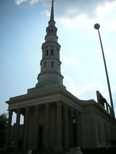
39°6′12″N 84°30′33″W / 39.10333°N 84.50917°W43 St. Peter-In-Chains Cathedral 
January 18, 1973 325 W. 8th St.
39°6′13″N 84°31′11″W / 39.10361°N 84.51972°W44 Saxony Apartment Building 
March 3, 1980 105-111 W. 9th St.
39°6′19″N 84°30′56″W / 39.10528°N 84.51556°W45 Taft Museum 
January 29, 1973 316 Pike St.
39°6′9″N 84°30′12″W / 39.1025°N 84.50333°WAlso known as Baum-Taft House 46 Times-Star Building 
November 25, 1983 800 Broadway
39°6′21″N 84°30′24″W / 39.10583°N 84.50667°W47 Underwriters Salvage Corps 
July 15, 1982 110-112 E. 8th St.
39°6′18″N 84°30′42″W / 39.105°N 84.51167°W48 Union Trust Building 
August 29, 2008 36 E. 4th St.
39°6′.43″N 84°30′41.53″W / 39.1001194°N 84.5115361°W49 West Fourth Street Historic District 
August 13, 1976 Bounded by Central Ave, W. 5th, Plum, and McFarland Sts.; also W. 5th and Perry Sts. between Central Ave. and Plum St., 4th St. between Central Ave. and Race St.; also 1-35 and 2-18 W. 4th St.
39°5′58″N 84°31′6″W / 39.09944°N 84.51833°WSecond and third sets of boundaries represent boundary increases 50 Young Women's Christian Association of Cincinnati 
September 16, 1982 9th and Walnut Sts.
39°6′19″N 84°30′43″W / 39.10528°N 84.51194°W
See also
- List of National Historic Landmarks in Ohio
- National Register of Historic Places listings in Cincinnati, Ohio
References
- ^ The latitude and longitude information provided in this table was derived originally from the National Register Information System, which has been found to be fairly accurate for about 99% of listings. For about 1% of NRIS original coordinates, experience has shown that one or both coordinates are typos or otherwise extremely far off; some corrections may have been made. A more subtle problem causes many locations to be off by up to 150 yards, depending on location in the country: most NRIS coordinates were derived from tracing out latitude and longitudes off of USGS topographical quadrant maps created under North American Datum of 1927, which differs from the current, highly accurate GPS system used by Google maps. Chicago is about right, but NRIS longitudes in Washington are higher by about 4.5 seconds, and are lower by about 2.0 seconds in Maine. Latitudes differ by about 1.0 second in Florida. Some locations in this table may have been corrected to current GPS standards.
- ^ "National Register of Historic Places: Weekly List Actions". National Park Service, United States Department of the Interior. Retrieved on November 4, 2011.
- ^ Numbers represent an ordering by significant words. Various colorings, defined here, differentiate National Historic Landmark sites and National Register of Historic Places Districts from other NRHP buildings, structures, sites or objects.
- ^ "National Register Information System". National Register of Historic Places. National Park Service. 2008-04-24. http://nrhp.focus.nps.gov/natreg/docs/All_Data.html.
Categories:- National Register of Historic Places in Cincinnati, Ohio
-


Wikimedia Foundation. 2010.