- National Register of Historic Places listings in western Puerto Rico
-
 Municipalities of Porta del Sol
This is a list of properties and districts in the Porta del Sol municipalities of Puerto Rico that are listed on the National Register of Historic Places. It includes places along the western coast, and on islands, and in the peaks and on the western slope of Puerto Rico's Cordillera Central.
The area covered spans from the 17 municipalities in the Porta del Sol area: Quebradillas, Isabela, San Sebastián, Moca, Aguadilla, Aguada, Rincón, Añasco, Mayagüez, Las Marías, Maricao, Hormigueros, San Germán, Sábana Grande, Guánica, Lajas and Cabo Rojo.. All NRHP-listed places west, on the coasts, islands, slopes, and in the peaks of the Cordillera are included.
Names of places given are as they appear in the National Register, reflecting name as given in NRHP application at the date of listing. Note, the National Register name system does not accommodate Spanish á, ñ and other letters.
See also:
- National Register of Historic Places listings in southern Puerto Rico
- National Register of Historic Places listings in northern Puerto Rico
- National Register of Historic Places listings in eastern Puerto Rico
- National Register of Historic Places listings in central Puerto Rico
- National Register of Historic Places listings in metropolitan San Juan, Puerto Rico
Contents
Western municipalities
Aguada
Landmark name Image Date listed Location City/ Town Summary 1 Puente de Coloso December 29, 2010 State Road No. 418, km .5 Guanabano Historic Bridges of Puerto Rico MPS Aguadilla
Landmark name Image Date listed Location City/ Town Summary 1 Cardona Residence 
January 2, 1985 Betances St. No. 55
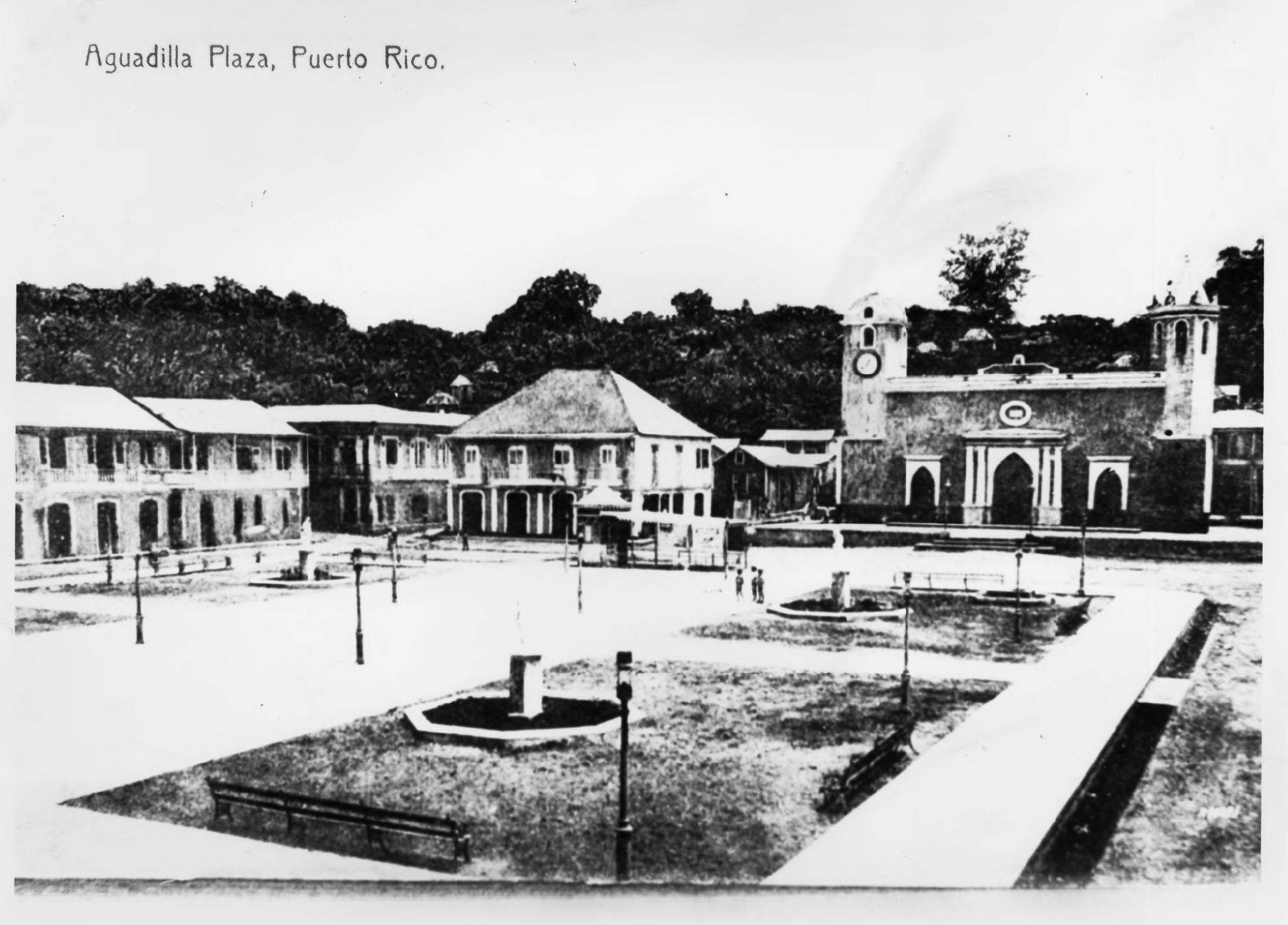
18°25′47″N 67°8′47″W / 18.42972°N 67.14639°WAguadilla Also known as Quiñones-Elías Lawyer's Office. 2 Casa de Piedra April 3, 1986 14 Progresso St.
18°25′22″N 67°8′48″W / 18.42278°N 67.14667°WAguadilla A Spanish colonial house, also known as Amparo Roldán House 3 District Courthouse January 2, 1985 Progreso
18°25′36″N 67°8′48″W / 18.42667°N 67.14667°WAguadilla 4 El Parterre-Ojo De Agua January 13, 1986 Bounded by Munoz Rivera, Gonzalo Firpo, De Diego, and Mango Sts.
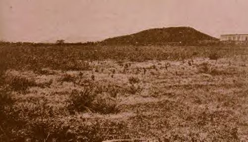
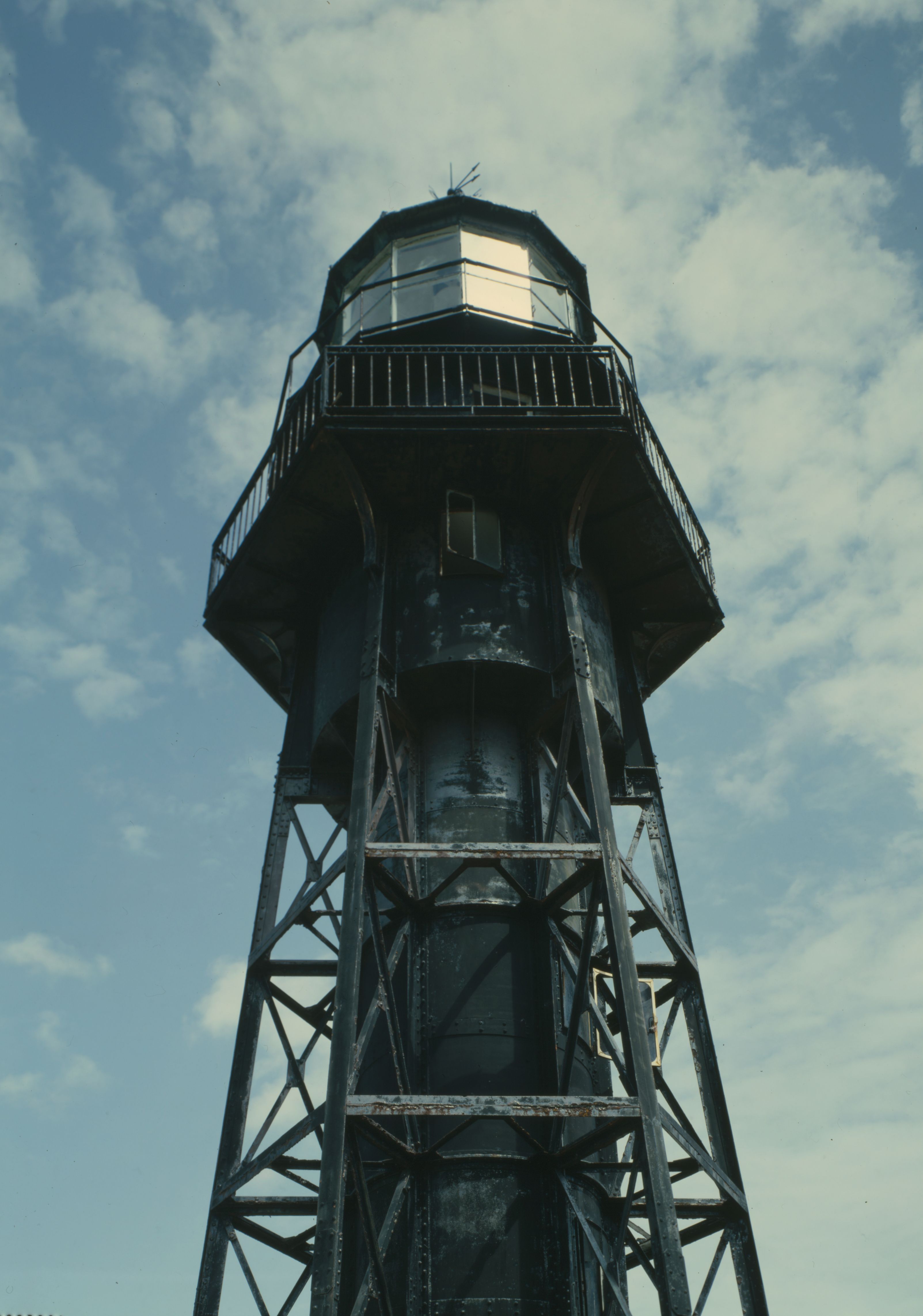
18°25′57″N 67°8′47″W / 18.4325°N 67.14639°WAguadilla 5 Faro de Punta Borinquen 
October 22, 1981 18°30′1″N 67°8′7″W / 18.50028°N 67.13528°W Aguadilla 6 Fuerte de la Conception April 3, 1986 Stahl St.
18°26′17″N 67°9′2″W / 18.43806°N 67.15056°WAguadilla 7 Old Urban Cemetery January 2, 1985 Cuesta Vieja
18°26′28″N 67°9′4″W / 18.44111°N 67.15111°WAguadilla 8 Residence Lopez January 2, 1985 Progreso St. No. 67
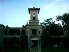
18°25′36″N 67°9′15″W / 18.42667°N 67.15417°WAguadilla 9 Church San Carlos Borromeo of Aguadilla 
September 18, 1984 Diego St., Town Plaza
18°25′54″N 67°9′13″W / 18.43167°N 67.15361°WAguadilla A church Añasco
Landmark name Image Date listed Location City/ Town Summary 1 Puente de Anasco 
January 18, 2011 PR 2 at kilometer 146.1 Añasco/Mayagüez border Cabo Rojo
Landmark name Image Date listed Location City/ Town Summary 1 Punta Ostiones August 25, 2004 Vic. of Cabo Rojo Cabo Rojo 2 Faro de los Morrillos de Cabo Rojo 
October 22, 1981 17°56′1″N 67°11′32″W / 17.93361°N 67.19222°W Cabo Rojo Guánica
Landmark name Image Date listed Location City/ Town Summary 1 Faro de Guanica 
March 28, 1977 Vic. of Guanica
17°57′12″N 66°54′12″W / 17.95333°N 66.90333°WGuanica Lighthouse from 1893 2 Hacienda Santa Rita 
January 5, 1984 Vic. of Guanica
18°0′30″N 66°53′1″W / 18.00833°N 66.88361°WGuanica 3 Yauco Battle Site 
September 2, 2008 Near Guanica Guanica Site of the Battle of Yauco in 1898, in the Spanish-American War. See Spanish-American War in Puerto Rico MPS. ( Is this located in the municipality of Guanica or the municipality of Yauco? ) Hormigueros
Landmark name Image Date listed Location City/ Town Summary 1 Santuario de la Monserrate de Hormigueros and Casa de Peregrinos 
April 17, 1975 Calle Peregrinos No. 1 on Insular Rte. 344
18°8′35″N 67°7′39″W / 18.14306°N 67.1275°WHormigueros A church 2 Silva Bridge July 19, 1995 Near Hormigueros Hormigueros Pratt pony truss bridge from 1897 3 Torrens Bridge May 11, 2000 Near Hormigueros Hormigueros Lattice, transverse joist bridge from 1878 Isabela
Landmark name Image Date listed Location City/ Town Summary 1 Hermitage of San Antonio de Padua de la Tuna December 2, 1983 Isabela Maricao
Landmark name Image Date listed Location City/ Town Summary 1 Church San Juan Bautista of Maricao September 18, 1984 Baldorioty St., Town Plaza
18°10′58″N 66°58′48″W / 18.18278°N 66.98°WMaricao Gothic church built in 1890 2 Del Treinta Bridge July 19, 1995 Near Maricao Maricao A rolled steel beam bridge from 1924, designed by Enrique Ortega Mayagüez
Landmark name Image Date listed Location City/ Town Summary 1 Asilo De Pobres 
December 2, 1985 Post St.
18°11′45″N 67°8′32″W / 18.19583°N 67.14222°WMayagüez A municipal poor asylum, in Classical Revival architecture from 1920 2 Casa Consistorial De Mayagüez 
December 2, 1985 Peral St.
18°12′11″N 67°8′23″W / 18.20306°N 67.13972°WMayagüez City hall, from 1926 3 Cementerio Municipal de Mayagüez 
August 25, 1988 Southern end of Post St.
18°10′0″N 67°7′30″W / 18.166667°N 67.125°WMayagüez Cemetery 4 Duran Esmoris Residencia September 7, 1988 Mendez Vigo B204 L204 Mayagüez Bungalow or Craftsman building from 1921, designed by Luis Fernando Nieva 5 Edificio José de Diego 
November 18, 1977 University of Puerto Rico campus
18°12′47″N 67°8′15″W / 18.21306°N 67.1375°WMayagüez Central administration building of the University of Puerto Rico at Mayagüez, from 1913 6 Faro de la Isla de la Mona 
October 22, 1981 E side of Mona Island
18°5′18″N 67°50′48″W / 18.08833°N 67.84667°WMona Island 7 Gómez Residencia June 15, 1988 Mendez Vigo No. 60 Mayagüez Building from 1933 designed by architect Francisco Porrata Doria 8 Isla de Mona 
December 17, 1993 Mona Island
18°5′12″N 67°53′22″W / 18.08667°N 67.88944°WMona Island NRHP listing in 1993 gives 1493 as date of significance, presumably a Columbus landing date 500 years before? 9 La Case Solariega de Jose De Diego April 3, 1986 52 Liceo St.
18°12′7″N 67°8′11″W / 18.20194°N 67.13639°WMayagüez From 1890 10 Logia Adelphia February 19, 1986 64 E. Sol St.
18°12′8″N 67°8′19″W / 18.20222°N 67.13861°WMayagüez From 1912, designed by Sabas Honore 11 Nazario Rivera Residencia September 13, 1988 Post St. No. 105
18°12′1″N 67°8′29″W / 18.20028°N 67.14139°WMayagüez From 1872, designed by Juaquín Hernández. 12 Plaza Publica December 3, 1985 McKinley St.
18°12′11″N 67°8′21″W / 18.20306°N 67.13917°WMayagüez From 1760 13 Ramírez Fuentes Residencia July 12, 1988 Calle Mendez Vigo #117
18°12′13″N 67°8′13″W / 18.20361°N 67.13694°WMayagüez Bungalow/Craftsman building from 1925, designed by Pascasio Fajardo 14 Residencia Heygler July 12, 1988 Calle Liceo #51 Mayagüez From 1830 15 Residencia Ramirez De Arellano en Guanajibo February 5, 1987 PR 102
18°10′19″N 67°10′38″W / 18.17194°N 67.17722°WMayagüez Plantation style building from 1930 16 Teatro Yagüez 
December 2, 1985 McKinley and Basora Sts.
18°12′11″N 67°8′29″W / 18.20306°N 67.14139°WMayagüez From 1909, designed by Sabas Honore et al. 17 US Custom House 
February 10, 1988 Ava. Gonzalez Clemente, esq. McKinley Mayagüez From 1924, designed by Rafael Carmoega 18 U.S. Post Office and Courthouse (Mayagüez, Puerto Rico) 
May 21, 1986 McKinley and Pilar DeFillo Sts. Mayagüez From 1935, designed by Louis A. Simpson Moca
Landmark name Image Date listed Location City/ Town Summary 1 Hacienda Iruena Manor House 
August 14, 1987 Km. 115.7 PR Rd. No. 2 Moca Renaissance/French Chateau style building from 1893. Quebradillas
Landmark name Image Date listed Location City/ Town Summary 1 Puente Blanco 
February 23, 1984 NE of Quebradillas off PR 485
18°29′17″N 66°55′35″W / 18.48806°N 66.92639°WQuebradillas Bridge built in 1922 2 Teatro Liberty May 4, 1989 Calle Rafols #157
18°28′31″N 66°56′23″W / 18.47528°N 66.93972°WQuebradillas Building from 1921 designed by Arcilio Rosa Rincon
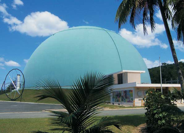
Landmark name Image Date listed Location Municipality Summary 1 Boiling Nuclear Superheater (BONUS) Reactor Facility 
November 14, 2007 Punta Higuero Sector, PR 41318°21′59″N 67°16′7″W / 18.36639°N 67.26861°W Rincon 2 Faro de Punta Higuero 
October 22, 1981 18°21′49″N 67°16′15″W / 18.36361°N 67.27083°W Rincon Sabana Grande
Landmark name Image Date listed Location City/ Town Summary 1 Church of San Isidro Labrador and Santa María de la Cabeza of Sabana Grande 
December 10, 1984 Ángel G. Martínez St.
18°4′53″N 66°57′36″W / 18.08139°N 66.96°WSabana Grande Church from 1844 2 Hacienda San Francisco 
April 7, 1995 18°4′40″N 66°57′46″W / 18.07778°N 66.96278°W Sabana Grande 3 Lassise-Schettini House October 21, 1987 Calle Ángel Ramírez, final
18°5′5″N 66°57′33″W / 18.08472°N 66.95917°WSabana Grande 4 Berta Sepulveda House June 17, 1994 37 Munoz Rivera St. Sabana Grande San Germán
Landmark name Image Date listed Location City/ Town Summary 1 Alcantarilla Pluvial sobre la Quebrada Manzanares 
April 12, 1990 Calle Ferrocarril and Calle Esperanza San Germán Built in 1835 2 Jaime Acosta y Fores Residence December 31, 2099 70 Calle Dr. Santiago Veve
18°5′7″N 67°2′25″W / 18.08528°N 67.04028°WSan Germán Vernacular Criollo house built in 1917 3 Casa de los Ponce de León March 9, 1983 13 Calle Dr. Santiago Veve
18°2′43″N 67°5′3″W / 18.04528°N 67.08417°WSan Germán 4 Church San Germán de Auxerre 
December 31, 2099 Calle de la Cruz
18°5′4″N 67°2′41″W / 18.08444°N 67.04472°WSan Germán Church built in 1688 5 Convento de Porta Coeli 
September 8, 1976 Plaza Porta Coeli
18°5′4″N 67°2′40″W / 18.08444°N 67.04444°WSan Germán 6 Hacienda Buena Unión August 23, 1983 Vic. of San Germán San Germán 7 San Germán Historic District 
February 16, 1994 Roughly bounded by Calle Luna, Calle Estrella, Calle Concepción, Calle Javilla, and Calle Ferrocarril San Germán Historic district of colonial and other architecture dating to 1606 San Sebastián
Landmark name Image Date listed Location Municipality Summary 1 Church San Sebastián Mártir of San Sebastián December 18, 1984 Severo Arana St., Town Plaza
18°20′19″N 66°59′28″W / 18.33861°N 66.99111°WSan Sebastián References
Categories:- National Register of Historic Places in Puerto Rico


Wikimedia Foundation. 2010.