- National Register of Historic Places listings in western Washington, D.C.
-
This is a list of properties and districts that are listed on the National Register of Historic Places in the Northwest quadrant of Washington, D.C. which are west of Rock Creek.
-
- This National Park Service list is complete through NPS recent listings posted November 10, 2011.[1]
Current listings
Landmark name Image Date listed Location Neighborhood Summary 1 Alban Towers Apartment Building 
September 9, 1994 3700 Massachusetts Ave., NW.
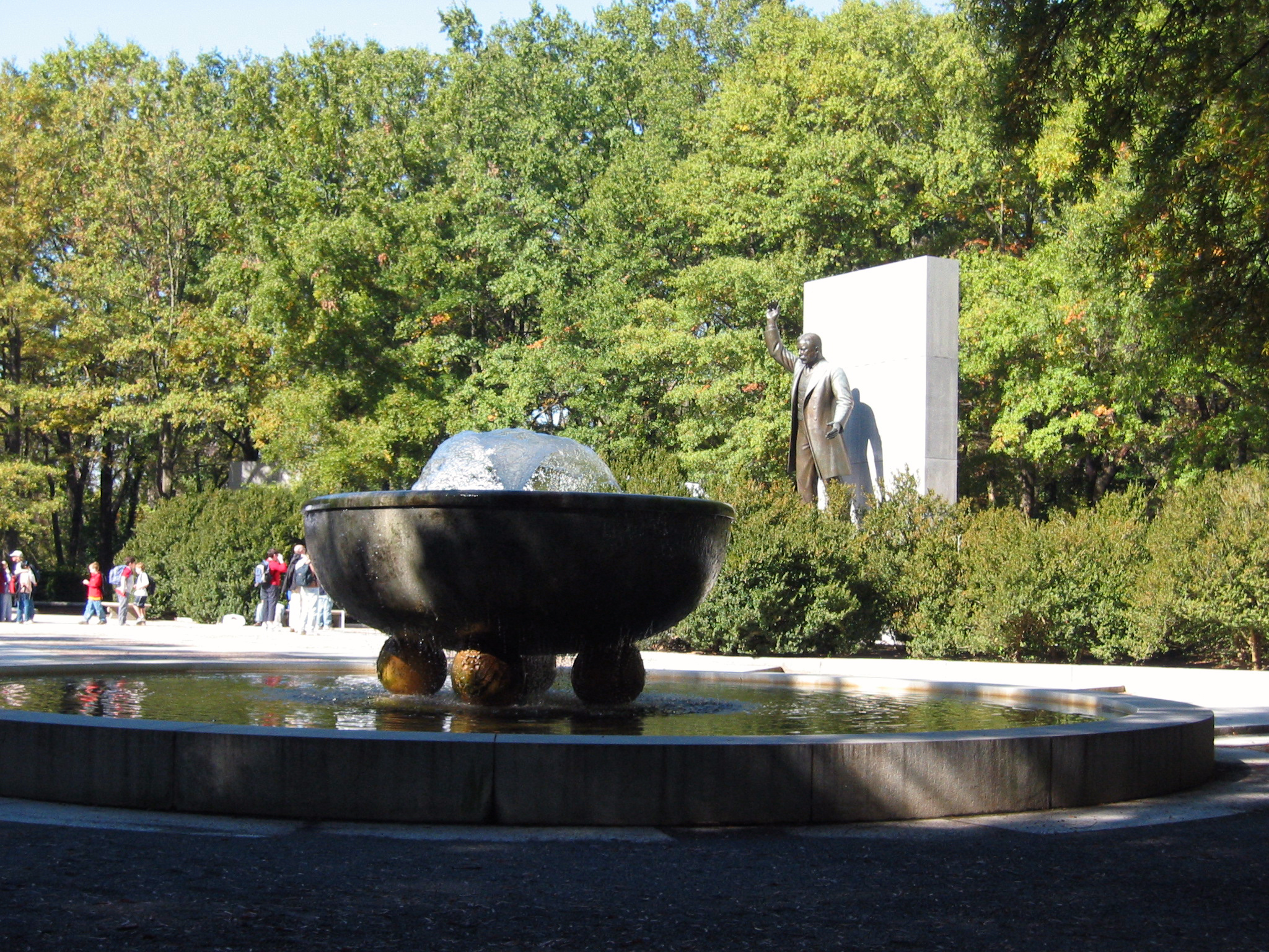
38°55′43″N 77°4′26″W / 38.92861°N 77.07389°WCathedral Heights 2 American Revolution Statuary 
July 14, 1978 Public buildings and various parks within DC
38°56′16″N 77°5′9″W / 38.93778°N 77.08583°WAmerican University Park 14 statues including 11 in central DC, and General Artemas Ward in American University Park 3 Babcock-Macomb House 
February 10, 1995 3415 Massachusetts Ave., NW.
38°55′29″N 77°4′4″W / 38.92472°N 77.06778°WMassachusetts Heights 4 Newton D. Baker House 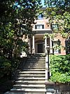
December 8, 1976 3017 N St., NW
38°54′25″N 77°3′37″W / 38.90694°N 77.06028°WGeorgetown 5 Alexander Graham Bell Laboratory 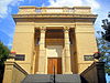
November 28, 1972 3414 Volta Pl., NW.
38°54′34″N 77°4′9″W / 38.90944°N 77.06917°WGeorgetown 6 Boulder Bridge and Ross Drive Bridge 
March 20, 1980 Rock Creek Park
38°56′53″N 77°2′42″W / 38.94806°N 77.045°WRock Creek Park Extends to both sides of Rock Creek 7 Building at 3901 Connecticut Ave., NW 
September 11, 1997 3901 Connecticut Ave., NW
38°56′24″N 77°3′38″W / 38.94°N 77.06056°WForest Hills 8 Hilleary T. Burrows House 
June 27, 2011 4520 River Rd., NW
38°57′20″N 77°5′25″W / 38.95556°N 77.09028°WAmerican University Park American University Park in Washington, D.C.: Its Early Houses, Pre-Civil War to 1911 MPS 9 Samuel and Harriet Burrows House 
June 28, 2011 4624 Verplanck Pl., NW
38°56′37″N 77°5′30″W / 38.94361°N 77.09167°WAmerican University Park American University Park in Washington, D.C.: Its Early Houses, Pre-Civil War to 1911 MPS 10 Carnegie Institution of Washington, Geophysical Laboratory 
December 29, 1994 2801 Upton St., NW.
38°56′35″N 77°3′24″W / 38.94306°N 77.05667°WForest Hills 11 Castle Gatehouse, Washington Aqueduct 
March 13, 1975 Near jct. of Reservoir Rd. and MacArthur Blvd., NW.
38°54′39″N 77°5′24″W / 38.91083°N 77.09°WFoxhall 12 Cathedral Mansions Apartment Buildings 
September 9, 1994 2900, 3000 and 3100 Connecticut Ave., NW.
38°55′48″N 77°3′21″W / 38.93°N 77.05583°WWoodley Park 13 The Causeway 
June 28, 1990 3029 Klingle Rd., NW.
38°55′54″N 77°3′40″W / 38.93167°N 77.06111°WCleveland Park Also known as Tregaron 14 Chain Bridge Road School 
December 9, 2003 2820 Chain Bridge Rd.
38°55′45″N 77°5′48″W / 38.92917°N 77.09667°WNW 15 N. Webster Chappell House 
June 23, 2011 4131 Yuma St., NW.
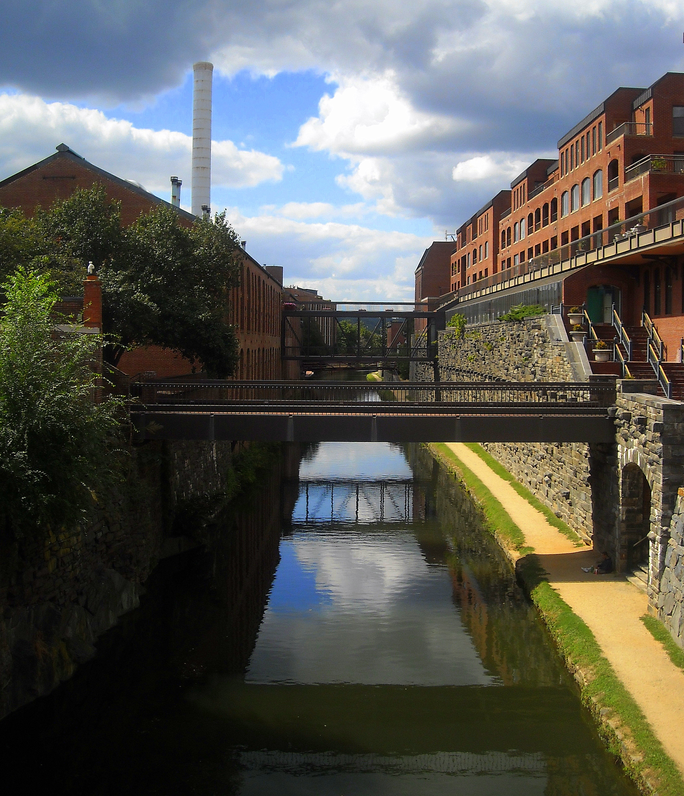
38°56′48″N 77°4′52″W / 38.94667°N 77.08111°WTenleytown Tenleytown in Washington, D.C.: 1770-1941, MPS 16 Chesapeake and Ohio Canal National Historical Park 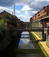
October 15, 1966 Bordering the Potomac River from Georgetown, D.C. to Cumberland, Maryland
38°54′15.39″N 77°3′45.6″W / 38.904275°N 77.062667°WGeorgetown 17 Chevy Chase Arcade 
August 4, 2003 5520 Connecticut Ave.
38°57′49″N 77°4′30″W / 38.96361°N 77.075°WChevy Chase 18 Chevy Chase Theater 
July 18, 1996 5612 Connecticut Ave.
38°57′56″N 77°4′35″W / 38.96556°N 77.07639°WChevy Chase 19 Christ Church 
March 16, 1972 3116 O St., NW.
38°54′47″N 77°3′43″W / 38.91306°N 77.06194°WGeorgetown 20 City Tavern Club 
January 17, 1992 3206 M St., NW.
38°54′17″N 77°3′48″W / 38.90472°N 77.06333°WGeorgetown 21 Cleveland Park Historic District 
April 27, 1987 Roughly bounded by Tilden St., Connecticut Ave., Klingle Rd., and Wisconsin Ave.
38°56′7″N 77°3′54″W / 38.93528°N 77.065°WCleveland Park 22 Cloverdale 
August 9, 1990 2600 and 2608 Tilden St. NW.
38°56′25″N 77°3′16″W / 38.94028°N 77.05444°WForest Hills 23 Conduit Road Schoolhouse 
November 30, 1973 4954 MacArthur Blvd., NW.
38°55′17″N 77°5′59″W / 38.92139°N 77.09972°WThe Palisades 24 Connecticut Avenue Bridge over Klingle Valley 
May 21, 2004 Connecticut Avenue, NW over Klingel Valley
38°56′1″N 77°3′23″W / 38.93361°N 77.05639°WCleveland Park 25 Convent de Bon Secours 
November 19, 2004 4101 Yuma St. NW
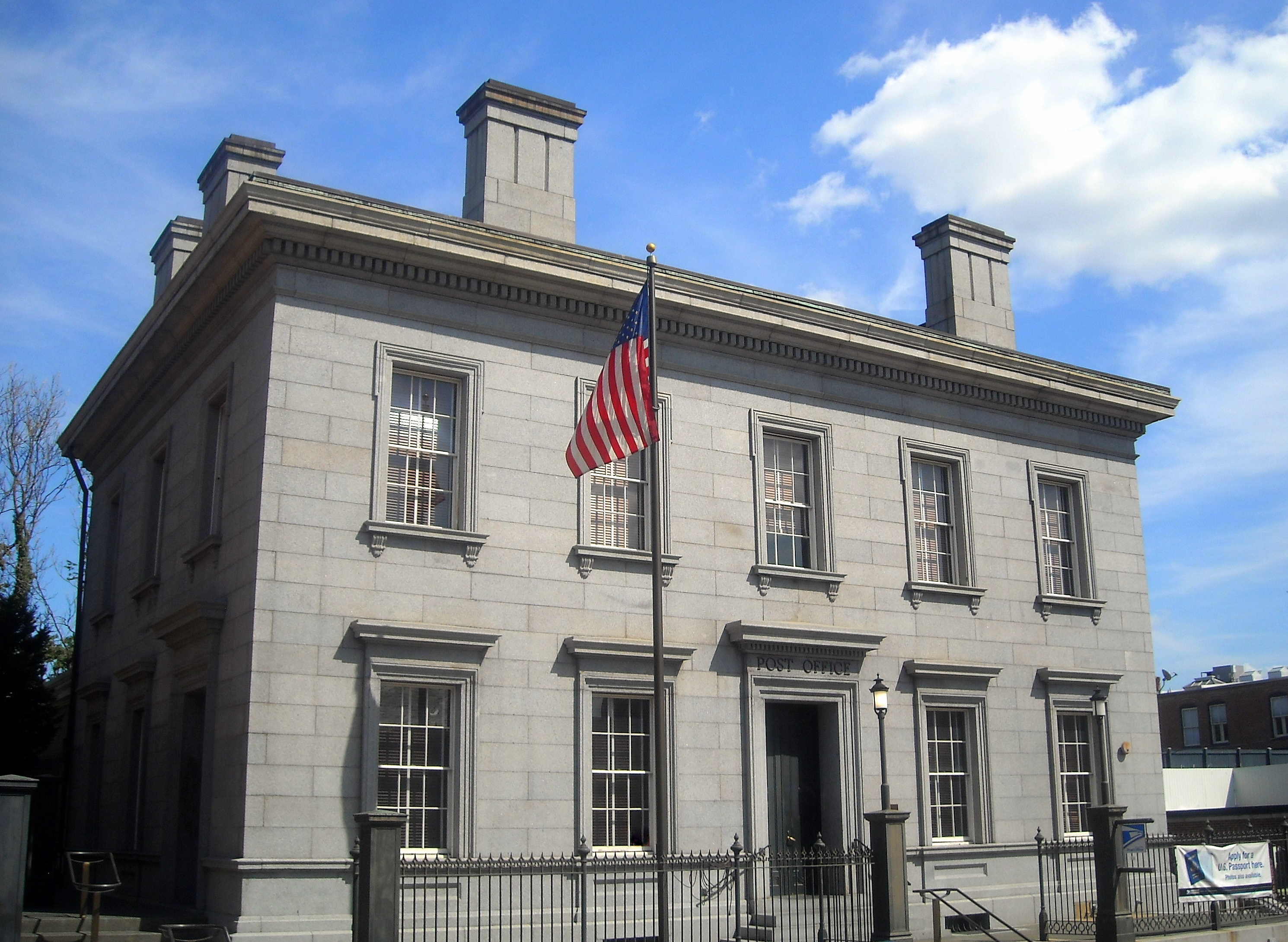
38°56′54″N 77°4′50″W / 38.94833°N 77.08056°WTenleytown 26 Customhouse and Post Office 
September 10, 1971 1221 31st St., NW.
38°54′20″N 77°3′40″W / 38.90556°N 77.06111°WGeorgetown Picture of the Custom House 27 Dumbarton House 
January 28, 1991 2715 Q St., NW.
38°54′39″N 77°3′22″W / 38.91083°N 77.05611°WGeorgetown 28 Dumbarton Oaks Park and Montrose Park 
May 28, 1967 R St. NW
38°54′55″N 77°3′44″W / 38.91528°N 77.06222°WGeorgetown 29 Dumblane 
September 21, 2005 4120 Warren St., NW.
38°56′46″N 77°4′55″W / 38.94611°N 77.08194°WTenleytown 30 Eldbrooke United Methodist Church 
September 5, 2008 4100 River Rd., NW.
38°56′55.72″N 77°4′48.79″W / 38.9488111°N 77.0802194°WTenleytown 31 Engine Company 31 
May 18, 2011 4930 Connecticut Ave., NW
38°57′16″N 77°4′10″W / 38.95444°N 77.06944°WNorth Cleveland Park Firehouses in Washington DC MPS 32 Evermay 
April 3, 1973 1623 28th St., NW.
38°54′41″N 77°3′24″W / 38.91139°N 77.05667°WGeorgetown 33 Forrest-Marbury House 
July 2, 1973 3350 M St., NW.
38°54′17″N 77°4′4″W / 38.90472°N 77.06778°WGeorgetown 34 Foxhall Village Historic District 
November 29, 2007 Bounded by Reservoir Rd. NW, Glover-Archibald Park, P St. NW & Foxhall Rd. NW.
38°54′37.37″N 77°4′55.91″W / 38.9103806°N 77.0821972°WFoxhall Village 35 Garden Club of America Entrance Markers at Chevy Chase Circle 
April 29, 2008 Reservation 335A
38°58′3″N 77°4′37″W / 38.9675°N 77.07694°WChevy Chase Garden Club of America Entrance Markers in Washington, D.C. MPS 36 Garden Club of America Entrance Markers at Westmoreland Circle 
April 29, 2008 Reservation 559
38°56′56.11″N 77°6′3.28″W / 38.9489194°N 77.1009111°WWestmoreland Circle Garden Club of America Entrance Markers in Washington, D.C. MPS 37 Garden Club of America Entrance Markers at Wisconsin Avenue 
May 12, 2008 Wisconsin Ave. at Western Ave.
38°57′38.94″N 77°5′8.48″W / 38.9608167°N 77.0856889°WFriendship Heights Garden Club of America Entrance Markers in Washington, D.C. MPS 38 Glover-Archbold Park 
January 16, 2007 Reservation 351 and 450 (Foundry Branch Valley)
38°55′31.32″N 77°4′55.33″W / 38.9253667°N 77.0820361°WNW 39 Georgetown Academy for Young Ladies 
March 29, 1991 1524 35th St., NW.
38°54′38″N 77°4′16″W / 38.91056°N 77.07111°WGeorgetown 40 Georgetown Historic District 
May 28, 1967 Roughly bounded by Whitehaven St., Rock Creek Park, Potomac River, and Georgetown University campus
38°54′34″N 77°3′54″W / 38.90944°N 77.065°WGeorgetown 41 Georgetown Market 
May 6, 1971 3276 M St., NW.
38°54′17″N 77°3′56″W / 38.90472°N 77.06556°WGeorgetown 42 Georgetown University Astronomical Observatory 
July 2, 1973 Georgetown University
38°54′30″N 77°4′39″W / 38.90833°N 77.0775°WGeorgetown 43 Glen Hurst 
June 1, 2005 4933 MacArthur Blvd. NW
38°55′15″N 77°5′56″W / 38.92083°N 77.09889°WFoxhall 44 Grace Protestant Episcopal Church 
May 6, 1971 1041 Wisconsin Ave., NW.
38°54′13″N 77°3′44″W / 38.90361°N 77.06222°WGeorgetown 45 Grant Road Historic District 
March 3, 2004 4400 and 4500 blks of Grant Rd., NW
38°57′1″N 77°4′38″W / 38.95028°N 77.07722°WNorth Cleveland Park 46 Halcyon House 
March 31, 1971 3400 Prospect St., NW.
38°54′20″N 77°4′6″W / 38.90556°N 77.06833°WGeorgetown 47 John Stoddert Haw House 
July 16, 1973 2808 N St., NW.
38°54′23″N 77°3′29″W / 38.90639°N 77.05806°WGeorgetown 48 Healy Building, Georgetown University 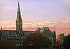
May 27, 1971 Georgetown University campus, junction of O and Thirty-seventh Sts.
38°54′26″N 77°4′23″W / 38.90722°N 77.07306°WGeorgetown 49 The Highlands 
March 16, 1972 3825 Wisconsin Ave., NW.
38°56′21″N 77°4′27″W / 38.93917°N 77.07417°WCleveland Park Now the Sidwell Friends School 50 Hillandale-Main Residence and Gatehouse January 31, 1995 3905 Mansion Ct., NW. and 3905 Reservoir Rd., NW.
38°54′55″N 77°4′43″W / 38.91528°N 77.07861°WBurleith-Hillandale 51 Janney Elementary School 
May 10, 2010 4130 Albemarle St., NW.
38°56′52″N 77°4′50″W / 38.94778°N 77.08056°WTenleytown 52 Jesse Reno School 
September 7, 2010 4820 Howard St., NW
38°57′9″N 77°4′38″W / 38.9525°N 77.07722°WFriendship Heights Public School Buildings of Washington, DC MPS 53 Dr. Franklin E. Kameny House November 2, 2011 5020 Cathedral Ave., NW
38°55′48″N 77°6′8″W / 38.93°N 77.10222°WNW Unprepossessing home and office of gay rights activist Frank Kameny (1925-2011). Location of important organizing meetings in gay rights struggle. 54 Kennedy-Warren Apartment Building 
September 7, 1994 3133 Connecticut Ave., NW
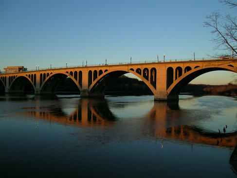
38°55′54″N 77°3′21″W / 38.93167°N 77.05583°WCleveland Park 55 Francis Scott Key Bridge 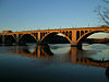
March 1, 1996 US 29 over the Potomac River
38°54′8″N 77°4′13″W / 38.90222°N 77.07028°WGeorgetown 56 Massachusetts Avenue Historic District 
October 22, 1974 Both sides of Massachusetts Ave. between 17th St. and Observatory Circle, NW
38°54′50″N 77°3′6″W / 38.91389°N 77.05167°WDupont Circle, Kalorama Heights and Woodland-Normanstone Terrace Extends to both sides of Rock Creek 57 Massachusetts Avenue Parking Shops 
July 25, 2003 4841-4861 Massachusetts Ave. NW
38°56′44″N 77°5′47″W / 38.94556°N 77.09639°WAmerican University Park 58 The Methodist Cemetery 
September 5, 2008 Murdock Mill Rd. between River Rd. and 42nd St., NW.
38°56′56.78″N 77°5′3.75″W / 38.9491056°N 77.084375°WTenleytown 59 Montrose Park 
November 15, 2007 R St. & Lovers' Ln. (Res. 324)
38°54′50.6″N 77°3′42.48″W / 38.914056°N 77.0618°WGeorgetown 60 Morris House 
March 14, 2011 4001 Linnean Ave., NW
38°56′29″N 77°3′14″W / 38.94139°N 77.05389°WForest Hills 61 Mount Zion Cemetery 
August 6, 1975 27th and Q Sts., NW.
38°54′42″N 77°3′16″W / 38.91167°N 77.05444°WGeorgetown 62 Mount Zion United Methodist Church 
July 24, 1975 1334 29th St., NW.
38°54′28″N 77°3′31″W / 38.90778°N 77.05861°WGeorgetown 63 National Cathedral 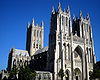
May 3, 1974 Wisconsin and Massachusetts Ave., NW.
38°55′46″N 77°4′12″W / 38.92944°N 77.07°WCathedral Heights 64 National Zoological Park 
April 11, 1973 3000 block of Connecticut Ave., NW.
38°55′44″N 77°2′59″W / 38.92889°N 77.04972°WRock Creek Park 65 Francis Griffith Newlands Memorial Fountain 
October 12, 2007 Chevy Chase Cir., Connecticut & Western Aves., NW (Res. 335A)
38°58′10″N 77°4′38″W / 38.96944°N 77.07722°WChevy Chase 66 North Corner Boundary Marker of the Original District of Columbia 
November 1, 1996 1880 block of East-West Hwy.
38°59′45″N 77°2′29″W / 38.99583°N 77.04139°WNW 67 Northwest No. 4 Boundary Marker of the Original District of Columbia 
November 1, 1996 5906 Dalecarlia Pl., NW
38°56′16″N 77°6′56″W / 38.93778°N 77.11556°WPalisades 68 Northwest No. 5 Boundary Marker of the Original District of Columbia 
November 1, 1996 Dalecarlia Reservoir, 600 ft. W of Dalecarlia Parkway and 300 ft SE of concrete culvert
38°56′41″N 77°6′24″W / 38.94472°N 77.10667°WDalecarlia Reservoir 69 Northwest No. 6 Boundary Marker of the Original District of Columbia 
November 1, 1996 150 ft. NE of jct. of Park and Western Aves., NW
38°57′19″N 77°5′37″W / 38.95528°N 77.09361°WAmerican University Park 70 Northwest No. 7 Boundary Marker of the Original District of Columbia 
November 1, 1996 5600 Western Ave.
38°57′56″N 77°4′49″W / 38.96556°N 77.08028°WChevy Chase 71 Northwest No. 8 Boundary Marker of the Original District of Columbia 
November 1, 1996 6422 Western Ave.
38°58′32″N 77°4′3″W / 38.97556°N 77.0675°WBarnaby Woods 72 Northwest No. 9 Boundary Marker of the Original District of Columbia 
November 1, 1996 Rock Creek Park, approximately 165 ft. NW of the centerline of Daniel Rd. and 5 ft. SE from edge of 2701 Daniel Rd.
38°59′8″N 77°3′16″W / 38.98556°N 77.05444°WRock Creek Park 73 Oak Hill Cemetery Chapel 
March 16, 1972 R St. at 29th St., NW.
38°54′46″N 77°3′32″W / 38.91278°N 77.05889°WGeorgetown 74 Old Stone House 
November 30, 1973 3051 M St., NW.
38°54′20″N 77°3′38″W / 38.90556°N 77.06056°WGeorgetown 75 Old Woodley Park Historic District 
June 15, 1990 Roughly bounded by Rock Creek Park, 24th St., 29th St., Woodley Rd. and Cathedral Ave., NW.
38°55′32″N 77°3′12″W / 38.92556°N 77.05333°WWoodley Park 76 Isaac Owens House 
June 19, 1973 2806 N St., NW.
38°54′24″N 77°3′29″W / 38.90667°N 77.05806°WGeorgetown 77 Peirce Mill (Pierce Mill) 
March 24, 1969 Rock Creek Park, NW corner of Tilden St. and Beach Dr., NW
38°56′24″N 77°3′8″W / 38.94°N 77.05222°WRock Creek Park (Known also as Peirce Mill) 78 Pierce Springhouse and Barn 
October 25, 1973 2400 Block of Tilden St. and Beach Dr., NW
38°56′27″N 77°3′13″W / 38.94083°N 77.05361°WForest Hills 79 Peirce Still House 
September 6, 1990 2400 Tilden St., NW.
38°56′25″N 77°3′10″W / 38.94028°N 77.05278°WForest Hills 80 Ponce de Leon Apartment Building 
September 7, 1994 4514 Connecticut Ave., NW.
38°56′55″N 77°3′59″W / 38.94861°N 77.06639°WNorth Cleveland Park 81 Potomac Boat Club 
June 27, 1991 3530 Water St., NW.
38°54′15″N 77°4′14″W / 38.90417°N 77.07056°WGeorgetown 82 Potomac Palisades Site 
April 15, 1982 Above the Potomac at the junction of MacArthur Boulevard and Foxhall Rd.
38°54′21″N 77°4′52″W / 38.90583°N 77.08111°W[2]NW 83 Prospect House 
March 16, 1972 3508 Prospect St., NW.
38°54′20″N 77°4′11″W / 38.90556°N 77.06972°WGeorgetown 84 Quality Hill 
March 16, 1972 3425 Prospect St., NW.
38°54′22″N 77°4′9″W / 38.90611°N 77.06917°WGeorgetown 85 Rock Creek and Potomac Parkway Historic District 
May 4, 2005 Rock Creek and Potomac Parkway
38°54′47″N 77°3′16″W / 38.91306°N 77.05444°WNW Extends to both sides of Rock Creek 86 Rock Creek Park Historic District 
October 23, 1991 Roughly, Rock Creek Park from Klingle Rd. to Montgomery County line
38°57′27″N 77°2′42″W / 38.9575°N 77.045°WNW See Rock Creek Park. Extends to both sides of Rock Creek. 87 Theodore Roosevelt Island National Memorial 
October 15, 1966 S of Key Bridge in the Potomac River
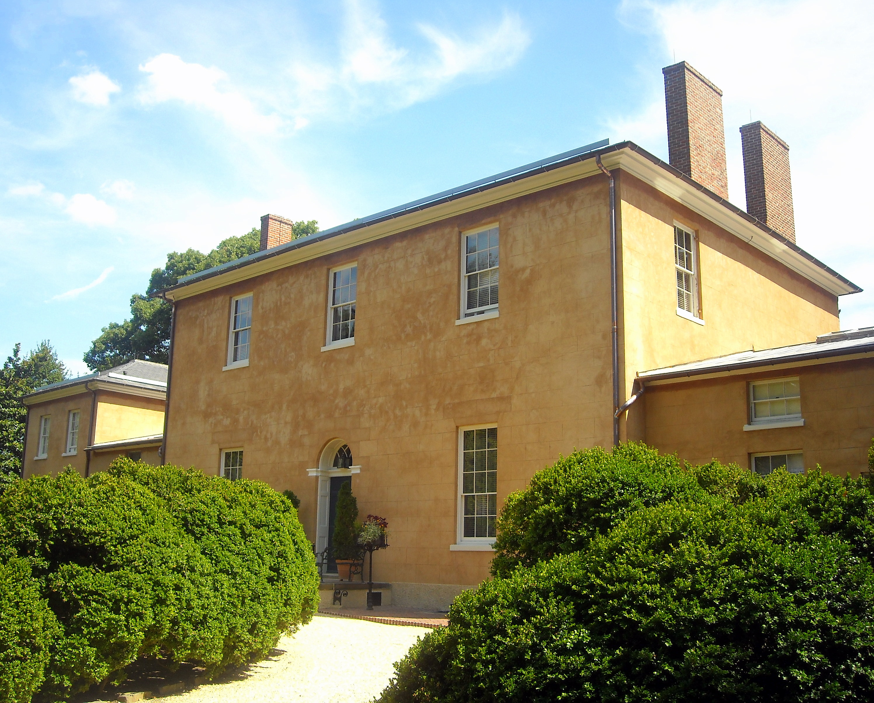
38°53′44″N 77°3′44″W / 38.89556°N 77.06222°WNW 88 Rosedale 
May 8, 1973 3501 Newark St., NW.
38°56′8″N 77°4′7″W / 38.93556°N 77.06861°WCleveland Park 89 Sears, Roebuck and Company Department Store 
February 16, 1996 4500 Wisconsin Ave., NW
38°56′54″N 77°4′50″W / 38.94833°N 77.08056°WTenleytown 90 William L. Slayton House 
October 2, 2008 3411 Ordway St.
38°56′19″N 77°4′3″W / 38.93861°N 77.0675°WCleveland Park International style house, one of only three houses designed by I.M. Pei 91 Springland 
August 9, 1990 3550 Tilden St. NW.
38°56′28″N 77°4′13″W / 38.94111°N 77.07028°WCleveland Park 92 Spring Valley Shopping Center 
August 7, 2003 4820, 4860, 4872, 4874 Massachusetts Ave., and 4301 49th St. NW
38°56′40″N 77°5′47″W / 38.94444°N 77.09639°WSpring Valley 93 Robert and Lillie May Stone House 
June 27, 2011 4901 47th St., NW
38°57′13″N 77°5′32″W / 38.95361°N 77.09222°WAmerican University Park American University Park in Washington, D.C.: Its Early Houses, Pre-Civil War to 1911 MPS 94 Traveling Carousel September 11, 1997 Jct. of Massachusetts and Wisconsin Aves. NW
38°55′43″N 77°4′15″W / 38.92861°N 77.07083°WCathedral Heights Assembled and operated once a year at the All Hallows Guild spring Flower Mart on the south lawn of the National Cathedral. 95 Tudor Place 
October 15, 1966 1644 31st St., NW
38°54′39″N 77°3′48″W / 38.91083°N 77.06333°WGeorgetown 96 Twin Oaks February 5, 1986 3225 Woodley Rd.
38°55′54″N 77°3′50″W / 38.93167°N 77.06389°WNW 97 Van Ness Mausoleum 
December 17, 1982 Oak Hill Cemetery, 3001 R St. NW
38°54′42″N 77°3′16″W / 38.91167°N 77.05444°WGeorgetown 98 Vigilant Firehouse 
May 6, 1971 1066 Wisconsin Ave., NW.
38°54′16″N 77°3′49″W / 38.90444°N 77.06361°WGeorgetown 99 Walde-Carter House 
June 27, 2011 4628 48th St., NW
38°57′2″N 77°5′41″W / 38.95056°N 77.09472°WAmerican University Park American University Park in Washington, D.C.: Its Early Houses, Pre-Civil War to 1911 MPS 100 Wardman Park Annex and Arcade 
January 31, 1984 2600 Woodley Rd. NW
38°55′30″N 77°3′13″W / 38.925°N 77.05361°WWoodley Park 101 Washington Aqueduct 
September 8, 1973 5900 MacArthur Blvd., NW
38°56′8.95″N 77°6′42.65″W / 38.9358194°N 77.1118472°WPalisades 102 Washington Canoe Club 
March 19, 1991 3700 K St., NW.
38°54′16″N 77°4′20″W / 38.90444°N 77.07222°WGeorgetown 103 Western High School 
July 25, 2003 35th and R Sts., NW
38°54′47″N 77°4′14″W / 38.91306°N 77.07056°WBurleith-Hillandale 104 Wetzell-Archbold Farmstead 
April 19, 1991 4437 Reservoir Rd., NW.
38°54′47″N 77°4′56″W / 38.91306°N 77.08222°WFoxhall 105 Woodrow Wilson High School 
May 10, 2010 3950 Chesapeake St., NW.
38°57′2″N 77°4′37″W / 38.95056°N 77.07694°WTenleytown References
- ^ "National Register of Historic Places: Weekly List Actions". National Park Service, United States Department of the Interior. Retrieved on November 10, 2011.
- ^ Location derived from Artemel, Janice G., et al. "Preliminary Archaeological Survey 23 Recreation Facilities Washington DC." Washington, D.C.: Engineering-Science for the District of Columbia Department of Recreation, 1984-09, 4. The NRIS lists the site as "Address Restricted."
Categories:- National Register of Historic Places in Washington, D.C.
-


Wikimedia Foundation. 2010.