- Naughton, Suffolk
-
Coordinates: 52°00′00″N 0°57′25″E / 52.0°N 0.957°E
Naughton 
 Naughton
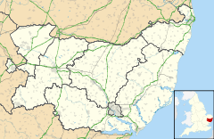
Naughton shown within SuffolkPopulation 380 (2001 census) OS grid reference TM020480 District Babergh Shire county Suffolk Region East Country England Sovereign state United Kingdom Post town Bildeston Postcode district IP7 EU Parliament East of England List of places: UK • England • Suffolk Naughton is a village located in Suffolk, England. It is 10 miles (16 km) north-west of Ipswich and 7 miles (11 km) south-west of Stowmarket. It's a part of the old Hundreds of Suffolk of Cosford. It is often joined with two other villages in the area Nedging-with-Naughton.
Naughton is formed from the junction of two roads, the Whatfield Road which comes in from the south-west and heads north to Nedging Tye and New Road which comes in from the south-east. St. Mary's church is a 14th century flint built church stands at the centre of the village, just west of this junction.
Contents
History
Sir Henry Adair was lord of the manor in the past.
Present day
just to the south of RAF Wattisham.
One pub in the village, the Wheelhouse (formerly Wheeler's Arms) and dates from the 17th century.
There are three farms in the area, Cooper's Farm (to the north), Brickhouse Farm (to the east) and Fidget's Farm (to the south-west).
Reference
External links
Babergh Towns Sudbury • HadleighCivil Parishes Acton · Aldham · Alpheton · Arwarton · Assington · Belstead · Bentley · Bildeston · Boxford · Boxted · Brantham · Brent Eleigh · Brettenham · Bures St Mary · Burstall · Capel St Mary · Chattisham · Chelmondiston · Chelsworth · Chilton · Cockfield · Copdock and Washbrook · East Bergholt · Edwardstone · Elmsett · Freston · Glemsford · Great Cornard · Great Waldingfield · Groton · Hadleigh (town) · Harkstead · Hartest · Higham · Hintlesham · Hitcham · Holbrook · Holton St Mary · Kersey · Kettlebaston · Lavenham · Lawshall · Layham · Leavenheath · Lindsey · Little Cornard · Little Waldingfield · Long Melford · Milden · Monks Eleigh · Nayland with Wissington · Nedging with Naughton · Newton · Pinewood · Polstead · Preston St Mary · Raydon · Semer · Shelley · Shimpling · Shotley · Somerton · Sproughton · Stanstead · Stoke by Nayland · Stratford St Mary · Stutton · Sudbury (town) · Tattingstone · Thorpe Morieux · Wattisham · Wenham Magna · Wenham Parva · Whatfield · Wherstead ·
WoolverstoneOther settlements Ash Street · Bower House Tye · Bridge Street · Broad Street · Burstallhill · Calais Street · Castling's Heath · Chelsworth Common · Cock Street · Cornard Tye · Cuckoo Tye · Dorking Tye · Drakestone Green · East End · Gosling Green · Hadleigh Heath · Honey Tye · Horner's Green · Humble Green · Kersey Tye · Kersey Upland · Lindsey Tye · Lower Holbrook · Lower Raydon · Mill Green · Naughton · Nayland · Nedging · Nedging Tye · Newman's Green · Parliament Heath · Polstead Heath · Priory Green · Rooksey Green · Rose Green, Assington · Rose Green, Lindsey · Round Maple · Sackers Green · Scotland Street · Smithwood Green · Swingleton Green · Sherbourne Street · Shop Corner · Stackyard Green · Stone Street · Tattingstone White Horse · Thorington Street · Upper Somerton · Washmere Green · Whelp Street · Whitestreet Green · Wicker Street Green · William's Green · Wissington · Washbrook · Washbrook Street · White Street Green · Withermarsh Green · Workhouse GreenBuildings: Abbas Hall · Flatford Mill · Kentwell Hall · Melford Hall · Milden Castle · St James's Chapel · Wattisham Strict Baptist Chapel · Willy Lott's Cottage · Woolverstone HallCategories:- Hamlets in Suffolk
- Babergh


Wikimedia Foundation. 2010.