- Navassa Island Light
-
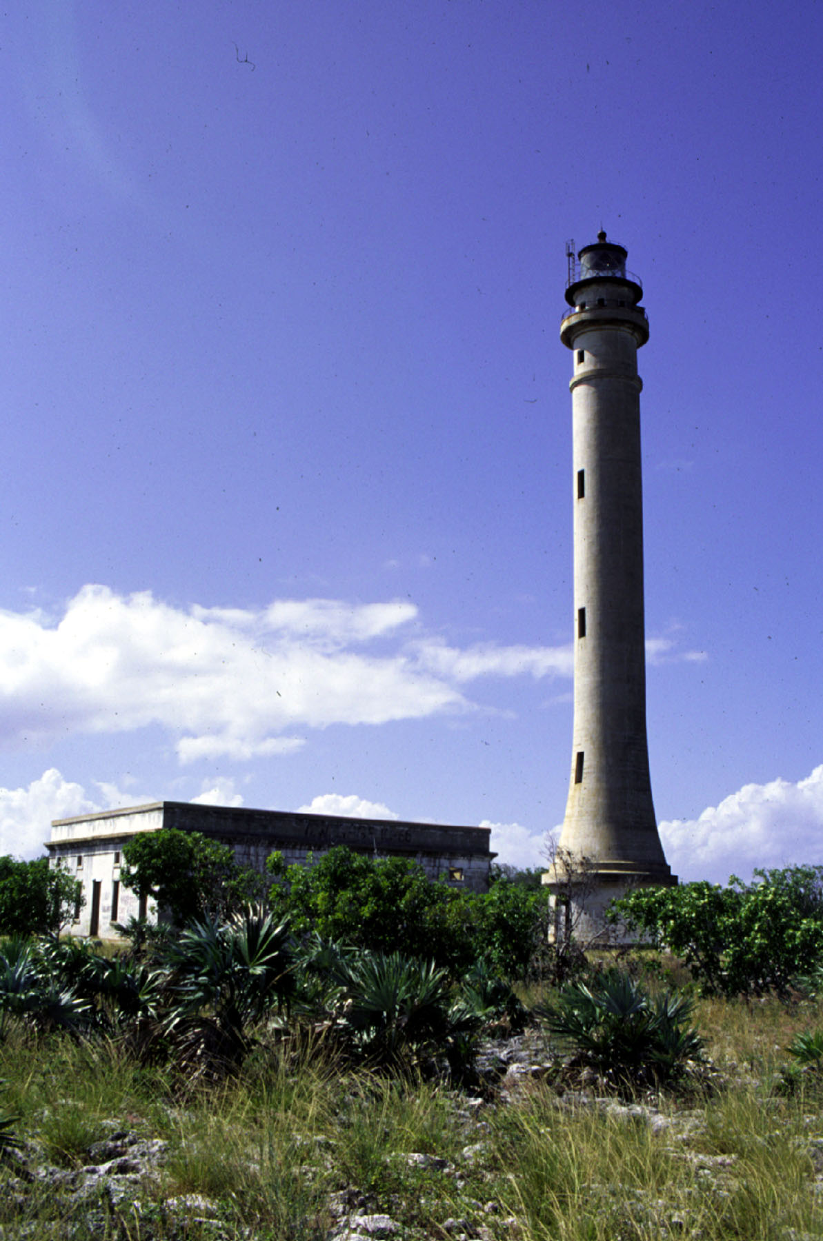
Navassa Island Light 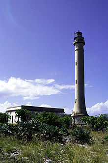
1999 Location The Windward Passage
Caribbean SeaCoordinates 18°24′1″N 75°0′39″W / 18.40028°N 75.01083°WCoordinates: 18°24′1″N 75°0′39″W / 18.40028°N 75.01083°W Year first constructed 1916 Year first lit 1917 Automated 1929 Deactivated 1996 Foundation Stone Construction Concrete Tower shape Conical with buttresses Markings / pattern Tower: unpainted
lantern: blackHeight 162 feet (49 m) Focal height 395 feet (120 m) Original lens 2nd order Fresnel lens Admiralty number formerly J5362 ARLHS number NAV-001 Navassa Island Light is a deactivated lighthouse on Navassa Island, which lies at the south end of the Windward Passage between the island of Santo Domingo to the east and Cuba and Jamaica to the west. It is on the shortest route between the east coast of the United States and the Panama Canal. The light was built in 1917 and deactivated in 1996. The light is gradually deteriorating from lack of maintenance. The keepers' house is roofless and in ruins.[3]
The importance of the light before the advent of GPS is evident in the fact that it has the twelfth highest tower and fourth highest focal plane of all US lights.
References
- ^ "Historic Light Station Information and Photography: West Indies / Virgin Islands". United States Coast Guard Historian's Office. http://www.uscg.mil/history/weblighthouses/LHAWI.asp.
- ^ Rowlett, Russ. "Navassa Island Lighthouse". The Lighthouse Directory. University of North Carolina at Chapel Hill. http://www.unc.edu/~rowlett/lighthouse/nvi.htm.
- ^ a b "Navassa Island". U.S. Geologic Survey. http://coastal.er.usgs.gov/navassa/.
Categories:- Lighthouse stubs
- Navassa Island
- Lighthouses in territories of the United States
- Buildings and structures completed in 1917
Wikimedia Foundation. 2010.