- Navotas
-
City of Navotas
Lungsod ng Navotas— Highly Urbanized City — 
SealNickname(s): Fish Trading Capital of the Philippines Motto: Integrity, Responsive, Self-sufficiency Map of Metro Manila showing the location of Navotas.
Country Philippines Region National Capital Region Districts Lone District of Navotas City Barangays 14 Established December 20,1827 Cityhood June 24,2007 Government - Mayor John Reynald M. Tiangco (PMP) - Vice Mayor Patrick Joseph A. Javier (LP) - Sangguniang Panlungsod CouncilorsArea - Total 10.77 km2 (4.2 sq mi) Population (2007) - Total 245, 344 Time zone PST (UTC+8) ZIP code 1411, 1412, 1413, 1409, 1485, 1489, 1490 Area code(s) 2 Website www.navotas.gov.ph The City of Navotas (Filipino: Lungsod ng Navotas) is a 1st class city in Metro Manila, Philippines. The city occupies a narrow strip of land along the eastern shores of Manila Bay. Navotas is directly north of Manila, west of Malabon City, and south of Obando, Bulacan.
Dubbed as the "Fish Trading Capital of the Philippines", Navotas is considered to be a very important fishing community with 70% of its population deriving their livelihood directly or indirectly from fishing and its related industries like fish trading, fish net mending, and fish producing having marginal percentage of inter-Island fish producers. Navotas occupies a portion of the Metropolitan Manila bound in the west with shoreline of Manila Bay, which is a strategic coastal front and suitable for all kinds of vessels.Navotas is part of the informal subregion of Metro Manila called CAMANAVA. This subregion, aside from Navotas, includes the cities of Caloocan, Malabon, and Valenzuela. Navotas is perceived to be prone to flood especially during the rainy season and during high tide, but the national and local government are trying to alleviate the problem. Pollution and overpopulation are other problems that the government is trying to solve. Navotas is famous for fish sauce and shrimp paste (patis and bagoong in Tagalog respectively).
Navotas celebrates its foundation day every January 16 and it became a city after a plebiscite was held on June 24, 2007.[1]
Contents
History
The entire region of Navotas was once part of Malabon. According to one legend, the long and narrow delta extended unbroken from north to south along the seashore. The strip of land between the former district of Tondo, Manila and this town was eaten away by the sea until an opening was made. Water began to flow through the opening. The geographical change prompted the people to refer to the place as "butas", "nayon ng butas",or "nabutas",a Tagalog word that means breached or pierced through. What began as a natural channel developed into a regular waterway, now known as the Navotas River. In later years, the place came to be known as "Nabotas", then "Navotas".
It as also known as hacienda de Navotas, it was once owned by the Dominican friars until it was sold to the Pascual family during the early days of the American regime and developed into a residential estate.
San Jose de Navotas was the name given to the locality after its patron saint, Saint Joseph. On June 11, 1859, a "Superior Decreto" established a new parish and municipality under the supervision of Friar Matias Navoa. The populace was divided into two distinct groups, the naturales (locals) and the mestizos. Mariano Estrellas was the gobernadorcillo (petty governor) of the naturales and Mariano Israel, of the mestizos. Today, because records are incomplete, recognition is only given to the gobernadorcillos for the mestizos. A school in honor of San Jose was built and known as "San Jose Academy."
In 1904, the town was again merged with Malabon. Bernardo Dagala, a native of Navotas, was elected municipal president.
Historical timeline
- December 20, 1827 – The movement for separation of Navotas which was then a part of Malabon (Tambobong).
- February 16, 1859 – The date when the barrios of San Jose, Navotas and Bangculasi were separated from Malabon.
- 1859 – Cavada, the year when Navotas became an independent town.
- August 6, 1898 – Navotas joined the revolutionary government of General Emilio Aguinaldo.
- June 11, 1901 – Navotas was eventually incorporated into the newly created province of Rizal enacted Act. No. 137.
- January 16, 1906 – Navotas finally became an independent municipality with the enactment of Act. No. 1442 which separated it from Malabon.
- January 16, 2006 - Navotas celebrated it's centennial
- June 24, 2007 – Navotas became a city after a plebiscite was conducted.
Government
Past Mayors
Mayor Year of Service John Rey M. Tiangco 2010 - Present Tobias Reynald M. Tiangco 2007 - 2010 Tobias Reynald M. Tiangco 2001 - 2007 Cipriano Bautista 1998 - 2001 Felipe Del Rosario Jr. 1986 - 1998 Victor B. Javier 1986 Dr. Felipe Neri Del Rosario Roberto Monroy Tomas Gomez Pacifico G. Javier Hermogenes Monroy Angelo Angeles Alejandro Leongson Canuto Celestino Arcadio Jiongco Mission and Vision
- Vision: "Navotas as a Marina City in a well ordered urban landscape serving as a regional fishing hub with a healthy and empowered community in a sustainable environment governed by a transparent, dedicated, responsive and financially self-sufficient local Government."
- Mission: "To harness all resources to serve the needs of its constituency towards industrialization and urbanization through the dedicated and accountable public official and empowered citizenry."
Geography
Navotas is a coastal town in the northwest part of Metro Manila. It is a narrow strip of land with an aggregated shoreline of approximately 4.5 km. In the north, Navotas shares a common border with the town of Obando, Bulacan, along Sukol Creek. Along the eastern border runs the Binuangan River, the Daang Cawayan River, the Dampalit River, the Batasan River, the Navotas River, the Bangculasi Channel, the Malabon Channel and the Estero de Maypajo.
It is bordered on the north by Obando, Bulacan along Sukol Creek; on the south by the city of Manila; on the east by Daang Binuangan River, Bangkulasi Channel, Malabon Channel and Estero de Maypajo; and on the west by Manila Bay.
Barangays
Navotas is politically subdivided into 2 districts, with a total of 14 barangays:
District 1
- Bagumbayan North
- Bagumbayan South
- Bangkulasi
- Navotas East
- Navotas West
- Northbay Boulevard, North
- Northbay Boulevard, South
- San Rafael Village
- Sipac-Almacen
District 2
- Daanghari
- San Jose
- San Roque
- Tangos
- Tanza
Catholic Churches
- San Ildefonso Parish
- San Jose de Navotas Parish
- San Roque de Navotas Parish
- San Lorenzo Ruiz and Companion Martyrs Parish
- Sta. Cruz Parish
Largest cities of Philippines
Philippines 2007 CensusRank City Name Region Pop. Rank City Name Region Pop. 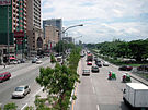
Quezon City
1 Quezon City Metro Manila 2,679,450 11 Dasmariñas CALABARZON 556,330 
Caloocan
2 Manila Metro Manila 1,660,714 12 Cagayan de Oro Northern Mindanao 553,966 3 Caloocan Metro Manila 1,378,856 13 Parañaque Metro Manila 552,660 4 Davao City Davao Region 1,363,337 14 Las Piñas Metro Manila 532,223 5 Cebu City Central Visayas 798,809 15 General Santos SOCCSKSARGEN 529,542 6 Zamboanga City Zamboanga Peninsula 774,407 16 Makati Metro Manila 510,383 7 Antipolo CALABARZON 633,971 17 Bacolod Western Visayas 499,497 8 Pasig Metro Manila 617,301 18 Muntinlupa Metro Manila 452,943 9 Taguig Metro Manila 613,343 19 Tagum Davao Region 450,526 10 Valenzuela Metro Manila 568,928 20 San Jose del Monte Central Luzon 439,090 References

Obando, Bulacan Manila Bay 
Malabon  Navotas

Manila South Caloocan  Metropolitan Manila
Caloocan
Las Piñas
MakatiMarikina
Muntinlupa
NavotasParañaque
Pasay
PasigTaguig
ValenzuelaMetropolitan Manila Development Authority Cities of the PhilippinesHighly-urbanized Cities Angeles · Bacolod · Baguio · Butuan · Cagayan de Oro · Caloocan · Cebu · Davao · General Santos · Iligan · Iloilo · Lapu-Lapu · Las Piñas · Lucena · Makati · Malabon · Mandaluyong · Mandaue · Manila · Marikina · Muntinlupa · Navotas · Olongapo · Parañaque · Pasay · Pasig · Puerto Princesa · Quezon City · San Juan · Tacloban · Taguig · Zamboanga
Independent
Component CitiesComponent Cities Alaminos · Antipolo · Bago · Bais · Balanga · Batangas · Batac · Bayawan · Baybay · Bayugan · Biñan · Bislig · Bogo · Borongan · Cabadbaran · Cabanatuan · Cadiz · Calamba · Calapan · Calbayog · Candon · Canlaon · Carcar · Catbalogan · Cauayan · Cavite · Danao · Dapitan · Dasmariñas · Digos · Dipolog · Dumaguete · El Salvador · Escalante · Gapan · Gingoog · Guihulngan · Himamaylan · Iriga · Isabela · Kabankalan · Kidapawan · Koronadal · La Carlota · Lamitan · Laoag · Legazpi · Ligao · Lipa · Maasin · Malaybalay · Malolos · Marawi · Masbate · Mati · Meycauayan · Muñoz · Naga, Cebu · Oroquieta · Ozamiz · Pagadian · Palayan · Panabo · Passi · Roxas · Sagay · Samal · San Carlos, Negros Occidental · San Carlos, Pangasinan · San Fernando, La Union · San Fernando, Pampanga · San Jose · San Jose del Monte · San Pablo · Santa Rosa · Silay · Sipalay · Sorsogon · Surigao · Tabaco · Tabuk · Tacurong · Tagaytay · Tagbilaran · Tagum · Talisay, Cebu · Talisay, Negros Occidental · Tanauan · Tandag · Tangub · Tanjay · Tarlac · Tayabas · Toledo · Trece Martires · Tuguegarao · Urdaneta · Valencia · Victorias · Vigan
Categories:- Metro Manila
- Cities in the Philippines
- Populated places established in 1859


Wikimedia Foundation. 2010.