- Nelson Round Barn
-
Nelson Round Barn
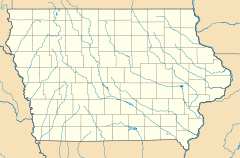

Location: County Road J46, Allerton, Iowa Coordinates: 40°42′24″N 93°20′44″W / 40.70667°N 93.34556°WCoordinates: 40°42′24″N 93°20′44″W / 40.70667°N 93.34556°W Built: 1912 Architect: Emil Cable Governing body: Private MPS: Iowa Round Barns: The Sixty Year Experiment TR NRHP Reference#: 86003189 [1] Added to NRHP: November 19, 1986 The Nelson Round Barn is an historical structure located near Allerton in rural Wayne County, Iowa. It was built in 1912 and has been listed on the National Register of Historic Places since 1986.[1] The building is a true round barn that measures 50 feet (15.2 m) around.[2] It features white vertical siding, an aerator, and a conical roof.[2]
References
- ^ a b "National Register Information System". National Register of Historic Places. National Park Service. 2010-11-08. http://www.nps.gov/nr/.
- ^ a b "Iowa Round Barn List". Dale Travis Barn List. http://www.dalejtravis.com/rblist/rbia.htm. Retrieved 2011-01-10.
U.S. National Register of Historic Places Topics Lists by states Alabama • Alaska • Arizona • Arkansas • California • Colorado • Connecticut • Delaware • Florida • Georgia • Hawaii • Idaho • Illinois • Indiana • Iowa • Kansas • Kentucky • Louisiana • Maine • Maryland • Massachusetts • Michigan • Minnesota • Mississippi • Missouri • Montana • Nebraska • Nevada • New Hampshire • New Jersey • New Mexico • New York • North Carolina • North Dakota • Ohio • Oklahoma • Oregon • Pennsylvania • Rhode Island • South Carolina • South Dakota • Tennessee • Texas • Utah • Vermont • Virginia • Washington • West Virginia • Wisconsin • WyomingLists by territories Lists by associated states Other  Category:National Register of Historic Places •
  Portal:National Register of Historic PlacesCategories:
- 1912 architecture
- Buildings and structures in Wayne County, Iowa
- Barns on the National Register of Historic Places in Iowa
- Round barns in Iowa
- Iowa Registered Historic Place stubs
- Iowa building and structure stubs

Wikimedia Foundation. 2010.