- Neturia (community development block)
-
Neturia — Community development block — Location in West Bengal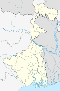
 Neturia
Coordinates: 23°39′47″N 86°49′37″E / 23.66306°N 86.82694°E Country  India
IndiaState West Bengal District Purulia Parliamentary constituency Bankura Assembly constituency Raghunathpur Area - Total 77 sq mi (199.37 km2) Population (2001) - Total 90,632 - Density 1,178.4/sq mi (455/km2) Time zone IST (UTC+5.30) PIN Literacy Rate 57.72 per cent Website http://purulia.gov.in/ Neturia (community development block) (Bengali: নেতুরিয়া সমষ্টি উন্নয়ন ব্লক) is an administrative division in Raghunathpur subdivision of Purulia district in the Indian state of West Bengal. Neturia police station serves this block. Headquarters of this block is at Ramkanali. Hijuli and Par Beliya are urban areas in this block.[1][2]
Contents
History
Jaina Bhagavati-Sutra of 5th century AD mentions that Purulia was one of the sixteen mahajanapadas and was a part of the kingdom known as Vajra-bhumi in ancient times. In 1833, Manbhum district was carved out of Jungle Mahals district, with head quarters at Manbazar. In 1838, the headquarters was transferred to Purulia. In 1956, Manbhum district was partitioned between Bihar and West Bengal under the States Reorganization Act and the Bihar and West Bengal (Transfer of Territories) Act 1956.[3]
Geography
Neturia is located at 23°39′47″N 86°49′37″E / 23.663°N 86.827°E.
Neturia community development block has an area of 199.37 km2.[2]
The area forms the lowest step of the Chota Nagpur Plateau. The general scenario is undulating land with scattered hills.[4]
Gram panchayats
Gram panchayats of Neturia block/panchayat samiti are: Bhamuria, Digha, Guniara, Janardandi, Raibandh, Saltore and Sarbari.[5]
Demographics
As per 2001 census, Neturia block had a total population of 90,632, out of which 46,900 were males and 43,732 were females. Neturia block registered a population growth of 10.24 per cent during the 1991-2001 decade. Decadal growth for Purulia district was 13.96 per cent.[2]Decadal growth in West Bengal was 17.84 per cent.[6]
Scheduled castes at 26,821 formed around one-third the population. Scheduled tribes numbered 20,411, forming around one-fourth the population.[7]
Literacy
As per 2001 census, Neturia block had a total literacy of 57.72 per cent for the 6+ age group. While male literacy was 72.96 per cent female literacy was 41.27 per cent. Purulia district had a total literacy of 55.57 per cent, male literacy being 73.72 per cent and female literacy being 36.50 per cent.[8]
References
- ^ "Contact details of Block Development Officers". Purulia district. West Bengal Government. http://wbprd.gov.in/html/asp/bdo_contact.asp?cd=EH. Retrieved 2011-08-08.
- ^ a b c "Provisional population totals, West Bengal, Table 4, Purulia District". Census of India 2001. Census Commission of India. http://web.cmc.net.in/wbcensus/DataTables/02/Table4_14.htm. Retrieved 2011-08-08.
- ^ "Historical background". Purulia District. Archived from the original on 2008-01-03. http://web.archive.org/web/20080103032840/http://purulia.gov.in/district_profile/dist_profile.html. Retrieved 2008-03-02.
- ^ Houlton, Sir John, Bihar, the Heart of India, 1949, p. 170, Orient Longmans Ltd.
- ^ "Annexure A to G.O No.121(Sanction)-RD/CCA/BRGF/1C-5/08". Allotment under BRGF Fund 1st Instalment 2010-11 – Purulia District. Government of West Bengal - Department of Panchayats & Rural Development. http://wbprd.nic.in/html/asp/writereaddata/Notifications/01070066.doc. Retrieved 2011-08-04.
- ^ "Provisional Population Totals, West Bengal. Table 4". Census of India 2001. Census Commission of India. http://web.cmc.net.in/wbcensus/DataTables/02/FrameTable4_1.htm. Retrieved 2011-08-04.
- ^ "TRU for all Districts (SC & ST and Total)". Census 2001. Census Commission of India. http://web.cmc.net.in/wbcensus/HouseListingF/SCST/All_distSCST(TRU1)14.htm. Retrieved 2008-03-02.
- ^ "Provisional population totals, West Bengal, Table 5, Purulia District". Census of India 2001. Census Commission of India. http://web.cmc.net.in/wbcensus/DataTables/02/Table5_14.htm. Retrieved 2011-08-08.
Municipalities & CD blocks of West Bengal Municipal
CorporationsMunicipalities Alipurduar · Arambagh · Ashoknagar Kalyangarh · Baduria · Baidyabati · Bally · Balurghat · Bangaon · Bankura · Bansberia · Baranagar · Barasat · Bardhaman · Barrackpore · Baruipur · Basirhat · Beldanga · Berhampore · Bhadreswar · Bhatpara · Bidhannagar · Birnagar · Bishnupur · Bolpur · Budge Budge · Chakdaha · Champdani · Chandrakona · Contai · Cooch Behar · Dainhat · Dalkhola · Darjeeling · Dhulian · Dhupguri · Diamond Harbour · Dinhata · Dubrajpur · Dum Dum · Egra · English Bazar · Gangarampur · Garulia · Gayespur · Ghatal · Gobardanga · Guskara · Habra · Haldia · Haldibari · Halisahar · Hugli-Chuchura · Islampur · Jalpaiguri · Jamuria · Jangipur · Jhalda · Jhargram · Jiaganj Azimganj · Jaynagar Mazilpur · Kaliaganj · Kalimpong · Kalna · Kalyani · Kamarhati · Kanchrapara · Kandi · Katwa · Kharagpur · Kharar · Khardaha · Kshirpai · Konnagar · Krishnanagar · Kulti · Kurseong · Madhyamgram · Maheshtala · Mal · Mathabhanga · Mekhliganj · Memari · Midnapore · Murshidabad · Nabadwip · Naihati · Nalhati · New Barrackpur · North Barrackpur · North Dumdum · Old Maldah · Panihati · Panskura · Pujali · Purulia · Raghunathpur · Raiganj · Rajarhat · Rajpur Sonarpur · Ramjibanpur · Rampurhat · Ranaghat · Raniganj · Rishra · Sainthia · Shantipur · Serampore · Sonamukhi · South Dumdum · Suri · Taki · Tamluk · Tarakeswar · Titagarh · Tufanganj · Uluberia · Uttarpara Kotrung
Community
development
blocks*A Alipuduar I · Alipurduar II · Amdanga · Amta I · Amta II · Andal · Arambagh · Arsha · Ausgram I · Ausgram II B Baduria · Bagdah · Baghmundi · Bagnan I · Bagnan II · Balagarh · Balarampur · Balurghat · Bally Jagachha · Bamangola · Bandwan · Bangaon · Bankura I · Bankura II · Barjora · Bansihari · Barabani · Barabazar · Barrackpore I · Barrackpore II · Barasat I · Barasat II · Baruipur · Basanti · Basirhat I · Basirhat II · Beldanga I · Beldanga II · Berhampore · Bhagawangola I · Bhagawangola II · Bhagabanpur I · Bhagabanpur II · Bhangore I · Bhangore II · Bharatpur I · Bharatpur II · Bhatar · Binpur I · Binpur II · Bishnupur, Bankura · Bishnupur I, South 24 Parganas · Bishnupur II, South 24 Parganas · Bolpur Sriniketan · Budge Budge I · Budge Budge II · Burdwan I · Burdwan II · Burwan C Canning I · Canning II · Chakdaha · Chanchal I · Chanchal II · Chandipur · Chanditala I · Chanditala II · Chapra · Chandrakona I · Chandrakona II · Chhatna · Chinsurah-Mogra · Chopra · Contai I · Contai II · Contai III · Cooch Behar I · Cooch Behar II D Darjeeling Pulbazar · Dantan I · Dantan II · Daspur I · Daspur II · Debra · Deganga · Diamond Harbour I · Diamond Harbour II · Deshapran · Dhaniakhali · Dhupguri · Dinhata I · Dinhata II · Domjur · Domkal · Dubrajpur E Egra I · Egra II · English Bazar F Falakata · Falta · Farakka · Faridpur-Durgapur G Gaighata · Galsi I · Galsi II · Gangajalghati · Gangarampur · Garhbeta I · Garhbeta II · Garhbeta III · Gazole · Ghatal · Goalpokhar I · Goalpokhar II · Goghat I · Goghat II · Gopiballavpur I · Gopiballavpur II · Gorubathan · Gosaba H Habibpur · Habra I · Habra II · Haldia · Haldibari · Hanskhali · Hariharpara · Haringhata · Haripal · Harirampur · Harishchandrapur I · Harishchandrapur II · Haroa · Hasnabad · Hemtabad · Hili · Hingalganj · Hirbandh · Hura I Ilambazar · Indas · Indpur · Islampur · Itahar J Jagatballavpur · Jalangi · Jalpaiguri · Jamalpur · Jamboni · Jamuria · Jangipara · Jaynagar I · Jaynagar II · Jhalda I · Jhalda II · Jhargram · Jorebunglow Sukhiapokhri · Joypur, Bankura · Joypur, Purulia · K Kakdwip · Kalchini · Kaliachak I · Kaliachak II · Kaliachak III · Kaliaganj · Kaliganj · Kalimpong I · Kalimpong II · Kalna I · Kalna II · Kandi · Kanksa · Karandighi · Karimpur I · Karimpur II · Kashipur · Katwa I · Katwa II · Keshiari · Keshpur · Ketugram I · Ketugram II · Khanakul I · Khanakul II · Khandaghosh · Kharagpur I · Kharagpur II · Khargram · Kharibari · Khatra · Khejuri I · Khejuri II · Khoyrasole · Kotulpur · Krishnaganj · Krishnanagar I · Krishnanagar II · Kulpi · Kultali · Kumarganj · Kumargram · Kurseong · Kushmandi L Labpur · Lalgola M Madarihat-Birpara · Magrahat I · Magrahat II · Mahisadal · Mal · Manbazar I · Manbazar II · Mandirbazar · Manikchak · Manteswar · Mathabhanga I · Mathabhanga II · Mathurapur I · Mathurapur II · Matiali · Matigara · Maynaguri · Mayureswar I · Mayureswar II · Mejia · Mekhliganj · Memari I · Memari II · Midnapore Sadar · Minakhan · Mirik · Mohammad Bazar · Mohanpur · Mongalkote · Moyna · Murarai I · Murarai II · Murshidabad-Jiaganj N Nabadwip · Nabagram · Nagrakata · Nakashipara · Nalhati I · Nalhati II · Namkhana · Nandakumar · Nandigram I · Nandigram II · Nanoor · Naoda · Narayangarh · Naxalbari · Nayagram · Neturia O Old Malda · Onda · P Panchla · Pandabeswar · Pandua · Panskura I · Panskura II · Para · Patashpur I · Patashpur II · Patharpratima · Patrasayer · Phansidewa · Pingla · Polba-Dadpur · Puncha · Purbasthali I · Purbasthali II · Pursurah · Purulia I · Purulia II R Raghunathganj I · Raghunathganj II · Raghunathpur I · Raghunathpur II · Raiganj · Raina I · Raina II · Raipur · Rajarhat · Rajganj · Rajnagar · Ramnagar I · Ramnagar II · Rampurhat I · Rampurhat II · Ranaghat I · Ranaghat II · Rangli Rangliot · Ranibandh · Raniganj · Raninagar I · Raninagar II · Ratua I · Ratua II S Sabang · Sagar · Sagardighi · Sahid Matangini · Sainthia · Salanpur · Salboni · Saltora · Samserganj · Sandeshkhali I · Sandeshkhali II · Sankrail, Howrah · Sankrail, Paschim Medinipur · Santipur · Santuri · Sarenga · Shyampur I · Shyampur II · Simlapal · Singur · Sitai · Sitalkuchi · Sonamukhi · Sonarpur · Sreerampur-Uttarpara · Suri I · Suri II · Sutahata · Suti I · Suti II · Swarupnagar T Taldangra · Tamluk · Tapan · Tarakeswar · Tehatta I · Tehatta II · Thakurpukur Mahestala · Tufanganj I · Tufanganj II U Udaynarayanpur · Uluberia I · Uluberia II
- Similar to Tehsils in many states of India
Purulia district topics General Ajodhya Hills • Bargi • Charra Airfield • Chhau dance • Chota Nagpur Plateau • Dharmathakur • Garh Panchkot • Jungle Mahals • Manbhum • Purulia arms drop case • SarakSubdivisions Purulia Sadar East • Purulia Sadar West • RaghunathpurLocations
other than cities and townsGoorinathdham • MadhukundaMunicipalities Community development blocks Purulia Sadar East subdivision Manbazar I • Manbazar II • Bandwan • Purulia I • Purulia II • Hura • Puncha Purulia Sadar West subdivision Jhalda I • Jhalda II • Joypur • Arsha • Baghmundi • Balarampur • Barabazar Raghunathpur subdivision Para • Raghunathpur I • Raghunathpur II • Neturia • Santuri • KashipurRivers Lok Sabha constituencies Vidhan Sabha constituencies Former Vidhan Sabha constituencies Arsha • Jhalda • HuraSee also Cities and towns in Purulia district • People from Purulia district • Villages in Purulia district • Damodar ValleyOther districts in West Bengal Bankura • Bardhaman • Birbhum • Cooch Behar • Dakshin Dinajpur • Darjeeling • Hooghly • Howrah • Jalpaiguri • Kolkata • Malda • Murshidabad • Nadia • North 24 Parganas • Paschim Medinipur • Purba Medinipur • South 24 Parganas • Uttar DinajpurSurrounding areas outside West Bengal Jharkhand Cities and towns in North Chotanagpur Division • North Chotanagpur division topics • Cities and towns in South Chotanagpur Division • South Chotanagpur division topics • Cities and towns in Kolhan Division • Kolhan division topicsCategories:- Community development blocks in Purulia district

Wikimedia Foundation. 2010.