- New Brighton Village Hall
-
New Brighton Village Hall
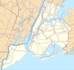

Location: 66 Lafayette Ave., Staten Island, New York Coordinates: 40°38′35″N 74°5′46″W / 40.64306°N 74.09611°WCoordinates: 40°38′35″N 74°5′46″W / 40.64306°N 74.09611°W Area: less than one acre Built: 1868-1871 Architect: Whitford, James Architectural style: French Second Empire Governing body: State NRHP Reference#: 78001904[1] Added to NRHP: December 15, 1978 New Brighton Village Hall is a historic village hall located at New Brighton, Staten Island, New York. It was built between 1868 and 1871 in the Second Empire style. It is a three story brick building with a mansard roof sheathed with gray slate shingles.[2]
It was added to the National Register of Historic Places in 1978.[1]
References
- ^ a b "National Register Information System". National Register of Historic Places. National Park Service. 2009-03-13. http://nrhp.focus.nps.gov/natreg/docs/All_Data.html.
- ^ Barnett Shepherd and Elizabeth Spencer-Ralph (1976). "National Register of Historic Places Registration: New Brighton Village Hall". New York State Office of Parks, Recreation and Historic Preservation. http://www.oprhp.state.ny.us/hpimaging/hp_view.asp?GroupView=7733. Retrieved 2010-12-06. See also: "Accompanying six photos". http://www.oprhp.state.ny.us/hpimaging/hp_view.asp?GroupView=7746.
Categories:- Government buildings on the National Register of Historic Places in New York City
- Second Empire architecture in New York
- Buildings and structures completed in 1871
- Buildings and structures in Staten Island
- New York City Region, New York Registered Historic Place stubs


Wikimedia Foundation. 2010.