- Fletton
-
Coordinates: 52°34′N 0°14′W / 52.56°N 0.24°W
Fletton 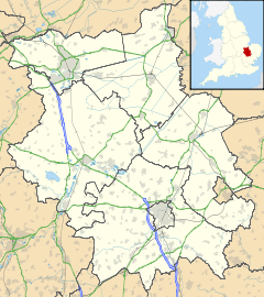
 Fletton
Fletton shown within CambridgeshireUnitary authority Peterborough Ceremonial county Cambridgeshire Region East Country England Sovereign state United Kingdom EU Parliament East of England List of places: UK • England • Cambridgeshire Fletton is a residential area and electoral ward of the city of Peterborough, Cambridgeshire in the United Kingdom. For parliamentary purposes it falls within North West Cambridgeshire constituency. The area is home to League One Peterborough United F.C., known locally as The Posh, who play at London Road Stadium.
Contents
Administration
Lying south of the River Nene, the area was historically part of Huntingdonshire (although not the present district of that name), rather than the Soke of Peterborough in Northamptonshire. It was divided into Old Fletton, which prior to the Local Government Act 1972 formed a separate town with its own council (Old Fletton Urban District) and New Fletton which, from 1874, was administered as part of Peterborough Municipal Borough. Some maps still show New Fletton (on the south bank of the river) as well as Old Fletton (further to the south) with the boundary at Fletton Spring. Fletton Spring rises in the west of the area near Celta Road but soon disappears underground, re-emerging near Fletton Fields before being fenced in again and eventually merging with Stanground Lode in the east.
In 1965, the administrative counties of Huntingdonshire and the Soke of Peterborough amalgamated as Huntingdon and Peterborough and, in 1974, Fletton became part of the Peterborough district of non-metropolitan Cambridgeshire.[1]
The parish church, which is situated on Fletton Avenue, is dedicated to Saint Margaret.[2][3] Although in the Diocese of Ely, it has now been placed under the pastoral care of the Bishop of Peterborough, acting as Assistant Bishop in the Diocese of Ely.[4][5] The Italian Catholic mission church of Saint Anthony (San Antonio) is run by the Scalabrini Fathers.[6]
Old Fletton County Primary School is located in the area; secondary pupils attend nearby Stanground College and Orton Longueville School.
Industry
 Town Bridge (1934) over the River Nene, traditional boundary between the Northamptonshire and Huntingdonshire.
The sub-soil is Oxford Clay, the character of which led to the establishment of large brickworks. The area gave its name to the Fletton Brick Company and to Fletton Brick in the nineteenth century, when a large area of land was auctioned off to investors; this eventually became the London Brick Company, now owned by Hanson Plc. The dominance of London Brick in the market during this period gave rise to some of the country's most well known landmarks, all built using the ubiquitous Fletton.[7] During the 1950s the requirement for workers in the brick industry was far greater than that available locally and many Italians—initially housed in the old prisoner of war camps and in barracks and hostels belonging to the company—were recruited in the southern regions of Puglia and Campania.
By 1960, approximately 3,000 Italian men were employed by London Brick, mostly at the Fletton works.[8] Very soon after the first men had arrived, they were followed by around 2,000 Italian women, some of whom worked alongside the men, whilst others worked in sectors such as clothing, rubber, ceramics, food processing, agriculture and the NHS. Consequently Fletton has a significant Italian population today. The Fleet complex, off the High Street, has been managed by the Italian Community Association since it opened in 1985.[9]
Historically, diesel manufacturers, Perkins Engines, (previously Joseph Farrow's canning factory) and Bennie Lifts, situated on Queens Road, also gave work to a large number of people locally.
See also
References
- ^ The Huntingdon and Peterborough Order 1964 (SI 1964/367), see Local Government Commission for England (1958 - 1967), Report and Proposals for the East Midlands General Review Area (Report No. 3), 31 July 1961 and Report and Proposals for the Lincolnshire and East Anglia General Review Area (Report No. 9), 7 May 1965
- ^ Lewis, Samuel Fletton (St. Margaret) Topographical Dictionary of England (7th ed.) vol. 2 (pp. 241-244) S. Lewis & Co., London, 1848
- ^ St. Margaret, Fletton, Cambridgeshire The Corpus of ROMANESQUE SCULPTURE in Britain and Ireland, The British Academy and Ron Baxter (retrieved 23 April 2008)
- ^ RELIGION: Bishops bridge boundaries aboard boat Peterborough Evening Telegraph, 2 August 2004
- ^ Bridging the divide in a city Diocese of Ely, Ref. 0471, 29 July 2004
- ^ Beacock, Kirsten Vatican call to save a Fletton parish church Peterborough Evening Telegraph, 13 August 2010
- ^ London Brick: 130 Years of History 1877–2007 Hanson Building Products, 2007
- ^ Colpi, Terry The Italian Factor: The Italian Community in Great Britain (p. 149) Mainstream Publishing, Edinburgh, 1991
- ^ City's Italian community enjoys a Carnival celebration Peterborough Evening Telegraph, 12 February 2008
External links
Categories:- Geography of Peterborough


Wikimedia Foundation. 2010.