- New Marston
-
Coordinates: 51°45′47″N 1°14′06″W / 51.763°N 1.235°W
New Marston 
St. Michael & All Angels parish church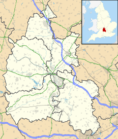
 New Marston
New Marston shown within OxfordshireOS grid reference SP5207 Parish Marston District Oxford Shire county Oxfordshire Region South East Country England Sovereign state United Kingdom Post town Oxford Postcode district OX3 Dialling code 01865 Police Thames Valley Fire Oxfordshire Ambulance South Central EU Parliament South East England UK Parliament Oxford East List of places: UK • England • Oxfordshire New Marston is a suburb about 1.25 miles (2 km) northeast of the centre of Oxford, England.
Contents
History
New Marston is built on land that was originally part of the manor of Headington. It was rural until the 19th century, when housing began to develop along Marston Road from St. Clement's towards the village of Marston. New Marston seems to have received a mains water supply by the end of the 1870's and mains drainage by the 1920's.[1]
New Marston's main development was in the 20th century, when the County Borough of Oxford developed estates of council houses around Marston Road and north of Headley Way. The County Borough had built 138 council houses at New Marston by 1938 and added another 70 after 1950.[2]
Churches
Cowley Road Congregational Church opened a mission hall in New Marston in 1885.[3] This was replaced by a new building opened in 1939.[3] It is now Marston United Reformed Church.[4]
 The former Church of England mission hall, now the Russian Orthodox church of St. Nicholas the Wonderworker
In 1919 the Church of England parish of St. Nicholas, Marston opened a mission hall in Ferry Road to serve the parts of New Marston that had been built by that time.[5] Somewhat later a campanile was added, its style and sand-lime brick suggesting that it is the work of the then Oxford Diocesan Architect T. Lawrence Dale.
In 1954-56 Saint Michael and All Angels parish church[6] was built on Marston Road at the corner of Jack Straw's Lane as a chapel of ease for the parish of St. Andrew, Headington.[5] St Michael's was consecrated in September 1955[7] and superseded the Ferry Road mission hall, which was then deconsecrated and sold for secular use.[5] In 1963 the Diocese of Oxford constituted St. Michael's as a parish church, with its new parish formed from parts of Headington, Marston and St. Clement's parishes.[5]
 St. Michael & All Angels parish church from the southeast
St. Michael's was designed by T.L. Dale[8] in a "vaguely Italian renaissance style"[5] that includes a slender campanile[7] for its single bell. It has a statue of St. Michael by Michael Groser and a reredos painted by Leon Underwood.[7][9] St. Michael's is unusual for its elliptical windows and for its tall, box-like chancel.
The Russian Orthodox Diocese of Sourozh established the parish of Saint Nicholas the Wonderworker in Oxford in 2006.[10] The congregation worshipped in rented premises until 2010, when it acquired the former Church of England mission hall in Ferry Road and restored it to use as a church.[10] The Russian congregation has added a small onion dome and a small mosaic picture of St Nicholas to the south gable of the building.
Schools
New Marston Church of England School in Marston Road opened in 1928 and became St Michael's Church of England Aided Primary School in 1955.[11][12]
Milham Ford School, a girls' secondary school that had been founded in Cowley Place in 1906, moved to newly built and larger premises in Marston Road in 1939.[11] The school was closed in 2003 and its premises sold to Oxford Brookes University.
Infant and junior mixed schools were opened in Copse Lane north of Headley Way in 1948.[11] They are now New Marston Primary School.[13]
References
- ^ Crossley & Elrington, 1979, pages 350-364
- ^ Crossley & Elrington, 1979, pages 181-259
- ^ a b Crossley & Elrington, 1979, pages 415-424
- ^ Marston United Reformed Church
- ^ a b c d e Crossley & Elrington, 1979, pages 369-412
- ^ Saint Michael and All Angels
- ^ a b c "Colourful New Church - Consecration Tonight". Oxford Mail. 28 September 1955.
- ^ Sherwood & Pevsner, 1974, page 336
- ^ Sherwood & Pevsner, 1974, page 337
- ^ a b "Parish Background". Parish of Saint Nicholas the Wonderworker. Parish of Saint Nicholas the Wonderworker. http://www.stnicholas-oxford.org/parish/docs/52-parish-background. Retrieved 12 March 2011.
- ^ a b c Crossley & Elrington, 1979, pages 442-462
- ^ St Michael's CE Aided Primary School
- ^ New Marston Primary School
Sources
- Crossley, Alan; Elrington, C.R. (eds.); Chance, Eleanor; Colvin, Christina; Cooper, Janet; Day, C.J.; Hassall, T.G.; Selwyn, Nesta (1979). A History of the County of Oxford, Volume 4. Victoria County History.
- Sherwood, Jennifer; Pevsner, Nikolaus (1974). Oxfordshire. The Buildings of England. Harmondsworth: Penguin Books. pp. 336–337. ISBN 0 14 071045 0.
Categories:- Districts of Oxford


Wikimedia Foundation. 2010.