- Nicholstown, Southampton
-
Coordinates: 50°54′41″N 1°23′44″W / 50.91133°N 1.39551°W
Nicholstown-Newtown 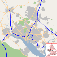
 Nicholstown-Newtown
Nicholstown-Newtown shown within SouthamptonUnitary authority Southampton Ceremonial county Hampshire Region South East Country England Sovereign state United Kingdom Post town SOUTHAMPTON Postcode district SO14 Dialling code 023 Police Hampshire Fire Hampshire Ambulance South Central EU Parliament South East England UK Parliament Southampton Test List of places: UK • England • Hampshire Nicholstown-Newtown (usually called Nicholstown, or Newtown) is a small area to the north-east of Southampton's city centre. To the north is Bevois Valley, to the east Northam and to the west and south is St Mary's. In the north of Newtown is the Mount Pleasant area, which spills over into the north of Northam. Black signs saying "Welcome to Nicholstown-Newtown" [1] demarcate the district on the roads running east from St. Mary's Rd - hence the district is bordered on the west by St. Mary's Road, the south by Six Dials road, and the east by the railway lines.
The area is dominated by the Royal South Hampshire Hospital which was built in 1843-1844.
Contents
History
In the 1960s and 1970s the area was notorious as Southampton's red-light district with high crime rates.[1]. Frustrated with the inaction of the city council and police, over 2,000 people marched from Derby Road to the civic centre. Following this "march of neglect", the Queen visited the area and a cash injection of half a million pounds followed.[1] However, by the 21st century, little had changed. In the year 2000 a report highlighted that the urban renewal area encompassing Nicholstown "exhibits both the highest levels of unfitness and disrepair ... in the city"[2] and the area was still very much a red light district in 2004.[3]
Nicholstown today
The Newtown Youth Centre is situated in Graham Road and attracts over 100 individuals between the ages of 11 and 21 in a year.[4]
References
- ^ a b This is Hampshire: 5th July 2004: Inner-city pride restored Accessed 11th April 2007
- ^ "Inner city homes to get cash boost". Newsquest Media Group. 26 September 2000. http://archive.thisishampshire.net/2000/9/26/83030.html. Retrieved 2008-09-01.
- ^ Thompson, Kate (6 July 2004). "Life beyond the streets". The Southern Daily Echo (Newsquest Media Group). http://archive.dailyecho.co.uk/2004/7/6/27011.html. Retrieved 2008-09-01.
- ^ Hampshire Police Authority - Crime Prevention Committee - 25 January 2007: Report of the Consultant to the Committee Accessed 11th April 2007
smmb southampton youth club
External links
Areas and Suburbs of Southampton City of Southampton Electoral Wards (and their neighbourhoods) listed by Constituency — sources: 1 2.Southampton Itchen Bargate Ward (City Centre, Ocean Village, The Polygon, St Mary's) • Bitterne Ward (Bitterne, Thornhill) • Bitterne Park Ward (Bitterne Park, Bitterne Manor, Midanbury, Townhill Park) • Harefield Ward (Harefield) • Peartree Ward (Peartree Green) • Sholing Ward (Sholing) • Woolston Ward (Woolston, Weston)Southampton Test Bevois Ward (Bevois Valley, Nicholstown, Northam) • Coxford Ward (Lordshill, Lordswood) • Freemantle Ward (Freemantle) • Millbrook Ward (Millbrook, Regents Park) • Portswood Ward (Portswood, Highfield, St Denys) • Redbridge Ward (Redbridge, Maybush) • Shirley Ward (Shirley, Southampton Common)Romsey and Southampton North Areas of Greater Southampton outside the City boundary include Chartwell Green, Chilworth, Nursling, Rownhams, Eastleigh, Totton, and West End.Categories:- Districts of Southampton
- Southampton
- Hampshire geography stubs

![[1]](http://www.connections-exhibition.org/parallels/cities/images/s_nicholstown_l.jpg)
Wikimedia Foundation. 2010.