- Gudivada
Infobox Indian Jurisdiction
native_name = Gudivada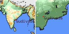
latd = 16.27|longd = 80.59
state_name = Andhra Pradesh
district =Krishna district
leader_title = MLA
leader_name = Sri Venkateswara Rao Kodali (Nani) [ Election results of the Gudivada assembly from the [http://www.eci.gov.in/ElectionAnalysis/AE/S01/partycomp85.htm Election Commission of India] ]
altitude = 5
population_as_of = 2001 | population_total = 167,821| area_telephone= 91-08674
postal_code= 521301
vehicle_code_range=AP-16
footnotes = |Gudivada is a
census town inKrishna district in theIndia n state ofAndhra Pradesh . It is a mandal headquarters with more than 100,000 inhabitants, lying as junction ofVijayawada -Machilipatnam -Bhimavaram -Nuzvid -Eluru in the Krishna district of Andhra Pradesh of India.History
Gudi means temple and vada means place in Telugu. Gudivada might be derived from existence of number of temples. Gudivada was known as VIDARBHAPURI in past.Reference:Khandeyayani Kaikaluru Silasasanam of AD 1628. The place was in existence for over 2,000 years and has been flourishing perpetually from the time of the
Satavahanas .Gudivada was a cultural center during the period of
Vijayanagar Empire . The excavations discovered certain archaeological remains such as Buddhist and Jain relics. There are also about 99 low mounds with the ruins of Buddhiststupa s. The notable one among the old Buddhist stupas is an elevated mound in a cylindrical form with a semi-spherical topMahatma Gandhi addressed the public in Gudivada onDecember 17 ,1933 .Geography
Gudivada is located at coord|16.45|N|80.98|E|. [ [http://www.fallingrain.com/world/IN/2/Gudivada.html Falling Rain Genomics, Inc - Gudivada] ] It has an average elevation of 6
metre s (19 feet).Gudivada is Great placeAssembly Constituency
Gudivada is an assembly constituency in Andhra Pradesh. Kodali Sri Venkateswara Rao(Kodali Nani) is the top leader of Telugu Desam Party and he is now the sitting MLA for gudiwada.
Villages in Gudivada Mandal
The following is the list of villages in this Mandal. [cite web
url=http://www.krishna.gov.in/eldistrict2/htm/52.htm
title=Villages in Gudivada Mandal
publisher=
accessdate=2007-02-22 ]
#Gudivada Urban
#Gudivada Rural
#Lingavaram
#Merakagudem
#Valivarthipadu
#Dondapadu
#Saidepudi
#Serigolvepalle
#Guntakoduru
#Moturu
#Chowtapalli
#Chilakamudi
#Bethavol
#Pedayerukapadu
#Mandapadu
#Billapadu
#Gangadharapuram
#Siddhantam
#Chowtapalle
#Kalvapudiagraharam
#Seridintakurru
#Serivelpur
#Bommuluru
#Chinayerukapadu
#Tatiparru
#Seepudi
#Kasipudi
#Allidoddi
#Ramanapudi
#Chirichintala
#Ramachandrapuram
#Nuzella (This Village is a Hamlet of Serivelpuru)Demographics
Climate
Gudivada falls in the hot humid region of the country and it is less than 40 miles from Bay of Bengal. The climate of the town is very hot and it is pleasant during the winter. The hottest day falls in the month of May with shift to June during some years. The maximum temperature observed is 50.3C and the minimum temperature observed is 12.90C.
Regional settings
The town has well-set-up infrastructure, including railway station, APSRTC bus station, head post office, government hospital, outdoor and indoor stadiums, court rooms, MRO office, police station(s), fire station, telegraph, telecom station, taxi stand, officers' club, municipal building, function halls, hospitals, hotels, movie theaters, banks, temples, pump house, rice mills, ice factories, cinema halls, schools, petrol/gas stations, city bus service, auto nagar.
Gudivada Administrative setup is spanned over Gudivada Urban, Gudlavalleru, Kaikalur, Kalidindi, Mandavelli, Mudinepalli, Nandivada, Pamarru and Pedaparupudi. Gudivada is a Mandal with head post office, court offices, Mandal Revenue Office.
It is well known for its
Thyagaraja Aradhana carnatic music festival, vegetable market, NTR Stadium.Gudivada is religiously diversified small town with Hindu Temples, Mosques, Churches, Meher mandir, Jain temple.
Close by villages include Anguluru, Dondapadu,
Kuchipudi , Ghantasala,Choutapalli , Gudlavalleru, Pamaru, Hanuman Junction, Mudinepalli, Ventrapragada, Vanapamula, Peddaparupudi, Chinaparupudi, Elamaru, Nimmakuru, Vadali etc. Many famous people includingNandamuri Taraka Rama Rao ,Akkineni Nageswara Rao ,Ghantasala Venkateswara Rao ,Cherukuri Ramoji Rao, Sonti Srihari etc. are from the same region.Travel modes
*Nearest airport is at
Gannavaram in 25 km distance. Nearest International Airport is at Hyderabad.
*Comes under south central railways. Gudivada acts as junction to Machilipatnam. Frequent trains from Vijayawada, Kakinada, Narsapur and Machilipatnam.
*Andhra Pradesh State Road Transport Corporation has Gudivada Depot (GDV). Gudivada has frequent bus service from Vijayawada, Eluru, Machilipatnam, and Nuzvid.Educational institutions
Gudivada town is a famous educational centre in the region with many primary schools, high schools, junior colleges, degree colleges, arts and science colleges, engineering college, industrial training centre, polytechnic college, homeopathy medical college. Gudivada comes under region of
Acharya Nagarjuna University ,Andhra University and Jawharlal Nehru technological university (for engineering college).Among the notable educational institutions in Gudivada are:
*ANR College (arts, science, degree, post graduation)
* [http://http://www.vkrvnbpolytechnic.org/ [VKR & VNB Polytechnic]
* Gudlavalleru Engineering College
* Dr. Mudunuru Gururaju Government Homeopathic Medical College
*District Institute of Education & Training(DIET) or Teacher Training Centre(TTC)
* ANRPL Arts and science college
* Montessori English and Telugu medium School
* K.T.R Women's College
*Viswa Bharathi English Medium High School
* Gowtham Concept School
* Vidyavikas Public School
* Sai Ushodaya Public School
* Sree Vidya College
* Sri Vidyalaya Junior College
* Little Flower Creative School
* Raghavendra public school
* Sri Vasavi English Medium High SchoolMedical facilities
Gudivada has lots of hospitals with wide range of specialties and facilities.
Some of the famous hospitals are :-
*Government General Hospital
*American Hospital
*Srirama Nursing Home
*Srikanth Nursing Home
*Vishnu Orthopedic Hospital
*Pinnananeni Children's Hospital
*VENKATESWARA NURSING HOME
*Manoj Surgical Hospital, Mudinepalli
*Annapurna Hospitals
*Karuna Nursing Home
*ADITYA CHILDRENS HOSPITAL
*VIJAYA ORTHOPEDIC CENTREMoney/Economy
Being a mandal headquarters. Gudivada is a financial centre. Most of the income is generated from agriculture and fishing. Gudivada being in heart of Krishna district is great place for real estate business. Trade mostly depends on agricultural yields in that season from the near by regions. However, jewellery and gold business and cinema seems to have a special place.
Major businesses around this place are: milk, rice mills, transportation/cargo, fisheries, education, medical, cinema, jewellery, finance, textile, vegetables etc.
Most of the nationalised banks have their branch(s) some of them have ATM and locker Facilities. Following are list of some branches available in Gudivada:
#Gudivada Cooperative Urban Bank
#Sapthagiri Grameena Bank
#Karur Vysya Bank with ATM Facility
#Vijaya Bank
#Bank of Baroda with ATM Facility
#Indian Overseas Bank with ATM Facility
#Canara Bank
#Andhra Bank with ATM Facility
#State Bank of Hyderabad with ATM Facility
#State Bank of India with ATM Facility
#City Union Bank with ATM Facility
#Axis Bank with ATM Facility
#ICICI Bank with ATM Facility
#Union Bank of India with ATM Facility
#Syndicate Bank Private commercial banks like HDFC, HSBC, ABN AMRO do not have their branches yet. Stock trading in this region is done mainly with help of stock brokers. Chit fund companies are mostly privately owned, how ever companies like Sriram Chits and Margadarsi has their branches.
mall details
Localities inside Gudivada town(urban) include Pedda Kalava, Auto Nagar, Koti Bomma Center, Satyanarayana puram, Bus Stand, Over Bridge, Municipal Buildings, Post Office, Railway station, Bethavolu, Masid Center, Market center, Stadium, Nehru Chowk, Gowri sankar puram, Patimeeda, Neelamahal center, Montessori, Eluru Road, Rajendar Nagar, sriram puram, Bipass Road, Janardhana puram, Bank colony, RTC colony,Mubarak Center
Cinema hall
*Bommarillu A/C DTS
*Anand Mayuri(A/C)
*Ganga Mahal
*Neela Mahal
*Bhaskar70mm A/C-DTS
*Bhaskar35mm A/C-DTS
*Sarat
*Balaji
*Sri Venkateswara A/C-DTS
*Sri Rama
*Sri Lakshmi
*Sri Brahma(A/C)
*sri Lakshmi RamaUnder Development
*
Gudivada Engineering College
*MAYARA Seetha Ramaiah Memorial Hall (under construction)External links
* [http://www.anrcollege.edu/ ANR College]
* [http://www.viswabharatigudivada.com Viswabharati School] .
* [http://www.jinalaya.com/india/gudivada.htm Jain Temple in Gudivada]
* [http://www.jainjagat.com/viewtemple.php/Place/Country/India/State/Andhra%20Pradesh/City/Gudivada/323 Gudivada Tirth]
* [http://www.angaluru.com Angaluru Village in Gudivada Mandal]References
Wikimedia Foundation. 2010.