- Newton-in-Bowland
-
Coordinates: 53°56′49″N 2°27′40″W / 53.947°N 2.461°W
Newton-in-Bowland 
Newton Hall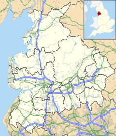
 Newton-in-Bowland
Newton-in-Bowland shown within LancashirePopulation 237 (2001 Census) OS grid reference SD697505 Parish Newton District Ribble Valley Shire county Lancashire Region North West Country England Sovereign state United Kingdom Post town CLITHEROE Postcode district BB7 Dialling code 01200 Police Lancashire Fire Lancashire Ambulance North West EU Parliament North West England List of places: UK • England • Lancashire Newton-in-Bowland is a village in Lancashire, England, formerly known as Newton-on-Hodder. It lies in the civil parish of Newton, which in 2001 had a population of 237, according to the United Kingdom Census.[1] The township covers almost 6000 acres of the Forest of Bowland.
The village pub - The Parkers Arms - takes its name from the neighbouring Parker family of Browsholme Hall. For many generations, the Parkers have served the Lords of Bowland as Bowbearers of the Forest of Bowland. The Parkers Arms is popular with tourists and locals alike. It serves modern British food and local ales and is renowned for sourcing much of its food from within the Bowland area. [2]
Contents
History
See also: Lordship of BowlandRecorded in Domesday as Neutone and part of the ancient parish of Slaidburn since Saxon times,[3] Newton has been a constituent part of the demesne of the Manor of Slaidburn since the second half of the fourteenth century.[4] A fall in the population resulting from the Black Death (1348-50) as well as the absorption of Bowland into the Duchy of Lancaster had led to wholesale manorial reorganisation during the 1360s. As a result, the Domesday manors of West Bradford and Grindleton - being part of the parish of Mitton - were also annexed into a new Liberty of Slaidburn, with the caput moving from Grindleton to Slaidburn.[5]
From the late eleventh century, the Manor of Slaidburn had formed part of the ancient Lordship of Bowland. That Lordship in turn comprised a Royal Forest and a Liberty of ten mesne manors spanning eight townships within four ancient parishes and covered an area of almost 300 square miles (800 km2) on the historic borders of Lancashire and Yorkshire. The manors within the Liberty of Bowland were Slaidburn (including Newton, West Bradford and Grindleton), Knowlmere, Waddington, Easington, Bashall, Mitton, Withgill (Crook), Leagram, Hammerton and Dunnow (Battersby).[5]
Two of the mesne manors of the Lords of Bowland remained within the bounds of the township of Newton after the fourteenth century but did not fall within the demesne of Slaidburn: Battersby was held by the eponymous Battersby family until the late sixteenth century. It was acquired and re-named Dunnow by a branch of the Shireburnes of Stonyhurst who held the manor until the time of the English Civil Wars. Much land being sold during this period, the Slinger family acquired the remnant which they held until 1728. Thereafter, the manor passed to Robert Parker, a relative of the Slingers, who sold it to the Wilkinsons in the early 1800s. The current Dunnow Hall dates from the nineteenth century. The last so-called Squire of Dunnow, John King-Wilkinson, died in May 2011.
Knowlmere was a mesne manor of the Lords of Bowland originally subinfeudated to the Savile family but held by the Hammertons from 1382. From at least the mid-thirteenth century, some thirty acres, the core of the estate, had been tenanted by the De Knoll family from which the manor takes its name. The Hammertons suffered severe penalties for Sir Stephen Hammerton's involvement in the Pilgrimage of Grace and their lands, including Knowlmere, were confiscated in 1537.[6] By this time, the manor of Knowlmere comprised "some eighteen farms and lesser holdings which included Birkett, Foulscales, Thorneyholme, Mossthwaite and other properties on the south side of the Hodder between Newton and Dunsop Bridge".[7] A portion of the original Knoll family holding, close to Burholme, appears to have been retained by the family until 1503 when it came into the possession of the Earls of Derby.[8] There has been some speculation that the mysterious Bogeuurde in Domesday - identified by Ekwall with Barge Ford, near Foulscales - may in fact be the manor of Knowlmere in its earliest manifestation.[9]
Title to the Manor and Liberty of Slaidburn, West Bradford and Grindleton, including the township of Newton, was bought by Tory MP, Ralph Assheton, later first Baron Clitheroe, in 1950.[10] In 1977, his second son, the Hon Nicholas Assheton, was granted title.[11] Since 2003, the Lord of the Manor and Liberty of Slaidburn has been Thomas Assheton, son of the Hon Nicholas Assheton and nephew of the second Baron Clitheroe.[12][5]
Newton was an early centre of Nonconformist religion. Richard Leigh of Birkett, the founder of Newton's first independent chapel in 1696, was closely associated with the great Congregationalist preacher Thomas Jollie.[13][14] Thomas Jollie's grandson, also Thomas, married Leigh's daughter while his nephew, John Jollie, served as Newton's first Congregationalist minister from 1696-1702. The old chapel was replaced by today's building in 1887. Newton also boasts an historic Quaker burial ground.[15]
Geography
The Roman road known as Watling Street, that runs from Manchester via Ribchester to Carlisle, passes in a NNE direction to the west of the village.
The River Hodder flows through Newton, joined by Easington Brook on the eastern edge of the village, and Foulscales Brook a little further south. The confluence of Foulscales Brook and the Hodder is the location of Barge Ford, considered to be the mysterious Bogeuurde mentioned in Domesday[16] and by some, linked to the early origins of the manor of Knowlmere. Close by sits Foulscales Farm, a fourteenth-century hall, the oldest dwelling in Bowland, tenanted by the Eastwood family, descendants of Richard Eastwood (d. 1871), Bowbearer of the Forest of Bowland and founder of St Hubert's Catholic Chapel, Dunsop Bridge.
Governance
The civil parish of Newton was created from the township of the same name in 1866. In 1938, the geographically non-contiguous division of Lower Easington was transferred to Newton.[17]
Media gallery
-

Newton Bridge
-

Footbridge over River Hodder
-

Newton Chapel
-

Dunnow Hall
-

The Parkers Arms
-

Quaker Burial Ground
References
C J Spencer and S W Jolly. "Bowland: the rise and decline, abandonment and revival of a medieval lordship". The Escutcheon: Journal of the Cambridge University Heraldic & Genealogical Society. http://www.forestofbowland.com/files/uploads/Escutcheon.pdf.
- ^ "Census 2001 : Parish Headcounts : Ribble Valley". Office for National Statistics. http://www.neighbourhood.statistics.gov.uk/dissemination/viewFullDataset.do?instanceSelection=03070&productId=779&$ph=60_61&datasetInstanceId=3070&startColumn=1&numberOfColumns=4&containerAreaId=790443. Retrieved 24-04-2011.
- ^ http://www.parkersarms.co.uk
- ^ Jenny Bradley, Slaidburn: A Walk through the Village (Slaidburn Village Archive 2011), p. 6
- ^ Slaidburn Court Rolls, 16th year of reign of Richard II, 1392/3, No 1: 8 membranes, 1 wrapper, Lancashire Record Office, DDHC1; William Farrer, Latin transcription (1900), Manchester City Archive
- ^ a b c Spencer and Jolly: Escutcheon Vol 15
- ^ RW Hoyle, The Pilgrimage of Grace and the Politics of the 1530s(Oxford University Press 2001)
- ^ J Porter, The Forest of Bowland: Its Landscape and History (Farnborough 1994), p. 37
- ^ Alice Peel, The Manor of Knowlmere (Privately published: Knowlmere 1913)
- ^ Eilert Ekwall, The Place-names of Lancashire (Manchester University Press: Manchester 1922)
- ^ HM Land Registry, 22 June 1950
- ^ HM Land Registry, 26 August 1977
- ^ HM Land Registry, LA937696, 1 June 2003; ownership of common land is registered under LA955806, LA955807, LA955808, LA955809
- ^ Henry Fishwick, ed., The Notebook of the Rev Thomas Jollie, AD 1671-1693 (Chetham Society: Manchester 1894)
- ^ William Bowland, The Lord and the Preacher http://www.forestofbowland.com/files/uploads/THE_LORD_AND_THE_PREACHER%20minus%20picture%20Nov%202010.pdf
- ^ Brian Dale, Bicentenary of Nonconformity in the Village of Newton in Bowland (Willliam Byles: Bradford 1897)
- ^ Eilert Ekwall, The Place-names of Lancashire (Manchester University Press: Manchester 1922)
- ^ "History of NEWTON". visionofbritain.org.uk. http://www.visionofbritain.org.uk/relationships.jsp?u_id=10457130&c_id=10001043. Retrieved 30-04-2011.
External links
Categories:- Villages in Lancashire
- Civil parishes in Lancashire
- Geography of Ribble Valley
- Forest of Bowland
-


Wikimedia Foundation. 2010.