- Newtonville, New York
-
Newtonville Hamlet Official name: Newtonville, New York Name origin: For early settler John M. Newton Country United States State New York Region Capital District County Albany Municipality Town of Colonie Elevation 367 ft (112 m) Coordinates 42°43′27″N 73°45′30″W / 42.72417°N 73.75833°W Settled 1840 Timezone EST (UTC-5) - summer (DST) EDT (UTC-4) ZIP Code 12128 (PO Box only); home delivery by 12211 or 12110 Area code 518 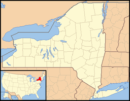
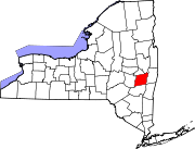
 Location of Newtonville within the state of New York
Newtonville is a hamlet in the town of Colonie in Albany County, New York, United States. Located along U.S. Route 9, the hamlet is just south of Latham and north of Loudonville. Colonie Town Hall is located in the hamlet of Newtonville.
Contents
History
 Newtonville Methodist Church
Newtonville is named after John M. Newton, an early landowner,[1] it was originally called Newton Corners.[2] Mr. Newton was in the business of manufacturing bricks, ceramics, and stove linings. He built the First Baptist Church in 1852, today it is the Newtonville Post Office and is on the National Register of Historic Places.[2] The first post office at Newtonville was established in 1850 and located in the store owned by John H. Kemp.[1] On October 27, 1887 the Rev. Dr. William Arthur, father of President Chester A. Arthur, died in Newtonville.[3] During the early 1900's Newtonville was a popular place in guide books catering to touring the countryside in early automobiles, such as- Scarborough's Official Tour Book (1918), Automotive Industries (1905), Albany Guide Book (1917), Automotive Blue Book (1921), Red Book: Interstate Automobile Guide, and the A.L.A. Green Book: Official Route Book (1920). In 1906 David Jeram began the Loudonville Autobus line with an 18 passenger Knox bus traveling between Latham's Corners and Albany with a stop at Newtonville.[4] In 1987 the Buhrmaster Barn, built in the 1800's along the Mohawk River was moved to Newtonville at the site of the historical museum, the Pruyn House. In 1997 the Verdoy Schoolhouse was also moved to that location.[5]
Geography
Newtonville is centered on the intersection of Maxwell Road and US Route 9 (New Loudon Road). As a hamlet its boundaries are indeterminate. Newtonville is generally determined to extend north on Route 9 to the intersection with Old Loudon Road, where the hamlet of Latham begins and west on Maxwell Road to include sections of Old Niskayuna Road.
Location

Interstate 87/Northway Hamlet of Latham Interstate 87/Northway Wolf Road Commercial District

 Hamlet of Newtonville

Hamlet of Loudonville Famous natives
- Rev. Dr. William Arthur, father of President Chester A. Arthur[3] and reverend of the Newtonville First Baptist Church[2]
References
- ^ a b George Rogers Howell and Jonathan Tenney (1886). Bi-centennial history of the county of Albany, New York from 1609-1886. W.W. Munsell & Co.. pp. 935–6. http://books.google.com/books?id=nWkJAQAAIAAJ&pg=PA936&dq=ireland%27s+corners+loudonville&lr=&cd=1#v=onepage&q=ireland%27s%20corners%20loudonville&f=false. Retrieved 2010-01-31.
- ^ a b c Francis Ingraham (1994-08-21). "Quiet Hamlet of Newtonville Continues to Grow". Albany Times Union. http://archives.timesunion.com/mweb/wmsql.wm.request?oneimage&imageid=5718139. Retrieved 2009-04-20.
- ^ a b Edmund Burke and James Dodsley (1887). Annual Register. p. 161. http://books.google.com/books?id=FXtdAAAAIAAJ&pg=RA5-PA161&dq=newtonville+william+arthur+annual+register&lr=&as_brr=1. Retrieved 2009-03-21.
- ^ The Horseless Age. January 3, 1906. p. 431 and 462. http://books.google.com/books?id=GgsAAAAAMAAJ&pg=PA462&dq=newtonville+loudonville&lr=&as_brr=1. Retrieved 2009-03-21.
- ^ "Pruyn House". Town of Colonie. http://www.colonie.org/pruyn. Retrieved 2009-03-21.
Municipalities and communities of Albany County, New York Cities Albany | Cohoes | Watervliet
Towns Berne | Bethlehem | Coeymans | Colonie | Green Island | Guilderland | Knox | New Scotland | Rensselaerville | Westerlo
Villages Altamont | Colonie | Green Island | Menands | Ravena | Voorheesville
CDPs Other
hamletsAlcove | Boght Corners | Clarksville | Crescent Station | Dunsbach Ferry | Elsmere | Feura Bush | Fort Hunter | Fullers | Glenmont | Guilderland | Guilderland Center | Karner | Latham | Lisha Kill | Loudonville | Mannsville | McKownville | New Salem | Newtonville | Normansville | Roessleville | Selkirk | Slingerlands | South Bethlehem | Verdoy | West Albany
Categories:- Hamlets in New York
- Colonie, New York
- Populated places in Albany County, New York


Wikimedia Foundation. 2010.