Niceto Pérez

Niceto Pérez
Niceto Pérez
—  Municipality  —
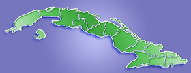
Niceto Pérez is located in Cuba
Location of Niceto Pérez in Cuba
Coordinates: 20°07′39″N 75°20′32″W / 20.1275°N 75.34222°W / 20.1275; -75.34222Coordinates: 20°07′39″N 75°20′32″W / 20.1275°N 75.34222°W / 20.1275; -75.34222
Country  Cuba
Province Guantánamo
Area[1]
 – Total 640 km2 (247.1 sq mi)
Elevation 60 m (197 ft)
Population (2004)[2]
 – Total 17,783
 – Density 27.8/km2 (72/sq mi)
Time zone EST (UTC-5)
Area code(s) +53-21

Niceto Pérez is a municipality and city in the Guantánamo Province of Cuba. It is located 10 kilometres (6.2 mi) west of the provincial capital, Guantánamo.

Demographics

In 2004, the municipality of Niceto Pérez had a population of 17,783.[2] With a total area of 640 km2 (250 sq mi),[1] it has a population density of 27.8 /km2 (72 /sq mi).

See also

References


Wikimedia Foundation. 2010.

Игры ⚽ Поможем написать реферат

Look at other dictionaries:

  • Niceto Pérez — 20.1275 75.34222 Koordinaten: 20° 8′ N, 75° 21′ W Niceto Pérez …   Deutsch Wikipedia

  • Niceto Pérez, Cuba — Infobox Settlement official name = Niceto Pérez other name = native name = nickname = settlement type = Municipality motto = imagesize = image caption = flag size = image seal size = image shield = shield size = city logo = citylogo size =… …   Wikipedia

  • Niceto Alcalá-Zamora — 6th …   Wikipedia

  • Jesús Urríos Pérez — (Villajoyosa, 22 de febrero de 1880 1936) fue un abogado y político valenciano. Inicialmente fue el jefe del sector romanonista del Partido Liberal en Villajoyosa, pero su candidatura fue derrotada por la de José Jorro Miranda en las elecciones… …   Wikipedia Español

  • VII Legislatura de la Asamblea Nacional del Poder Popular de Cuba — La VII Legislatura de la Asamblea Nacional del Poder Popular de Cuba está conformada por los diputados miembros de la misma. Inició sus funciones en 2008 y concluirá en 2013. Los diputados fueron electos para su cargo en las Elecciones de 2008… …   Wikipedia Español

  • Municipalities of Cuba — Cuba …   Wikipedia

  • Guantánamo — 20.138333333333 75.206111111111 Koordinaten: 20° 8′ N, 75° 12′ W Guantánamo …   Deutsch Wikipedia

  • CU-14 — Guantánamo (Provinz) Statistische Daten Hauptstadt: Guantánamo Fläche: 6.178 km² Einwohner: 507.300 Bevölkerungsdichte …   Deutsch Wikipedia

  • Guantánamo (Provinz) — Statistische Daten Hauptstadt: Guantánamo Fläche: 6.168 km² Einwohner: 510.706[1] …   Deutsch Wikipedia

  • La Maya — 20.173333333333 75.646388888889225Koordinaten: 20° 10′ N, 75° 39′ W …   Deutsch Wikipedia

Share the article and excerpts

Direct link
Do a right-click on the link above
and select “Copy Link”