- Normal Heights, San Diego
-
Normal Heights — Community of San Diego — Normal Heights sign Location within Central San Diego
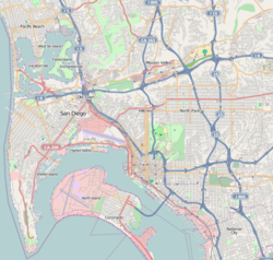
 Normal Heights
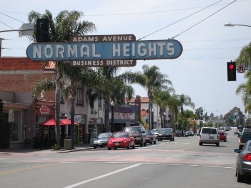
Coordinates: 32°45′48.09″N 117°07′08″W / 32.7633583°N 117.11889°W Country United States State California County County of San Diego City City of San Diego Normal Heights is a neighborhood of the mid-city region of San Diego, California. It is known for its affordable pubs, restaurants, coffee houses, antique shops, book shops, and burgeoning arts community.
Contents
History
The "Normal" part of "Normal Heights" refers to the State Normal School, which is the predecessor to San Diego State University (formerly located in nearby University Heights). The State Normal School building now serves as the Eugene Brucker Education Center, the central office for the San Diego Unified School District.
Geography
Normal Heights is centrally located in San Diego's hills above Mission Valley. Its borders are defined by Interstate 805 to the West, Interstate 8 to the North, Interstate 15 to the East, and El Cajon Boulevard to the South. The majority of "typical" neighborhood businesses are located along Adams Avenue. Some residents define the western border as the bridge where Adams Avenue crosses over Texas Street nine blocks west of Interstate 805; those who accept I-805 as the western border refer to the area between the bridge and the interstate as "Between Heights" because it is east of University Heights, whose eastern border is marked by the bridge, and west of Normal Heights (as defined by the western border being I-805). According to the City of San Diego this area is officially part of North Park.
Culture
Like other urban mesa neighborhoods north of Balboa Park, Normal Heights has a high rate of pedestrian activity and a unique mix of nationalities relative to the rest of San Diego. Three important neighborhood events take place in Normal Heights: The Adams Avenue Roots Festival, The Adams Avenue Street Fair, and Art Around Adams. The Adams Avenue Roots Festival is typically held the last weekend in April, featuring American, Latin, British, and various other European folk styles played live for free. The Adams Avenue Street Fair, Southern California's largest free music festival, is typically held the last weekend in September. Art Around Adams is a local community art event where unique and talented artists showcase their work inside and outside interesting little businesses and spaces along Adams Avenue. The stretch of Adams Avenue between Texas Street on the west and Ohio Street on the east is sometimes referred to as Antique Row, due to the large quantity of antique stores along that stretch (some area residents consider Antique Row to be part of the "Between Heights" neighborhood; see the "Geography" section for clarification).
Education
- Adams Elementary School (San Diego Unified School District)
- Normal Heights Elementary (San Diego Unified School District)
External links
- Normal Heights Neighborhood web site
- Between Heights Community web site
- Adams Avenue Business Association web site
- Art Around Adams
Neighborhoods of San Diego Northern Bay Ho · Bay Park · Carmel Valley · Clairemont · Del Mar Heights · Del Mar Mesa · La Jolla · La Jolla Village · Mission Beach · North City · Pacific Beach · Pacific Highlands Ranch · Torrey Hills · Torrey Pines · University City · Village of La JollaNortheastern Black Mountain Ranch · Carmel Mountain Ranch · Mira Mesa · Miramar · Rancho Bernardo · Rancho Encantada · Rancho Peñasquitos · Sabre Springs · San Pasqual Valley · Scripps Ranch · Sorrento Valley · Sorrento Mesa · Torrey HighlandsEastern Birdland · Kearny Mesa · Mission Valley East · Navajo (Allied Gardens · Del Cerro · Grantville · San Carlos) · Serra Mesa · TierrasantaWestern Burlingame · Hillcrest · Linda Vista · Midtown · Mission Hills · Mission Valley West · Morena · North Park · Ocean Beach · Old Town · Point Loma (La Playa · Liberty Station · Loma Portal · Midway · Point Loma Heights · Roseville-Fleetridge · Sunset Cliffs · Wooded Area) · University HeightsCentral Downtown (Columbia · Core · Cortez Hill · East Village · Gaslamp Quarter · Harborview · Little Italy · Marina) · Balboa Park · Bankers Hill · Barrio Logan · Golden Hill · Grant Hill · Logan Heights · Middletown · Sherman Heights · South Park · StocktonMid-City Adams North · Azalea/Hollywood Park · Castle · Cherokee Point · Chollas Creek · City Heights · Colina del Sol · College Area · Corridor · Darnall · El Cerrito · Fairmont Park · Fox Canyon · Gateway · Islenair · Kensington · Normal Heights · Oak Park · Ridgeview · Redwood Village · Rolando · Swan Canyon · Talmadge · Teralta · WebsterSoutheastern Alta Vista · Bay Terraces · Broadway Heights · Chollas View · Emerald Hills · Encanto · Jamacha-Lomita · Lincoln Park · Mountain View · Mount Hope · Paradise Hills · Shelltown · Skyline · Southcrest · Valencia ParkSouthern Border · Egger Highlands · Nestor · Ocean View Hills · Otay Mesa · Otay Mesa West · Palm City · San Ysidro · Tijuana River ValleyCoordinates: 32°45′48.09″N 117°07′08.00″W / 32.7633583°N 117.11889°W
Categories:- Neighborhoods in San Diego, California
- Urban communities in San Diego, California

Wikimedia Foundation. 2010.