- North Dardanelle, Arkansas
-
North Dardanelle, Arkansas — Unincorporated community — North Dardanelle's position in Arkansas.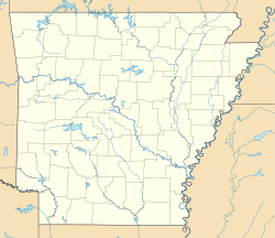
 North Dardanelle, Arkansas
Coordinates: 35°13′46″N 93°08′29″W / 35.22944°N 93.14139°WCoordinates: 35°13′46″N 93°08′29″W / 35.22944°N 93.14139°W Country  United States
State  Arkansas
County Pope Elevation 110 m (361 ft) Time zone Central (CST) (UTC-6) – Summer (DST) CDT (UTC-5) GNIS feature ID 77859 North Dardanelle, Arkansas is an unincorporated community in Illinois Township, Pope County, Arkansas, United States.[1]
References
Municipalities and communities of Pope County, Arkansas Cities Atkins | Dover | London | Russellville

Towns Unincorporated
communitiesAppleton | Augsburg | Bernice | Bethel | Bullfrog Valley | Buttermilk | Caglesville | Center Valley | Economy | Galla Rock | Georgetown | Happy Bend | Holla Bend | Lost Corner | Mill Creek | Moreland | New Hope | Nogo | Norristown | North Dardanelle | Oak Grove | Piney | Pleasant Valley | Raspberry | Retta | Ross | Sand Gap | Scotia | Scottsville | Shiloh | Silex | Simpson | Smyrna | Solo | Tag | Taral | Tilly | Treat | Victor | Walnut Grove | Welcome | Wilson | Worthen
Townships Bayliss | Burnett | Center | Clark | Convenience | Dover | Freeman | Galla | Griffin | Gum Log | Illinois | Jackson | Liberty | Martin | Moreland | Phoenix | Smyrna | Valley | Wilson
Categories:- Populated places in Pope County, Arkansas
- Unincorporated communities in Arkansas


Wikimedia Foundation. 2010.