- Northern Woods and Water Route
-
Northern Woods and Water Route

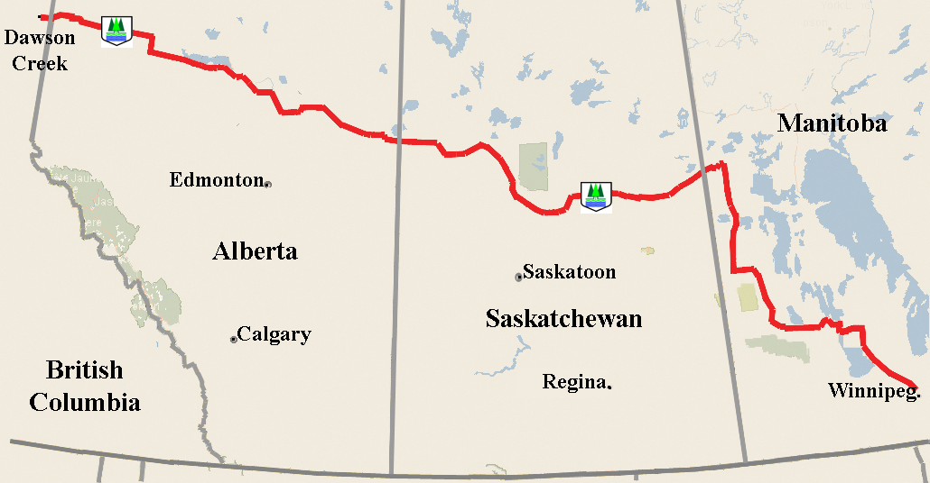
Route information Length: 2,400 km[1] (1,491 mi) Major junctions West end:  BC 97 at Dawson Creek, British Columbia
East end: Winnipeg Perimeter Highway-PTH 101 at Winnipeg, Manitoba Location Major cities: Dawson Creek, British Columbia; Athabasca, Alberta; Prince Albert, Saskatchewan; The Pas, Manitoba, Dauphin, Winnipeg, Manitoba Highway system British Columbia provincial highways
Provincial highways in Alberta
Provincial highways in Saskatchewan
Manitoba provincial highwaysThe Northern Woods and Water Route is a 2,400-kilometre (1,500 mi) route through northern British Columbia, Alberta, Saskatchewan and Manitoba. As early as the 1950s community groups came together to establish a northern travel route; this was proposed as the Northern Yellowhead Transportation Route. The Northern Woods and Water Route Association was established in 1974, and encouraged promotion of the route with the promise of an increase in tourist travel.[2] The route was designated in 1974 and is well signed throughout the connector highways. The route starts at Dawson Creek at the British Columbia Spirit River Highway 49 and ends at Winnipeg, Manitoba, running through the northern region of the western provinces.[3] The Northern Woods and Water Route (NWWR) includes connector routes from west to east including British Columbia Highway 49, Alberta Highway 49, AB Hwy 2A, AB Hwy 2, AB Hwy 55, Saskatchewan Highway 55, SK Hwy 9, Manitoba Provincial Road 283, Manitoba Highway 10, MB PTH 5, MB PTH 68, MB PTH 6. The halfway point of the NWWR is approximately at Goodsoil, Saskatchewan[4]
Fur traders and early settlers utilised the rivers and Red River cart roads such as Long Trail until the early 1900s when the railroad and bush planes supplemented travel to this northern boreal transition area. Corduroy roads provided a means for early land vehicles to cross over muskeg and swamp. Horse drawn ploughs filled low areas, settlers hauled gravel and cleared bush for the road ways surveyed along high elevations following lake and river shore lines. Municipalities would grade and gravel roads providing transportation between trading centres. The all weather road arrived alongside of the NWWR association's impetus for a travel and tourism corridor along the northern area of the western provinces. Traffic volume along the route is a major factor to determine highway classification, surface type, and construction upgrades.
Contents
Travel Route
British Columbia
In British Columbia (BC), the route starts within 17.6 kilometres (10.9 mi) of the BC and Alberta (AB) border in Dawson Creek at the intersection of BC Hwy 2 and British Columbia Spirit River Highway 49 west. The northern section of BC Hwy 97 is the Alaska Highway, and the southern sections are the Okanagan Highway, Cariboo Highway, and John Hart Highway from south to north, as well, BC Hwy 2 is known as Tupper Highway. The British Columbia Spirit River Highway 49 is the route designated in BC as the NWWR.
Alberta
The NWWR continues east into Alberta on Highway 49, the Spirit River Highway. Alberta Highway 49 contributes 19.5 kilometres (12.1 mi) to the NWWR in northwestern Alberta between Donnelly and the Alberta and BC border. The town of Spirit River's population is just over 1,000 and is supported by agriculture and the oil and gas industry creating an annual average daily traffic (AADT) near Spirit River that is about 2,000 vehicles per day vpd.[5][6]
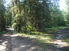
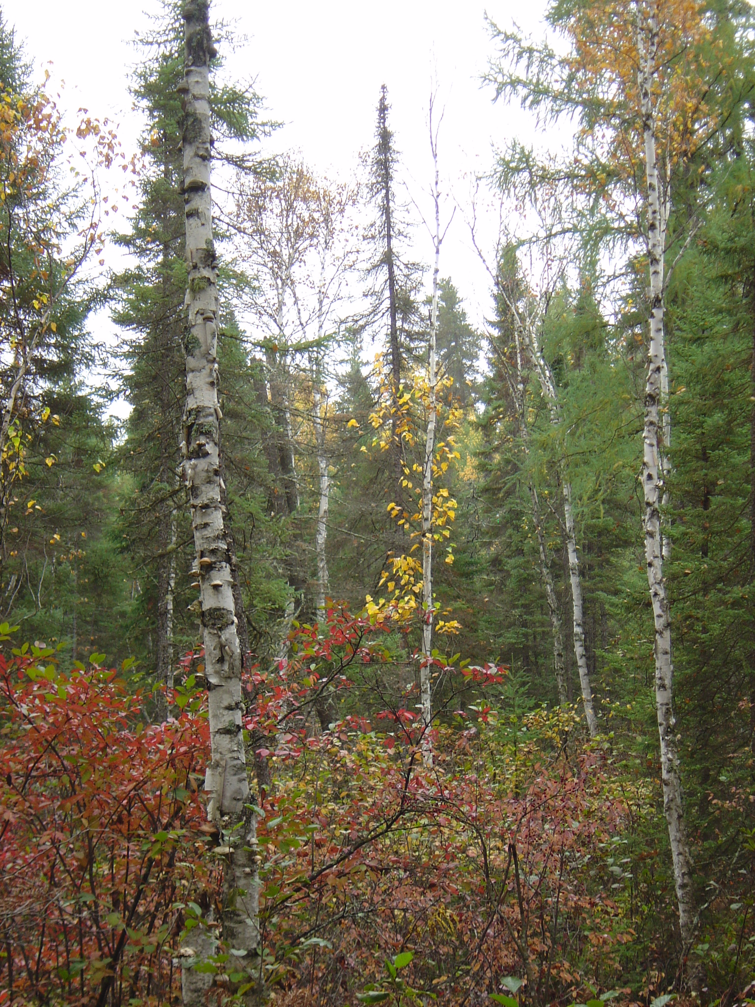
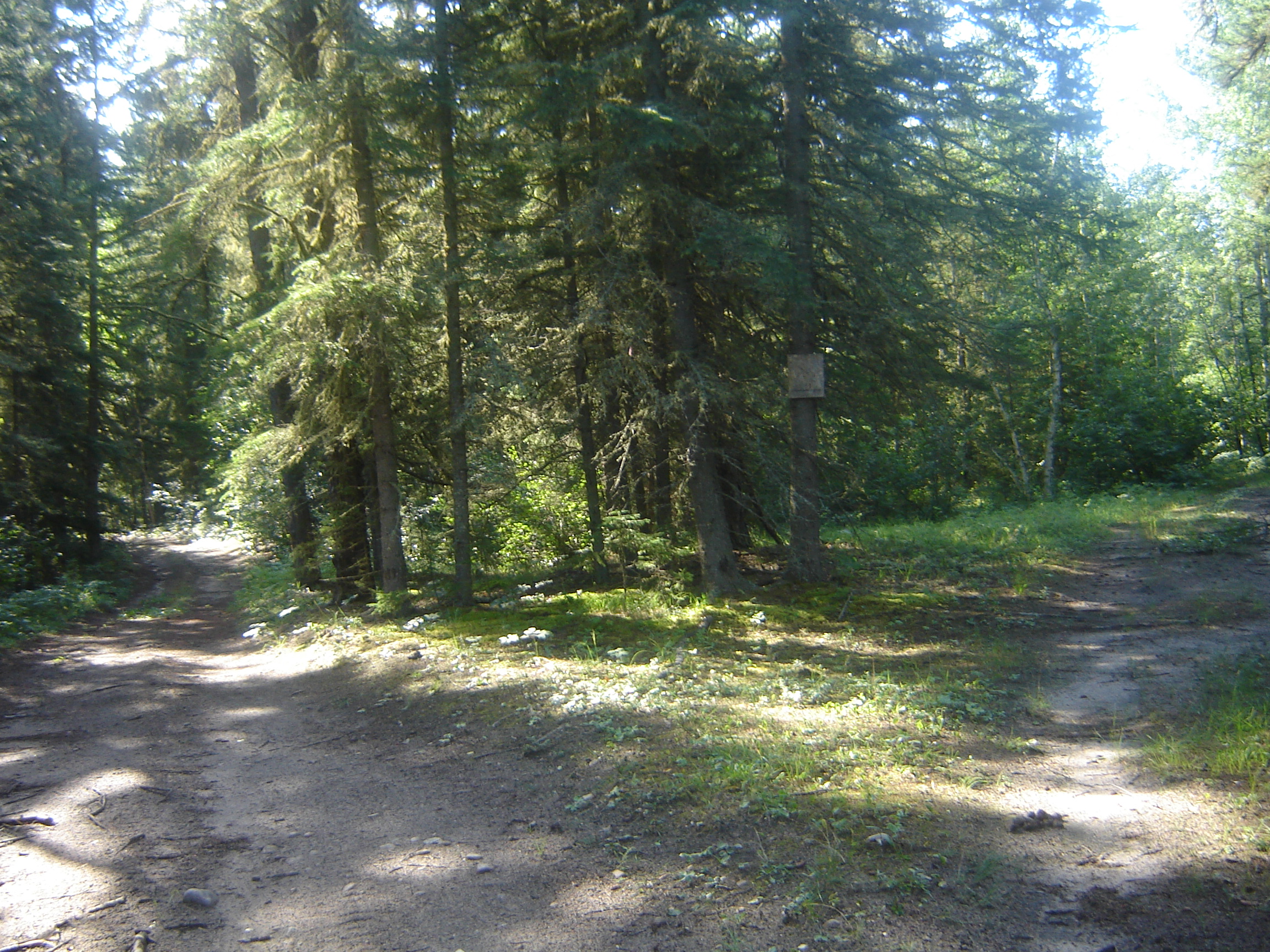
 Boreal forest
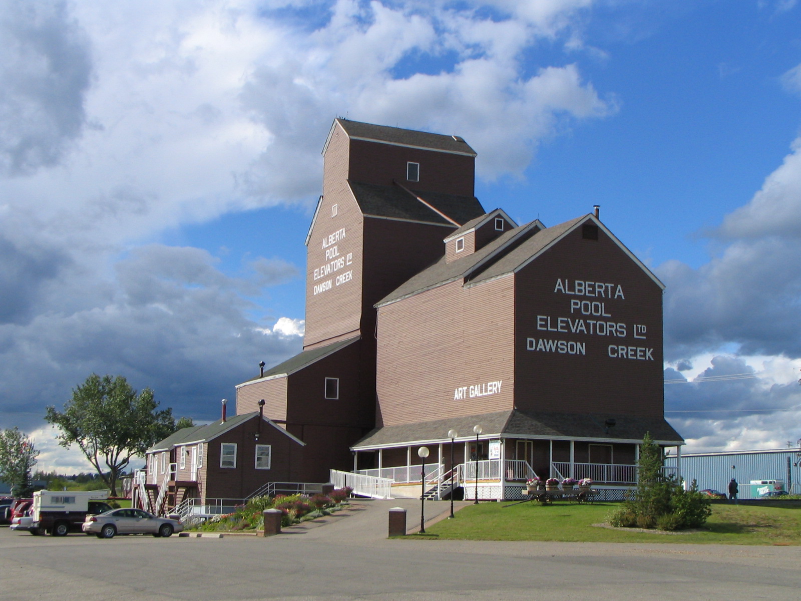
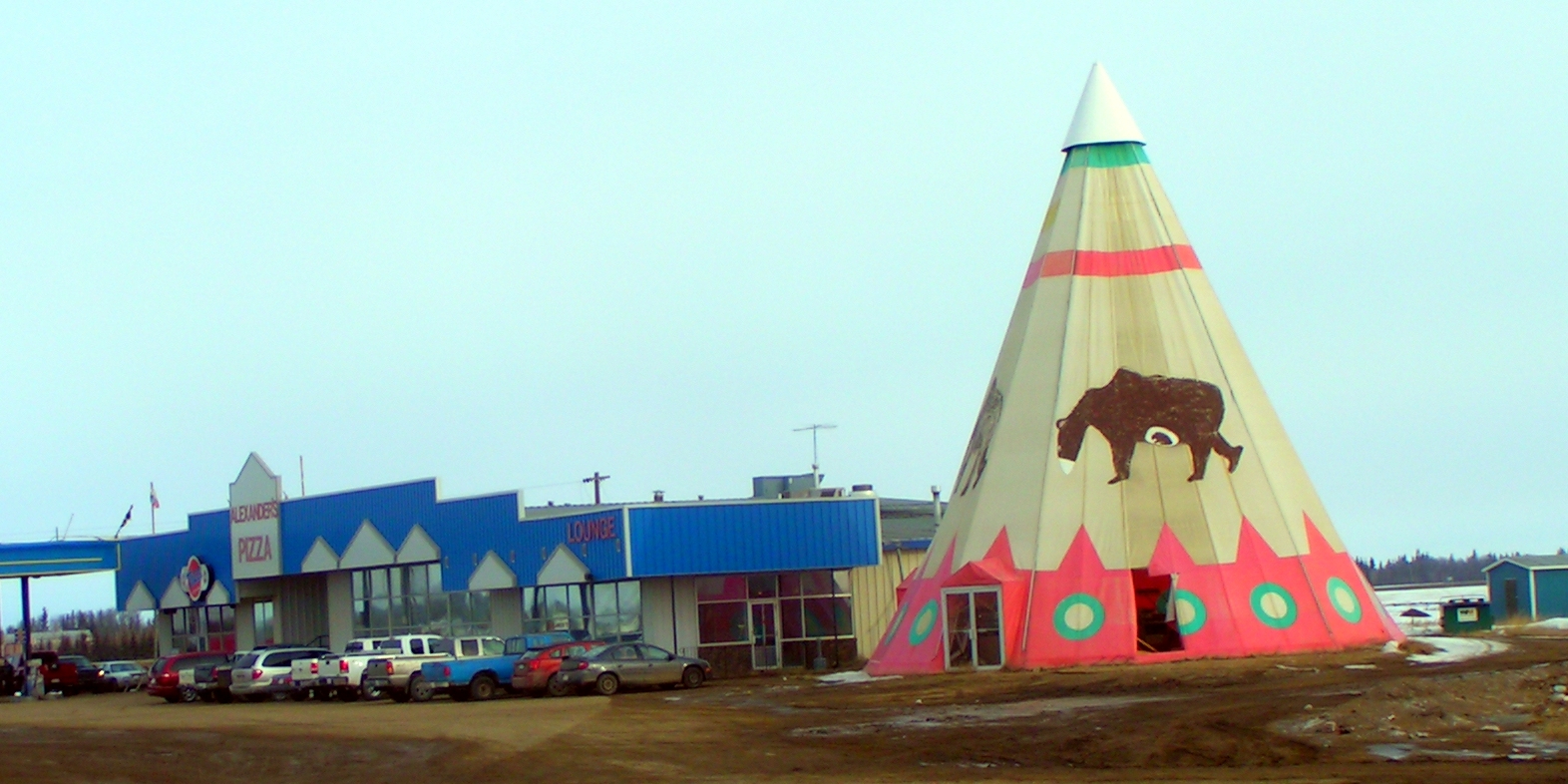
To the south is the Spirit River, a tributary of the Peace River, which is to the north.[1] The village of Rycroft, "The Hub of the Peace", has a population over 600, and welcomes travellers with their tourism booth in a giant teepee at the junction of Highway 49 and Highway 2 where the traffic volume increases to about 3,000 vpd.[5][7] Wanham Grizzly Bear Prairie Museum is located at the junction of Highway 49 and Highway 773, where the AADT declines to about 1,000 vpd for the village of Wanham, which has a population around 600.[5][8] Watino is an unincorporated area within Birch Hills County and the traffic volume declines to between 800 to 900 vpd.[9] Bad Heart River is a tributary of the Peace River and flows through Watino. Donnelly is near the junction of Highway 49 and Highway 2 and is also west of Kimiswan Lake.[10] At Donnelly, traffic volume rises to around 1,800, and the NWWR turns south before arriving at Highway 2A.[5] The next connecting highway along the NWWR is Highway 2. One route would be to follow Highway 2 west from Donnelly to McLennan whenceforth it turns south through Kathleen and intersection Highway 679 until the junction with Highway 2A when the route turns east. This route following Highway 2 through McLennan is 49.9 kilometres (31.0 mi). McLennan holds Northern Woods and Water Route caravans every August.[11] The other route would be to follow Highway 2A, a designated alternative route to Highway 2, by turning south at Donnelly staying on Highway 49 until the eastern turn on Highway 2A. This branch from Donnelly till the connection with Highway 2 is 312.2 kilometres (194.0 mi). From Donnelly to Athabasca, Alberta, Highway 2 contributes 56.5 kilometres (35.1 mi) to the NWWR scenic route across the western provinces. High Prairie on the West Prairie River is west of the intersection of Highway 749 and Highway 2, where traffic jumps to about 7,000 vpd.[5][12] Enilda a small hamlet on the East Prairie River is a part of Big Lakes Municipal district.[13] Driftpile is a community on the Driftpile River within the Drift Pile River 150 Indian reserve.[9][14]
The Hill and Hollow Campsite and Bay Shore Resort Inc. are located at Faust, which is located on the south shore of Lesser Slave Lake along Highway 2.[15] Within the Municipal district of Lesser Slave River No. 124 is the small hamlet of Wagner.[9] Canyon Creek, Widewater and Slave Lake, “The Jewel of the North", are also on Lesser Slave Lake.[16]
 Lesser Slave Lake
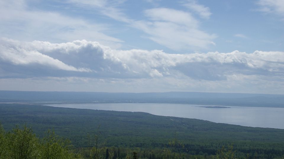
The town of Athabasca, "Land of the Whispering Hills", on the Athabasca River has a population over 2,500 and marks the transition between the NWWR connector routes Highway 2 and Highway 55. Traffic volume around Athabasca ranges from 6,000 to 8,000 vpd according to AADT traffic counts at various areas.[17][18] Lac La Biche is located south of Lac la Biche and Beaver Lake on the junction of Highway 36 and Highway 55, where traffic remains around 7,000 vpd.[5] Sir Winston Churchill Provincial Park on Lac la Biche is to the north of the NWWR at this point.[19] Rich Lake is in Lac La Biche County municipal district, and the traffic volume declines to around 800 vpd.[5][18] La Corey, Beaver Crossing are along Highway 55, which is an asphalt highway and has yearly maintenance.[20]
Saskatchewan
Saskatchewan (SK) has six travel corridors of which the Northern Woods and Water Route is the most northerly.[21] The NWWR begins its journey in north western SK on SK Hwy 55, which crosses 670.9 kilometres (416.9 mi) of northern Saskatchewan. Pierceland, a small hamlet of the Beaver River No. 622 rural municipality (RM), is located at the junction of SK Hwy 55, SK Hwy 950 north and SK Hwy 21 south where traffic volume is around 1,000 vpd.[9] The unincorporated area of Peerless, is located at the junction of SK Hwy 55 and SK Hwy 26 which bears a traffic volume between 600 to 70 vpd.[22]
 Meadow Lake Provincial Park
Goodsoil, the approximate halfway point of the NWWR is located on SK Hwy 26 6.2 kilometres (3.9 mi) north of the NWWR enroute to the Meadow Lake Provincial Park. Rapid View is an unincorporated area of the RM of Meadow Lake No. 588 RM.[9] The town of Meadow Lake is located on the north-western shore of Meadow Lake where the AADT is approximately 1,700 to 2,500 vpd.[22][23] Green Lake, located at the intersection of SK Hwy 55] and SK Hwy 155, is at the northern tip of Green Lake. Traffic volume is considerably higher west of Green River at about 900 vpd dropping to about 350 to the east.[22][24] Between Green Lake and Shellbrook, the NWWR bears south east skirting around the western edge of the Prince Albert National Park. The NWWR follows the eastern shoreline of Cowan Lake until the southern tip at Big River which is just west of Delaronde Lake, and the highway volume at this point is about 1,000 vpd.[22][25] Big River No. 555 RM provides civic administration to Bodmin.[9] Debden, a village of about 350, is at the SK Hwy 55 and SK Hwy 793 junction where traffic volume is about 850 vpd to the north and around 1,200 vpd to the south of the intersection.[9][22] Polwarth, at the SK Hwy 55 and SK Hwy 793 south junction, is a hamlet of Canwood No. 494 RM. The village of Canwood, population of about 350, is located between Polwarth and the town of Shellbrook. Shellbrook is at the intersection of SK Hwy 55 and SK Hwy 240 where the AADT increases to about 2,000 vpd.[22][26] At Shellbrook, the 42.5 kilometres (26.4 mi) concurrency with SK Hwy 3 begins and the multiplex ends in Prince Albert. Crutwell, a hamlet of Shellbrook No. 493 RM, is located south of the NWWR, and north of the North Saskatchewan River. On the NWWR, at Crutwell, the traffic volume rises to about 3,100.[22] At the city of Prince Albert SK Hwy 55 connects with SK Hwy 3 and SK Hwy 2. Traffic volume west of the city is about 4200 vpd, whereas east of the city the AADT drops to approximately 2,090 vpd.[22] Prince Albert, located on the North Saskatchewan River, is within 89.8 kilometres (55.8 mi) of the Prince Albert National Park.[27]
Meath Park is a village of about 200 at the junction of SK Hwy 55, SK Hwy 255 and SK Hwy 120 where the traffic volume is heaviest west towards Prince Albert at about 2,000 vpd, and the AADT trickles down to 1,000 vpd east of Meath Park.[9][22] The NWWR is located in the Boreal transition ecoregion which features agricultural fields on the parkland mixed with dense taiga and sparse population. Over the next 37.5 kilometres (23.3 mi) there are three small unincorporated areas with populations less than 100; Weirdale is found in the Garden River No. 490 RM; Foxford in Paddockwood No. 520, RM; and Shipman of Torch River No. 488 RM.[9] At the SK Hwy 55 and SK hwy 255 junction is the village of Smeaton, and at the SK Hwy 55 and SK Hwy 691 junction is the hamlet of Snowden. Choiceland is 1-kilometre (0.62 mi) north of the SK Hwy 55] and the SK Hwy 6 national highway intersection. Garrick is a part of Torch River No. 488 RM and Love, a village of around 60, marks a turn south east for the NWWR. White Fox, a village of about 375 is near the SK Hwy 55 and SK Hwy 35 intersection where the traffic volume raises to 1,700 vpd.[22] At the intersection, the NWWR turns south and a 12 kilometres (7.5 mi) concurrency begins until the town of Nipawin. Nipawin on the Saskatchewan River, and near both Tobin Lake and Codette Lake is home to the Northern Woods and Water Route Association.[28][29] West of Nipawin until the SK Hwy 23 intersection the traffic volume remain around 1,300 vpd and following the intersection to the east the traffic falls to about 400 vpd. There are no communities along the SK Hwy 9 route which contributes 40 kilometres (25 mi) to the entire NWWR. At the junction between SK Hwy 55 and Sk hwy 9, the AADT is less than 100 vpd.[22][30]
Manitoba
Travel along the NWWR enters Manitoba via the MB PR 283 west ending at The Pas, a town of about 5,500 where the AADT increases to 980 vpd.[31] MB PR 283 provides 38.6 kilometres (24.0 mi) of the NWWR where the economy has been supported by the fur trade, trapping, mining, fishing, logging and agricultural industries.[32]:35 The Pas, which has not yet incorporated as a city (requisite population of 5,000), is located south of the Saskatchewan River and south of the Clearwater Provincial Park and Cormorant Provincial Forest.[33]
Travel along the NWWR out of The Pas continues south along MB PTH 10 and continues on MB PTH 10 for 411.6 kilometres (255.8 mi). Pasquia River flows through The Pas, and travels west of the NWWR until it turns west to Saskatchewan near Westray. Freshford and Westray are both within the Kelsey RM.[9] Overflowing River, a small community with less than 100 residents is a part of the Unorganized Division No. 21. Overflowing River community is located on the Overflowing River and at the north-west tip of Dawson Bay of Lake Winnipegosis whereas Makefing is east of the Porcupine Provincial Forest. Bellsite, Novra, and Birch River are all small unorganised areas of Mountain (North) RM located west of Swan Lake. Bowsman with a population of over 300, is the next largest village along the NWWR after The Pas.[9][34]
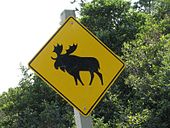 Moose Crossing sign on MB PTH 10
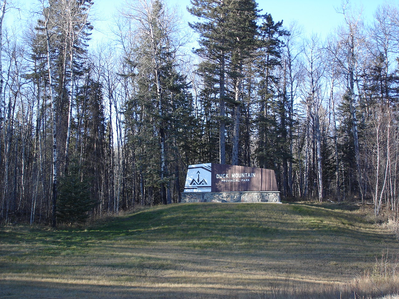
Swan River, in the Swan River valley, is between the Duck Mountains and Porcupine Mountains. North of Swan River, the AADT increases to about 2,000 vpd and the NWWR changes course at Swan River and bears east.[31][35] Minitonas is on the Favel River and at the junction of MB PTH 10 and MB PR 366 south. West of MB PTH 10 and MB PR 268 north intersection, traffic volume is over 1,100 vpd, and east of MB PR 268 traffic declines to about 750 vpd.[31] Renwer is a small community found in the Minitonas RM. The MB PTH 10 and MB PTH 20 intersection is located at the hamlet of Cowan in Mountain (South) RM and here the NWWR resumes its route south. Sclater and Pine River two places with populations less than 100 are also found in Mountain (South) RM. The NWWR is to the east of Duck Mountain Provincial Park and Duck Mountain Provincial Forest and west of Lake Winnipegosis. Garland is located at the intersection of MB PR 489 east, MB PR 367 west, MB PTH 10A and MB PTH 10. Ethelbert, a small hamlet of the Ethelbert RM, is located at the intersection of MB PR 269 west, MB PR 274 south and MB PTH 10. The AADT along MB PTH 10 declines to about 680 vpd near this intersection.[31]
Ashville is located north of the MB PTH 10 and MB PTH 5 junction in this parkland area of Gilbert Plains, RM. The NWWR continues east along the MB PTH 5, using this connector route for a total of 40 kilometres (25 mi).[9] The city of Dauphin is located north of Riding Mountain National Park and south of Dauphin Lake. Near this city, the traffic volume jumps to 2,750 vpd, with the heaviest day of the week being Friday, and the highest volume occurring between April and October during daylight hours.[31][36] Ochre River is located at the junction of MB PTH 10 and MB PR 582 south of Rainbow Beach Provincial Park.[37] Ste. Rose du Lac, a town of about 1,000, is at the intersection of MB PTH 5, MB PTH 68 and MB PR 276. Near this intersection, the traffic volume declines to around 1,800 vpd.[31] At Ste. Rose du Lac, cattle capital of Manitoba, the NWWR continues west on MB PTH 68 and this connector highway will carry the NWWR for 128.2 kilometres (79.7 mi).[38] Shergrove is located close to the turn off north from the easterly direction of MB PTH 68. Ebb and Flow Lake is east of Eddystone which is part of Alonsa RM. Wapah, another small community, is between Ebb and Flow Lake, and Lake Manitoba. Siglunes RM administrates civic affairs for Vogar which is south of Dog Lake. At Vogar the NWWR returns to an east direction. At Mulvihill the NWWR turns south and the 10.4 kilometres (6.5 mi) concurrency between MB PTH 68 and MB PTH 6 begins.
At Eriksdale, MB PTH 68 turns east and the concurrency between MB PTH 68 and MB PTH 6 ends, however the NWWR continues on MB PTH 6 in a southerly direction for the final 135.6 kilometres (84.3 mi) leg of the travel corridor. Deerhorn is found in the Eriksdale, RM. The NWWR continues south along PTH 6 and parallel to the eastern shores of Lake Manitoba. Lundar and Clarkleigh are both located in Coldwell, RM. The unincorporated area of Lundar is located at the intersection of MB PR 418 east, PTH 6, and MB PR 419. MB PR 419 west provides access to the Lundar Beach Provincial Park. The hamlet of Clarkleigh is located at the intersection of MB PTH 6, and MB PR 229 east. Oakpoint is at the intersection of MB PTH 6, and MB PR 419, and St. Laurent is at MB PTH 6 and MB PR 415.
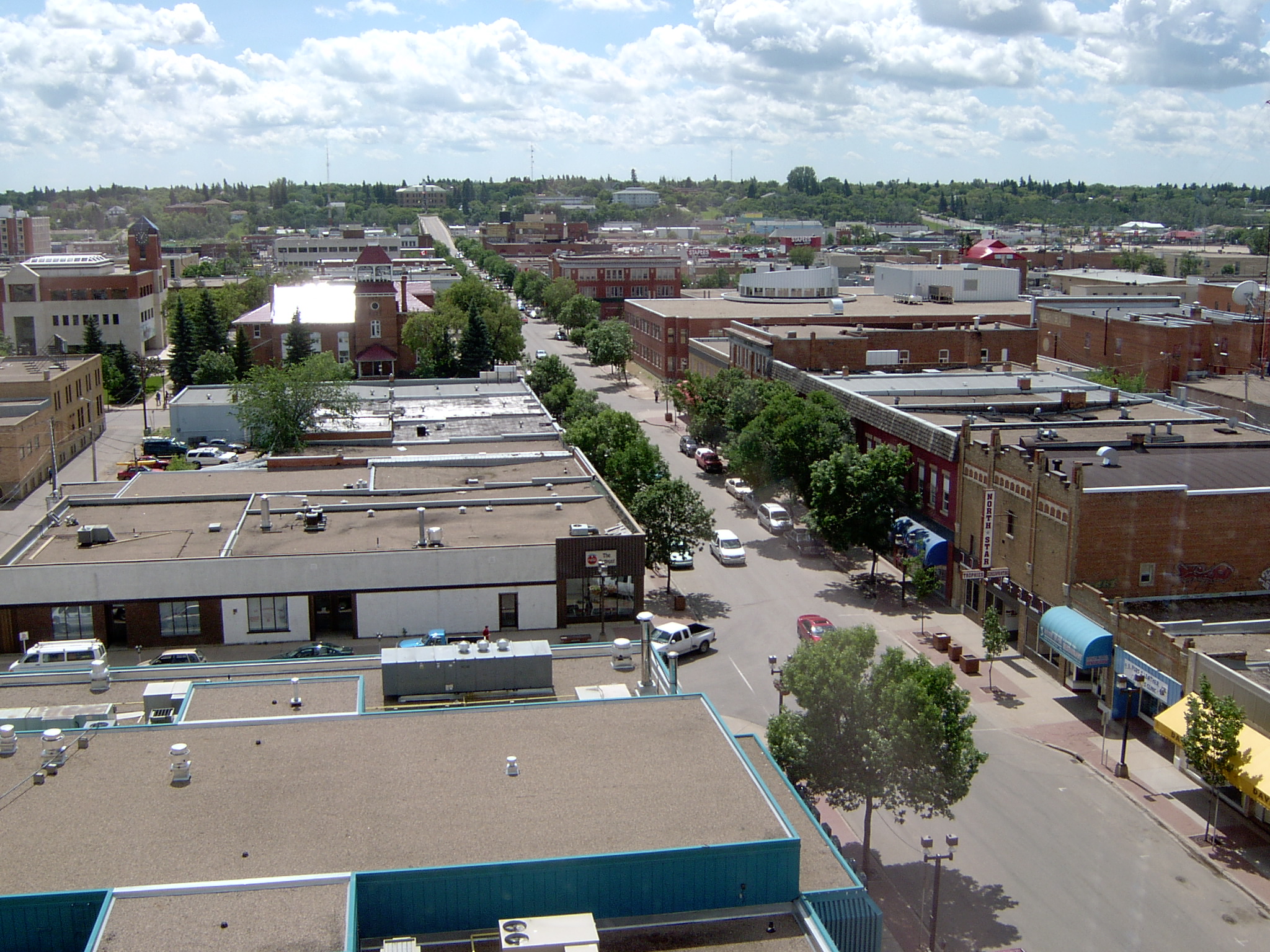
 Winnipeg, Manitoba
The hamlet of Lake Francis is located west of West Shoal Lake. Both Woodlands and Warren are unincorporated areas with small populations below 100 of Woodlands RM. The AADT along the NWWR increases to over 2,500 vpd near these communities.[31] Woodlands is at thei intersection of PTH 6 and MB PR 518 and Warren is located at MB PTH 67 and MB PTH 6. Grosse Isle is the last hamlet along NWWR before arriving at Perimeter Highway, the PTH 101 around Winnipeg, the ending terminus of the NWWR.[39][40]
History
 Boreal forest
The Long Trail followed the Peace River 100 miles (160 km)530 across northern AB. As the flow of traffic increased due to the fur trade industry along the Long Trail, stopping places developed providing rest and food for travelers. In 1923, the three routes out of Lac La Biche were to the west, which corresponds to the route of AB Hwy 55 along the south shores of Lesser Slave Lake. Edmonton or Saddle Lake trail departed to the south, which would be the initial stages of AB Hwy 55 out of Lac La Biche.[41] Heart Lake trail traveled northeast from Lac La Biche, which would form a base for secondary AB Hwy 858. Work was done on the Athabaska Trail to make it passable for motor traffic as many roads had been graded.[42] Before stopping places developed, caches were set up at stopping points along the way.[41] Before the arrival of rails the waterways such as the Lesser Slave Lake near Athabasca, Alberta and the Saskatchewan River near Prince Albert were traversed by long boat, canoe, and steamship.[43] The rail did not reach the northern areas until the early twentieth century due to the geological hurdles of mountains, muskeg, swamp, boreal forest, and river systems to traverse.[41] A huge flood in 1899 near The Pas left no ground to walk upon, yet the railway track construction work began in 1906, with more continuing in 1911.[32] In 1928, the Canadian Pacific Railway (CPR) surveyed their line across the Saskatchewan River near Prince Albert, and contractors started work on the bridge. The upper deck served the train, and the lower deck was built for highway traffic opening for vehicles in 1932.[43] In 1929, travel was overland on trails, and rivers were forded in many places.[44]
As early as 1896 oil wells were drilled at Athabasca supplementing the rich soils and grain growing economy. There was a rush of settlers to the area in the early 1900s, at this time transportation for goods was freighted on Lesser Slave Lake to connecting river routes or via early rail lines overland.[45] Fortune seekers during the gold rush of 1896 traveled north through Edmonton or took the rail as far north as Prince Albert. The westerly route proceeded from Prince Albert to Green Lake, and from there to the Long Trail by following the Beaver River to the Churchill River, Athabaska, Slave and Mackenzie rivers until bearing north following the rivers of the Yukon to Dawson City.[46]
The first garage to service McLaughlin cars opened in High River as early as 1909. In 1912 travelers could stop here at a filling station for their automobiles. This same year the speed limit through town was not over ten miles per hour (16 km/h) and not over five miles per hour (8 km/h) upon approaching another horse or pedestrian, the fine was not more than C$50.00.[nb 1][47][48][49] [50] The Pas, Manitoba saw its first car arrive in 1916, yet it had been active with fur trading posts and explorers in the area since 1741.
Settlers would not only haul gravel for the new roadways, but they also cleared brush for the road allowance.[51] Early roads did not follow the road allowances of the Dominion Land Survey, but rather kept to higher ground, however due to the nature of the Boreal transition ecoregion, muskegs and swamps still needed to be traversed. The first pioneers filled these watery areas with branches and brush and proceeded along their trip. Later corduroy roads were built across these areas were traffic got mired in the mud. A corduroy road consisted of logs laid across the road as a rail tie is across the rail line, however the logs were placed one against another and mud filled between the logs for a smoother surface. One log provided about 6 inches (15 cm) of roadway, so only the worst areas were constructed in this fashion.[52]
Debden, Saskatchewan had a horse and caboose taxi for settlers as early as 1912 providing regular trips to Prince Albert and taking children to school. In 1945, the taxi service was provided by automobile.[53] Bush planes arrived in the 1920s to the northern bus areas providing communication in an era where travel was limited when the snow fell, or the water froze.[32] In 1968, High Prairie was looking forward to hard surface construction for AB Hwy 2 which would supplement the economic trading base with tourism.[54] A new bridge across the Saskatchewan River at Prince Albert was erected in 1974, and caused re-routing of the highway by one and a half miles (2.4 km).[43] Community groups came together as early as the 1950s to establish a northern travel route.
The early name proposed for these travel corridor was the Northern Yellowhead Transportation Route. The Northern Woods and Water Route Association was established in 1974, their further promotion of the route was to increase tourist travel.[2] George R. Stephenson (1916–2003), of McLennan was one of the first facilitators to organise the Northern Woods and Water Route across Western Canada in 1974.[55] Henry Andres was chairman of the Northern Woods and Water Association for eight years wherein the association worked on placing NWWR signs both on provincial highways and maps. Brochures promoting tourism were printed, and the association sponsored more than five cavalcades where wagons would traverse the route between Winnipeg and Dawson Creek promoting tourism and the creation of the travel corridor. On August 21, 1975, one of these Northern Woods and Water Cavalcades stopped at Nipawin Regional Park and toured Nipawin.[43][43]:304
Current engineering concerns would be to determine maintenance of the current travel corridor and construction upgrades. The route does contain a variety of road surfaces ranging from asphalt concrete, thin membrane surface (TMS), granular pavements and gravel highway.[56] Insight into current surface texture, traffic volume, traffic speed, percentage of loaded trucks, climate variations, construction costs and time as well as available materials will affect upgrade procedures.[57] The entire route is paved except for a Class 4 gravel highway segment between Nipawin and the Manitoba border.[2][58] Here the traffic volume declines to 80 and 85 vpd and two checkpoints near the Manitoba border.[22][59]
Major intersections from west to east
Province Location Km[1] Roads intersected Notes British Columbia Dawson Creek 0 BC Hwy 49/
BC Hwy 2 /
BC Hwy 97BC AB border 17.6 BC Hwy 49/
AB Hwy 49/NWWR exits BC and enters AB Alberta Rycroft 106.2 AB Hwy 49/
 AB Hwy 2
Donnelly 211.2 AB Hwy 49/
Here the NWWR can continue on AB Hwy 2 or take AB Hwy 2A 243.3  AB Hwy 2A/
270.8 AB Hwy 2A/
AB Hwy 2359.6 AB Hwy 2/
Slave Lake 400.2 AB Hwy 2
462.2 AB Hwy 2
Athabasca 535.9 AB Hwy 2
567.3
 AB Hwy 63 South
592.8
AB Hwy 63 North652.7
La Corey 741.3
AB SK border 801.1
SK Hwy 55/55
Travel corridor exits AB and enters SK Saskatchewan Pierceland 823.9 SK Hwy 55/55
SK Hwy 21 South21865.0 SK Hwy 55/55
SK Hwy 2626Goodsoil is north of the route Meadow Lake 932.1 SK Hwy 55/55
SK Hwy 4 South4Green Lake 985.5 SK Hwy 55/55
SK Hwy 155 North155Shellbrook 1150.9 SK Hwy 55/55
SK Hwy 3/3
SK Hwy 4040west end of concurrency between SK Hwy 3 and SK Hwy 55 Prince Albert 1195.7 SK Hwy 55/55
SK Hwy 3/3
SK Hwy 22east end of concurrency between SK Hwy 3 and SK Hwy 55 Meath Park 1237.9 SK Hwy 55/55
SK Hwy 120/120
SK Hwy 355355Smeaton 1276.6 SK Hwy 55/55
SK Hwy 106106Choiceland 1298.0 SK Hwy 55/55
SK Hwy 66Nipawin 1339.0 SK Hwy 55/55
SK Hwy 35351367.7 SK Hwy 55/55
SK Hwy 23231473.8 SK Hwy 55/55
SK Hwy 99SK MB border 1512.0 SK Hwy 55/55
NWWR exits SK and enters MB Manitoba 1535.6
MB PR 282The Pas 1550.6
1625.2
1705.6
Swan River 1781.8
1831.3
1937.4
1961.7
2001.7
MB PR 2762081.1
MB PR 325 North2129.9
north end of concurrency between MB PTH 6 and MB PTH 68 Eriksdale 2141.1
south end of concurrency between MB PTH 6 and MB PTH 68 Woodlands 2220.0
MB PR 411/
MB PR 248Winnipeg 2265.5 /
MB PTH 1011.000 mi = 1.609 km; 1.000 km = 0.621 mi See also
Notes
- ^ C$50,00 from 1912 is equivalent to $1.1 thousand in present day terms.
References
- ^ a b c Microsoft Corporation Redmond Washington. Microsoft Streets and Tips (Map) (2004 ed.).
- ^ a b c Johnston, Mark (October 31, 2006). "Working Proposal Development" (doc). Prince Albert Model Forest Proposal Submission. http://mfiqlx.sasktelwebhosting.com/pubs/PAMFCP%20Proposal%20-%20Final.doc. Retrieved 209-02-11.
- ^ "Northern Woods and Water Route, Canada". PlanetWare Inc. 1995-2009. http://www.planetware.com/canada/northern-woods-and-water-route-cdn-bc-nwwr.htm.
- ^ "Village of Goodsoil". Plazma Website Design. http://www.goodsoil.sasktelwebsite.net/. Retrieved 2009-02-11.
- ^ a b c d e f g "Traffic Volumes at Points on the Highwayr". Alberta Highways 1 to 986 Traffic Volume History (1998-2007). Government of Alberta. 1995 - 2008. http://www.transportation.alberta.ca/2639.htm. Retrieved 2009-02-11.
- ^ "Town of Spirit River". The Town of Spirit River, Alberta, Canada. 2009. http://www.townofspiritriver.ca/. Retrieved 2009-02-11.
- ^ Connors, Ken (2009). "Rycroft, Alberta". Discover the Peace. http://www.discoverthepeacecountry.com/htmlpages/rycroft.html. Retrieved 2009-02-11.
- ^ Connors, Ken (2009). "Wanham, Alberta". Discover the Peace. http://www.discoverthepeacecountry.com/htmlpages/wanham.html. Retrieved 2009-02-11.
- ^ a b c d e f g h i j k l "Community Profiles". Statistics Canada. Government of Canada. 2006. http://www12.statcan.ca/census-recensement/2006/dp-pd/prof/92-591/index.cfm?Lang=E. Retrieved 2009-02-11.
- ^ Connors, Ken (2009). "Donnelly, Alberta". Discover the Peace. http://www.discoverthepeacecountry.com/htmlpages/donnelly.html. Retrieved 2009-02-11.
- ^ Connors, Ken (2009). "McLennan, Alberta". Discover the Peace. http://www.discoverthepeacecountry.com/htmlpages/mclennan.html. Retrieved 2009-02-11.
- ^ Connors, Ken (2009). "High Prairie, Alberta". Discover the Peace. http://www.discoverthepeacecountry.com/htmlpages/highprairie.html. Retrieved 2009-02-11.
- ^ "The Signing of Treaty No. 8 - Enilda, Alberta - Alberta Heritage". Waymarking.com. 2009. http://www.waymarking.com/waymarks/WM5REJ. Retrieved 2009-02-11.
- ^ "Alberta First Nations Home". 500 Inc.. 1999-2009. http://500nations.com/Alberta_Tribes.asp. Retrieved 2009-02-11.
- ^ "Alberta First Nations Where to Stay". Faust Campgrounds. World Web Technologies Inc.. 1994-2009. http://www.northernalberta.worldweb.com/Faust/WheretoStay/Campgrounds/. Retrieved 2009-02-11.
- ^ "Slave Lake". Municipal Township of Slave Lake. 2004. http://www.slavelake.ca/Rainbow/. Retrieved 2009-02-11.[dead link]
- ^ "Athabasca, Alberta". Municipal Township of Slave Lake. 2004. http://www.town.athabasca.ab.ca/. Retrieved 2009-02-11.
- ^ a b "Alberta Road Map RV Travel Guide: #55 Alberta Highway #55 AB/SK Border to City of Athabasca". Mile By Mile Media. 2007. http://www.milebymile.com/main/Canada/Alberta/State_55/Canada_Alberta_road_map_travel_guides.html. Retrieved 2009-02-11.
- ^ "Lac La Biche". The Lac La Biche Regional Community Development Corporation. Lc La Biche Region. http://www.laclabicheregion.com/index.php?id=72. Retrieved 2009-02-11.[dead link]
- ^ [http:/ /coldlake.infomall.ca/ "InfoMall - Cold Lake, Alberta"]. Nemtek.net. 2007. http:/ /coldlake.infomall.ca/. Retrieved 2009-02-11.
- ^ "Getting to Saskatchewan, Airports, Rail, Road, Water, Air Travel". 2009. World Travel Guide - Nexus Business Media. A. http://www.worldtravelguide.net/country/243/international_travel/North-America/Saskatchewan.html. Retrieved 209-02-11.
- ^ a b c d e f g h i j k l "Highway Traffic Volume Map trafficvolume-2007.pdf ( 1.5 MB )" (Have to rename file as a pdf to open and view). Highways and Infrastructure About Highways/Saskatchewan Maps. Saskatchewan Government. 2007. http://www.highways.gov.sk.ca/adx/aspx/adxGetMedia.aspx?DocID=227,81,1,Documents&MediaID=1386&Filename=trafficvolume-2007.pdf. Retrieved 2009-02-08.[dead link]
- ^ "InfoMall - Cold Lake, Alberta". Town of Meadow Lake Meadow Lake, Saskatchewan. 2009. http://www.meadowlake.ca/. Retrieved 2009-02-11.
- ^ "Northern Village". Northern Village, Green lake, Saskatchewan, CANADA.. 2009. http://www.nvgreenlake.ca/. Retrieved 2009-02-11.
- ^ "Big River SK and Region". Northern Village, Green lake, Saskatchewan, CANADA.. 2009. http://www.bigriver.ca/. Retrieved 2009-02-11.
- ^ "iCompass Technologies Inc.". Shellbrook, SK. 2006. http://www.shellbrook.net/siteengine/activepage.asp. Retrieved 2009-02-11.
- ^ "City of Prince Albert Home". City of Prince Albert. 2008. http://www.citypa.ca/. Retrieved 2009-02-11.
- ^ "Town of Nipawin". Nipawin.com. http://www.nipawin.com/index.php?mw=1024. Retrieved 2009-02-11.
- ^ "Northern Woods and Water Route -". Tourism Saskatchewan. Government of Saskatchewan. http://www.sasktourism.com/places-to-go/road-trips/northern-woods-and-water-route. Retrieved 2009-02-11.
- ^ "Manitoba Road Map RV Travel Guide: #68 The Northern Woods and Water Route Manitoba Road Map Travel Guide". 2007. Mile By Mile Media. http://www.milebymile.com/main/Canada/Saskatchewan/State_55_2/Canada_Saskatchewan_road_map_travel_guides.html. Retrieved 2009-02-11.
- ^ a b c d e f g "Manitoba Highway Traffic Information System (MHTIS)". 2007 Traffic Report. University of Manitoba Transport Information Group. 1995 - 2008. http://umtig.mgmt.umanitoba.ca/. Retrieved 2009-02-11.
- ^ a b c The Pas Manitoba (1971) (Digitised online by Our Roots Nos Racines). Fiftieth Anniversary, 1912 - 1962, The Pas, Manitoba, Canada: golden jubilee celbrations, August 24, 25, 26, 1962. University of Calgary, Université Laval. pp. 17. http://www.nosracines.ca/e/page.aspx?id=4062867. Retrieved 2009-02-18.
- ^ "The Pas Area". 2006 - 2009. Township of The Pas. http://www.thepasarea.com/. Retrieved 2009-02-11.
- ^ "Manitoba Community Profiles - Community Profile:Village of Bowsman". 2006 - 2009. Government of Manitoba. http://www.communityprofiles.mb.ca/cgi-bin/csd/index.cgi?id=4620052. Retrieved 2009-02-11.[dead link]
- ^ Solonyka, Ed. "Town of Swan River". 1999 - 2006. emediawebsites.com. http://swanrivermanitoba.ca/. Retrieved 2009-02-11.
- ^ "Dauphin". Dauphin Economic Development. 2003-2005. http://www.dauphin.ca/. Retrieved 2009-02-11.
- ^ "Ochre River.". R.M. of Ochre River Community Profile:. Government of Manitoba. http://www.communityprofiles.mb.ca/cgi-bin/csd/index.cgi?id=4617045. Retrieved 2009-02-11.[dead link]
- ^ "Ochre River.". Town of Ste Rose du Lac. Government of Manitoba. http://www.town.sterosedulac.mb.ca/. Retrieved 2009-02-11.
- ^ "Manitoba Road Map RV Travel Guide: #68 The Northern Woods and Water Route Manitoba Road Map Travel Guide". 2007. Mile By Mile Media. http://www.milebymile.com/main/Canada/Manitoba/Parkway_68/Canada_Manitoba_road_map_travel_guides.html. Retrieved 209-02-11.
- ^ "New Page 0". 2002-2003. Aliner Owners Club. http://www.alinerclub.org/alaskatrip_pierre.htm. Retrieved 209-02-11.
- ^ a b c Spirit River History Book Committee (2006) (Digitised online by Our Roots Nos Racines). Chepi sepe:Spirit River: the land, the people. University of Calgary, Université Laval. pp. 35–42. http://www.nosracines.ca/e/page.aspx?id=3712710. Retrieved 2009-02-18.
- ^ Hotchkiss, C.F. (1923) (Digitised online by Our Roots Nos Racines). Lac la Biche District Alberta: a guide for intending settlers : compiled information obtained on land classification surveys.. University of Calgary, Université Laval. pp. 35–42. http://www.nosracines.ca/e/page.aspx?id=863091. Retrieved 2009-02-18.
- ^ a b c d e Nipawin Historical Society (2006) (Digitised online by Our Roots Nos Racines). Bridging the Years: Nipawin Saskatchewan. University of Calgary, Université Laval. pp. 78–84. http://www.nosracines.ca/e/page.aspx?id=3712710. Retrieved 2009-02-18.
- ^ Lac La Biche Heritage Society (1971) (Digitised online by Our Roots Nos Racines). Lac La Biche: yesterday and today. University of Calgary, Université Laval. pp. 38. http://www.nosracines.ca/e/page.aspx?id=3610704. Retrieved 2009-02-18.
- ^ Oppen, William A (1971) (Digitised online by Our Roots Nos Racines). Athabasca Landing. University of Calgary, Université Laval. pp. 73–75. http://www.nosracines.ca/e/page.aspx?id=3619248. Retrieved 2009-02-18.
- ^ Abrams, Gary William DAvid (1971) (Digitised online by Our Roots Nos Racines). Prince Albert: the first century, 1866-1966. University of Calgary, Université Laval. pp. 109–110. http://www.nosracines.ca/e/page.aspx?id=545759. Retrieved 2009-02-18.
- ^ Consumer Price Index (estimate) 1800–2008. Federal Reserve Bank of Minneapolis. Retrieved December 7, 2010.
- ^ "A History of the Canadian Dollar". Le Site De Justiceplus - The Justiceplus Site. http://www.justiceplus.org/thedollar.htm. Retrieved 2008-12-28. Rationale to use US currency converson template. $10 Canadian was equivalent to US$10 gold eagle 1851-1867. 1879-1914 the US and Canadian dollar traded again at par.
- ^ "The Canadian Dollar under the Gold Standard (1854-1914)" (pdf). Bank of Canada. http://www.bankofcanada.ca/en/dollar_book/1854-1914.pdf. Retrieved 2008-12-28. Rationale to use US currency converson template. Bank of Canada notes that from 1854-1914 the US and Canadian dollar traded at par.
- ^ originally pbulished McAra Presses (1971) (Digitised online by Our Roots Nos Racines). Spitzee Days. University of Calgary, Université Laval. pp. 118. http://www.nosracines.ca/e/page.aspx?id=4388. Retrieved 2009-02-18.
- ^ Ewanchuk, M (1988) (Digitised online by Our Roots Nos Racines). Pioneer Settlers: Ukrainians in the Dauphin Area, 1896 - 1926. University of Calgary, Université Laval. pp. 160. http://www.nosracines.ca/e/page.aspx?id=2614. Retrieved 2009-02-18.
- ^ Griffith, David (1967 online publication 2006) (Digitised online by Our Roots Nos Racines). Notes on the Goodridge and area. University of Calgary, Université Laval. http://www.nosracines.ca/e/page.aspx?id=3538426. Retrieved 2009-02-18.
- ^ Debden History Book Association (1985) (Digitised online by Our Roots Nos Racines). Memories to Stay, 1912-1985: History of Debden and area. University of Calgary, Université Laval. pp. 39. http://www.nosracines.ca/e/page.aspx?id=4388. Retrieved 2009-02-18.
- ^ Farm Women's Union of Alberta Centennial Book Committee (1968) (Digitised online by Our Roots Nos Racines). Pioneers who Blazed the Trail: a history of High Prairie and district (The Foundations and its Builders). University of Calgary, Université Laval. pp. 317. http://www.nosracines.ca/e/page.aspx?id=4388. Retrieved 2009-02-18.
- ^ "George R. Stephenson, 1916-2003". South Peace News Obituary. 1999-2003. http://www.southpeacenews.com/obituaries/georgerstephenson.html. Retrieved 209-02-11.
- ^ Gerbrandt, Ron (2000). "Guidelines must be followed strictly - No exceptions". Effect of Cold-[in-place recycling on the Heavyweight Trucking Industry. 6th International Conference on Heavy Vehicle Weights and Dimension Proceedings. http://engrwww.usask.ca/entropy/tc/publications/pdf/cirheavyweighttruckingpostedfinalpdf.pdf. Retrieved 2009-01-25.
- ^ Gransberg, Douglas D. (2005) (Digitised online by Google books). Chip Seal Best Practices. National Cooperative Highway. Transportation Research Board. pp. 13–20. ISBN 0309097444, 9780309097444. http://books.google.ca/books?id=gTCHtuGENwQC&dq=Chip+Seal+Best+Practices&printsec=frontcover&source=bl&ots=aasxrb4p_f&sig=-Mv9yWOzDTOBfqwazscYcMQInz8&hl=en&ei=I6uhSa_ZEozaNP3WuOIL&sa=X&oi=book_result&resnum=3&ct=result#PPA15,M1. Retrieved 2009-02-25.
- ^ "2007-08 Saskatchewan Highway Surface Type surface.pdf (302 KB)" (Have to rename file as a pdf to open and view). Highways and Infrastructure About Highways/Saskatchewan Maps. Saskatchewan Government. 2007. http://www.highways.gov.sk.ca/adx/aspx/adxGetMedia.aspx?DocID=227,81,1,Documents&MediaID=1461&Filename=surface.pdf.
- ^ "2007-08 Road Classification Map 2007-08 Road Classification.pdf (424.5 KB)" (Have to rename file as a pdf to open and view). Highways and Infrastructure About Highways/Saskatchewan Maps. Saskatchewan Government. 2007. http://www.highways.gov.sk.ca/adx/aspx/adxGetMedia.aspx?DocID=227,81,1,Documents&MediaID=1500&Filename=2007-08+Road+Classification.pdf. Retrieved 2009-02-08.[dead link]
Further reading
- The Northern Woods & Water Route : Highway Guide By Northern Woods and Water Route Association, Northern Woods and Water Route Association, Published by Victory Impressions, 1994, 35 pages
- A Study of the Inter-Provincial Northern Woods and Water Route: Phase 1 Published by Consortium 4, 1976
- Canada By Andrea Schulte-Peevers Edition: 9, illustrated Published by Lonely Planet, 2005 ISBN 1740597737, 9781740597739 912 pages - Page 530
- Historic Trails Alberta by Mark Anderako. Gelnbow Alberta Institute, Historical Paper N. 2, Kelly, L.V. North with Peace River Jim.
- Grourard - Peace River Trail by Edith Van Kleek. 'Our Trail North'
- The Land of the Lobstick, the log of a canoe journey in The Pas district of northern Manitoba
External links
- Lac la Biche (Alberta)
- Canadian Highway Markers
- World Country Guide
- Town of McLennan Alberta
- Attractions and Events Rural Municipality of Ochre River
- EcoInformatics International Inc.
- 2006 Agriculture Community Profiles Bodmin, Big River RM
Provincial highways of Saskatchewan Primary 1 · 2 · 3 · 4 · 5 · 6 · 7 · 8 · 9 · 10 · 11 · 12 · 13 · 14 · 15 · 16 · 16A · 16B · 17 · 18 · 19 · 20 · 21 · 22 · 23 · 24 · 25 · 26 · 27 · 28 · 29 · 30 · 31 · 32 · 33 · 34 · 35 · 36 · 37 · 38 · 39 · 40 · 41 · 41A · 42 · 43 · 44 · 45 · 46 · 47 · 48 · 49 · 51 · 52 · 54 · 55 · 56 · 57 · 58 · 60 · 80 · 99Northern Secondary 201 · 202 · 209 · 210 · 211 · 212 · 219 · 220 · 221 · 224 · 225 · 229 · 240 · 247 · 255 · 263 · 264 · 265 · 271 · 301 · 302 · 303 · 304 · 305 · 306 · 307 · 308 · 309 · 310 · 312 · 316 · 317 · 318 · 320 · 321 · 322 · 324 · 332 · 334 · 335 · 339 · 340 · 342 · 343 · 349 · 350 · 354 · 355 · 357 · 358 · 361 · 362 · 363 · 364 · 365 · 367 · 368 · 369 · 371 · 373 · 374 · 375 · 376 · 377 · 378 · 379 · 381 · 394 · 396 · 397600s (north-south) 600 · 601 · 603 · 604 · 605 · 606 · 610 · 611 · 612 · 614 · 615 · 616 · 617 · 619 · 620 · 621 · 623 · 624 · 627 · 628 · 630 · 631 · 633 · 635 · 637 · 638 · 639 · 640 · 641 · 642 · 643 · 644 · 645 · 646 · 647 · 649 · 650 · 651 · 653 · 654 · 655 · 656 · 657 · 658 · 659 · 660 · 661 · 662 · 663 · 664 · 665 · 667 · 668 · 669 · 670 · 671 · 672 · 673 · 674 · 675 · 676 · 677 · 678 · 679 · 680 · 681 · 682 · 683 · 684 · 685 · 686 · 687 · 689 · 690 · 691 · 692 · 693 · 694 · 695 · 696 · 697 · 698 · 699700s (east-west) 702 · 703 · 704 · 705 · 707 · 709 · 711 · 715 · 716 · 717 · 718 · 720 · 721 · 722 · 724 · 725 · 726 · 727 · 728 · 730 · 731 · 732 · 733 · 734 · 735 · 737 · 738 · 741 · 743 · 745 · 747 · 749 · 751 · 752 · 753 · 754 · 755 · 756 · 758 · 761 · 762 · 763 · 764 · 766 · 767 · 768 · 771 · 772 · 773 · 776 · 777 · 778 · 780 · 781 · 782 · 783 · 784 · 785 · 786 · 787 · 788 · 789 · 790 · 791 · 792 · 793 · 794 · 795 · 796 · 797 · 798 · 799900s (northern) 903 · 904 · 905 · 908 · 909 · 910 · 911 · 912 · 913 · 914 · 915 · 916 · 917 · 918 · 919 · 920 · 921 · 922 · 923 · 924 · 925 · 926 · 927 · 928 · 929 · 930 · 931 · 932 · 933 · 934 · 935 · 936 · 937 · 938 · 939 · 940 · 941 · 942 · 943 · 945 · 946 · 950 · 951 · 952 · 953 · 954 · 955 · 956 · 962 · 963 · 964 · 965 · 966 · 967 · 968 · 969 · 970 · 980 · 981 · 982 · 983 · 984 · 994 · 995 · 999Highways in Alberta 
Expressways
and FreewaysNamed
HighwaysAnthony Henday · Bicentennial · Bighorn · Bow Valley Parkway · Bow Valley Trail · Buffalo · Cowboy · Crowsnest · David Thompson · Devonian Way · Dinosaur · Forestry Trunk · Grizzly · Hoo Doo Trail · Icefields Parkway · Mackenzie · Northern Woods and Water Route · Parkland · Poundmaker · Queen Elizabeth II · Red Coat Trail · Sherwood Park Freeway · Stoney · Trans-Canada · Veterans Memorial · Yellowhead1-216 Series 1 · 1A · 1X · 2 · 2A · 3 · 3A · 4 · 5 · 6 · 7 · 8 · 9 · 10 · 10X · 11 · 11A · 12 · 13 · 13A · 14 · 15 · 16 · 16A · 17 · 18 · 19 · 20 · 20A · 21 · 22 · 22X · 23 · 24 · 25 · 26 · 27 · 28 · 28A · 29 · 31 · 32 · 33 · 35 · 36 · 37 · 38 · 39 · 40 · 41 · 41A · 42 · 43 · 44 · 45 · 47 · 49 · 50 · 52 · 53 · 54 · 55 · 56 · 58 · 59 · 60 · 61 · 62 · 63 · 64 · 64A · 66 · 68 · 69 · 72 · 88 · 93 · 93A · 100 · 201 · 216Categories:- British Columbia provincial highways
- Alberta Primary Highways, 1-216 series
- Saskatchewan provincial highways
- Manitoba provincial highways
- Geography of Alberta
- Geography of Manitoba
- Geography of Saskatchewan
- Historic trails and roads in Canada


Wikimedia Foundation. 2010.