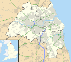
Northumberland Park, Tyne and Wear
- Northumberland Park, Tyne and Wear
-
Coordinates: 55°02′00″N 1°34′00″W / 55.033333°N 1.566667°W / 55.033333; -1.566667
Northumberland Park is a newly built village in the Metropolitian Borough of North Tyneside. Although built as an individual settlement along the A19 corridor, it is often now referred to as being part of Shiremoor.
There are 2 main housing estates in Northumberland park and a Metro Station.
Economy
There are a number of retail outlets in Northumberland park situated next to the Metro Station. the main outlet is a purpose build Sainsbury's.
Categories:
- Villages in Tyne and Wear
Wikimedia Foundation.
2010.
Look at other dictionaries:
Tyne and Wear Metro — Overview Type Rapid transit/light rail … Wikipedia
Tyne and Wear — Infobox England county name = Tyne and Wear motto = status = Metropolitan county Ceremonial county origin = 1974(Local Government Act 1972) region = North East England arearank = Ranked 44th area km2 = 540 ons = 2D nutscode = 2 nuts3 = UKC22/23… … Wikipedia
Tyne and Wear Passenger Transport Executive — Nexus Type Passenger Transport Executive Founded Transport Act 1968 (as Tyneside PTE) Headquarters Nexus House, St James Boulevard … Wikipedia
Civil parishes in Tyne and Wear — A map of Tyne and Wear, showing the Metropolitan Boroughs: (1) Gateshead; (2) Newcastle upon Tyne; (3) North Tyneside; (4) South Tyneside; and (5) Sunderland. A civil parish is a subnational entity, forming the lowest unit of local government in… … Wikipedia
List of Tyne and Wear Metro stations — The following is a list of Tyne and Wear Metro stations.Purpose built stationsThe following stations were built specifically for the Tyne and Wear Metro system.* Airport (opened 17 November 1991) * Bank Foot (opened 10 May 1981) * Bede (opened 24 … Wikipedia
List of Sites of Special Scientific Interest in Tyne and Wear — There are 36 Sites of Special Scientific Interest (SSSIs) in Tyne and Wear, England. As of 2008, of the 36 designated sites, ? have been designated due to their biological interest, ? due to their geological interest, and ? for both. [cite web |… … Wikipedia
Ryton, Tyne and Wear — infobox UK place country = England official name= Ryton latitude= 54.9729 longitude= 1.7634 population = around 8,000 metropolitan borough= Gateshead metropolitan county= Tyne and Wear region= North East England constituency westminster= Blaydon… … Wikipedia
List of High Sheriffs of Tyne and Wear — Below is an incomplete list of High Sheriffs of Tyne and Wear since the creation of that county in 1974.1974 2000*1974 1975: Fuller Mansfield Osborn, CBE, of 9 Furzefield Road, Gosforth, Newcastle upon Tyne… … Wikipedia
Northumberland Park Metro station — Northumberland Park … Wikipedia
Northumberland Park station — may refer to: Northumberland Park Metro station, Tyne and Wear, England, United Kingdom Northumberland Park railway station, London, England, United Kingdom This disambiguation page lists articles associated with the same title. If an … Wikipedia
 Northumberland Park