- Ntungamo
-
"Ntungamo" redirects here. For Ntungamo District, see Ntungamo District.
Ntungamo
Ntungamo MunicipalityLocation in Uganda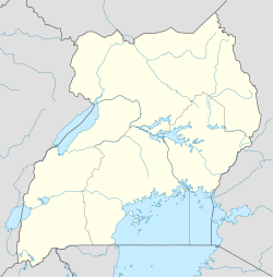
 Ntungamo
Coordinates: 00°52′55″S 30°15′55″E / 0.88194°S 30.26528°E Country  Uganda
Region Western Uganda Sub-region Ankole sub-region District Ntungamo District Elevation 4,593 ft (1,400 m) Population (2011 Estimate) - Total 16,400 Ntungamo is a town in Western Uganda. It is the largest town in Ntungamo District and the district headquarters are located there. The district is named after the town.
Contents
Location
Ntungamo is located about 66 kilometres (41 mi), by road, southwest of the town of Mbarara, the largest metropolitan area in the sub-region, on the highway between Mbarara and Kabale.In 1982 Muntuyera and G.Rutawheire changed Ntungamo by developing the district and their own personal area Rwashamire,Till today it is still being developed by the Sons of Muntuyera and Rutawheire,(Asiimwe's,Bijurenda's,Mugisha Muntu,Kwesiga's,Habert Muntu,Byarugaba's and the rest of their family,these are all family members of the Muntuyera-Rutawheire CLAN.They are many things still being brought into Rwashamire like:Cinemas,Shopping malls,Bars,Schools and Churches)It has also been sugested recently that,Rwashamire and Ntungamo,become a County with A Town hall which will have clerks,Leaders and Various other positions.God has really helped Uganda and Ntungamo/Kabale especially.God is Great.[1] This location lies approximately 360 kilometres (220 mi), by road, southwest of Kampala, the capital of Uganda and the largest city in that country.[2] The coordinates of the town are: 00 52 55S, 30 15 55E.
Population
The 2002 national census put the population of the town at 13,300 and in 2008, the Uganda Bureau of Statistics (UBOS), estimated the population of the town at 15,300.[3] In 2011, UBOS estimated the mid-year population of Ntungamo at 24,750.[4]
Landmarks
The landmarks within the town limits or near the town borders include:
- The headquarters of Ntungamo District Administration
- The offices of Ntungamo Town Council
- A branch of Centenary Bank
- A branch of Stanbic Bank
- A branch of PostBank Uganda
- A branch of Uganda Finance Trust Limited - A Tier III Financial Institution
- Ntungamo Central Market
- Karegyeya Rock Shelter
- The Mbarara-Kabale Highway - The highway continues to Gatuna and Kigali in the Republic of Rwanda
- Itojo Hospital - A public 120-bed hospital administered by the Uganda Ministry of Health, located 22 kilometres (14 mi), northeast of Ntungamo, on the Kabale-Mbarara Road.
-Rwashamire town -Church of Rwashamire -THE Muntuyera High school -Rwashamire Public School -Rutawheire High School
Tourism in Ntungamo
Tourism in Ntungamo is not much developed but there are notable tourism potential sites like;
- Karegyeya Rock
- Lake Nyabihoko
- Uganda-Rwanda Border
- Bird life in the wetlands
- Agricultural activities
There are also plans to build a University in Ntungamo which will have more than 1000 Students and will also attract more Education in Western Uganda.Another plan about Education will be the Prestigious plan to build a girls secondary school which will have over 750 students,Both these projects are expected to start by January 2012.
External links
See also
- Ntungamo District
- Ankole sub-region
- Western Region, Uganda
References
 Ntungamo District
Capital: Ntungamo Towns and villages NtungamoEconomy Centenary Bank · Stanbic Bank · Uganda Finance Trust Limited · PostBank UgandaNotable landmarks Notable people Categories:- Populated places in Uganda
- Cities in the Great Rift Valley
- Western Region, Uganda
- Ntungamo District

Wikimedia Foundation. 2010.