- Sabana Yegua
-
Sabana Yegua — Municipality — Location in Dominican Republic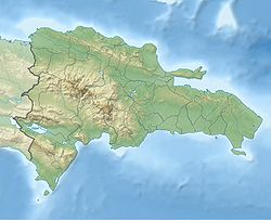
 Sabana Yegua
Coordinates: 18°27′N 70°39′W / 18.45°N 70.65°WCoordinates: 18°27′N 70°39′W / 18.45°N 70.65°W Country Dominican Republic Province Azua Established 2000 Area[1] – Municipality 101.58 km2 (39.2 sq mi) Population (2002)[2] – Municipality 24,015 – Density 236.4/km2 (612.3/sq mi) – Urban 10,395 – Rural 13,620 Sabana Yegua is a municipality (municipio) of the Azua province in the Dominican Republic.
As of the Dominican Republic's 2002 census, the municipality had a total population of 24,015 inhabitants, of which 10,395 resided in urban areas and 13,620 in rural areas.[2] This includes the municipal districts (distritos municipal) of Ganadero, Proyecto 2-C, and Proyecto 4.[3]
It located currently in the kilometer 11 of the highway Azua-San Juan, old was located more to the south, next to San Juan de la Maguana, after crossing Villarpando, entering for the crossing of El Corozo.
It was transferred to the current location, due to the construction of the Dam of Sabana Yegua, on the riverbed Yaque del Sur, when completed its filled earlier than expected, due to the step of the hurricane David October 31, 1979, causing the massive eviction and by force of its inhabitants, which did not avoid the death of many people.
Its hydroelectric power station generates an important quantity of the energy electrica of the country. The irrigation ditch by-product of Sabana also contributes a volume of 8 m³ of water, what has changed the economy of Azua, and where they have been established several important agroindustrias.
Sabana Yegua was and continues being of the districts but prosperous of the province Azua, and the largest one of the human settlements created by the Dominican government. Its economy is based on the present time in the cultivation of platain, bananas, tomato aji, eggplants, cilantro, onion and other.
References
- ^ Superficies a nivel de municipios, Oficina Nacional de Estadistica
- ^ a b Oficina Nacional de Estadística (9 February 2004). "VIII Censo 2002 Poplación y Vivienda" (in Spanish) (PDF in ZIP). http://one.gob.do/censo/volumen_I_pdf.zip. Retrieved 24 January 2007.
- ^ Oficina Nacional de Estadistica, Departamento de Cartografia, Division de Limites y Linderos. "Listado de Codigos de Provincias, Municipio y Distritos Municipales, Actualizada a Junio 20 del 2006" (in Spanish). Archived from the original on 14 March 2007. http://web.archive.org/web/20070314215735/http://www.one.gob.do/index.php?option=com_docman&task=cat_view&gid=113. Retrieved 24 January 2007.
Municipalities Azua de Compostela • Estebanía • Guayabal • Las Charcas • Padre Las Casas • Peralta • Pueblo Viejo • Sabana Yegua • Tábara Arriba
Municipal districts Azua: Barreras • Barro Arriba • Clavellina • Emma Balaguer Viuda Vallejo • Las Barias-La Estancia • Las Lomas • Los Jovillos • Puerto Viejo – Las Charcas: Hatillo • Palmar de Ocoa – Las Yayas de Viajama: Hato Nuevo-Cortés • Villarpando – Padre Las Casas: La Siembra • Las Lagunas • Los Fríos – Pueblo Viejo: El Rosario – Sabana Yegua: Ganadero • Proyecto 2-C • Proyecto 4 – Tábara Arriba: Amiama Gómez • Los Toros • Tábara Abajo
Categories:- Azua Province
- Populated places in the Dominican Republic

Wikimedia Foundation. 2010.