- Nwoya
-
Nwoya Location in Uganda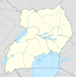
 Nwoya
NwoyaCoordinates: 02°38′06″N 32°00′00″E / 2.635°N 32°E Country  Uganda
Region Northern Uganda Sub-region Acholi sub-region District Nwoya District Government - Mayor Elevation 3,215 ft (980 m) Nwoya is a town in Northern Uganda. It is the main municipal, administrative and commercial centre of Nwoya District. The district is named after the town.
Contents
Location
Nwoya is located on the main Gulu-Arua Road, approximately 44 kilometres (27 mi), by road, southwest of Gulu, the largest city in the sub-region.[1] This location is approximately 330 kilometres (210 mi), by road, north of Kampala, the largest city in Uganda and the capital of that country.[2] This The coordinates of the town are:02 38 06N, 32 00 00E (Latitude:2.6350; Longitude:32.0000).[3]
Overview
Nwoya is one of the towns in Nwoya District, the others being:
- Anaka Municipality
- Pakuba
- Paraa
Population
As of December 2010[update], the exact population of the town of Nwoya is not publicly known.
Landmarks
The landmarks within the town limits or close to the edges of the town include:
- The headquarters of Nwoya District Administration
- The offices of Nwoya Town Council
- Nwoya Central Market
- The Gulu-Arua Highway - The highway arrives into town from Gulu in a north-south direction. It leaves town towards Arua in a northeast-southwest direction.
See also
- Nwoya District
- Acholi sub-region
- Acholi people
- Northern Uganda
References
Capital: Nwoya Towns and villages Anaka · Nwoya · Pakuba · ParaaGeography Victoria Nile · Ayago RiverEconomy Murchison Falls National Park · Pakuba Airport · Paraa Safari Lodge · Chobe Safari Lodge · Ayago Power StationNotable landmarks Victoria Nile · Murchison FallsNotable people Opiyo OloyaCategories:- Nwoya District
- Populated places in Uganda
- Cities in the Great Rift Valley
- Northern Region, Uganda

Wikimedia Foundation. 2010.