- Oil Creek and Titusville Railroad
-
Oil Creek and Titusville Railroad 
ALCO S-2 #75Reporting mark OCTL, OCTT Locale Crawford County and Venango County, Pennsylvania Dates of operation July 18, 1986– Predecessor Conrail Track gauge 4 ft 8 1⁄2 in (1,435 mm) (standard gauge) Length 16.5 miles (26.6 km) Headquarters Oil City, Pennsylvania Website octrr.clarion.edu Oil Creek and Titusville Railroad Legend


Fieldmore Springs / East Titusville 
Perry Street (Titusville) 
South Franklin Street (PA 8) 
Oil Creek 

Crawford County–Venango County Oil Creek 

Drake Well 
Oil Creek State Park trail Oil Creek Petroleum Centre Oil Creek Rynd Farm 
Western NY & PA To Oil City
The Oil Creek and Titusville Railroad (reporting mark OCTT) is a tourist railroad that runs from Titusville to Rynd Farm north of Oil City in the U.S. state of Pennsylvania. The Oil Creek and Titusville Lines (reporting mark OCTL) is the designated operator of the railroad, as well as the freight carrier on the line.Contents
History
The Oil Creek and Titusville operates over tracks that were originally built as the main line of the Buffalo, New York and Philadelphia Railroad in the 1880s; trackage in Titusville was originally owned by the Dunkirk, Allegheny Valley and Pittsburgh Railroad.[1] The Buffalo, New York and Philadelphia was reorganized in 1887 into the Western New York and Pennsylvania Railroad, which was eventually acquired by the Pennsylvania Railroad in 1900. The Pennsylvania was merged with the New York Central Railroad in 1968 and became Penn Central. In 1976, Penn Central went bankrupt, along with several other railroads, and was combined into Conrail.
In 1986, the line was acquired from Conrail by the Oil Creek Railway Historical Society, with the first tourist trains running on July 18; freight operations began on September 25, 1986.[1] Briefly, from December 2, 1995 to August 1996, the Oil Creek and Titusville operated over the former Conrail main line between Meadville and Corry.[1] The operation and ownership of that line reverted back to Conrail before being turned over to the Western New York and Pennsylvania Railroad.
Infrastructure
The OC&T is notable in that it operates the only working Railway Post Office[2] in the United States. For income, it may carry a few freight cars at the end of the passenger cars. The trackage was formerly Conrail and was out of service in 1986 when it was purchased by the founders. The inaugural excursion came in July of that year.The railway travels through the Oil Creek State Park on its journey over 13.5 miles (21.7 km) of track. It hauls over 1,000 carloads of freight and 500,000 passengers each year.
Stations
 Rail station along the line.
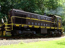
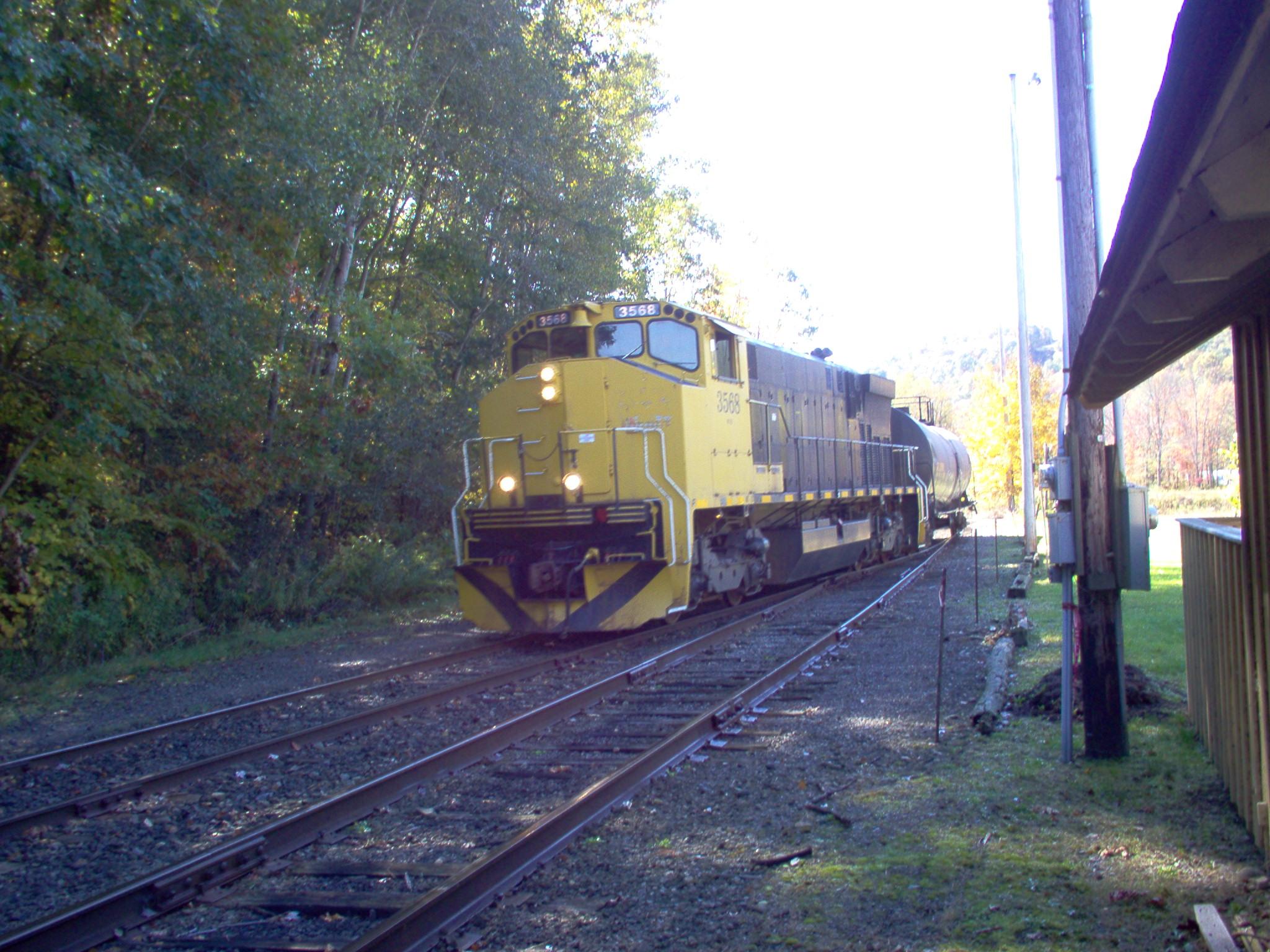
Four stations along the line that have been used off and on to present day: Perry Street, Petroleum Centre, Rynd Farm, and Drake Well. It has seven passenger cars converted from powered units and an open-air, gondola car. It has three operating locomotives: MLW M-420 #3568, and Alco S-2's #75 and #85 (the Atlas 50T 00 is not used).
The railway also havs a caboose marked O.C.T.R. 10R plus several motels made up of cabooses no longer in service.
Image No. Model Builder Built Notes 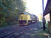
3568 M-420 Montreal Locomotive Works 1970 ex St. Thomas and Eastern Railway[3]
exx Canadian National Railway[3]85 S-2 American Locomotive Company 1950 75 S-2 American Locomotive Company 1947 See also
References
- ^ a b c Lewis, Edward A (1996). American Shortline Railway Guide. Waukesha, Wisconsin: Kalmbach Publishing. p. 235. ISBN 0-89024-290-9.
- ^ octrr.clarion.edu
- ^ a b Springirth, Kenneth C (2010). Railroads of Northwestern Pennsylvania. Images of Rail. Charleston, South Carolina: Arcadia Publishing. p. 121. ISBN 0-7385-7347-7.
External links
Railroads of Pennsylvania Common carriers AOR • AVR • BDRV • BLE (CN) • BPRR • BVRY • CHR • CNYK • CORY • CSXT • DH (CP) • DL • EEC • ESPN • EV • GET • JVRR • KRL • KJR • LRWY • LS • LVR • LVRB • LVRR • MIDH • MKC • MMID • MSUB NBER • NCIR • NDCR • NHRR • NS • NSHR • NYSW • OCTL • PAM • POHC • PSCC • PSWR • RBMN • RJCN • RJCP • SBR • SH • SLRS • SRC • SVRR • SWP • TCKR • TMSS • TYBR • UCIR • UMP • URR • WCOR • WE • WNYP • YRC • YSRR

Passenger carriers Private carriers Former carriers See also: List of United States railroads by political divisionCategories:- Heritage railroads in Pennsylvania
- Pennsylvania railroads
- Railway companies established in 1986
- United States railroad museum and tourist line stubs


Wikimedia Foundation. 2010.