- Ontario Highway 405
-
Highway 405
General Brock Parkway 
Route information Length: 8.7 km[2] (5.4 mi) Existed: September 11, 1963[1] – present Major junctions West end:  Queen Elizabeth Way – St. Catharines
East end:  I-190 near Lewiston, NY
Highway system Ontario provincial highways
400-series • Former←  Highway 404
Highway 406  →
→King's Highway 405, also known as Highway 405 and the General Brock Parkway, is a 400-Series Highway in the Canadian province of Ontario connecting the Queen Elizabeth Way (QEW) near St. Catharines with the Lewiston-Queenston Bridge in the village of Queenston. It then crosses the bridge and continues through the international border with the United States, where it becomes Interstate 190.
Designated and under construction by 1960, the short freeway was opened to traffic on September 11, 1963. Since that time, an interchange was added in 1969 and another removed in 2004. On August 13, 2006, Highway 405 was dedicated the General Brock Parkway. The speed limit on Highway 405 is 100 kilometres per hour (62 mph), except approaching the border. As Highway 405 entirely lies within the Province of Ontario and is not subject to alternative, federal, administration, its entire length is patrolled by the Ontario Provincial Police.
Contents
Route description
The primary purpose of Highway 405 is to connect the northern end of Interstate 190 in New York at the Lewiston–Queenston Bridge to the QEW, and as such it follows a somewhat direct path between the two.[3][4] Throughout its length, the highway gently climbs the Niagara Escarpment, reaching the top east of Stanley Avenue before crossing the Niagara Gorge. The highway is surrounded by forest to either side for most of its length, and the only notable settlement is the village of Queenston.[5]
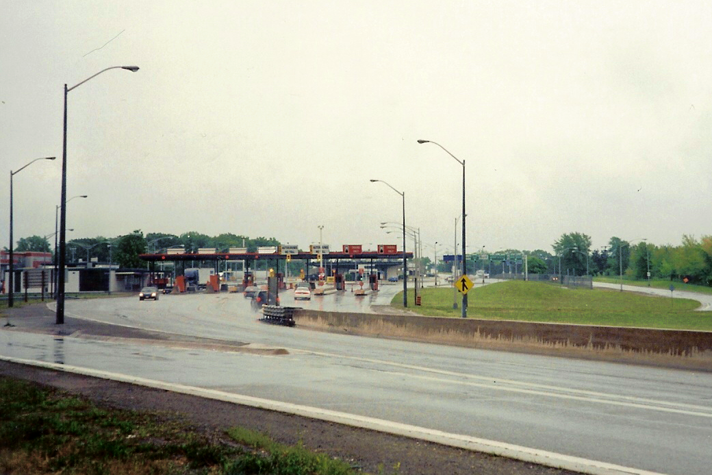
Highway 405 begins by diverging from the QEW at St. Catharines. It continues north-east for 1.5 km, then gently curves south-easterly. The opposing lanes, initially separated by a wide gap, converge towards each other to form a 15-metre (49 ft) grass median.[5][6] The highway dips into a shallow gully, widens to five lanes (three eastbound, two westbound), and then curves northeast to pass to the north of a hydroelectric reservoir.[5] The opposing lanes converge, with an Ontario Tall Wall separating them, and pass beneath Niagara Regional Road 102 (Stanley Avenue). The freeway's lone interchange is with Stanley Avenue, and traffic continuing east must cross the Lewiston–Queenston Bridge into the United States. The additional lane provided along this section is for the queueing of trucks.[7] After passing the top of the reservoir, the highway reaches the Canadian border plaza. It then passes over the Niagara Parkway and begins to cross the Lewiston–Queenston Bridge.[5] The Highway 405 designation ends at the border with New York, where it becomes I-190.[7]
 Highway 405 crosses the Lewiston–Queenston Bridge into New York.
History
Highway 405 was part of a network of divided highways envisioned by Thomas McQuesten in the mid-1930s to connect New York with Ontario.[3] Though the Queen Elizabeth Way would cross the Niagara River by 1942 in Niagara Falls, Highway 405 and the Lewiston–Queenston Bridge would form the first direct freeway link between the neighbouring countries. Planning for both was underway by 1958, and construction began in 1960.[8][9] The bridge was built at the same time as the freeway, though it opened several months earlier on November 1, 1962.[10] Highway 405 was completed in August 1963[11] and officially opened to the public on September 11, 1963.[1]
During the 1969 construction season, an interchange with Stanley Avenue was built and opened to traffic.[12] In 2004, the eastern end of the freeway was modified to permit the queueing of trucks at the border.[7] This included the addition of one lane to the eastbound carriageway beginning at Stanley Avenue, as well as the gradual removal of the interchange with the Niagara Parkway; the westbound on-ramp from the Parkway remained open to traffic until December 4, 2006.[13] The highway was named the General Brock Parkway on 13 October 2006 in honour of the War of 1812 hero, Major General Sir Isaac Brock, who died at the Battle of Queenston Heights.[14][15]
Exit list
The following table lists the major junctions along Highway 405, as noted by the Ministry of Transportation of Ontario.[2] The entire route is located in the Regional Municipality of Niagara. All exits are unnumbered.
Location km[2] Destinations Notes Niagara-on-the-Lake 0 Queen Elizabeth Way – St. Catharines, TorontoWestbound exit and eastbound entrance Niagara Falls 5.5 Regional Road 61 (Townline Road)
Regional Road 102 (Stanley Avenue) – Niagara-on-the-LakeLast exit in Ontario; on/off ramps at Niagara Parkway are now closed off to regular traffic Niagara Parkway Ramps removed 8.7 Canada–United States border Toll rates Lewiston-Queenston Bridge over the Niagara River
 Highway 405 continues into New York as I-190
 1.000 mi = 1.609 km; 1.000 km = 0.621 mi
Concurrency terminus • Closed/Former • Incomplete access • UnopenedSee also
References
- ^ a b A.A.D.T. Traffic Volumes 1955–1969 And Traffic Collision Data 1967–1969. Ontario Department of Highways. 1970. p. 11.
- ^ a b Ministry of Transportation of Ontario (2004). "Annual Average Daily Traffic (AADT) counts". Government of Ontario. http://www.raqsb.mto.gov.on.ca/techpubs/TrafficVolumes.nsf/tvweb?OpenForm&Seq=5. Retrieved February 26, 2010.
- ^ a b Stamp, Robert M. (1987). The Queen Elizabeth Way, Canada's First Superhighway. Boston Mills Press. ISBN 0-919783-84-8.
- ^ Peter Heiler (2010). Ontario Back Road Atlas (Map). Cartography by MapArt. p. 19, section R34–35. ISBN 978-1-55198-226-7.
- ^ a b c d Ministry of Natural Resources Canada. Canadian Topographic Atlas - Highway 405 (Map). http://atlas.nrcan.gc.ca/site/english/maps/topo/map?layers=nodata_ntdb_50k%20north_arrow%20other_features%20million_grid%20t50k_grid%20roads%20hydrography%20boundary%20builtup%20vegetation%20populated_places%20railway%20power_network%20manmade_features%20designated_areas%20water_features%20water_saturated_soils%20relief%20contours%20toponymy%20contour&scale=40000.000000&mapxy=1315180.5572053108%20-493633.9137385053&map_layer&91;northarrow&93;_class&91;0&93;_style&91;0&93;=ANGLE%20-14.33157017424027&mapsize=525%20466&urlappend=. Retrieved June 10, 2010.
- ^ Google, Inc. Google Maps – Route of Highway 405 (Map). Cartography by Google, Inc. http://maps.google.com/maps?f=d&source=s_d&saddr=ON-405+E&daddr=43.153395,-79.130276&hl=en&geocode=FdZxkgIdPElI-w%3B&mra=mi&mrsp=1,0&sz=16&sll=43.151834,-79.134758&sspn=0.008406,0.022702&ie=UTF8&ll=43.151129,-79.133706&spn=0.016813,0.045404&t=k&z=15. Retrieved June 10, 2010.
- ^ a b c "Queenston–Lewiston Bridge 5th Lane". Canadian Consulting Engineer (Business Information Group). October 2006. http://www.canadianconsultingengineer.com/issues/story.aspx?aid=1000207283. Retrieved June 28, 2010.
- ^ "Above the Regular Budget". The Ottawa Citizen 116 (29): p. 7. July 31, 1958. http://news.google.com/newspapers?id=uT4vAAAAIBAJ&sjid=qN8FAAAAIBAJ&dq=hamilton%20expressway%20toronto&pg=4732%2C2879605. Retrieved October 20, 2010.
- ^ 1960 Annual Report (Report). Ontario Department of Highways. March 31, 1961. pp. 11, 175. http://books.google.com/books?id=ngAjAQAAIAAJ&dq=%22annual+report%22+%22Highway+405%22+Ontario&q=%22Highway+405%22. Retrieved June 24, 2010.
- ^ Berketa, Rick. "Bridges Over Niagara Falls". Niagara Falls Thunder Alley. http://www.niagarafrontier.com/bridges.html#b15. Retrieved June 26, 2010.
- ^ Spieler, Cliff (June 9, 1963). "A New View Is In Store For Niagara Visitors". New York Times. p. 445. http://select.nytimes.com/gst/abstract.html?res=F60D13F73A55177A93CBA9178DD85F478685F9. Retrieved June 25, 2010.
- ^ Annual Report (Report). Ontario Department of Highways. March 31, 1970. p. 22.
- ^ D. Hackston, R. Taylor, P. Skorochod, G.W. English, P. Heimrath, J. MacDonald (March 2007). Eastern Ontario Transportation Logistics Study (Report). Northumberland County. pp. 20–21. http://www.northumberlandcounty.ca/en/common/Eastern%20Ontario%20Transportation%20Logistics%20Study.pdf. Retrieved June 28, 2010.
- ^ 38:2 Bill 66, General Brock Parkway Act (Report). Ontario Legislative Assembly. 2006. http://www.ontla.on.ca/web/bills/bills_detail.do?locale=en&BillID=361&isCurrent=false&detailPage=bills_detail_the_bill&Intranet=. Retrieved June 25, 2010.
- ^ Forsyth, Paul (June 28, 2006). "Monument, University Named for 1812 War Hero Sir Isaac Brock, and Now, Highway". Niagara This Week (Metroland Media Group). http://www.niagarathisweek.com/NiagaraThisWeek/Article/210301. Retrieved June 26, 2010.
External links
Controlled-access highways of Ontario 400-series highways Other highways Current: 2A · 11 · 58 · 115 · 137 · Conestoga Pkwy. · Dougall Pkwy. · E.C. Row Expwy. · Hanlon Pkwy. · Queensway · Thunder Bay Expwy.
Municipal: Black Creek Dr. · Burlington St. · Cootes Dr. · Don Valley Pkwy. · Gardiner Expwy. · Harbour Expwy. · Highbury Ave. · Lincoln M. Alexander Pkwy. · Queensway · Red Hill Valley Pkwy. · Vets Mem. Pkwy. · W.R. Allen Rd.
Proposed: GTA West Corridor · Halton–Peel Freeway · Mid-Peninsula Highway · Bradford Bypass · West Durham Link · East Durham LinkCounty roads in Ontario · Ontario numbered highways · Expressways and 400-series highways · King's Highways · Secondary highways · Tertiary and 7000-series highways · List of Ontario provincial highways · List of former provincial highways in Ontario · Highways in Ontario · List of Ontario expressways · Trans-Canada Highway · Connecting Link · Emergency Detour RouteCategories:- 400-series highways in Ontario


Wikimedia Foundation. 2010.