- Obedjiwan, Quebec
-
Obedjiwan
Opitciwan— Native reserve — 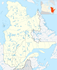
 Obedjiwan
Coordinates: 48°40′14″N 74°55′43″W / 48.67056°N 74.92861°WCoordinates: 48°40′14″N 74°55′43″W / 48.67056°N 74.92861°W Country  Canada
Province  Quebec
Region Mauricie Census division La Tuque Settled 1825 (trading post) Formation March 21, 1950 (reserve) Government[1] – Chief Paul Méquish – Federal riding Saint-Maurice—Champlain – Prov. riding Laviolette Area[1][2] – Total 9.27 km2 (3.6 sq mi) – Land 8.68 km2 (3.4 sq mi) Population (2006)[2] – Total 1,782 – Density 205.4/km2 (532/sq mi) Time zone EST (UTC-5) – Summer (DST) EDT (UTC-4) Postal Code G0W 3B0 Area code(s) 819 Website www.opitciwan.ca
www.obedjiwan.caObedjiwan (officially designated as Obedjiwan 28) is a First Nation reserve and village on the north shore of Gouin Reservoir in the Mauricie region of Quebec, Canada. It belongs to the Atikamekw d'Opitciwan band of the Atikamekw Nation.[3]
The reserve is an enclave within the City of La Tuque. It is the most isolated Atikamekw reserve in Quebec, 143 kilometres (89 mi) south of Chibougamau, and accessible by an approximately 200 kilometres (120 mi) long gravel road that branches off from Quebec Route 167.
Contents
Etymology
The word Obedjiwan, written in the standardized Atikamekw spelling as Opitciwan, comes from the roots oba or obe meaning "strait", and djwan meaning "running". So, it can be translated as "current of the strait/narrows/pass".[4]
The name, first attributed to the lake, has undergone many spelling variations. In 1825, when the Hudson's Bay Company set up a post, they called it Waupatchinauganiskau, which is understood to be the original form of the toponym. In 1871, explorer John P. Bignell visited the place and made mention of the name Obidjouan. In 1904, the Fifth Report of the Geographic Board of Canada called it Obiduan and this remained the accepted form until 1964. Other variations included Obijuan and Wabijiwoine.[4]
History
The area of the upper Saint-Maurice River had long been the homeland of the Atikamekw indigenous people. Lake Obedjiwan (a lake at the headwaters of the Saint-Maurice River that was inundated during the construction of Gouin Reservoir) was located along important canoe routes to Lac Saint-Jean via Lake Necouba and to James Bay. In the 17th century, and perhaps since prehistoric times, the shores of this lake were a gathering and trading place for the Atikamekw, as well as other indigenous people of surrounding areas, where they engaged in social, economic, and cultural interaction. The Atikamekw procured wheat, flour, and perhaps firearms from the Hurons, in exchange for moose or beaver skins.[5]
In 1825, the Hudson's Bay Company (HBC) and the King's Posts Company established trading posts on Lake Obedjiwan, that quickly attracted indigenous hunters not only from the area, but also from the eastern James Bay and the upper Ottawa regions. In 1840, the Hudson's Bay Company deserted Lake Obedjiwan and settled at Kikendatch Lake (now Kikendatch Bay at the outlet of Gouin Reservoir). Yet in 1911, the HBC transferred its Kikendatch Post back to Lake Obedjiwan, causing the Atikamekw also to return to the area. The HBC wanted to move away from competing dealers who undermined its trade at Kikendatch while the Atikamekw liked to avoid Europeans who became more and more numerous in the south. At that time, there was still no real settlement although the Oblates built a chapel in 1916, which was located on the left bank of the Saint-Maurice River opposite of the HBC Post, separated by the Obedjiwan Narrows.[4][5]
The area experienced a great change when the dam at La Loutre was constructed in 1917. The reservoir forming behind the dam flooded not only hundreds of lakes, including Lake Obediwan, but also the old settlement and its archaeological sites. A new village, 3 kilometers west at the current location, was not actually built until 1925 following arduous negotiations with the Commission des eaux courantes.[4][5]
On December 31, 1941, the Quebec Government proclaimed the Lands and Forests Act that provided for the reservation of lands for the benefit of "Indians". On January 14, 1944, an area of 2290 acres (9.27 km2) in the geographic township of Toussaint was transferred from the government of Quebec to the Government of Canada, and was officially established as the "Obiduan Indian Reserve" on March 21, 1950. It was renamed to "Obedjiwan Indian Reserve" on January 23, 1964.[6]
Demographics
Population trend:[7]
- Population in 2006: 1782 (2001 to 2006 population change: 7.0 %)
- Population in 2001: 1666
- Population in 1996: 1464
- Population in 1991: 1125
Private dwellings occupied by usual residents: 347 (total dwellings: 388)
Language
Atikamekw language is still spoken by the vast majority of families, and therefore it is among the indigenous languages least threatened with extinction according to some studies. The language has some similarities with the Cree language spoken by the Cree communities of southern Quebec (Waswanipi and Oujé-Bougoumou). This parallel development of both languages may be the result of the frequent interaction between the nearby Cree and Atikamekw. The second language used in Obedjiwan is French.[8]
Mother tongue:[2]
- English as first language: 0 %
- French as first language: 2.3 %
- English and French as first language: 0 %
- Other as first language: 97.7 %
References
- ^ a b Ministère des Affaires Municipales, Régions et Occupation du territoire - Répertoire des municipalités: Obedjiwan
- ^ a b c Statistics Canada 2006 Census - Obedjiwan community profile
- ^ Government of Canada, Aboriginal Canada Portal - Obedjiwan 28
- ^ a b c d "Obedjiwan (Réserve indienne)" (in French). Commission de toponymie du Québec. http://www.toponymie.gouv.qc.ca/CT/toposweb/fiche.aspx?no_seq=45105. Retrieved 2010-03-09.
- ^ a b c Claude Gélinas (June 2001). "Le lac Obedjiwan, un lieu de rassemblement autochtone traditionnel" (in French). HISTOIRE QUÉBEC. http://www.histoirequebec.qc.ca/publicat/vol7num1/v7n1_6la.htm. Retrieved 2010-03-09.
- ^ Natural Resources Canada - Legal Surveys Division, Historical Review - Obedjiwan
- ^ Statistics Canada: 1996, 2001, 2006 census
- ^ "Cultures et traditions" (in French). Conseil des Atikamekw d'Opitciwan. http://www.opitciwan.ca/index.php/menutourisme. Retrieved 2010-03-09.
Categories:- Communities in Mauricie
- First Nations reserves in Quebec
- Hudson's Bay Company trading posts

Wikimedia Foundation. 2010.