- Riviersonderend
-
This article is about the town. For the river, see Sonderend River. For the mountain range, see Riviersonderend Mountains.
Riviersonderend Location in the Western Cape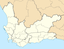
 Riviersonderend
Coordinates: 34°09′01″S 19°54′52″E / 34.15028°S 19.91444°ECoordinates: 34°09′01″S 19°54′52″E / 34.15028°S 19.91444°E Country  South Africa
Province Western Cape District Overberg Municipality Theewaterskloof Area[1] – Total 2.4 km2 (0.9 sq mi) Population (2001)[1] – Total 3,603 – Density 1,501.3/km2 (3,888.2/sq mi) Time zone SAST (UTC+2) Postal code 7250 Area code 028 Riviersonderend is a small town in the Overberg region of the Western Cape, South Africa, about 140 kilometres (87 mi) east of Cape Town. It is located on a loop of the Sonderend River, from which it takes its name. In the census of 2001 it was recorded as having a population of 3603 in an area of 2.4 square kilometres (0.93 sq mi).[1]
The N2 national road passes through Riviersonderend, forming its main street; it is 161 kilometres (100 mi) by road from central Cape Town.
References
- ^ a b c "Main Place 'Riviersonderend'". Census 2001. http://census.adrianfrith.com/place/11113. Retrieved 1 April 2011.
External links

Cities and towns Arniston • Baardskeerdersbos • Barrydale • Betty's Bay • Birkenhead • Botrivier • Bredasdorp • Caledon • Dennehof • De Kelders • Elgin • Elim • Fisherhaven • Franskraalstrand • Gansbaai • Genadendal • Grabouw • Greyton • Hawston • Hermanus • Hotagterklip • Infanta • Kleinbaai • Kleinmond • L'Agulhas • Napier • Onrusrivier • Pearly Beach • Pringle Bay • Riviersonderend • Rooi-Els • Stanford • Struisbaai • Suiderstrand • Suurbraak • Swellendam • Van Dyksbaai • Vermont • Villiersdorp
Categories:- Populated places in the Overberg District Municipality
- Western Cape geography stubs


Wikimedia Foundation. 2010.