- Arkansas Highway 11
-
Highway 11
Route information Maintained by AHTD Section 1 Length: 43.9 mi (70.7 km) South end:  U.S. 63
North end:  Hwy. 367 – Searcy
Section 2 Length: 37.3 mi (60.0 km) West end: U.S. 63East end: Huff's Island Public Use Area Section 3 Length: 12.8 mi (20.6 km) West end:  Hwy. 88
East end: 
 U.S. 165 / Hwy. 152
Highway system Arkansas Highway System
Interstates • US • State
Business • Spurs • Scenic←  Hwy. 10
Hwy. 12  →
→Arkansas Highway 11 (AR 11 and Hwy. 11) is the name of multiple state highways in Arkansas.
Contents
Section 1
Arkansas Highway 11 is a state highway of 43.9 miles (70.7 km) in Prairie and White Counties.[1][2]
Route description
AR 11 begins at US 63 by Interstate 40 exit 193. The route runs north untin forming a 3.0 miles (4.8 km) concurrency with AR 38 east to Des Arc. Continuing north into White County, AR 11 runs through Griffithville and Higginson before terminating at AR 367 at the southern limits of Searcy.
Route history
Arkansas Highway 11 formerly continued past its current southern terminous. The route went south to Hazen, and continued south into Arkansas County as early as 1935[3] and as late as 1992.[4] Most of the route was paved by 1963.[5]
Hazen spur route
Highway 11S
Location: Hazen Length: 0.9 mi (1.4 km) Arkansas Highway 11 Spur was a spur route of 0.9 miles (1.4 km) in Prairie County.[6] It was replaced by U.S. Route 63 Spur when AR 11 was truncated at I-40 north of Hazen.[7]
Section 2
Arkansas Highway 11 is a state highway of 43.9 miles (70.7 km) in Cleveland and Lincoln Counties.[8][9]
Route description
AR 11 begins in Cleveland County at US 63 in Pansy and runs east. The continues northeast upon entering Lincoln County, intersecting US 425/AR 45 in Star City. AR 11 has a 0.6 miles (0.97 km) business route in Star City. AR 11 runs east until Fresno, when it turns north and meets US 65 in Grady. After Grady, the route runs north to Huff's Island Public Use Area, where it terminates.
Star City business route
Highway 11B
Location: Star City Length: 0.6 mi (1.0 km) Arkansas Highway 11 Business is a business route of 0.6 miles (0.97 km) in Lincoln County.[9] It is known in Star City as Drew Street.
Section 3
Arkansas Highway 11 is a state highway of 12.8 miles (20.6 km) in Jefferson and Arkansas Counties.[10][11]
Route description
The route begins at AR 88 in Jefferson County and runs east. Upon entering Arkansas County, the route is crossed by AR 276. AR 11 runs north to terminate at US 165/AR 152 at Eldridge Corner.
Section 4, Kauffman Road segment
Old Arkansas 11, Kauffman Road Segment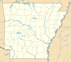
 Location of Kauffman Rd.
Location: Kauffman Rd., Stuttgart, Arkansas vicinity Coordinates: 34°22′59″N 91°32′26″W / 34.38306°N 91.54056°WCoordinates: 34°22′59″N 91°32′26″W / 34.38306°N 91.54056°W Area: Arkansas County Built: 1916 MPS: Arkansas Highway History and Architecture NRHP Reference#: 06000834 [12] Added to NRHP: September 2006 Arkansas Highway 11 is a former state highway segment of 1.1 miles (1.8 km) in Arkansas County.[11] It is listed on the National Register of Historic Places.
History
The segment was the main automobile route in its part of Arkansas County from the time of its construction around 1916 until U.S. Route 165 was established in the area.
References
- ^ Arkansas State Highway and Transportation Department. AHTD Prairie County map Retrieved on April 2, 2010.
- ^ Arkansas State Highway and Transportation Department. AHTD White County map Retrieved on April 2, 2010.
- ^ "Prairie County, Arkansas State Highway Map - 1925." Revised 1935. Historic Map. Retrieved April 2, 2010.
- ^ "Prairie County, Arkansas State Highway Map - 1992." Historic Map. Retrieved April 2, 2010.
- ^ "Prairie County Highway Map - 1957." Revised 1963. Historic Map. Retrieved April 2, 2010.
- ^ "Prairie County Highway Map - 1992." Historic Map. Retrieved April 2, 2010.
- ^ "Prairie County Map - 2000." County Highway Map. Retrieved April 2, 2010.
- ^ Arkansas State Highway and Transportation Department. AHTD Cleveland County map Retrieved on April 2, 2010.
- ^ a b Arkansas State Highway and Transportation Department. AHTD Lincoln County map Retrieved on April 2, 2010.
- ^ Arkansas State Highway and Transportation Department. AHTD Jefferson County map Retrieved on April 3, 2010.
- ^ a b Arkansas State Highway and Transportation Department. AHTD Arkansas County map Retrieved on April 3, 2010.
- ^ "National Register Information System". National Register of Historic Places. National Park Service. 2010-03-03. http://nrhp.focus.nps.gov/natreg/docs/All_Data.html.
U.S. National Register of Historic Places Topics Lists by states Alabama • Alaska • Arizona • Arkansas • California • Colorado • Connecticut • Delaware • Florida • Georgia • Hawaii • Idaho • Illinois • Indiana • Iowa • Kansas • Kentucky • Louisiana • Maine • Maryland • Massachusetts • Michigan • Minnesota • Mississippi • Missouri • Montana • Nebraska • Nevada • New Hampshire • New Jersey • New Mexico • New York • North Carolina • North Dakota • Ohio • Oklahoma • Oregon • Pennsylvania • Rhode Island • South Carolina • South Dakota • Tennessee • Texas • Utah • Vermont • Virginia • Washington • West Virginia • Wisconsin • WyomingLists by territories Lists by associated states Other  Category:National Register of Historic Places •
  Portal:National Register of Historic Places
Roads of Pine Bluff Interstate Highways Interstate 69 (Future) • I-530 Scenic Byway
U.S. Routes Arkansas State Highways Categories:- National Register of Historic Places in Arkansas
- State highways in Arkansas
- Transportation in Arkansas County, Arkansas
- Transportation in Cleveland County, Arkansas
- Transportation in Jefferson County, Arkansas
- Transportation in Lincoln County, Arkansas
- Transportation in Prairie County, Arkansas
- Transportation in White County, Arkansas


Wikimedia Foundation. 2010.