- Ōmazaki Lighthouse
-
Ōmazaki Lighthouse
大間埼灯台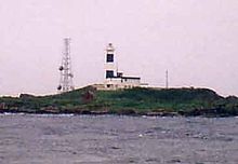
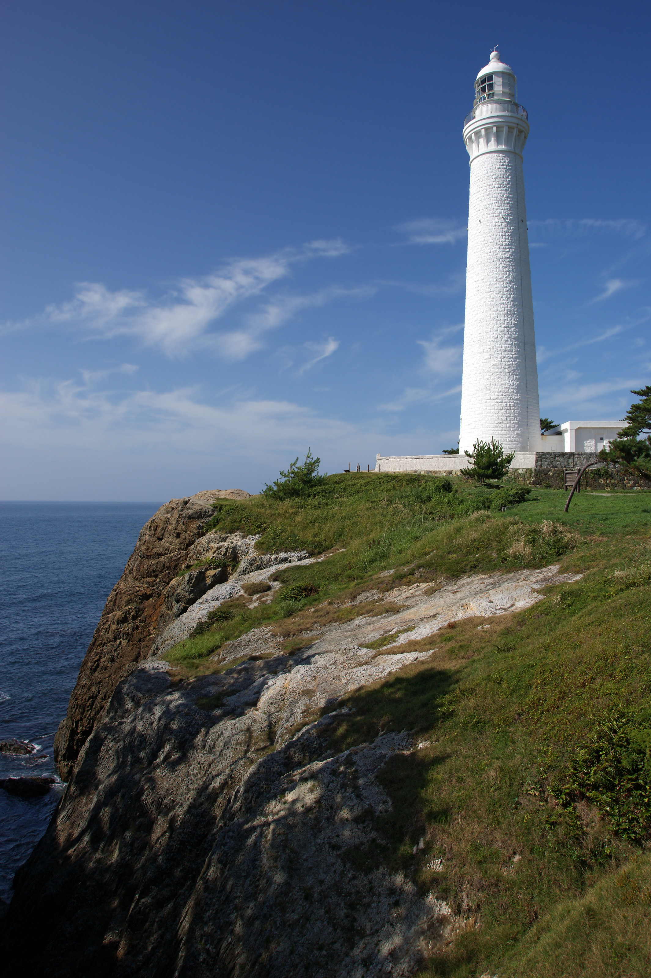
Ōmazaki Lighthouse Location Ōma, Aomori Prefecture, Japan Coordinates 41°44′07″N 140°54′54″E / 41.73528°N 140.915°E Year first lit 1921, 1953 Automated 1991 Foundation Concrete Construction Concrete Tower shape Round Height 25.4 metres (83 ft) Focal height 36 metres (118 ft) Original lens Fourth Order Fresnel Intensity 120,000 candela Range 31 kilometres (17 nmi) Characteristic Fl (3) W 30s The Ōmazaki Lighthouse (大間埼灯台 Ōmazaki tōdai) is a lighthouse located at the northernmost extremity of Honshū island, on Bentenjima, an island 600 meters off Cape Ōmazaki in Ōma, Aomori Prefecture, Japan. It is within the borders of the Shimokita Hanto Quasi-National Park.
The Ōmazaki Lighthouse illuminates the Tsugaru Strait at the entrance to Mutsu Bay. Its light can be seen across the strait to Hokkaido.
Work began on the Ōmazaki Lighthouse in September 1920, and it was first lit on November 1, 1921. During World War II, it was hit repeated by air strikes by United States Navy aircraft and by 1945 it was in ruins. While being rebuilt after the war, it was again severely damaged by the 1952 Tokachioki Earthquake. The second generation lighthouse was completed in July 1953. A radar beacon was established on April 17, 1983. Since April 1, 1993, the lighthouse has been fully automated, and is now unmanned.
It is listed as one of the “50 Lighthouses of Japan” by the Japan Lighthouse Association.
External links
- (Japanese) Lighthouses in Japan
Lighthouses of Japan Early Meiji lighthouses
(Léonce Verny)Kannonzaki Lighthouse (1869) • Nojimazaki Lighthouse (1869)• Shinagawa Lighthouse (1870) • Jōgashima Lighthouse (1870)
Later Meiji lighthouses
(“Brunton’s Children”)Kashinozaki Lighthouse (1870) • Tsurugisaki Lighthouse (1871) • Esaki Lighthouse (1871) • Hesaki Lighthouse (1871) • Mikomotoshima Lighthouse (1871) • Irōzaki Lighthouse (1871) • Iojimazaki Lighthouse (1871) • Satamisaki Lighthouse (1871) • Nosappumisaki Lighthouse (1872) • Tomogashima Lighthouse (1872) • Mutsurejima Lighthouse (1872) • Shirasu Lighthouse (1873) • Sugashima Lighthouse (1873) • Anorisaki Lighthouse (1873) • Tsurushima Lighthouse (1873) • Shionomisaki Lighthouse (1873) • Inubōsaki Lighthouse (1874) • Omaezaki Lighthouse (1874) • Eboshijima Lighthouse (1875) • Shiriyazaki Lighthouse (1876) • Kinkasan Lighthouse (1876) • Tsunoshima Lighthouse (1876) •Taisho period lighthouses Sunosaki Lighthouse (1919) • Nomazaki Lighthouse (1921)Modern lighthouses Yokohama Marine Tower (1961)Categories:- Aomori Prefecture
- Lighthouses in Japan

Wikimedia Foundation. 2010.