- Orbost railway line
-
Orbost railway line, Victoria 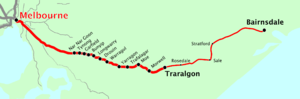
Line details Commenced 1877 Completed 1916 Closed 1987[1] Used by V/Line passenger services, freight traffic Rail transport in Victoria List of stations
Closed railwaysThe Orbost railway line (also known as the Gippsland line) is a railway serving the Latrobe Valley and Gippsland regions of Victoria, Australia. Running east from the state capital Melbourne though the cities of Moe, Morwell, Traralgon, Sale and Bairnsdale until reaching the eventual terminus of Orbost.
Today the line ends at Bairnsdale, with the remaining section to Orbost now existing as the East Gippsland Rail Trail, a shared bicycle, walking, and horseriding track.[2]
Contents
Services
Metro Trains Melbourne operates suburban passenger services along the inner section of the line as the Pakenham Line, while V/Line services operate as the Interurban Traralgon Line and the Intercity Bairnsdale Line. Freight services also use the line, operated by Pacific National.
History
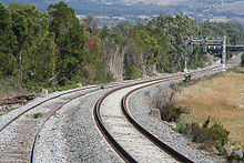
 The current end of the line at Bairnsdale
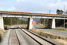
 Section of line at Morwell Loop upgraded as part of the Regional Fast Rail project
Rail lines were built to Gippsland in the 1870s and initially played a crucial role in developing agricultural industries in Gippsland as well as tourism. It also played a crucial role in the development of coal mining in the Latrobe Valley in the 1920s. At its peak, the railway travelled as far east as Orbost and there are still frequent services to many of the towns. Some of the disused rail lines have been turned into tourist railways and/or rail trails.
The Melbourne and Suburban Railway Company opened a line from Princes Bridge railway station to Punt Road (Richmond) and South Yarra in 1859, Prahran in 1859 and Windsor in 1860, connecting with the St Kilda and Brighton Railway Company line. This line was extended to Dandenong, Pakenham, Warragul, Moe, Morwell, Traralgon, Sale, Stratford and Bairnsdale between 1877 and 1879. It was extended to Orbost in 1916. The line east of Sale was closed in 1994, but was reopened to Bairnsdale in 2004.
The railway to Orbost opened in 1916 and operated until 1987, principally carrying timber and farming produce. In the early days of the railway's operation dedicated passenger trains ran but these ceased by the 1930s. The track infrastructure was dismantled in 1994. The line traversed a mixture of farmland, hills and heavily forested country. It included numerous bridges, including the Stoney Creek Trestle Bridge, the largest of its kind in Victoria.
In 1954 the line beyond Dandenong was electrified mainly because of the expected briquette traffic from the brown coal mines in the Latrobe Valley, and over the next two years most of the line between Dandenong and Pakenham was duplicated and provided with power signalling, although Narre Warren to Berwick was not done until 1962. In due course, the rail transport of briquettes petered out as industry converted to natural gas and homes were converted to other forms of heating.
Electrification was cut back to Warragul in 1987, when suburban services started to Warragul. Electrification and suburban services were cut back to Bunyip in 1998, before ceasing beyond Pakenham in 2001. The Victorian Regional Fast Rail project upgraded one of the two lines in 2005, between Pakenham and Traralgon.
Branch lines
 The private SECV Morwell Interconnecting Railway bridge crossing the main Gippsland railway
A branch line was built north from Warragul in stages from the 1890s, reaching Noojee in 1919. This was closed in stages from 1954 to 1958 [3].
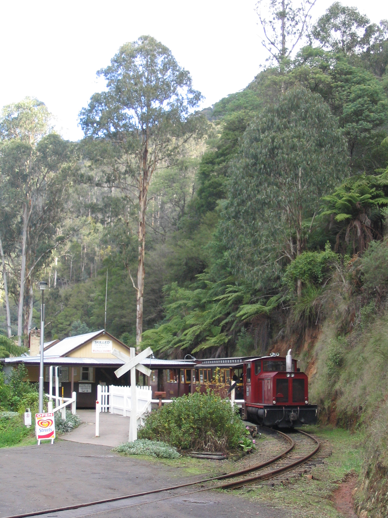
The narrow gauge (762 mm) Walhalla branch line was completed across mountainous country from Moe to Erica and Walhalla in 1910. The Platina to Walhalla section closed in 1944, Erica to Platina in 1952, and finally Moe to Erica in 1954 [4]. The northern-most section between Thomson and Walhalla stations has been reopened as a tourist railway by the Walhalla Goldfields Railway, and provides regularly scheduled trains.
A branch line was also opened from Moe to Thorpdale in 1888, which was closed in 1958.
The Yallourn branch was opened from Hernes Oak (between Moe and Morwell) to Yallourn in 1922 to serve the adjacent power station development. It was replaced by a line from Moe to Yallourn in 1953 because its route was required for brown coal mining,[5] but the new line closed in 1987, having been disused since the late 1970s.[5][6]
The Mirboo North branch line was opened in stages from Morwell to Mirboo North between 1885 and 1886, however was closed in 1974.[7] The route of the line was partly dug up as part of the Hazelwood open cut mine. The Maryvale paper siding also connects to the main line at Morwell and remains open today for regular freight traffic.
The loop line via Maffra was opened from Traralgon to Heyfield, Maffra and Stratford in 1887 and closed in stages between 1987 and 1993. A branch line was opened from Maffra to Briagolong in 1889 and closed in 1952.
Several timber tramways also existed from many of the stations between Pakenham and Yarragon.
Significance
The expansion of the railway in the late 1870s helped to develop Gippsland. It enabled milk from western Gippsland to be sold fresh into Melbourne while the dairy industry of East Gippsland provided cheese and butter. It also enabled development of west Gippsland's market gardening and orcharding industry for sale in Melbourne markets.
It also encouraged the development of a tourism industry notably at Lakes Entrance. It did however end coastal shipping traffic and the use of Sale and Bairnsdale as ports.
In the 1920s, the Gippsland railway played an important role in developing the mining of lignite coal and the development of the Latrobe Valley for power generation primarily serving Melbourne and Victoria. This saw the development of industry in towns such as Yallourn, Morwell, Traralgon, Moe, Warragul and Drouin.
The development of the Gippsland Railway helped fuel the Melbourne land boom in the 1870s. The original departure point for the railway was Oakleigh with the line connecting Oakleigh and Melbourne not built until 1879. The Victorian railways bought land in Oakleigh for use as workshops. Oakleigh became a centre of what was known as "railway fever" as developers developed and marketed houses close to rail lines between Oakleigh and other suburbs for use of workers travelling to and from their job. At the height of the land boom in 1888, land sales were being held two or three times a week in the district. The collapse of the land boom in 1889 eventually contributed to banking collapses in 1893 and the major depression of the 1890s.
The Gippsland railway remains a significant passenger corridor on the V/Line network although its use for freight business has now declined to only one major customer, being Australian Paper's export traffic from Maryvale
Tourist railways and rail trails
 Walhalla Goldfields Railway
Many of the lines in Gippsland have closed because they had become uneconomic. Some of these have been turned into tourist railways including:
- the Walhalla Goldfields Railway between Moe and Walhalla; and
- the South Gippsland Railway between Leongatha, Korumburra and Nyora.
Other stretches of line have become rail trails for use by bicyclists. These include:
- the Noojee Trestle Bridge Trail in the upper reaches of the Latrobe River;
- a section between Erica and the Thomson River on the former Walhalla line (pending eventual reconstruction of the Walhalla Goldfields Railway's tourist line between Thomson and Erica stations).;
- Collins Siding to Tyers Valley Rail Trail near Moe;
- Moe to Yallourn Rail Trail;
- Mirboo North to Boolarra Rail Trail;
- Great Southern Rail Trail from Leongatha to Foster;
- Bass Coast Rail Trail Anderson to Wonthaggi;
- East Gippsland Rail Trail from Bairnsdale to Nowa Nowa, and in 2005 being extended to Orbost; and the
- Gippsland Plains Rail Trail from Stratford to Maffra.
Line guide
 Preserved substation and overhead wiring at Bunyip
Bold stations are termini.
Orbost railway line Legend

0.0 km Southern Cross 
1.2 km Flinders St 
Pakenham Line 3.6 km Richmond 11.8 km Caulfield 20.4 km Clayton 31.2 km Dandenong 

South Gippsland line 44.4 km Berwick 58.1 km Pakenham End of Pakenham Line service 
Princes Freeway 
64.57 km Nar Nar Goon 69.46 km Tynong 72.66 km Garfield 77.86 km Bunyip 82.26 km Longwarry 90.99 km Drouin Princes Freeway 
101.76 km Warragul 

Noojee line 
Nilma railway station(closed) Darnum (closed) 114.21 km Yarragon 122.26 km Trafalgar 
Walhalla line (narrow gauge) 132.22 km Moe Yallourn line (2nd) 
Thorpdale line Hernes Oak (closed) Yallourn line (1st) 
Morwell-Yallourn Interconnecting Railway (ICR) 
Mirboo North line 146.37 km Morwell 
Hazelwood siding Maryvale (closed) 

Maryvale Paper Mill siding Princes Freeway 160.07 km Traralgon End of Traralgon Line service Maffra line Loy Yang (closed) Flynn (closed) 182.36 km Rosedale Kilmany (closed) Fulham (closed) 

Sale Wharf spur (closed) 

208.02 km Sale (switchback station closed 1983) 
Montgomery (closed) Maffra line Stratford Junction (closed) 224.10 km Stratford 233 km Munro (closed) 246.22 km Fernbank (closed) 257 km Lindenow (closed) 262.92 km Hillside (closed) 
276.84 km Bairnsdale End of Bairnsdale Line service 

Bairnsdale Wharf spur (closed) 
286.631 km Nicholson (closed) 296.124 km Bumberrah (closed) 303.952 km Mossiface (closed) 306.296 km Bruthen (closed) 321.410 km Colquhoun (closed) 336.077 km Nowa Nowa (closed) 345.822 km Tostaree (closed) 358.825 km Waygara (closed) 
372.614 km Orbost (closed) References
- ^ "Rail » Infrastructure » Orbost Line". Vicsig Railways site. VICSIG. 1997-2009. http://www.vicsig.net/infrastructure/line/Orbost. Retrieved 2009-11-08.
- ^ East Gippsland Shire Council (2007). "East Gippsland Rail Trail". James Yeates Printing & Design.
- ^ Fiddian 1997, p. 170-171.
- ^ Fiddian 1997, p. 169-170.
- ^ a b S.E. Dornan and R.G. Henderson (1979). Electric Railways of Victoria. Australian Electric Traction Society. p. 88. ISBN 0 909459 06 1.
- ^ "VR History". www.victorianrailways.net. http://www.victorianrailways.net/vr%20history/history.html. Retrieved 2008-06-18.
- ^ "Railways of the Latrobe Valley". Latrobe City. http://www.latrobe.vic.gov.au/webfiles/media/link/march03/link%20mar%2003%20-%20page%2007.pdf. Retrieved 2006-06-07.
Further reading
- Fiddian, M (1997). "Trains, Tracks, Travellers".
External links
- South Gippsland Railway
- Statistics and detailed schematic map at the vicsig enthusiast website
History
- City of Monash page on the Gippsland Railway
- Gippsland Rail Trails
- Monash University gazeteer on Oakleigh
- Monash University gazeteer on Moe
Railway Lines in Victoria Main lines
Bendigo Line · Mildura line · North East Line · (Melbourne-Sydney) · Orbost Line · Port Fairy Line · Portland line · Serviceton Line · South Gippsland Line · Tocumwal line · Western SG line (Melbourne-Adelaide)Branch linesAlexandra line · Alvie line · Balranald line · Bolangum line · Briagolong line · Bright line · Buninyong line · Carpolac line · Casterton line · Cobram line · Cohuna line · Coleraine line · Cudgewa line · Daylesford line · Deniliquin line · Forrest line · Grampians line · Heathcote line · Kulwin line · Lancefield line · Maffra line · Mansfield line · Mortlake line · Mirboo North line · Navarre line · Noojee line · Oaklands line · Outtrim line · Patchewollock line · Peechelba East line · Picola line · Portland line · Redesdale line · Red Hill line · Robinvale line · Skipton line · Strzelecki line · Stony Crossing line · Tatong line · Thorpdale line · Timboon line · Wahgunyah line · Waubra line · Wedderburn line · Wonthaggi line · Woodside line · Yackandandah line · Yanac line · Yaapeet line ·
Cross Country linesAvoca line · Geelong-Ballarat line · Eaglehawk–Inglewood line · Moolort Line · Toolamba–Echuca line
V/Line servicesGeelong Line · Warrnambool Line · Ballarat Line · Maryborough Line · Ararat Line · Bendigo Line · Swan Hill Line · Echuca Line · Seymour Line · Shepparton Line · Albury-Wodonga Line · Traralgon Line · Bairnsdale Line
Melbourne suburban servicesCity Loop · Werribee line · Williamstown line · Sydenham line · Craigieburn line · Flemington Racecourse line · Upfield line · Epping line · Hurstbridge line · Lilydale line · Belgrave line · Alamein line · Glen Waverley line · Pakenham line · Cranbourne line · Frankston line · Stony Point line (unelectrified) · Sandringham line
Inner Circle line · Outer Circle line · Rosstown Railway · St Kilda - Windsor line · Spring Vale Cemetery line · Mont Park line · Kew line · Red Hill line · Whittlesea line · Warburton line · Mornington line · Healesville line · St Kilda line · Port Melbourne line Tourist railwaysNarrow gauge branch linesWhitfield line · Gembrook line · Crowes line · Walhalla line
Melbourne goods linesNewport-Sunshine line · Albion-Jacana line · South Kensington-West Footscray line
Categories:- Railway lines in Victoria (Australia)
- Railway lines opened in 1859


Wikimedia Foundation. 2010.