- Otay Mesa, San Diego
-
This article is about the neighborhood in San Diego. For the borough of Tijuana, see Mesa de Otay.
Otay Mesa — Community of San Diego — Location within Southern San Diego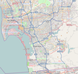
 Otay Mesa
Coordinates: 32°33′30″N 116°56′33″W / 32.5583913°N 116.9425228°W Country United States State California County County of San Diego City City of San Diego Otay Mesa is a community in the southern section of the city of San Diego, just north of the U.S.–Mexico border. It is bordered by the Otay River Valley and the city of Chula Vista on the north, Interstate 805 and the neighborhoods of Ocean View Hills and San Ysidro on the west, and unincorporated land of San Diego County on the north and east. Major thoroughfares include Otay Mesa Road/California State Route 905, Otay Valley Road/Heritage Road, Siempre Viva Road, and California State Route 125.
South of the border between the United States and Mexico, the same region continues as a residential and industrial area called "Mesa de Otay", which is one of nine "delegaciones" (boroughs) of Tijuana Municipality.
Contents
History
Otay (pronounced Oh-Tie) is derived from the Kumeyaay language. Although its meaning is disputed,[1] possible derivations include "otai", meaning "brushy"; "Tou-ti" meaning "big mountain";[2] or "etaay" meaning "big".[3] Mesa is the Spanish word for plateau, table or tableland.
Aviation pioneer John J. Montgomery made experimental glider aircraft flights from Otay Mesa in 1883.[4]
The area which now includes Otay Mesa West was annexed from San Diego County along with other portions of South San Diego in 1957.
Landmarks and facilities
The Otay Mesa Port of Entry is one of two border crossings within the city of San Diego, the other being the San Ysidro Port of Entry six miles to the west. Otay Mesa also houses an immigration detention center. Pacific Gateway Park is located between Otay Mesa Road and the international border.
Trucks are generally instructed to use the border crossing in Otay Mesa instead of the San Ysidro one.
Education
Public schools in Otay Mesa include San Ysidro High School.
See also
- Mexico – United States border
References
- ^ Google Books, San Diego County Place Names A to Z, Leland Fetzer.
- ^ Google Books, San Diego County Place Names A to Z, Leland Fetzer.
- ^ Gudde, Erwin. California Place Names, 4th ed. University of California Press, 1998. http://books.google.com/books?id=Kqwt5RlMVBoC&pg=PA273&dq=otay+otai&hl=en&ei=z19xTZGhEY-osAPLx-XQCw&sa=X&oi=book_result&ct=result&resnum=1&ved=0CC4Q6AEwAA#v=onepage&q=otay%20otai&f=false p.273
- ^ Stein, Lou, San Diego County Place-Names, pages 88-89, Rand Editions-Tofua Press, 1975
External links
- Otay Mesa community profile, city of San Diego
- Bureau of Transportation Statistics - Border Crossing/Entry Data
- Trans-Border Institute at the University of San Diego
- Mesa de Otay Delegation ,Tijuana, Mexico (In Spanish)
Neighborhoods of San Diego Northern Bay Ho · Bay Park · Carmel Valley · Clairemont · Del Mar Heights · Del Mar Mesa · La Jolla · La Jolla Village · Mission Beach · North City · Pacific Beach · Pacific Highlands Ranch · Torrey Hills · Torrey Pines · University City · Village of La JollaNortheastern Black Mountain Ranch · Carmel Mountain Ranch · Mira Mesa · Miramar · Rancho Bernardo · Rancho Encantada · Rancho Peñasquitos · Sabre Springs · San Pasqual Valley · Scripps Ranch · Sorrento Valley · Sorrento Mesa · Torrey HighlandsEastern Birdland · Kearny Mesa · Mission Valley East · Navajo (Allied Gardens · Del Cerro · Grantville · San Carlos) · Serra Mesa · TierrasantaWestern Burlingame · Hillcrest · Linda Vista · Midtown · Mission Hills · Mission Valley West · Morena · North Park · Ocean Beach · Old Town · Point Loma (La Playa · Liberty Station · Loma Portal · Midway · Point Loma Heights · Roseville-Fleetridge · Sunset Cliffs · Wooded Area) · University HeightsCentral Downtown (Columbia · Core · Cortez Hill · East Village · Gaslamp Quarter · Harborview · Little Italy · Marina) · Balboa Park · Bankers Hill · Barrio Logan · Golden Hill · Grant Hill · Logan Heights · Middletown · Sherman Heights · South Park · StocktonMid-City Adams North · Azalea/Hollywood Park · Castle · Cherokee Point · Chollas Creek · City Heights · Colina del Sol · College Area · Corridor · Darnall · El Cerrito · Fairmont Park · Fox Canyon · Gateway · Islenair · Kensington · Normal Heights · Oak Park · Ridgeview · Redwood Village · Rolando · Swan Canyon · Talmadge · Teralta · WebsterSoutheastern Alta Vista · Bay Terraces · Broadway Heights · Chollas View · Emerald Hills · Encanto · Jamacha-Lomita · Lincoln Park · Mountain View · Mount Hope · Paradise Hills · Shelltown · Skyline · Southcrest · Valencia ParkSouthern Border · Egger Highlands · Nestor · Ocean View Hills · Otay Mesa · Otay Mesa West · Palm City · San Ysidro · Tijuana River ValleyCategories:- Neighborhoods in San Diego, California

Wikimedia Foundation. 2010.