- Otis Pike Fire Island High Dune Wilderness
-


Fire Island Wilderness The Otis Pike High Dune Wilderness Area, also known as the Otis G. Pike Wilderness Area, is a federally protected wilderness area composed of barrier islands off the south shore of Long Island, New York.
The wilderness area, named for former New York congressman Otis G. Pike, is the only federally designated wilderness area in New York State.[1] At 1,363 acres (5.52 km2; 2.130 sq mi), it is also one of the smallest wilderness areas managed by the National Park Service.[2]
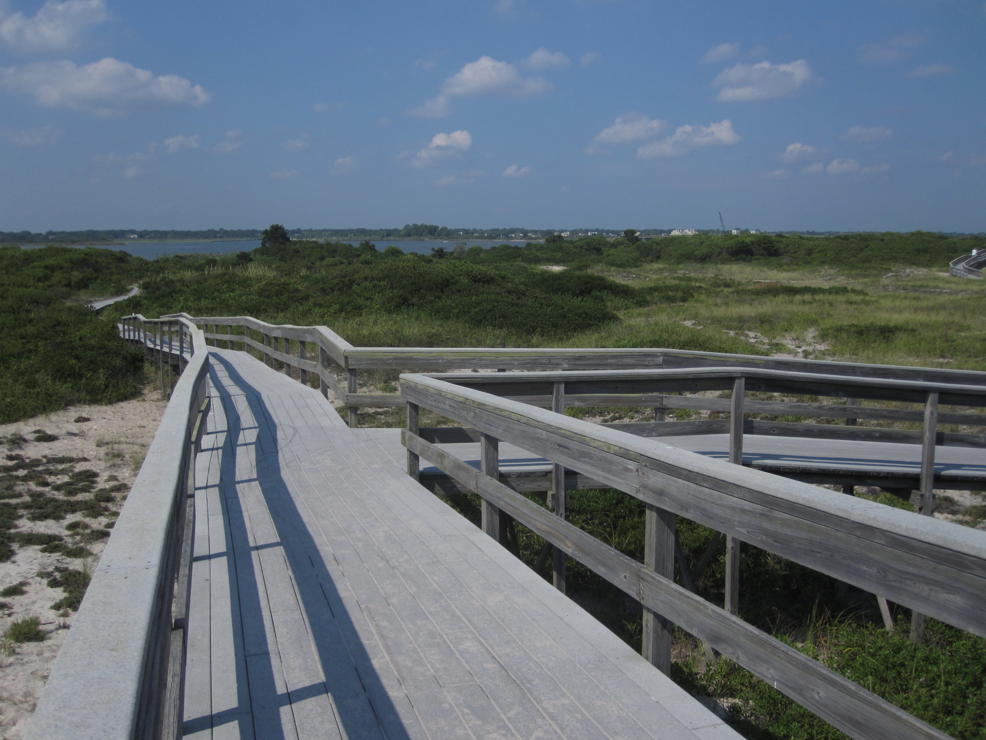
Access to the Fire Island Wilderness can be obtained either from Watch Hill (which is accessible seasonally by ferry or private boat), or Smith Point County Park, accessible year round by car or bus). The Wilderness Visitor Center (located adjacent to Privately-owned Bellport Beach splits the wilderness into two zones east and west of these protected areas.[citation needed]
The island is about 31 miles (50 km) long and 0.25 miles (0.40 km) wide at the widest point.[citation needed] The Otis G. Pike Wilderness area is 7 miles (11 km) of National Park Service wilderness located on the eastern side of Fire Island. It is the only National Park Service wilderness in New York State.[citation needed] The wilderness area is named for former New York Congressman Otis G. Pike, who co-sponsored the bill which created the Fire Island National Seashore and worked hard to secure public support and the legislation's passage through Congress to establish the new national park.
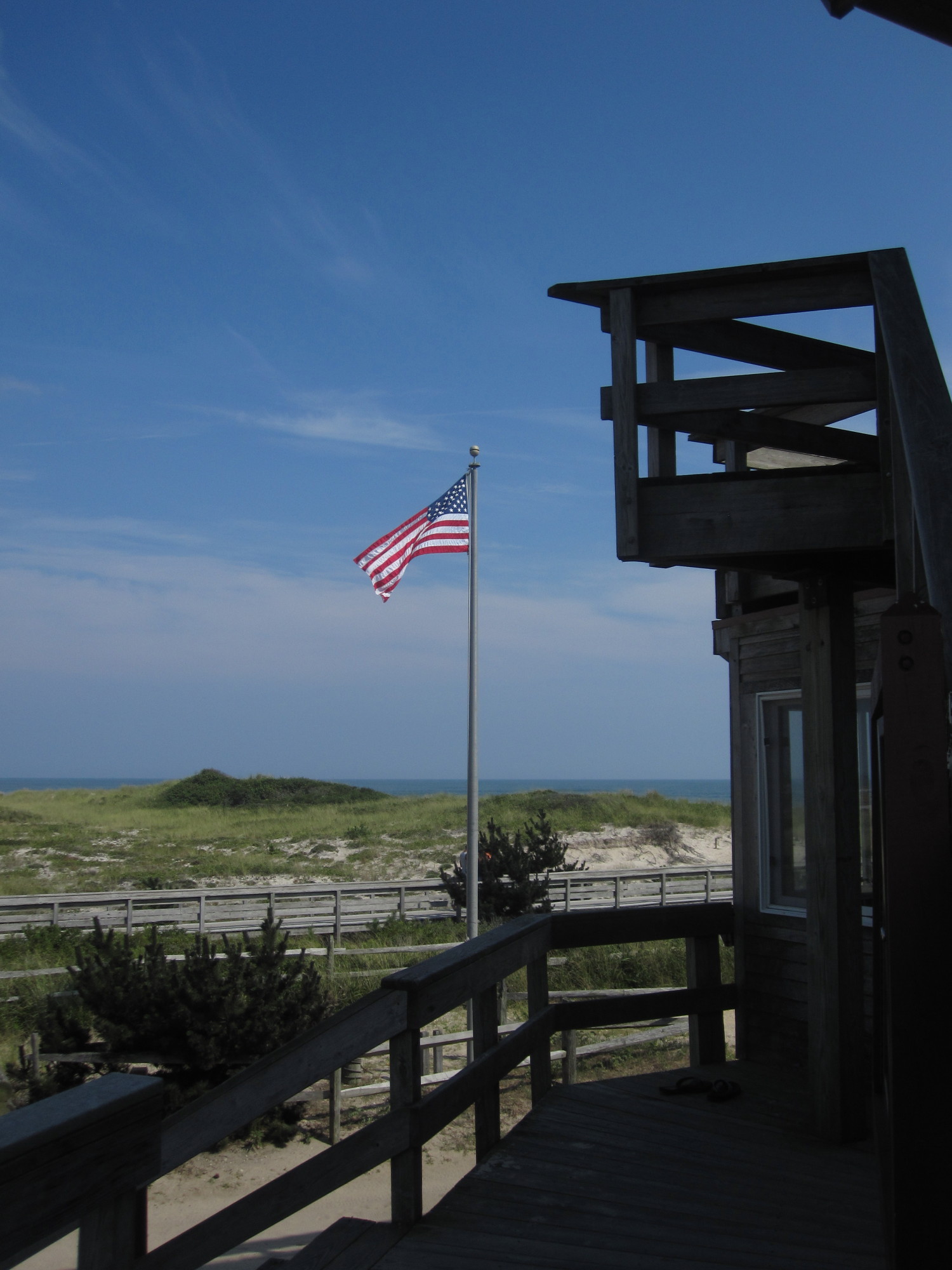
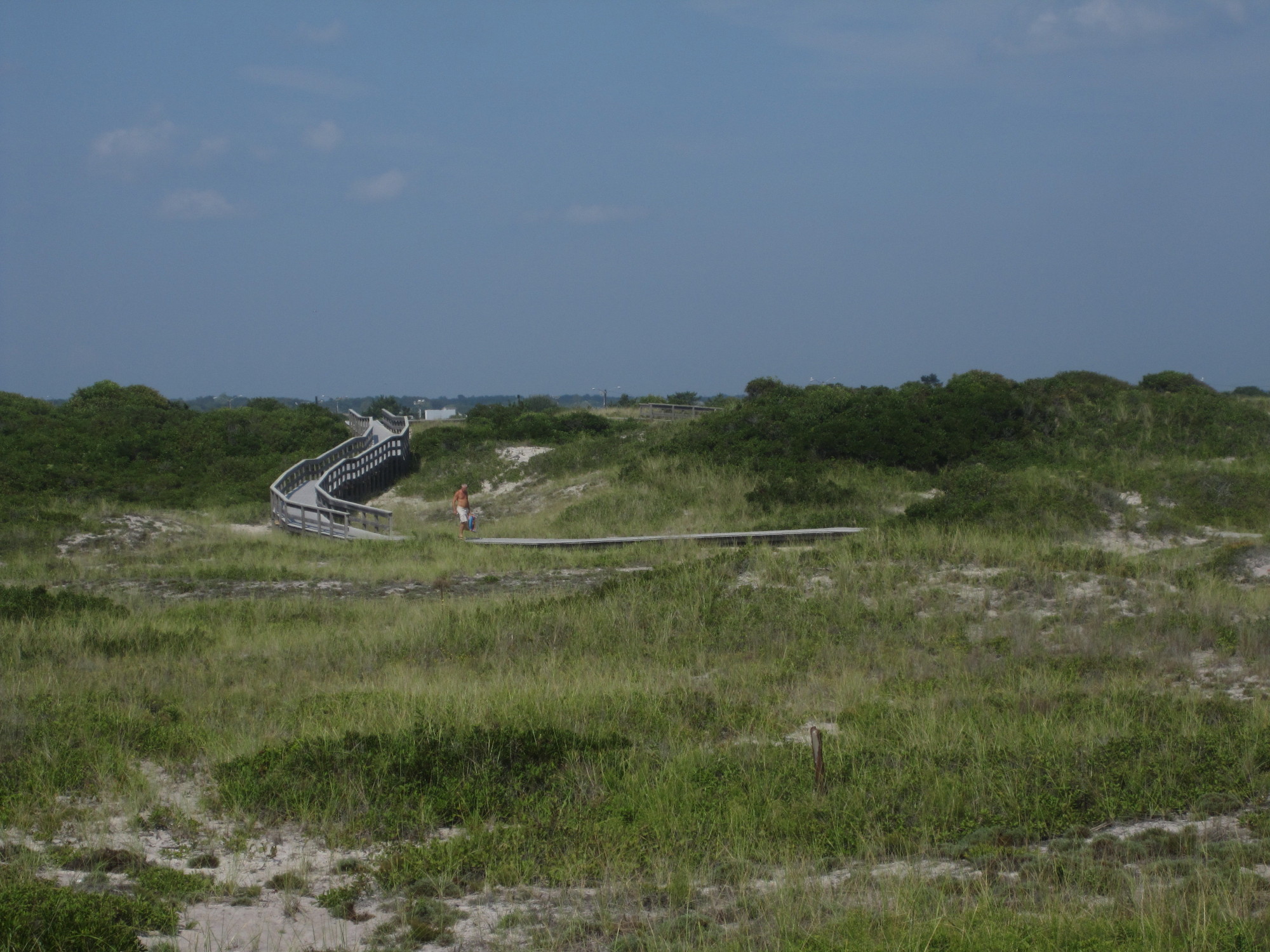
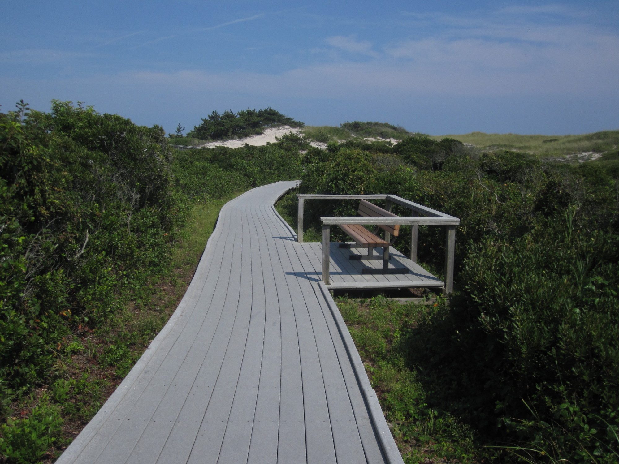
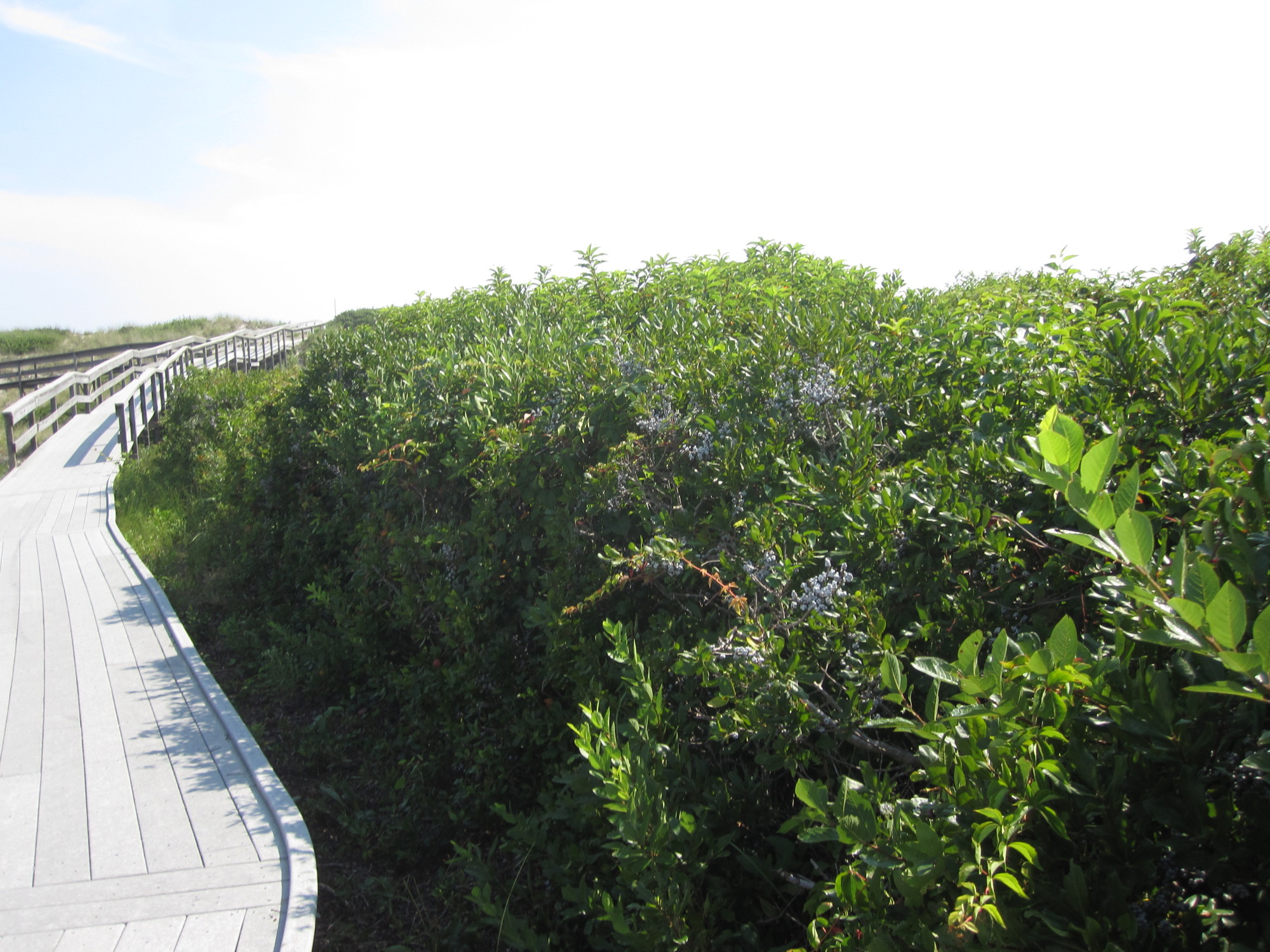
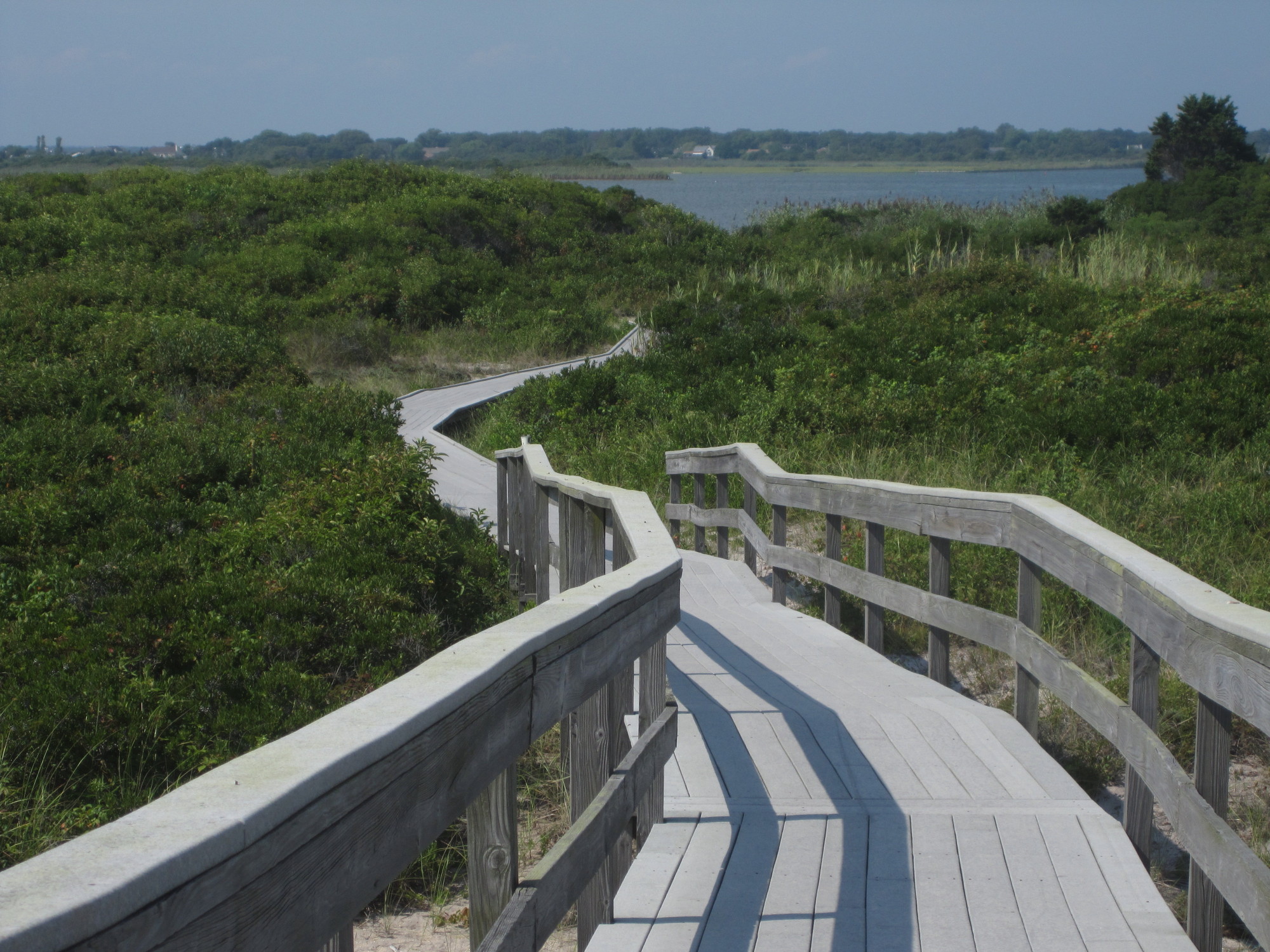
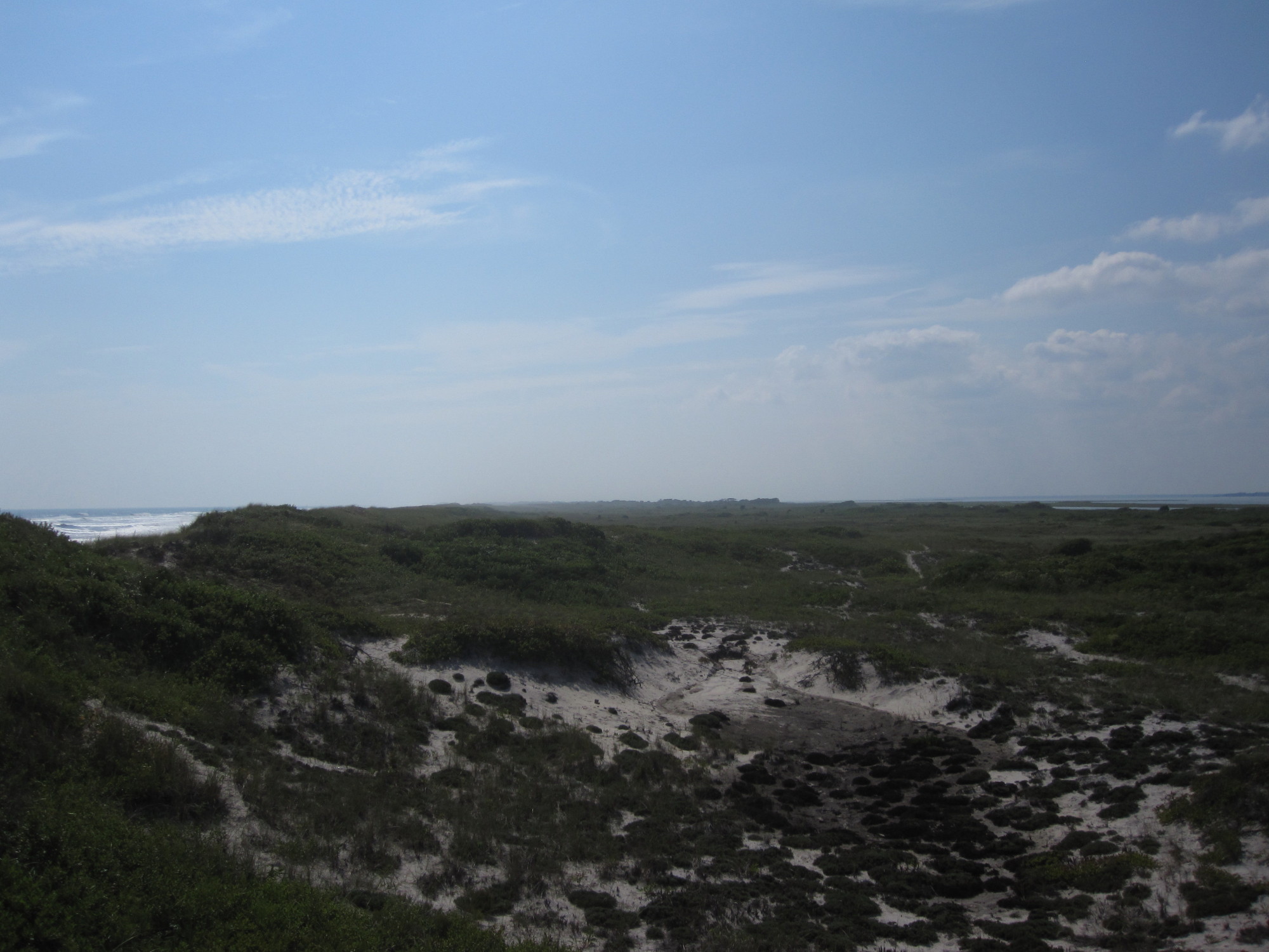
Miles of undeveloped beach, some 40-foot (12 m) high dunes, are covered in wildflowers, deer trails, Old bones, and many natural seaside artifacts. The Wilderness is only 50 miles (80 km) east of New York City.
The United States Congress designated the Otis Pike High Dune Wilderness Area in 1980 and it now has a total of 1,363 acres (5.52 km2; 2.130 sq mi). All of the wilderness is in New York and is managed by the National Park Service.
Contents
See also
Photo gallery
References
External links
Coordinates: 40°42′42″N 72°55′42″W / 40.71167°N 72.92833°W
Protected Areas of New York Federal Eleanor Roosevelt • Home of Franklin D. Roosevelt • Kate Mullany House • Martin Van Buren • Saint Paul's Church • Sagamore Hill • Saratoga National Historical Park • Theodore Roosevelt Birthplace • Theodore Roosevelt Inaugural • Thomas Cole House • Vanderbilt Mansion • Women's Rights National Historical Park
African Burial Ground • Castle Clinton • Federal Hall National Memorial • Fort Stanwix • General Grant National Memorial • Governors Island • Hamilton Grange National Memorial • Statue of Liberty
Appalachian Trail • North Country National Scenic Trail
Fire Island National Seashore • Gateway National Recreation Area • Otis Pike Fire Island High Dune Wilderness • Upper Delaware Scenic and Recreational River
Amagansett • Conscience Point • Elizabeth A. Morton • Iroquois • Montezuma • Oyster Bay • Sayville • Seatuck • Shawangunk Grasslands • Target Rock • Wallkill River • Wertheim
State Allen H. Treman • Allegany • Amherst • Battle Island • Bayard Cutting Arboretum • Bayswater Point • Bear Mountain • Beaver Island • Beechwood • Belmont Lake • Bethpage • Betty & Wilbur Davis • Big Six Mile Creek • Blauvelt • Bonavista • Bowman Lake • Braddock Bay • Brentwood • Bristol Beach • Brookhaven • Buckhorn Island • Buffalo Harbor • Burnham Point • Buttermilk Falls • Caleb Smith • Camp Hero • Canandaigua Lake • Canoe-Picnic Point • Captree • Catharine Valley Trail • Caumsett • Cayuga Lake • Cedar Island • Cedar Point • Chenango Valley • Cherry Plain • Chimney Bluffs • Chittenango Falls • Clarence Fahnestock • Clark Reservation • Clay Pit Ponds • Cold Spring Harbor • Coles Creek • Conesus Lake • Connetquot River • Crab Island • Croil Island • Cumberland Bay • Darien Lakes • De Veaux Woods • Dean's Cove • Delta Lake • Devil's Hole • Dewolf Point • Donald J. Trump • Earl W. Brydges • Eel Weir • Emma Treadwell Thacher • Empire – Fulton Ferry • Evangola • Fahnestock • Fair Haven Beach • Fillmore Glen • Fort Niagara • Four Mile Creek • Franklin D. Roosevelt • Frenchman Island • Galop Island • Gantry Plaza • Gilbert Lake • Gilgo • Glimmerglass • Golden Hill • Goosepond Mountain • Grafton Lakes • Grass Point • Green Lakes • Hamlin Beach • Harriet Hollister Spencer • Harriman • Haverstraw Beach • Heckscher • Hempstead Lake • High Tor • Highland Lakes • Higley Flow • Hither Hills • Honeoye • Hook Mountain • Hudson Highlands • Hudson River Islands • Hudson River • Hunt's Pond • Iona Island • Irondequoit Bay • Jacques Cartier • James Baird • Jamesport • John Boyd Thacher • Jones Beach • Joseph Davis • Keewaydin • Keuka Lake • Knox Farm • Kring Point • Lake Erie • Lake Superior • Lake Taghkanic • Lakeside Beach • Letchworth • Lock 32 • Lodi Point • Long Island • Long Point - Finger Lakes • Long Point - Thousand Islands • Long Point on Lake Chautauqua • Macomb Reservation • Margaret Lewis Norrie • Mark Twain • Mary Island • Max V. Shaul • Mexico Point • Midway • Mine Kill • Minnewaska • Montauk Downs • Montauk Point • Moreau Lake • Napeague • Newtown Battlefield • Niagara Falls • Nissequogue River • Nyack Beach • Oak Orchard • Ogden Mills & Ruth Livingston Mills • Old Croton Aqueduct • Old Erie Canal • Oquaga Creek • Orient Beach • Peebles Island • Pinnacle • Pixley Falls • Point Au Roche • Reservoir • Riverbank • Robert G. Wehle • Robert H. Treman • Robert Moses - Long Island • Robert Moses - Thousand Islands • Robert V. Riddell • Roberto Clemente • Rockefeller • Rockland Lake • Sampson • Sandy Island Beach • Saratoga Lake • Saratoga Spa • Schodack Island • Schunemunk Mountain • Selkirk Shores • Seneca Lake • Shadmoor • Shaver Pond Nature Center • Silver Lake • Sonnenberg Gardens & Mansion • Southwick Beach • St. Lawrence • State Park at the Fair • Sterling Forest • Steuben Memorial • Stony Brook • Storm King • Sunken Meadow • Taconic Outdoor Education Center • Taconic - Copake Falls Area • Taconic - Rudd Pond Area • Tallman Mountain • Taughannock Falls • Theodore Roosevelt Nature Center • Thompson's Lake • Tioga • Trail View • Valley Stream • Verona Beach • Waterson Point • Watkins Glen • Wellesley Island • Westcott Beach • Whetstone Gulf • Whirlpool • Wildwood • Wilson-Tuscarora • Wonder Lake • Woodlawn Beach
Bennington Battlefield • Caumsett • Clermont • Clinton House • Crailo • Crown Point • Darwin Martin House • Fort Montgomery • Fort Ontario • Ganondagan • Grant Cottage • Herkimer Home • Hyde Hall • John Brown Farm and Gravesite • John Burroughs Memorial (Woodchuck Lodge) • John Hay Homestead • Johnson Hall • Knox's Headquarters • Lorenzo • New Windsor Cantonment • Olana • Old Croton Aqueduct • Old Erie Canal • Old Fort Niagara • Oriskany Battlefield • Philipse Manor Hall • Plantings Fields Arboretum -- Coe Hall Historic House Museum • Sackets Harbor Battlefield • Schoharie Crossing • Schuyler Mansion • Senate House • Sonnenberg Gardens & Mansion • Staatsburgh • Steuben Memorial • Stony Point Battlefield • Walt Whitman Birthplace • Washington's Headquarters
Allen Lake • Altmar • Ambler • Armlin Hill • Arnold Lake • Artic China • Ashland Pinnacle • Baker School House • Bald Mountain • Balsam • Balsam Swamp • Barbour Brook • Basswood • Basswood Pond • Bates • Battenkill • Battle Hill • Beals Pond • Bear Creek • Bear Swamp • Bearpen Mountain • Beartown • Beaver Creek • Beaver Dams • Beaver Flow • Beaver Meadow • Beebe Hill • Berlin • Big Brook • Big Buck • Birdseye Hollow • Black Creek • Blenheim • Bobell • Bombay • Bonaparte's Cave • Boutwell Hill • Boyce Hill • Brasher Falls • Brokenstraw • Brookfield Railroad • Broome • Bryant Hill • Buck Hill • Bucks Brook • Buckton • Bucktooth • Bully Hill • Bumps Creek • Burnt-Rossman Hills • Burnt Hill • Bush Hill • Cadyville • Cairo Lockwood • Calhoun Creek • California Hill • California Road • Cameron Mills • Cameron • Canacadea • Canada Creek • Canaseraga • Cascade Valley • Cat Hollow • Cattaraugus • Catherineville • Catlin • Chalres E. Baker • Charleston • Chateaugay • Chautauqua Gorge • Chenango • Cherry Valley • Chestnut Woods • Cinnamon Lake • Clapper Hollow • Clark Hill • Cliffside • Clinton • Cobb Brook • Cobb Creek State Forest • Cold Creek • Cold Spring Brook • Cole Hill • Columbia Lake • Coon Hollow • Cotton Hill • Cotrell • Coventry • Coyle Hill • Coyote Flats • Crab Hollow • Crary Mills • Cuyler Hill • Daketown • Danby • Dannemora • Decatur • Deer River • Degrasse • Delaware • Depot Hill • Deruyter • Dobbins • Dog Hollow • Donahue Woods • Downerville • Dry Run • Dunkin's Reserve • Dutch Settlement • Dutton Ridge • Earlville • East Branch Fish Creek • East Osceola • East Otto • Edwin Hollow • Edwin Mountain • Eldridge Swamp • Elkdale • English Hill • Exeter • Fall Brook • Fairfield • Farmersville • Featherstonhaugh • Fire Fall • Fish Creek • Five Streams • Flat Rock • Florence Hill • Fort Jackson • Frank E. Jadwin • Franklin • Franklin 10 • Frozen Ocean • Furnace Creek • Gas Springs • Gates Hill • Gee Brook • Genegantslet • Gillies Hill • Glenmeal • Golden Hill • Goose Egg • Gorton Lake • Gould Corners • Groundry Hill • Grafton Lakes • Granger • Grant Powell • Grantville • Greenwood • Greenwood Creek • Griggs Gulf • Hall Island • Hammond Hill • Harris Hill • Harry E Dobbins • Hartwick • Harvey Mountain • Hatch Creek • Hawkins Pond • Hemlock Ridge • Hewitt • Hickok Brook • Hickory Lake • High Flats • High Knob • High Towers • High Woods • Hill Higher • Hiltonville • Hinckley • Hogsback • Honey Hill • Hooker Mountain • Hoxie Gorge • Huckleberry Ridge • Huntersfield • Hunts Pond • Independence River • Indian Pipe • Italy Hill • Jackson Hill • Jenksville • Jersey Hill • Karr Valley Creek • Kasoag • Keeney Swamp • Kennedy • Kerryville • Ketchumville • Kettlebail • Keyserkill • Klipnocky • Klondike • Knapp Station • Lafayetteville • Lake Desolation • Lassellsville • Lebanon • Leonard Hill • Lesser Wilderness • Lincklaen • Lincoln Mountain • Line Brook • Lonesome Bay • Long Pond • Lookout • Lost Nation • Lost Valley • Ludlow Creek • Lutheranville • Lyon Brook • Macomb Reservation • Mad River • Mallet Pond • Maple Hill • Maple Valley • Marisposa • Marsh Pond • McCarthy Hill • McDonough • Meads Creek • Melondy Hill • Michigan Hill • Middle Grove • Milford • Mohawk Springs • Montrose Point • Moon Pond • Morgan Hill • Morrow Mountain • Moss Hill • Mount Hunger • Mount Pisgah • Mount Pleasant • Mount Tom • Mount Washington • Muller Hill • Murphy Hill • Nanticoke Lake • Nelson Swamp • Newfield • New Michigan • Nimham Mountain • Nine Mile Creek • North Harmony • O'Hara • Oak Ridge • Oakley Corners • Ohisa • Onjebonge • Orebud Creek • Orton Hollow • Ossian • Otselic • Otsquago • Otter Creek • Palmer's Pond • Peck Hill • Painter Hill • Panama • Papish Pond • Partridge Run • Patria • Pease Hill • Penn Mountain • Perkins Pond • Petersburg • Phillips Creek • Pigeon Hill • Pigtail Hollow • Pinckney • Pine Hill • Pine Ridge • Pitcher Springs • Pittstown • Plainfield • Plattekill • Pleasant Lake • Plum Bottom • Point Rock • Popple Pond • Potato Hill • Pulpit Rock • R. Milton Hick • Raecher • Rakph Road • Raymondville • Red Brook • Relay • Rensselaer Number 3 • Rensselaerville • Robinson Hollow • Rock City • Rock Creek • Rockwood • Roeliff Jansen Kill • Roosa Gap • Roseboom • Rural Grove • Rush Creek • Saint Lawrence • Saint Regis • Salmon River • Sand Bay • Sand Flats • Sandy Creek • Scott Patent • Sears Pond • Shawangunk • Shindagin Creek • Shindagin Hollow • Silver Hill • Skinner Hill • Skyline Drive • Slader Creek • Snow Bowl • Sodom • Sonyea • Spring Brook • South Bradford • South Hammond • South Hill • South Mountain • South Valley • Southville • Stammer Creek • Steam Mill • Steuben Hill • Stewart • Stissing Mountain • Stockton • Stone Barn • Stone Hill • Stone Store • Stoney Pond • Sugar Hill • Summer Hill • Susquehanna • Swancott Mill • Swift Hill • Taconic Hereford • Taconic Ridge • Tassell Hill • Taylor Creek • Taylor Valley • Terry Mountain • Texas Hill • Texas Hollow • Texas School House • Three Springs • Tibbetts • Titusville Mountain • Tomannex • Toothaker Creek • Tracy Creek • Tri-County • Triangle • Trout Brook • Trout Lake • Trout River • Tug Hill • Tuller Hill • Turkey Hill • Turkey Point • Turkey Ridge • Turnpike • Urbana • Ushers Road • Vandermark • Vernooykill • Wagner Farm • Wassaic • Webster Hill • Wellman • West Branch • West Hill • West Mountain • West Oscela • West Parishville • Whalen • Whaupaunaucau • Whippoorwill Corners • Whiskey Flats • White Pond • Whittacker • Wiley Brook • Windfall Creek • Winona • Wolf Brook • Wolf Lake • Woodhull • Wurtsboro Ridge • Yatesville Falls • Yellow Barn • Yellow Lake
Wild ForestsAldrich • Balsam • Black River • Blackhead • Blue Mountain • Bluestone • Cherry Ridge • Colgate Lake • Cranberry Lake • Crystal Lake • Debar Mountain • Dry Brook • Ferris Lake • Fulton Chain • Grass River • Halcott Mountain • Hammond Pond • Horseshoe • Hunter Mountain • Independence River • Jessup River • Kaaterskill • Lake George • Middle Mountain • Moose River Plains • Overlook Mountain • Phoenica • Raquette Boreal • Saranac Lakes • Sargent Ponds • Shaler Mountain • Shandaken • Sundown • Taylor Pond • Vanderwhacker Mountain • Watson East Triangle • White Hill • Wilcox Lake • Willowemoc • Windham High Peak
Other Nature ConservancyEugene and Agnes Meyer Nature Preserve • Santanoni Preserve • Arthur W. Butler Memorial Sanctuary • Indian Brook Assemblage • Marrion Yarrow Preserve • Mildred E. Grierson Memorial Wildlife Sanctuary • Mount Holly Preserve • Long Pond Preserve • Mianus River Gorge Nature Preserve • Henry Morgenthau Preserve • Mount Holly Sanctuary • Otter Creek Preserve • Uplands Farm Nature Sanctuary • Atlantic Double Dunes • Pine Neck Nature Sanctuary • Long Island Center for Conservation • Ruth Wales Sanctuary • Calverton Ponds • Accabonac Harbor • Peconic Estuary Big Woods Preserve • Mashomack Nature Preserve • Montauk Mountain Preserve • Shadmoor Preserve • Andy Warhol Visual Arts Preserve • Coon Mountain Preserve • Gadway Sandstone Pavement Barrens • Silver Lake Bog Preserve • Spring Pond Bog Preserve • Everton Falls Preserve • Clintonville Pine Barrens • O.D. von Engeln Preserve at Malloryville • El Dorado Beach Preserve • Chaumont Barrens Preserve • Freund Wildlife Sanctuary • Lewis A. Swyer Preserve • Hannacroix Ravine Preserve • Kenrose Preserve • Limestone Rise Preserve • Whitbeck Memorial Grove • Stewart Preserve • Lordsland Conservancy • Nellie Hill Preserve • Pawling Nature Reserve • Roger Perry Memorial Preserve • Thompson Pond and Stissing Mountain Preserve • Schunemunk Mountain Preserve • Sam's Point Preserve • Christman Sanctuary • Lisha Kill Natural Area • Moccasin Kill Sanctuary • Denton Sanctuary • Lower Poultney River and Saddles Preserves • West Branch Preserve
Categories:- Fire Island, New York
- IUCN Category Ib
- Wilderness Areas of New York
- Protected areas of Suffolk County, New York
-

Wikimedia Foundation. 2010.